The Gulf of Saint Lawrence is the outlet of the North American Great Lakes via the Saint Lawrence River into the Atlantic Ocean. The gulf is a semi-enclosed sea, covering an area of about 226,000 square kilometres (87,000 sq mi) and containing about 34,500 cubic kilometres (8,300 cu mi) of water, which results in an average depth of 152 metres (499 ft).
Prince Charles Island is a large, low-lying island with an area of 9,521 km2 (3,676 sq mi), making it the world's 77th largest island and the 19th largest island in Canada. It is located in Foxe Basin, off the west coast of Baffin Island, in the Qikiqtaaluk Region of Nunavut, Canada. Despite the island's size, it was not discovered until 1932, when the tug captain W. A. Poole first sighted it. His information never made it onto any published map. It was rediscovered in 1948 by Albert-Ernest Tomkinson navigating an Avro Lancaster for the RCAF 408 (Photo) Squadron, though it was likely known to the local Inuit long before that. The island was named for Prince Charles, who was born the same year. The island is uninhabited and its temperatures are extremely cold.
Meighen Island is an uninhabited member of the Queen Elizabeth Islands, part of the Canadian Arctic Archipelago, in the Qikiqtaaluk Region of Nunavut, Canada.
Graham Island is an uninhabited island in Qikiqtaaluk Region, Nunavut, Canada. A member of the Queen Elizabeth Islands and Canadian Arctic Archipelago, it is located in Norwegian Bay off the coast of Ellesmere Island. Located at 77°25'N 90°30'W it has an area of 1,378 km2 (532 sq mi), 55 kilometres (34 mi) long and 40 kilometres (25 mi) wide. It was named in 1910.

Georgetown GO Station is a railway station served by GO Transit's Kitchener line and Via Rail's Toronto-Sarnia train. It is located west of Mountainview Road North at 55 Queen Street in Georgetown, Ontario, Canada.

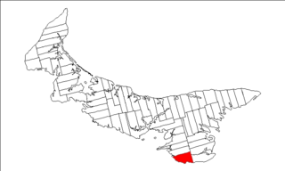
Lot 50 is a township in Queens County, Prince Edward Island, Canada. It is part of St. John's Parish. Lot 50 was awarded to Henry Gladwin and Captain Peter Innes in the 1767 land lottery. One quarter of the lot was granted to Loyalists in 1783.
Lot 62 is a township in Queens County, Prince Edward Island, part of St. John's Parish. Lot 62 was awarded to Richard Spry, Esquire in the 1767 Land Lottery, and came to be settled through the efforts of Thomas Douglas, The 5th Earl of Selkirk in 1803. Richard Spry, Esquire, was then Commodore, Commander-in-Chief, Mediterranean Fleet at Gibraltar 1766–1769. Becoming the proprietor, he would be familiar with then the Island of St. John, having first come out to North America in 1754, with the English naval blockade of Ile Royal and the Fortress of Louisbourg in 1756, and then serving off Quebec and in the St. Lawrence into 1759. In 1762, he returned as Commander-in-Chief, North America, quartered in Halifax.

Lot 8 is a township in Prince County, Prince Edward Island, Canada. It is part of Halifax Parish. Lot 8 was awarded to Arnold Nisbett (M.P.) in the 1767 land lottery, passed to William Kilpatrick and Benjamin Todd in 1775, and to Todd's heirs in 1783.

St. John's Parish was created as a civil parish in Queens County, Prince Edward Island, Canada, during the 1764-1766 survey of Samuel Holland.

St. George's Parish was created as a civil parish in Kings County, Prince Edward Island, Canada, during the 1764-1766 survey of Samuel Holland.
One Island Lake Provincial Park is a provincial park in British Columbia, Canada.

Tyne Valley is a municipality that holds community status in Prince Edward Island, Canada. It is located in Prince County. Incorporated in 1966, the community is located in the township of Lot 13 at the intersection of Routes 12 and 167.

Adams Island is an uninhabited island in the Qikiqtaaluk Region of Nunavut, Canada. The island is located in Baffin Bay off the northeastern coast of Baffin Island in the Canadian Arctic Archipelago. Nearby are Dexterity Island (northeast), Dexterity Fiord and Baffin Island (east), Tromso Fiord (south), Paterson Inlet (west), Bergesen Island (northwest), and Isbjorn Strait (north).
The Salikuit Islands are an uninhabited island group in the Qikiqtaaluk Region of Nunavut, Canada. The 103 island archipelago is located in eastern Hudson Bay between the Belcher Islands and the western coast of Quebec. The closest communities are the Inuit hamlets of Umiujaq, Quebec, 60 km to the east on the coast of Hudson Bay, and Sanikiluaq, 75 km (47 mi) to the west on Flaherty Island.

Saint-Charles is a Canadian parish in Kent County, New Brunswick.

Saint Andrews is a Canadian parish in Charlotte County, New Brunswick.
The Municipality of Lot 11 and Area is a municipality that holds community status in Prince Edward Island, Canada. It is located within Prince County.
Resort Municipality, officially named the Resort Municipality of Stanley Bridge, Hope River, Bayview, Cavendish and North Rustico, is the lone municipality in Prince Edward Island, Canada that holds resort municipality status. It was established in 1990.
Long River is an unincorporated community, in Queens County. Long River is in Lot 20 of Statistics Canada