Lot 2, Prince Edward Island

Last updated
Lot 2, Prince Edward Island
Township
Map of Prince Edward Island highlighting Lot 2.png
Map of Prince Edward Island highlighting Lot 2
Coordinates: 46°54′N64°6′W / 46.900°N 64.100°W / 46.900; -64.100 Coordinates: 46°54′N64°6′W / 46.900°N 64.100°W / 46.900; -64.100
Country Canada
Province Prince Edward Island
County Prince County
Parish North Parish
Area
  Total 85.84 km2 (33.14 sq mi)
Population (2006)
  Total 1,655
  Density 19.3/km2 (50/sq mi)
Time zone AST (UTC-4)
  Summer (DST) ADT (UTC-3)
Canadian Postal code C0B
Area code(s) 902
NTS Map 021I16
GNBC Code BAEQO

Lot 2 is a township in Prince County, Prince Edward Island, Canada created during the 1764–1766 survey of Samuel Holland. It is part of North Parish.

Prince County, Prince Edward Island Place

Prince County is located in western Prince Edward Island, Canada. The county's defining geographic feature is Malpeque Bay, a sub-basin of the Gulf of St. Lawrence, which creates the narrowest portion of Prince Edward Island's landmass, an isthmus upon which the city of Summerside is located.
Prince Edward Island Province of Canada

Prince Edward Island is a province of Canada consisting of the Atlantic island of the same name along with several much smaller islands nearby. PEI is one of the three Maritime Provinces. It is the smallest province of Canada in both land area and population, but it is the most densely populated. Part of the traditional lands of the Mi'kmaq, it became a British colony in the 1700s and was federated into Canada as a province in 1873. Its capital is Charlottetown. According to the 2016 census, the province of PEI has 142,907 residents.

Canada Country in North America

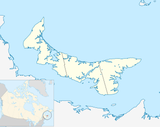
Canada is a country in the northern part of North America. Its ten provinces and three territories extend from the Atlantic to the Pacific and northward into the Arctic Ocean, covering 9.98 million square kilometres, making it the world's second-largest country by total area. Canada's southern border with the United States is the world's longest bi-national land border. Its capital is Ottawa, and its three largest metropolitan areas are Toronto, Montreal, and Vancouver. As a whole, Canada is sparsely populated, the majority of its land area being dominated by forest and tundra. Consequently, its population is highly urbanized, with over 80 percent of its inhabitants concentrated in large and medium-sized cities, many near the southern border. Canada's climate varies widely across its vast area, ranging from arctic weather in the north, to hot summers in the southern regions, with four distinct seasons.
Contents

Population

Communities

Incorporated municipalities:

Miminegash, Prince Edward Island human settlement in Prince Edward Island, Canada

Miminegash is a municipality that holds community status in Prince Edward Island, Canada. It is located 8 miles (13 km) northwest of Alberton and 11 miles (18 km) southwest of Tignish. It is part of a small area known as either the St. Louis, Palmer Road, or Miminegash area. This area is often associated with Tignish due to the shared Acadian roots between these areas.

St. Felix is a municipality that holds community status in Prince Edward Island, Canada. It is located in Prince County, 4 km (2.5 mi) south of Tignish.

St. Louis, Prince Edward Island Community in Prince Edward Island, Canada

St. Louis is a municipality that holds community status in Prince Edward Island, Canada.

Civic address communities:

Deblois, Prince Edward Island human settlement in Prince Edward Island, Canada

DeBlois is a settlement in Prince Edward Island.

Harper, Prince Edward Island human settlement in Prince County, Prince Edward Island, Canada

Harper is a Canadian rural community located in western Prince County, Prince Edward Island.

Kildare Capes, Prince Edward Island locality in Prince County, Prince Edward Island

Kildare Capes is a settlement on Prince Edward Island. It was named after Kildare in Ireland.

History

The township went through various owners under feudalism when Prince Edward Island was a British colony prior to Canadian Confederation:

Feudalism combination of legal and military customs in medieval Europe

Feudalism was a combination of legal and military customs in medieval Europe that flourished between the 9th and 15th centuries. Broadly defined, it was a way of structuring society around relationships derived from the holding of land in exchange for service or labour. Although derived from the Latin word feodum or feudum (fief), then in use, the term feudalism and the system it describes were not conceived of as a formal political system by the people living in the Middle Ages. In its classic definition, by François-Louis Ganshof (1944), feudalism describes a set of reciprocal legal and military obligations among the warrior nobility revolving around the three key concepts of lords, vassals and fiefs.

Canadian Confederation process by which the British colonies of Canada, Nova Scotia, and New Brunswick were united into one Dominion of Canada on July 1, 1867

Canadian Confederation was the process by which the British colonies of Canada, Nova Scotia, and New Brunswick were united into one Dominion of Canada on July 1, 1867. Upon confederation, the old province of Canada was divided into Ontario and Quebec; along with Nova Scotia and New Brunswick, the new federation thus comprised four provinces. Over the years since Confederation, Canada has seen numerous territorial changes and expansions, resulting in the current union of ten provinces and three territories.

Related Research Articles

Queens County, Prince Edward Island Place

Queens County is a county in the province of Prince Edward Island, Canada. It is the largest county in the province by population with 82,017 (2016), land area, and highest average income. Charlottetown is the county seat of Queens County, and is the largest city and the capital of Prince Edward Island.

Tignish, Prince Edward Island Town in Prince Edward Island, Canada

Tignish is a Canadian town located in Prince County, Prince Edward Island.

Lot 1, Prince Edward Island Township in Prince Edward Island, Canada

Lot 1 is a township in Prince County, Prince Edward Island, Canada created during the 1764–1766 survey of Samuel Holland. It is part of North Parish.

Lot 3, Prince Edward Island Township in Prince Edward Island, Canada

Lot 3 is a township in Prince County, Prince Edward Island, Canada created during the 1764–1766 survey of Samuel Holland. It is part of North Parish.

Lot 4, Prince Edward Island Township in Prince Edward Island, Canada

Lot 4 is a township in Prince County, Prince Edward Island, Canada created during the 1764–1766 survey of Samuel Holland. It is part of Egmont Parish.

Alberton, Prince Edward Island Town in Prince Edward Island, Canada

Alberton is a Canadian town located in Prince County, Prince Edward Island. It is situated in the western part of the county in the township of Lot 5. The population was 1,149 as of the 2016 census.

St. Simon & St. Jude Church (Tignish) Church in Prince Edward Island, Canada

St. Simon & St. Jude Church, known colloquially as Tignish Church is a 19th-century Roman Catholic church located in Tignish parish, Prince Edward Island, Canada. As of 2006, it is the single largest church on Prince Edward Island, measuring 185 feet high. It can be clearly seen for 6 miles on flat land, and for many more miles at sea. It is perhaps most famous for its widely publicized apparition of Jesus event.

Prince Edward Island Route 2 highway in Prince Edward Island

Route 2, also known as Veterans Memorial Highway and the All Weather Highway, is a 216-kilometre (134 mi) two-lane uncontrolled access highway traversing Prince Edward Island, Canada from Tignish to Souris. Route 2 was recognized as the first numbered highway in the province in 1890, when it opened between Charlottetown and Summerside.

Ascension Road, labelled Route 160, is a 2-lane collector highway in western Prince County, Prince Edward Island, Canada. It is located 2 miles (3.2 km) NW of the community of Tignish. Its maximum speed limit is 80 kilometres per hour (50 mph).

Pridham Road, labelled Route 154, is a 2-lane collector highway in western Prince County, Prince Edward Island, Canada. It is near the town of Alberton. Its maximum speed limit is 80 km/h (50 mph).

Greenmount Road, labelled Route 153, is a 2-lane collector highway in western Prince County, Prince Edward Island, Canada. It is between the communities of Tignish and Alberton. Its maximum speed limit is 90 km/h (56 mph). The road is considered part of two larger communities, Tignish and Alberton.

Tignish-Palmer Road Provincial electoral district in Prince Edward Island

Tignish-Palmer Road is a provincial electoral district for the Legislative Assembly of Prince Edward Island, Canada. It was formerly Tignish-DeBlois from 1996 to 2007.

Bobby Morrissey Canadian politician

Robert Joseph "Bobby" Morrissey is a Canadian politician. He represents the electoral district of Egmont in the House of Commons of Canada. He is a member of the Liberal Party.

1st Prince electoral district in the Canadian province of Prince Edward Island

1st Prince was an electoral district in the Canadian province of Prince Edward Island, which elected two members to the Legislative Assembly of Prince Edward Island from 1873 to 1993.

Big Tignish Light lighthouse in Prince Edward Island, Canada

The Big Tignish Light is a lighthouse on Prince Edward Island, Canada. It was built in 1881, and was deactivated in 1997. The unused lighthouse began to fall into disrepair, but was relocated to the Fisherman's Haven Community Park in 2009, where it was renovated and repainted.

Tignish Shore, Prince Edward Island

Tignish Shore is a municipality that holds community status in Prince Edward Island, Canada. It is located in the Lot 1 township.