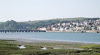
Bideford is a historic port town on the estuary of the River Torridge in north Devon, south-west England. It is the main town of the Torridge local government district.

Lot 10 is a township in Prince County, Prince Edward Island, Canada. It is part of Halifax Parish. Lot 10 was awarded to Simon Luttrell, 1st Earl of Carhampton in the 1767 land lottery. Ownership passed to John Motteux, High Sheriff of Norfolk by 1783, and to the Earl of Selkirk by 1806.

Lot 13 is a township in Prince County, Prince Edward Island, Canada. It is part of Richmond Parish. Lot 13 was awarded to John Pownall, Secretary to the Lords of Trade in the 1767 land lottery; and passed to the Marquess of Hertford by 1796.

Prince County is located in western Prince Edward Island, Canada. The county's defining geographic feature is Malpeque Bay, a sub-basin of the Gulf of St. Lawrence, which creates the narrowest portion of Prince Edward Island's landmass, an isthmus upon which the city of Summerside is located.

Ellerslie-Bideford was a municipality that held community status in Prince Edward Island, Canada. It was located in Prince County on Lot 12.
Freeland is a Canadian rural community in Prince County, Prince Edward Island.
Lennox Island is a Mi'kmaq First Nations band government in the Canadian province of Prince Edward Island. Its only currently inhabited reserve is Lennox Island 1, on Lennox Island, purchased by the Aborigines' Protection Society on behalf of the Mi'kmaq of Prince Edward Island in 1870 or 1878. The population on reserve is approximately 450. In 2005 the population was 320 on reserve and 720 off reserve, with 60% of the population being younger than 35. The 2016 census counted 323 residents on reserve. The band has two other reserves, Lennox Island 5, located in East Bideford, and Lennox Island 6, located in Fernwood, both acquired in the 2000s.
Lennox Island is an island located in Malpeque Bay off the northwest coast of Prince Edward Island, Canada. Connected by a short causeway and bridge, Lennox Island is home to the Lennox Island First Nation, of the Mi'kmaq people. The Mi'kmaq name for the island was L'nui Minegoo, and it has been informally known by European settlers as Indian Island.
Ellerslie Road, labelled Route 133, is a 2-lane collector highway in Prince County, Prince Edward Island, Canada. It is located 2.5–5 miles NE of the community of Tyne Valley and is located within the community of Ellerslie. Its maximum speed limit is 80 km/h (50 mph).
Tyne Valley is a municipality that holds community status in Prince Edward Island, Canada. It is located in Prince County. Incorporated in 1966, the community is located in the township of Lot 13 at the intersection of Routes 12 and 167.
Malpeque Bay is a 204 km2 (79 sq mi) estuarine bay on the north shore of Prince Edward Island, Canada.
Lennox Island may refer to:
Lady Slipper was a municipality that held community status in Prince Edward Island, Canada. On September 28, 2018, it was combined with the municipality of Ellerslie-Bideford, to create the new municipality of Central Prince.
The Municipality of Lot 11 and Area is a municipality that holds community status in Prince Edward Island, Canada. It is located within Prince County.
This is a list of elections in Canada scheduled to be held in 2018. Included are municipal, provincial and federal elections, by-elections on any level, referendums and party leadership races at any level.
Lennox Island 1 is a Mi'kmaq reserve located in Prince County, Prince Edward Island. In the 2016 Census, the reserve has 323 residents.
Lennox Island 5 is a Mi'kmaq reserve located in Prince County, Prince Edward Island. There are currently no residents.
Lennox Island 6 is a Mi'kmaq reserve located in Prince County, Prince Edward Island. There are currently no residents.
Central Prince is a rural municipality within Prince County in Prince Edward Island that was incorporated on September 28, 2018 through an amalgamation of two municipalities. The municipalities that amalgamated were the rural municipalities of Ellerslie-Bideford and Lady Slipper.
