
The Avalon Peninsula is a large peninsula that makes up the southeast portion of the island of Newfoundland. It is 9,220 square kilometres (3,560 sq mi) in size.

Avalon is a federal electoral district on Newfoundland Island in Newfoundland and Labrador, Canada. It has been represented in the House of Commons of Canada since 2004.

Lot 36 is a township in Queens County, Prince Edward Island, Canada. It is part of Bedford Parish. Lot 36 was awarded to merchants George Spence and John Mill in the 1767 land lottery. It was sold to Donald MacDonald in 1775.
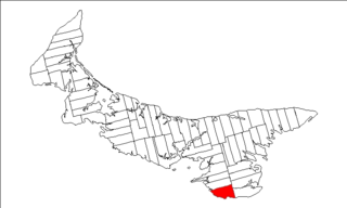
Lot 62 is a township in Queens County, Prince Edward Island, part of St. John's Parish. Lot 62 was awarded to Richard Spry, Esquire in the 1767 Land Lottery, and came to be settled through the efforts of Thomas Douglas, The 5th Earl of Selkirk in 1803. Richard Spry, Esquire, was then Commodore, Commander-in-Chief, Mediterranean Fleet at Gibraltar 1766–1769. Becoming the proprietor, he would be familiar with then the Island of St. John, having first come out to North America in 1754, with the English naval blockade of Ile Royal and the Fortress of Louisbourg in 1756, and then serving off Quebec and in the St. Lawrence into 1759. In 1762, he returned as Commander-in-Chief, North America, quartered in Halifax.

Lot 40 is a township in Kings County, Prince Edward Island, Canada. It is part of St. Patrick's Parish. Lot 40 was awarded to Lieutenant George Burns and merchants George Spence and John Mills in the 1767 land lottery.
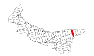
Lot 43 is a township in Kings County, Prince Edward Island, Canada. It is part of East Parish. Lot 43 was awarded to George Brydges Rodney, 1st Baron Rodney in the 1767 land lottery.

Lot 51 is a township in Kings County, Prince Edward Island, Canada. It is part of St. George's Parish. Lot 51 was awarded to John Pringle in the 1767 land lottery.

Lot 52 is a township in Kings County, Prince Edward Island, Canada. It is part of St. George's Parish. Lot 52 was awarded to Stuart, William, and Stair Douglas in the 1767 land lottery.
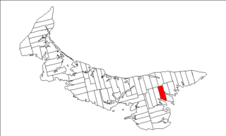
Lot 54 is a township in Kings County, Prince Edward Island, Canada. It is part of St. George's Parish. In the 1767 land lottery, Lot 54 was awarded to Robert Adair, surgeon to King George III of the United Kingdom.

Lot 55 is a township in Kings County, Prince Edward Island, Canada. It is part of St. George's Parish. Lot 55 was awarded to Hugh Finlay and Francis and Samuel McKay in the 1767 land lottery.

Lot 56 is a township in Kings County, Prince Edward Island, Canada. It is part of St. George's Parish. Lot 56 was awarded to George Townshend, 1st Marquess Townshend in the 1767 Lottery. General Townshend had assumed command of the British forces after General James Wolfe fell at the Battle of the Plains of Abraham during the Seven Years' War. Townshend later became Lord Lieutenant of Ireland. One quarter of the lot was granted to Loyalists in 1783.

Lot 66 is a township in Kings County, Prince Edward Island, Canada. It is part of St. George's Parish. Lot 66 was not distributed in the 1767 land lottery, but was reserved as demesne lands of the Crown.

St. George's Parish was created as a civil parish in Kings County, Prince Edward Island, Canada, during the 1764-1766 survey of Samuel Holland.

Prince County is located in western Prince Edward Island, Canada. The county's defining geographic feature is Malpeque Bay, a sub-basin of the Gulf of St. Lawrence, which creates the narrowest portion of Prince Edward Island's landmass, an isthmus upon which the city of Summerside is located.
Charles Worrell was a lawyer, land owner and political figure in Prince Edward Island. He represented Kings County in the Legislative Assembly of Prince Edward Island from 1812 to 1825. Worrell died in London in 1858.
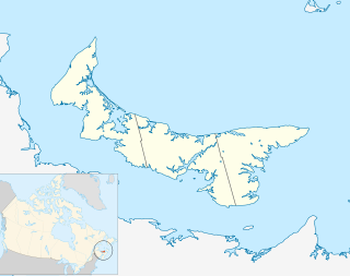
The Municipality of Malpeque Bay is a municipality that holds community status in Prince Edward Island, Canada. It is located in Prince County and Queens County.
Fisher Channel is a channel in the Central Coast region of the Canadian province of British Columbia. To its west are Hunter and Denny Islands, to its east King Island. It was first charted in 1793 by George Vancouver during his 1791-95 expedition. He named it "Fisher’s Channel" after "a much-respected friend" Reverend John Fisher.
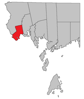
Saint Stephen is a civil parish in Charlotte County, New Brunswick, Canada, located in the southwestern corner of the province. It includes one town and three local service districts (LSD).

Resort Municipality, officially named the Resort Municipality of Stanley Bridge, Hope River, Bayview, Cavendish and North Rustico, is the lone municipality in Prince Edward Island, Canada that holds resort municipality status. It was established in 1990.


