
The Republic of Haiti comprises the western three-eighths of the island of Hispaniola, west of the Dominican Republic. Haiti is positioned east of the neighboring island of Cuba, between the Caribbean Sea and the North Atlantic Ocean. Haiti's geographic coordinates are at a longitude of 72° 25′ west and a latitude of 19° 00′ north.

Prince Rupert is a port city in the province of British Columbia, Canada. Its location is on Kaien Island near the Alaskan panhandle. This port city is the land, air, and water transportation hub of British Columbia's North Coast, and has a population of 12,220 people as of 2016.
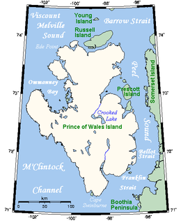
One of the larger members of the Canadian Arctic Archipelago, Prince of Wales Island is an Arctic island in Nunavut, Canada, lying between Victoria Island and Somerset Island and south of the Queen Elizabeth Islands.

Cornwall Island is a small island in the high arctic region of the Canadian territory of Nunavut. It is near the geometric centre of the Queen Elizabeth Islands. To the north, it is separated from Amund Ringnes Island by Hendriksen Strait. To the south, it is separated from Devon Island by Belcher Channel. It is the largest of six islands in the Norwegian Bay, west of Ellesmere Island.
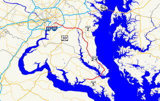
Maryland Route 4 is a state highway in the U.S. state of Maryland. The highway runs 64.85 miles (104.37 km) from MD 5 in Leonardtown north to Southern Avenue in Suitland at the District of Columbia boundary, beyond which the highway continues into Washington as Pennsylvania Avenue. MD 4 is a four- to six-lane highway that connects Washington and communities around the Capital Beltway with southern Prince George's County with southwestern Anne Arundel County. The highway is the primary highway for the length of Calvert County, during most of which the route runs concurrently with MD 2. MD 4 also connects Calvert and St. Mary's counties via the Governor Thomas Johnson Bridge across the Patuxent River. The highway connects the Southern Maryland county seats of Leonardtown, Prince Frederick, and Upper Marlboro.
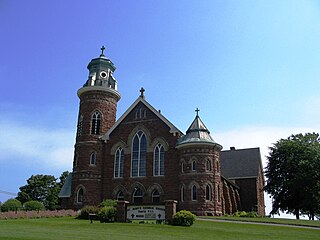
Souris is a Canadian town in Kings County, Prince Edward Island, near the northeastern tip of the province.
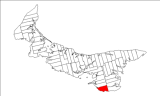
Lot 62 is a township in Queens County, Prince Edward Island, part of St. John's Parish. Lot 62 was awarded to Richard Spry, Esquire in the 1767 Land Lottery, and came to be settled through the efforts of Thomas Douglas, The 5th Earl of Selkirk in 1803. Richard Spry, Esquire, was then Commodore, Commander-in-Chief, Mediterranean Fleet at Gibraltar 1766–1769. Becoming the proprietor, he would be familiar with then the Island of St. John, having first come out to North America in 1754, with the English naval blockade of Ile Royal and the Fortress of Louisbourg in 1756, and then serving off Quebec and in the St. Lawrence into 1759. In 1762, he returned as Commander-in-Chief, North America, quartered in Halifax.

Prince County is located in western Prince Edward Island, Canada. The county's defining geographic feature is Malpeque Bay, a sub-basin of the Gulf of St. Lawrence, which creates the narrowest portion of Prince Edward Island's landmass, an isthmus upon which the city of Summerside is located.
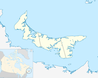
Murray Harbour is a municipality that holds rural municipality status in Prince Edward Island, Canada. It is located in southeastern Kings County.
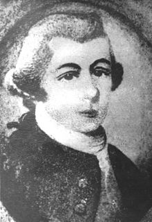
Walter Patterson was the first British colonial Governor of Prince Edward Island.

Belfast is a municipality that holds community status in Prince Edward Island, Canada. It is located in southeastern Queens County in the townships of Lot 57 and Lot 58.

Tyne Valley is a municipality that holds community status in Prince Edward Island, Canada. It is located in Prince County. Incorporated in 1966, the community is located in the township of Lot 13 at the intersection of Routes 12 and 167.
West Royalty-Springvale was a provincial electoral district for the Legislative Assembly of Prince Edward Island, Canada. It was previously known as Winsloe-West Royalty. It was abolished prior to the 2019 election into Charlottetown-Winsloe, Charlottetown-West Royalty, Brackley-Hunter River and New Haven-Rocky Point.

Malpeque Bay is a 204 km2 (79 sq mi) estuarine bay on the north shore of Prince Edward Island, Canada.

Charlottetown is the capital and largest city of the Canadian province of Prince Edward Island, and the county seat of Queens County. Named after Charlotte of Mecklenburg-Strelitz, queen consort of King George III of the United Kingdom, Charlottetown was originally an unincorporated town that incorporated as a city in 1855.

The Municipality of Malpeque Bay is a municipality that holds community status in Prince Edward Island, Canada. It is located in Prince County and Queens County.

The Tobacco Inspection Act of 1730 was a 1730 English law designed to improve the quality of tobacco exported from Colonial Virginia. Proposed by Virginia Lieutenant Governor Sir William Gooch, the law was far-reaching in impact in part because it gave warehouses the power to destroy substandard crops and issue bills of exchange that served as currency Richmond during the Colonial Period. The law centralized the inspection of tobacco at 40 locations described in the law.


