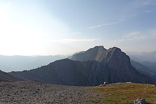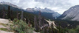
Mount Alberta is a mountain located in the upper Athabasca River Valley of Jasper National Park, Alberta, Canada. J. Norman Collie named the mountain in 1898 after Princess Louise Caroline Alberta. It is the most difficult of the 11,000ers from a climbing point of view.

Mount Brazeau is a mountain in Alberta, Canada.

The Blue Range is a mountain range of the Canadian Rockies, located on the Continental Divide in Banff National Park, Canada. The range was so named on account of its blueish colour when viewed from afar. Mount Alcantara is the highest point in the range.

Heart Mountain is a mountain located in the Bow River valley just south of Exshaw, Alberta. The peak was named in 1957 for the heart shaped layer of limestone near the top.

Pyramid Mountain is a mountain in Jasper National Park, Alberta, Canada, named for its pyramid-like shape. James Hector named the mountain in 1859 due to its appearance from the Athabasca River valley on the eastern side of the peak.

The Three Sisters is a mountain immediately north of Fernie, British Columbia, northwest of the confluence of Fairy Creek with the Elk River. It should not be confused with the Alberta Rockies' peaks of the same name, located further north outside Canmore.

The Fiddle Range is a mountain range of the Canadian Rockies located south of Highway 16 on the east border of Jasper National Park, Canada.

Mount Lyell is a mountain on the Alberta–British Columbia border in western Canada. Comprising five distinct summits, Mount Lyell reaches a height of 3,498 m (11,476 ft). The mountain was named by James Hector in 1858 in recognition of Scottish geologist Sir Charles Lyell.

Crowsnest Range is a mountain range of the Rocky Mountains in southwestern Alberta and southeastern British Columbia, Canada.

Sunwapta Pass is a mountain pass in the Canadian Rockies in the province of Alberta. Sunwapta Pass is the low point of the saddle created between Mount Athabasca and Nigel Peak. The pass marks the boundary between Banff and Jasper national parks. The Icefields Parkway travels through Sunwapta Pass 108 km (67 mi) southeast of the town of Jasper and 122 km (76 mi) northwest of the Parkway's junction with the Trans-Canada Highway near Lake Louise. The pass is the second highest point on the Icefields Parkway. Bow Summit in Banff National Park is the highest point on the parkway.

Panther Falls are a series of waterfalls in Banff National Park, Alberta, Canada. It is developed on Nigel Creek and its waters originate in Nigel Pass, between the slopes of Cirrus Mountain and Nigel Peak in the Parker Ridge of the Canadian Rockies.

Midnight Sun Peak is a mountain in the Baffin Mountains, Baffin Island, Nunavut, Canada. It is part of the Auyuittuq National Park area with an elevation of 1,967 m (6,453 ft).
Howson Peak is a mountain in west central British Columbia, Canada, located 54 km (34 mi) southwest of Telkwa and southwest of the head of Telkwa River. This prominent mountain is the highest of the Howson Range. Howson Peak was first climbed in 1958 after an accident during a 1957 attempt in which Rex Gibson, then president of the Alpine Club of Canada, was killed. That route, as well as many other lines, remains unclimbed. The mountain is now in Tazdli Wiyez Bin or Burnie-Shea Provincial Park. Access is by air to Burnie Lake or on foot from the Kitnayakwa River road. The Burnie Glacier Chalet is the nearest accommodation.
Thudaka Peak is the highest mountain of the Thudaka Range of the Cassiar Mountains in the Northern Interior of British Columbia, Canada, located between the heads of Obo River and Frog River. Glaciers exist on Thudaka's northern flanks, but the zone is usually quite dry.
Shedin Peak is the highest mountain in the Atna Range and in the Skeena Mountains of northern British Columbia, Canada, located 77 km (48 mi) north of Hazelton at the head of Rosenthal Creek. It has a prominence of 1,798 m (5,899 ft), created by the Bear-Driftwood Pass.
Birkenhead Peak, commonly known as Mount Birkenhead and sometimes Birkenhead Mountain or Mount Birken is a mountain in the Gates Valley region of the Lillooet Country of the South-Central Interior of British Columbia, Canada. Located approximately midway between the towns of Lillooet (NE) and Pemberton-Mount Currie, the mountain's very high prominence separates it from the adjoining Cadwallader Range by the pass between Blackwater Creek and Birkenhead Lake.
Mount Ulysses, is the highest mountain in the Muskwa Ranges of the Northern Canadian Rockies in British Columbia. It and neighbouring peaks are part of a group of names drawing on the epic poem The Odyssey, in which here Ulysses wanders for 10 years before being able to return home to Ithaca.

The Sundance Range is a mountain range in the Canadian Rockies, south of the town of Banff. It is located on the Continental Divide, which forms the boundary between British Columbia and Alberta in this region.


