
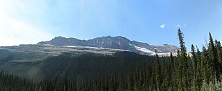
The Winston Churchill Range is a mountain range in the central section of the Park Ranges of the Canadian Rockies located in Jasper National Park. The range was named after Sir Winston Churchill, former British prime minister.

The Slate Range is a mountain range of the Canadian Rockies, located in Banff National Park, Canada. The range is named after slate, the primary composition of the mountains in the area.

The Sawback Range is a mountain range of the Canadian Rockies that stretches from the Bow Valley in Alberta into southeastern Banff National Park.
The President Range is a mountain range of the Canadian Rockies, located in the northwestern section of Yoho National Park. The range is named for the highest peak in the range, The President.

The Beaverfoot Range is a mountain range in the Kootenay Ranges of the Canadian Rockies, located in southeastern British Columbia. The range extends from Cedared Creek near Spillimacheen north to the Kicking Horse River.

The Vermilion Range is a mountain range of the Canadian Rockies, in Banff National Park, Canada. The range is east of the Sawback Range and west of the Bare and Palliser Ranges.

The Muskwa Ranges are a group of mountain ranges in northern British Columbia, Canada. They are part of the Northern Rockies section of the Rocky Mountains and are bounded on their west by the Rocky Mountain Trench and on their east by the Rocky Mountain Foothills. They are delimited on the north by the Liard River and on the south by the Peace Reach of the Lake Williston reservoir, south of which the next major grouping of the Rockies is the Hart Ranges.
The Fiddle Range is a mountain range of the Canadian Rockies located south of Highway 16 on the east border of Jasper National Park, Canada.

The Jacques Range is a mountain range in the Front Ranges of the Canadian Rockies, located south of Highway 16 and Jasper Lake in Jasper National Park, Alberta, Canada.

The Colin Range is a mountain range of the Canadian Rockies located directly northeast of the Jasper townsite in Jasper National Park, Canada.

The Misty Range is a mountain range of the Canadian Rockies located east of the Bighorn Highway within Kananaskis Country, Canada.

Mount Bridgland is a 2,930-metre (9,610 ft) mountain located in the Victoria Cross Ranges of Jasper National Park in Alberta, Canada. It was named by Frank Sissons in 1923 after Morrison P. Bridgland (1878-1948), a Dominion Land Surveyor who named many peaks in Jasper Park and the Canadian Rockies.

Utopia Mountain is a 2,602-metre (8,537-foot) mountain in the Miette Range of Jasper National Park, in the Canadian Rockies of Alberta, Canada. It was named by Morrison P. Bridgland in 1916. Bridgland (1878-1948) was a Dominion Land Surveyor who named many peaks in Jasper Park and the Canadian Rockies.

The Terminal Range is the northernmost mountain range of the Canadian Rockies, so-named for its position at the northern terminus of the Rockies. Lying west of Muncho Lake and the Trout River, its northern perimeter is the Liard River. The Sentinel Range lies to its east.

The Sundance Range is a mountain range in the Canadian Rockies, south of the town of Banff. It is located on the Continental Divide, which forms the boundary between British Columbia and Alberta in this region.
Emigrants Mountain is a summit in Jasper National Park in Alberta, Canada. accessible by walking track and with views over the Miette Valley, Mount Fitzwilliam and other peaks in the Great Divide. Emigrants Mountain was so named on account of gold prospectors in the area during the Cariboo Gold Rush.

Roche Miette is a 2,316-metre (7,598-foot) mountain at the northwestern tip of the Miette Range in Jasper National Park, in the Canadian Rockies of Alberta, Canada. The peak is a prominent landmark in the Athabasca Valley that is situated approximately thirty kilometres north-northeast of the municipality of Jasper, and four kilometres northeast of the Jasper House National Historic Site. It is visible from Highway 16 and the Canadian. Its nearest higher peak is Capitol Mountain, 5.0 km (3.1 mi) to the southeast. Roche Miette translates from French as Crumb Rock.

Franklin Glacier is a mountain glacier in the Waddington Range of the Pacific Ranges in southwestern British Columbia, Canada. It lies at the head of the Franklin River adjacent to Mount Waddington, the highest mountain entirely within British Columbia.

Cairngorm is a 2,610-metre (8,563 ft) mountain located in Alberta, Canada.
Roche Noire is a 2,920-metre (9,580 ft) mountain located in Alberta, Canada.

