
Gambo is a town and designated place in the Canadian province of Newfoundland and Labrador. It is in the northeastern portion of the island of Newfoundland on Freshwater Bay. It is in Division No. 7.
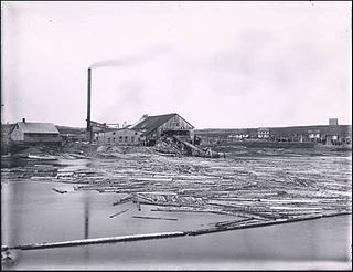
Botwood is a town in north-central Newfoundland, Newfoundland and Labrador, Canada in Census Division 6. It is located on the west shore of the Bay of Exploits on a natural deep water harbour used by cargo ships and seaplanes throughout the town's history. Botwood was the North American terminus for the first transatlantic commercial flights.

Ramea is a small village in Newfoundland and Labrador located on Northwest Island, one of a group of five major islands located off the south coast of Newfoundland, Canada. The island is approximately 3.14 km long by 0.93 km wide. The other major islands in the archipelago are Great Island, Middle Island, Harbour Island, and South West Island.

Cupids is a town of 743 people on Conception Bay, Newfoundland and Labrador, Canada. It has also been known as Coopers, Copers Cove, Cupers Cove, and Cuperts. It is the oldest continuously settled official British colony in Canada. Cupids is believed to be the site of the first child born of European parents in the country. The town was established by Englishman John Guy in 1610.

Stephenville Crossing is a town and designated place in the Canadian province of Newfoundland and Labrador. It is on the island of Newfoundland at the easternmost limit of Bay St. George.

Newfoundland and Labrador is a province of Canada on the country's Atlantic coast in northeastern North America. The province has an area of 405,212 square kilometres and a population in 2011 of 514,563, with approximately 95% of the provincial population residing on the Island of Newfoundland, with nearly half of the population residing on the Avalon Peninsula. People from Newfoundland and Labrador are called "Newfoundlanders," "Labradorians", or "Newfoundlanders and Labradorians".
Bay L'Argent is a town in the Canadian province of Newfoundland and Labrador. The town had a population of 241 in the Canada 2016 Census.
Bellburns is a fishing settlement in the Canadian province of Newfoundland and Labrador. The town had a population of 53 in the Canada 2016 Census. the town holds strong economic ties with the two closest towns Daniels harbor and Portland Creek.
Bird Cove is a town in the Canadian province of Newfoundland and Labrador. The town had a population of 179 in the Canada 2016 Census.
Brent's Cove is a town in the Canadian province of Newfoundland and Labrador. The town had a population of 157 in the Canada 2016 Census.
Brighton is a town in the Canadian province of Newfoundland and Labrador. The town had a population of 188 in the Canada 2016 Census.
Bryant's Cove is a town in the Canadian province of Newfoundland and Labrador. The town had a population of 395 in the Canada 2016 Census.
Chance Cove is a town in the Canadian province of Newfoundland and Labrador. The town had a population of 256 in the Canada 2016 Census.
Hughes Brook is a town in the Canadian province of Newfoundland and Labrador. The town had a population of 255 in the Canada 2016 Census. It is located to the northeast of Corner Brook, in the western Bay of Islands area.

Point au Gaul is a town in the Canadian province of Newfoundland and Labrador, Canada. The town had a population of 88 in the Canada 2016 Census, down from 97 in 2011, and 85 in the Canada 2006 Census.

L'Anse-au-Loup is a town in the Canadian province of Newfoundland and Labrador. The town had a population of 558 in the Canada 2016 Census, slightly up from 550 in 2011. In the Canada 2006 Census, there were 593 inhabitants. Common Surnames are Barney, Belben, Cabot, Earle, Linstead, Normore, O'Brien, Ryland.
Fogo Island is a town located on Fogo Island, the largest of the offshore islands in the province of Newfoundland and Labrador, Canada.

Random Sound West, previously known as Hillview-Adeytown-Hatchet Cove-St. Jones Within, is a local service district and designated place in the Canadian province of Newfoundland and Labrador.
This page is based on this
Wikipedia article Text is available under the
CC BY-SA 4.0 license; additional terms may apply.
Images, videos and audio are available under their respective licenses.
