
Mount Columbia is a mountain located in the Winston Churchill Range of the Rocky Mountains. It is the highest point in Alberta, Canada, and is second only to Mount Robson for height and topographical prominence in the Canadian Rockies. It is located on the border between Alberta and British Columbia on the northern edge of the Columbia Icefield. Its highest point, however, lies within Jasper National Park in Alberta.

Mount Alberta is a mountain located in the upper Athabasca River Valley of Jasper National Park, Alberta, Canada. J. Norman Collie named the mountain in 1898 after Princess Louise Caroline Alberta. It is the most difficult of the 11,000ers from a climbing point of view.

Mount Forbes is the seventh tallest mountain in the Canadian Rockies and the tallest within the boundaries of Banff National Park. It is located in southwestern Alberta, 18 km (11 mi) southwest of the Saskatchewan River Crossing in Banff. The mountain was named by James Hector in 1859 after Edward Forbes, Hector's natural history professor at the University of Edinburgh during the mid-19th century.

Mount Temple is a mountain in Banff National Park of the Canadian Rockies of Alberta, Canada.

Mount Brazeau is a mountain in Alberta, Canada.
Mount Cory is a mountain located in the Bow River Valley in southeast Banff National Park, just north of Banff, Alberta, Canada. The mountain was named in 1923 after William Wallace Cory, deputy minister of the Interior from 1905 to 1930.

The Blue Range is a mountain range of the Canadian Rockies, located on the Continental Divide in Banff National Park, Canada. The range was so named on account of its blueish colour when viewed from afar. Mount Alcantara is the highest point in the range.

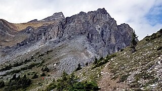
The Palliser Range is a mountain range of the Canadian Rockies that lies in the extreme southeast corner of Banff National Park, Alberta, Canada.

Mount Hector is a 3,394-metre (11,135-foot) mountain summit located in the Bow River valley of Banff National Park, in the Canadian Rockies of Alberta, Canada. The mountain was named in 1884 by George M. Dawson after James Hector, a geologist on the Palliser expedition. The mountain is located beside the Icefields Parkway, 17 km (11 mi) north of Lake Louise.

Mount Sir Sandford is the highest mountain of the Sir Sandford Range and the highest mountain in the Selkirk Mountains of southeastern British Columbia, Canada. It is the 12th highest peak in the province. The mountain was named after Sir Sandford Fleming, a railway engineer for the Canadian Pacific Railway.
Jack William Ady was a provincial-level politician from Alberta, Canada. He served as a member of the Legislative Assembly of Alberta from 1986 to 1997. He was born in Cardston, Alberta.
Mount Thomlinson is a mountain in the Babine Range of the Skeena Mountains in northern British Columbia, Canada, located at the head of Thomlinson Creek, southeast of the junction of Babine River and Skeena River and north of Hazelton. It has a prominence of 1,661 m (5,449 ft), created by the Babine-Stuart Pass, thus making it one of Canada's many Ultra peaks. Thomlinson is one of the most isolated mountains of Canada.
Mount Lawson is a mountain located in the Kananaskis Range of Alberta. It was named in 1922 by Walter Wilcox and H.G. Bryant after Major W.E. Lawson, an employee with the Geological Survey of Canada who was killed in France during World War I.

Highwood Pass is a mountain pass in Kananaskis Country, Alberta, Canada. It lies west of Mount Rae and Mount Arethusa of the Misty Range, south of Elbow Pass. It lies within the Peter Lougheed Provincial Park on Alberta Highway 40. The Highwood River originates in the pass.
Mount Farnham is British Columbia's 17th highest peak, and 21st most prominent. It was named after Paulding Farnham from New York. It is the highest peak in the Purcells.
A mountain formerly known as Mount Pétain, but with no current official name, is located on the border of the Canadian provinces of Alberta and British Columbia (BC) on the Continental Divide.
Mount Allenby is a mountain summit in Alberta, Canada.

Mount Turner is a 2,806-metre (9,206-foot) mountain summit located in the upper Spray River Valley of southern Banff National Park, in the Canadian Rockies of Alberta, Canada. Mount Turner in not visible from any road in Banff Park, however, it can be seen from Alberta Highway 742, also known as the Smith-Dorrien/Spray Trail in Kananaskis Country. Mount Turner's nearest higher peak is Cone Mountain, 2.91 km (1.81 mi) to the north.

Mount Mercer is a 2,970-metre (9,744-foot) mountain summit located in Alberta, Canada.
