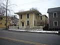
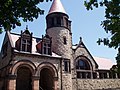
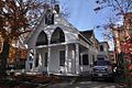
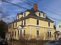
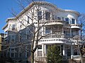
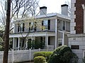
[ 3] Name on the Register [ 4] Image Date listed [ 5] Location Description 1 Edwin Abbot House Edwin Abbot House May 10, 1979 (# 79000354 1 Follen St. 42°22′43″N 71°07′24″W / 42.378480°N 71.123296°W / 42.378480; -71.123296 (Edwin Abbot House ) 2 John Aborn House John Aborn House April 13, 1982 (# 82001883 41 Orchard St. 42°23′29″N 71°07′14″W / 42.391507°N 71.120442°W / 42.391507; -71.120442 (John Aborn House ) 3 Alewife Brook Parkway Alewife Brook Parkway March 18, 2004 (# 04000249 Alewife Brook Parkway 42°23′45″N 71°08′26″W / 42.395889°N 71.140589°W / 42.395889; -71.140589 (Alewife Brook Parkway ) 4 Almshouse Almshouse April 13, 1982 (# 82001908 45 Matignon Road [ 6] 42°24′08″N 71°07′57″W / 42.402145°N 71.132543°W / 42.402145; -71.132543 (Almshouse ) Property is mostly in Cambridge; building extends into Somerville. 5 American Net and Twine Company Factory American Net and Twine Company Factory April 1, 1982 (# 82001906 155 2nd St. 42°22′01″N 71°04′47″W / 42.366883°N 71.079626°W / 42.366883; -71.079626 (American Net and Twine Company Factory ) 6 Ash Street Historic District Ash Street Historic District April 13, 1982 (# 82001916 Ash St. and Ash St. Place between Brattle and Mount Auburn Sts. 42°22′30″N 71°07′29″W / 42.3751°N 71.1248°W / 42.3751; -71.1248 (Ash Street Historic District ) 7 Athenaeum Press Athenaeum Press April 13, 1982 (# 82001917 215 1st St. 42°21′51″N 71°04′43″W / 42.364184°N 71.078597°W / 42.364184; -71.078597 (Athenaeum Press ) 8 Ephraim Atwood House Ephraim Atwood House June 30, 1983 (# 83000781 110 Hancock St. 42°22′09″N 71°06′28″W / 42.369272°N 71.107743°W / 42.369272; -71.107743 (Ephraim Atwood House ) 9 Austin Hall Austin Hall April 19, 1972 (# 72000128 Harvard University campus 42°22′37″N 71°07′08″W / 42.376986°N 71.118823°W / 42.376986; -71.118823 (Austin Hall ) 10 Avon Hill Historic District Avon Hill Historic District June 30, 1983 (# 83000782 Washington and Walnut Aves. and Agassiz, Humboldt, Arlington and Lancaster Sts. 42°23′09″N 71°07′21″W / 42.385833°N 71.1225°W / 42.385833; -71.1225 (Avon Hill Historic District ) 11 B and B Chemical Company B and B Chemical Company April 13, 1982 (# 82001918 780 Memorial Dr. 42°21′35″N 71°06′57″W / 42.359722°N 71.115833°W / 42.359722; -71.115833 (B and B Chemical Company ) Flagship center building of the complex is 784 Memorial Drive [ 7] 12 Maria Baldwin House Maria Baldwin House May 11, 1976 (# 76000272 196 Prospect St. 42°22′13″N 71°06′01″W / 42.370166°N 71.100335°W / 42.370166; -71.100335 (Maria Baldwin House ) 13 James B. Barnes House James B. Barnes House April 13, 1982 (# 82001919 109 Hampshire Street 42°22′11″N 71°05′45″W / 42.369608°N 71.095741°W / 42.369608; -71.095741 (James B. Barnes House ) 14 Beck-Warren House Beck-Warren House May 20, 1996 (# 96000520 11 Prescott St. 42°22′23″N 71°06′51″W / 42.372938°N 71.114098°W / 42.372938; -71.114098 (Beck-Warren House ) 15 Bennink-Douglas Cottages Bennink-Douglas Cottages May 19, 1986 (# 86001272 35–51 Walker St. 42°22′48″N 71°07′23″W / 42.380016°N 71.123012°W / 42.380016; -71.123012 (Bennink-Douglas Cottages ) 16 Berkeley Street Historic District Berkeley Street Historic District April 13, 1982 (# 82001920 Berkeley St.; also 1–8 Berkeley Pl. 42°22′42″N 71°07′33″W / 42.378436°N 71.125832°W / 42.378436; -71.125832 (Berkeley Street Historic District ) Berkeley Place represents a boundary increase 17 Bertram Hall at Radcliffe College Bertram Hall at Radcliffe College May 19, 1986 (# 86001270 53 Shepard St. 42°22′50″N 71°07′27″W / 42.380688°N 71.124042°W / 42.380688; -71.124042 (Bertram Hall at Radcliffe College ) 18 Beth Israel Synagogue Beth Israel Synagogue April 13, 1982 (# 82001921 238 Columbia St. 42°22′09″N 71°05′47″W / 42.369199°N 71.096400°W / 42.369199; -71.096400 (Beth Israel Synagogue ) 19 Bigelow Street Historic District Bigelow Street Historic District April 13, 1982 (# 82001922 Bigelow St. 42°22′05″N 71°06′19″W / 42.368156°N 71.105208°W / 42.368156; -71.105208 (Bigelow Street Historic District ) 20 Frederick Billings House Frederick Billings House April 13, 1982 (# 82001923 45 Orchard St. 42°23′30″N 71°07′14″W / 42.391621°N 71.120573°W / 42.391621; -71.120573 (Frederick Billings House ) 21 George D. Birkhoff House George D. Birkhoff House May 15, 1975 (# 75000295 22 Craigie St. 42°22′41″N 71°07′42″W / 42.378056°N 71.128333°W / 42.378056; -71.128333 (George D. Birkhoff House ) 22 Blake and Knowles Steam Pump Company National Register District Blake and Knowles Steam Pump Company National Register District June 13, 1997 (# 97000561 Bounded by Third, Binney, Fifth, and Rogers Sts. 42°21′58″N 71°05′02″W / 42.366111°N 71.083889°W / 42.366111; -71.083889 (Blake and Knowles Steam Pump Company National Register District ) 23 Bottle House Block Bottle House Block April 13, 1982 (# 82001924 204–214 3rd St. 42°22′02″N 71°04′53″W / 42.367222°N 71.081389°W / 42.367222; -71.081389 (Bottle House Block ) 24 E. H. Brabrook House E. H. Brabrook House May 19, 1986 (# 86001276 42–44 Avon St. 42°22′59″N 71°07′24″W / 42.382976°N 71.123250°W / 42.382976; -71.123250 (E. H. Brabrook House ) 25 William F. Bradbury House William F. Bradbury House June 30, 1983 (# 83000784 369 Harvard St. 42°22′17″N 71°06′42″W / 42.371496°N 71.111731°W / 42.371496; -71.111731 (William F. Bradbury House ) 26 Brattle Hall Brattle Hall April 13, 1982 (# 82001925 40 Brattle St. 42°22′25″N 71°07′17″W / 42.373557°N 71.121441°W / 42.373557; -71.121441 (Brattle Hall ) 27 William Brattle House William Brattle House May 8, 1973 (# 73000286 42 Brattle St. 42°22′25″N 71°07′18″W / 42.373694°N 71.121556°W / 42.373694; -71.121556 (William Brattle House ) 28 Percy Bridgman House Percy Bridgman House May 15, 1975 (# 75000298 10 Buckingham Pl. 42°22′45″N 71°07′44″W / 42.379167°N 71.128889°W / 42.379167; -71.128889 (Percy Bridgman House ) 29 Luther Brooks House Luther Brooks House September 12, 1986 (# 86002068 34 Kirkland St. 42°22′36″N 71°06′47″W / 42.376659°N 71.113079°W / 42.376659; -71.113079 (Luther Brooks House ) 30 Building at 1707–1709 Cambridge Street Building at 1707–1709 Cambridge Street June 30, 1983 (# 83000787 1707–1709 Cambridge St. 42°22′31″N 71°06′44″W / 42.375328°N 71.112179°W / 42.375328; -71.112179 (Building at 1707–1709 Cambridge Street ) 31 Building at 1715–1717 Cambridge Street Building at 1715–1717 Cambridge Street June 30, 1983 (# 83000788 1715–1717 Cambridge St. 42°22′31″N 71°06′45″W / 42.375329°N 71.112480°W / 42.375329; -71.112480 (Building at 1715–1717 Cambridge Street ) 32 Building at 10 Follen Street Building at 10 Follen Street April 13, 1982 (# 82001926 10 Follen St. 42°22′43″N 71°07′21″W / 42.378500°N 71.122362°W / 42.378500; -71.122362 (Building at 10 Follen Street ) 33 Building at 104–106 Hancock Street Building at 104–106 Hancock Street June 30, 1983 (# 83000789 104–106 Hancock St. 42°22′09″N 71°06′28″W / 42.369138°N 71.107744°W / 42.369138; -71.107744 (Building at 104–106 Hancock Street ) 34 Building at 102–104 Inman Street Building at 102–104 Inman Street June 30, 1983 (# 83000790 102–104 Inman St. 42°22′19″N 71°06′05″W / 42.372070°N 71.101448°W / 42.372070; -71.101448 (Building at 102–104 Inman Street ) 35 Building at 106–108 Inman St Building at 106–108 Inman St April 13, 1982 (# 82001927 106–108 Inman St. 42°22′20″N 71°06′05″W / 42.372279°N 71.101368°W / 42.372279; -71.101368 (Building at 106–108 Inman St ) 36 Buildings at 110–112 Inman St. Buildings at 110–112 Inman St. April 13, 1982 (# 82001929 110–112 Inman St. 42°22′21″N 71°06′04″W / 42.372492°N 71.101168°W / 42.372492; -71.101168 (Buildings at 110–112 Inman St. ) 37 Buildings at 15–17 Lee St. Buildings at 15–17 Lee St. April 13, 1982 (# 82001930 15–17 Lee St. 42°22′07″N 71°06′25″W / 42.368536°N 71.106994°W / 42.368536; -71.106994 (Buildings at 15–17 Lee St. ) 38 Building at 42 Edward J. Lopez Avenue Building at 42 Edward J. Lopez Avenue April 13, 1982 (# 82001928 42 Edward J. Lopez Ave. 42°22′04″N 71°04′48″W / 42.367778°N 71.08°W / 42.367778; -71.08 (Building at 42 Edward J. Lopez Avenue ) 39 Building at 259 Mount Auburn Street Building at 259 Mount Auburn Street June 30, 1983 (# 83000786 259 Mt. Auburn St. 42°22′29″N 71°07′55″W / 42.374824°N 71.132039°W / 42.374824; -71.132039 (Building at 259 Mount Auburn Street ) 40 Cambridge Common Historic District Cambridge Common Historic District April 13, 1973 (# 73000281 Garden, Waterhouse, Cambridge, and Peabody Sts., and Massachusetts Ave.June 30, 1983 , refnum 83004293): Massachusetts Ave. and Garden, Waterhouse, Cambridge, and Peabody Sts.January 26, 1987 , refnum 87000499): Roughly northwest of Waterhouse St. on Concord Ave. between Garden and Follen Sts. 42°22′35″N 71°07′15″W / 42.376389°N 71.120833°W / 42.376389; -71.120833 (Cambridge Common Historic District ) A historic district 41 Cambridge Home for the Aged and Infirm Cambridge Home for the Aged and Infirm October 22, 2002 (# 02001189 650 Concord Ave. 42°23′18″N 71°08′57″W / 42.388333°N 71.149167°W / 42.388333; -71.149167 (Cambridge Home for the Aged and Infirm ) Now Neville Place, a nursing facility. 42 Cambridge Public Library Cambridge Public Library April 13, 1982 (# 82001931 449 Broadway 42°22′27″N 71°06′41″W / 42.374167°N 71.111389°W / 42.374167; -71.111389 (Cambridge Public Library ) 43 Carpenter Center for the Visual Arts Carpenter Center for the Visual Arts April 20, 1978 (# 78000435 19 Prescott St. 42°22′25″N 71°06′50″W / 42.373478°N 71.113980°W / 42.373478; -71.113980 (Carpenter Center for the Visual Arts ) 44 Central Square Historic District Central Square Historic District March 2, 1990 (# 90000128 Roughly Massachusetts Ave. from Clinton St. to Main St.July 11, 2012 , refnum 12000404): Roughly 831 to 351–355 Massachusetts Ave. 42°21′54″N 71°06′13″W / 42.365°N 71.103611°W / 42.365; -71.103611 (Central Square Historic District ) 45 Charles River Basin Historic District Charles River Basin Historic District December 22, 1978 (# 78000436 Both banks of the Charles River from Eliot Bridge to Charles River Dam 42°21′25″N 71°05′03″W / 42.356873°N 71.084217°W / 42.356873; -71.084217 (Charles River Basin Historic District ) 46 Charles River Reservation Parkways Charles River Reservation Parkways January 18, 2006 (# 05001530 Soldiers Field, Nonantum, Leo Birmingham, Arsenal, Greenough, N. Beacon, Charles River , Norumbega, Recreation 42°22′03″N 71°08′11″W / 42.367597°N 71.136435°W / 42.367597; -71.136435 (Charles River Reservation Parkways ) Extends into Newton , Waltham , and Watertown and Weston , elsewhere in Middlesex County, and into Boston in Suffolk County 47 Francis J. Child House Francis J. Child House June 30, 1983 (# 83000791 67 Kirkland St. 42°22′40″N 71°06′34″W / 42.377664°N 71.109489°W / 42.377664; -71.109489 (Francis J. Child House ) 48 Christ Church Christ Church October 15, 1966 (# 66000140 Garden St. 42°22′31″N 71°07′16″W / 42.375278°N 71.121111°W / 42.375278; -71.121111 (Christ Church ) 49 Church of the New Jerusalem Church of the New Jerusalem June 30, 1983 (# 83000792 50 Quincy St. 42°22′35″N 71°06′50″W / 42.376389°N 71.113889°W / 42.376389; -71.113889 (Church of the New Jerusalem ) Also known as Cambridge Swedenborg Chapel 50 City Hall Historic District City Hall Historic District April 13, 1982 (# 82001932 Massachusetts Ave., Bigelow and Temple Sts, Inman and Richard Allen Dr. 42°22′00″N 71°06′20″W / 42.366667°N 71.105556°W / 42.366667; -71.105556 (City Hall Historic District ) 51 George Close Company Building George Close Company Building March 15, 2019 (# 100003472 243 Broadway 42°22′02″N 71°05′44″W / 42.3672°N 71.0956°W / 42.3672; -71.0956 (George Close Company Building ) 52 Cloverden Cloverden June 30, 1983 (# 83000793 29 Follen St. 42°22′44″N 71°07′16″W / 42.378921°N 71.121082°W / 42.378921; -71.121082 (Cloverden ) 53 Sara Foster Colburn House Sara Foster Colburn House April 13, 1982 (# 82004968 7 Dana St. 42°22′12″N 71°06′37″W / 42.37°N 71.1103°W / 42.37; -71.1103 (Sara Foster Colburn House ) 54 Conventual Church of St. Mary and St. John Conventual Church of St. Mary and St. John April 13, 1982 (# 82001933 980 Memorial Dr. 42°22′20″N 71°07′29″W / 42.372222°N 71.124722°W / 42.372222; -71.124722 (Conventual Church of St. Mary and St. John ) 55 William Cook House William Cook House April 13, 1982 (# 82001934 71 Appleton St. 42°22′46″N 71°08′02″W / 42.379582°N 71.133941°W / 42.379582; -71.133941 (William Cook House ) 56 Josiah Coolidge House Josiah Coolidge House June 30, 1983 (# 83000795 24 Coolidge Hill Rd. 42°22′27″N 71°08′23″W / 42.374084°N 71.139613°W / 42.374084; -71.139613 (Josiah Coolidge House ) 57 Cooper-Frost-Austin House Cooper-Frost-Austin House September 22, 1972 (# 72000124 21 Linnaean St. 42°23′04″N 71°07′18″W / 42.384426°N 71.121753°W / 42.384426; -71.121753 (Cooper-Frost-Austin House ) 58 Craigie Arms Craigie Arms July 10, 1986 (# 86001575 2–6 University Rd., 122 Mt. Auburn, and 6 Bennett Sts. 42°22′22″N 71°07′25″W / 42.372778°N 71.123611°W / 42.372778; -71.123611 (Craigie Arms ) 59 e.e. cummings House e.e. cummings House June 30, 1983 (# 83000796 104 Irving St. 42°22′44″N 71°06′38″W / 42.378843°N 71.110570°W / 42.378843; -71.110570 (e.e. cummings House ) 60 Reginald A. Daly House Reginald A. Daly House January 7, 1976 (# 76000305 23 Hawthorn St. 42°22′31″N 71°07′34″W / 42.375304°N 71.126077°W / 42.375304; -71.126077 (Reginald A. Daly House ) 61 Dana-Palmer House Dana-Palmer House May 19, 1986 (# 86001682 12–16 Quincy St. 42°22′23″N 71°06′53″W / 42.373027°N 71.114773°W / 42.373027; -71.114773 (Dana-Palmer House ) 62 William Morris Davis House William Morris Davis House January 7, 1976 (# 76000306 17 Francis Ave. 42°22′42″N 71°06′43″W / 42.378452°N 71.112040°W / 42.378452; -71.112040 (William Morris Davis House ) 63 Anna Day House Anna Day House April 13, 1982 (# 82001935 139 Cushing St. 42°22′43″N 71°09′08″W / 42.378611°N 71.152222°W / 42.378611; -71.152222 (Anna Day House ) 64 Deane-Williams House Deane-Williams House April 13, 1982 (# 82001936 21–23 Fayette St. 42°22′20″N 71°06′13″W / 42.372140°N 71.103634°W / 42.372140; -71.103634 (Deane-Williams House ) 65 DeRosay-McNamee House DeRosay-McNamee House March 2, 1990 (# 90000142 50 Mt. Vernon St. 42°23′14″N 71°07′17″W / 42.387328°N 71.121419°W / 42.387328; -71.121419 (DeRosay-McNamee House ) 66 Divinity Hall Divinity Hall September 12, 1986 (# 86002071 12 Divinity Ave. 42°22′43″N 71°06′53″W / 42.378611°N 71.114722°W / 42.378611; -71.114722 (Divinity Hall ) 67 Edward Dodge House Edward Dodge House April 13, 1982 (# 82001937 70 Sparks St. 42°22′47″N 71°07′53″W / 42.379722°N 71.131389°W / 42.379722; -71.131389 (Edward Dodge House ) 68 The Dunvegan The Dunvegan May 19, 1986 (# 86001279 1654 Massachusetts Ave. 42°22′54″N 71°07′12″W / 42.381611°N 71.120028°W / 42.381611; -71.120028 (The Dunvegan ) 69 East Cambridge Historic District East Cambridge Historic District June 30, 1983 (# 83000797 Roughly bounded by Cambridge, Hurley and 5th Sts. 42°22′12″N 71°04′51″W / 42.37°N 71.080833°W / 42.37; -71.080833 (East Cambridge Historic District ) 70 East Cambridge Savings Bank East Cambridge Savings Bank April 13, 1982 (# 82001938 292 Cambridge St. 42°22′16″N 71°04′51″W / 42.371124°N 71.080827°W / 42.371124; -71.080827 (East Cambridge Savings Bank ) 71 Eliot Hall at Radcliffe College Eliot Hall at Radcliffe College May 19, 1986 (# 86001280 51 Shepard St. 42°22′52″N 71°07′25″W / 42.381028°N 71.123510°W / 42.381028; -71.123510 (Eliot Hall at Radcliffe College ) 72 Asa Ellis House Asa Ellis House June 30, 1983 (# 83000798 158 Auburn St. 42°21′49″N 71°06′18″W / 42.363509°N 71.104890°W / 42.363509; -71.104890 (Asa Ellis House ) 73 Elmwood Elmwood October 15, 1966 (# 66000364 33 Elmwood Ave. 42°22′31″N 71°08′19″W / 42.375278°N 71.138611°W / 42.375278; -71.138611 (Elmwood ) 74 R.H. Farwell House R.H. Farwell House April 13, 1982 (# 82001939 2222–2224 Massachusetts Ave. 42°23′37″N 71°07′34″W / 42.393527°N 71.126141°W / 42.393527; -71.126141 (R.H. Farwell House ) 75 Isaac Fay House Isaac Fay House June 30, 1983 (# 83000799 125 Antrim St. 42°22′23″N 71°06′06″W / 42.373159°N 71.101696°W / 42.373159; -71.101696 (Isaac Fay House ) 76 First Baptist Church First Baptist Church April 14, 1975 (# 75000249 Magazine and River Sts. 42°21′53″N 71°06′20″W / 42.364722°N 71.105556°W / 42.364722; -71.105556 (First Baptist Church ) 77 Ernst Flentje House Ernst Flentje House June 30, 1983 (# 83000800 129 Magazine St. 42°21′32″N 71°06′40″W / 42.359026°N 71.111245°W / 42.359026; -71.111245 (Ernst Flentje House ) 78 Fogg Art Museum Fogg Art Museum May 19, 1986 (# 86001282 26–32 Quincy St. 42°22′27″N 71°06′53″W / 42.374167°N 71.114722°W / 42.374167; -71.114722 (Fogg Art Museum ) 79 Follen Street Historic District Follen Street Historic District May 19, 1986 (# 86001681 1–44 and 5–29 Follen St. 42°22′43″N 71°07′19″W / 42.378667°N 71.121981°W / 42.378667; -71.121981 (Follen Street Historic District ) 80 Fort Washington Fort Washington April 3, 1973 (# 73000284 95 Waverly St. 42°21′23″N 71°06′17″W / 42.356389°N 71.104722°W / 42.356389; -71.104722 (Fort Washington ) 81 Fresh Pond Hotel Fresh Pond Hotel April 13, 1982 (# 82001940 234 Lakeview Ave. 42°22′59″N 71°08′28″W / 42.382917°N 71.141028°W / 42.382917; -71.141028 (Fresh Pond Hotel ) 82 Fresh Pond Parkway-Metropolitan Park System of Greater Boston Fresh Pond Parkway-Metropolitan Park System of Greater Boston January 5, 2005 (# 04001429 Fresh Pond Parkway 42°22′48″N 71°08′40″W / 42.379979°N 71.144486°W / 42.379979; -71.144486 (Fresh Pond Parkway-Metropolitan Park System of Greater Boston ) 83 David Frost House David Frost House June 30, 1983 (# 83000801 26 Gray St. 42°23′00″N 71°07′20″W / 42.383315°N 71.122212°W / 42.383315; -71.122212 (David Frost House ) 84 Elizabeth Frost Tenanthouse Elizabeth Frost Tenanthouse June 30, 1983 (# 83000802 35 Bowdoin St. 42°23′01″N 71°07′17″W / 42.383626°N 71.121524°W / 42.383626; -71.121524 (Elizabeth Frost Tenanthouse ) 85 Robert Frost House Robert Frost House April 13, 1982 (# 82001941 29–35 Brewster St. 42°22′43″N 71°07′56″W / 42.378563°N 71.132183°W / 42.378563; -71.132183 (Robert Frost House ) 86 Walter Frost House Walter Frost House April 13, 1982 (# 82001942 10 Frost St. 42°23′10″N 71°07′03″W / 42.386053°N 71.117441°W / 42.386053; -71.117441 (Walter Frost House ) 87 Margaret Fuller House Margaret Fuller House July 2, 1971 (# 71000686 71 Cherry St. 42°21′52″N 71°05′51″W / 42.364551°N 71.097369°W / 42.364551; -71.097369 (Margaret Fuller House ) 88 George Gale House George Gale House February 10, 1988 (# 87002543 14–16 Clinton St. 42°22′06″N 71°06′22″W / 42.368315°N 71.106157°W / 42.368315; -71.106157 (George Gale House ) 89 Garfield Street Historic District Garfield Street Historic District June 30, 1983 (# 83000803 Garfield St. between Massachusetts Ave. and Oxford St. 42°23′02″N 71°07′06″W / 42.383889°N 71.118333°W / 42.383889; -71.118333 (Garfield Street Historic District ) 90 Gray Gardens East and West Historic District Gray Gardens East and West Historic District May 19, 1986 (# 86001283 1–37 Gray Gardens E, 3–24 Gray Gardens W, 91 Garden and 60 Raymond Sts. 42°23′01″N 71°07′43″W / 42.3836°N 71.1286°W / 42.3836; -71.1286 (Gray Gardens East and West Historic District ) 91 Asa Gray House Asa Gray House October 15, 1966 (# 66000655 88 Garden St. 42°22′59″N 71°07′41″W / 42.383056°N 71.128056°W / 42.383056; -71.128056 (Asa Gray House ) 92 Greek Revival Cottage Greek Revival Cottage April 13, 1982 (# 82001943 59 Rice St. 42°23′39″N 71°07′47″W / 42.394225°N 71.129720°W / 42.394225; -71.129720 (Greek Revival Cottage ) 93 Hall Tavern Hall Tavern June 30, 1983 (# 83000806 20 Gray Gardens West St. 42°22′59″N 71°07′46″W / 42.383091°N 71.129325°W / 42.383091; -71.129325 (Hall Tavern ) 94 Richard Hapgood House Richard Hapgood House May 19, 1986 (# 86001284 382–392 Harvard St. 42°22′18″N 71°06′48″W / 42.371716°N 71.113302°W / 42.371716; -71.113302 (Richard Hapgood House ) 95 Harvard Houses Historic District Harvard Houses Historic District September 12, 1986 (# 86002073 Roughly bounded by Mt. Auburn, Grant, and Cowperwaite Sts., Banks St., Putman Ave., Memorial Drive , and John F. Kennedy St. 42°22′12″N 71°07′05″W / 42.37°N 71.1181°W / 42.37; -71.1181 (Harvard Houses Historic District ) 96 Harvard Lampoon Building Harvard Lampoon Building March 30, 1978 (# 78000440 44 Bow St. 42°22′18″N 71°07′04″W / 42.371667°N 71.117778°W / 42.371667; -71.117778 (Harvard Lampoon Building ) 97 Harvard Square Historic District Harvard Square Historic District April 13, 1982 (# 82001944 Massachusetts Ave., John F. Kennedy and Brattle Sts.; also roughly bounded by Massachusetts Ave. and Harvard, Mt. Auburn, Winthrop, Bennett, Story, and Church Sts. 42°22′25″N 71°07′11″W / 42.373611°N 71.119722°W / 42.373611; -71.119722 (Harvard Square Historic District ) Second set of boundaries represents a boundary increase 98 Harvard Square Subway Kiosk Harvard Square Subway Kiosk January 30, 1978 (# 78000441 Massachusetts Ave. and John F. Kennedy St. 42°22′25″N 71°07′08″W / 42.373583°N 71.118972°W / 42.373583; -71.118972 (Harvard Square Subway Kiosk ) 99 Harvard Street Historic District Harvard Street Historic District April 13, 1982 (# 82001945 Harvard St. between Ellery and Hancock Sts. 42°22′14″N 71°06′35″W / 42.370556°N 71.109722°W / 42.370556; -71.109722 (Harvard Street Historic District ) 100 Harvard Union Harvard Union January 26, 1987 (# 87000500 Quincy and Harvard Sts. 42°22′21″N 71°06′54″W / 42.3725°N 71.115°W / 42.3725; -71.115 (Harvard Union ) 101 Harvard Yard Historic District Harvard Yard Historic District February 6, 1973 (# 73000287 Roughly bounded by an underpass, Broadway and Quincy Sts., Massachusetts Ave., and Peabody St. 42°22′28″N 71°07′02″W / 42.374444°N 71.117222°W / 42.374444; -71.117222 (Harvard Yard Historic District ) Originally listed as "Old Harvard Yard"; expanded and renamed December 14, 1987 102 Hastings Square Historic District Hastings Square Historic District April 13, 1982 (# 82001946 Roughly bounded by Rockingham, Henry, Chestnut and Brookline Sts. 42°21′23″N 71°06′36″W / 42.356389°N 71.11°W / 42.356389; -71.11 (Hastings Square Historic District ) 103 Oliver Hastings House Oliver Hastings House December 30, 1970 (# 70000681 101 Brattle St. 42°22′35″N 71°07′33″W / 42.376524°N 71.125857°W / 42.376524; -71.125857 (Oliver Hastings House ) 104 Hasty Pudding Club Hasty Pudding Club January 9, 1978 (# 78000442 12 Holyoke St. 42°22′21″N 71°07′05″W / 42.3725°N 71.118056°W / 42.3725; -71.118056 (Hasty Pudding Club ) 105 Henderson Carriage Repository Henderson Carriage Repository April 13, 1982 (# 82001947 2067–2089 Massachusetts Ave. 42°23′29″N 71°07′23″W / 42.391516°N 71.123075°W / 42.391516; -71.123075 (Henderson Carriage Repository ) 106 Col. Thomas Wentworth Higginson House Col. Thomas Wentworth Higginson House April 13, 1982 (# 82001948 29 Buckingham St. 42°22′50″N 71°07′47″W / 42.380618°N 71.129839°W / 42.380618; -71.129839 (Col. Thomas Wentworth Higginson House ) 107 Aaron Hill House Aaron Hill House June 30, 1983 (# 83000807 17 Brown St. 42°22′34″N 71°07′44″W / 42.376171°N 71.128832°W / 42.376171; -71.128832 (Aaron Hill House ) 108 Joseph Holmes House Joseph Holmes House June 30, 1983 (# 83000808 144 Coolidge Hill St. 42°22′20″N 71°08′24″W / 42.372249°N 71.139877°W / 42.372249; -71.139877 (Joseph Holmes House ) 109 Homer-Lovell House Homer-Lovell House December 22, 1983 (# 83004030 11 Forest St. 42°23′07″N 71°07′04″W / 42.385302°N 71.117856°W / 42.385302; -71.117856 (Homer-Lovell House ) 110 Hooper-Eliot House Hooper-Eliot House June 30, 1983 (# 83000809 25 Reservoir Rd. 42°22′44″N 71°08′13″W / 42.378889°N 71.136944°W / 42.378889; -71.136944 (Hooper-Eliot House ) 111 Hooper-Lee-Nichols House Hooper-Lee-Nichols House June 15, 1979 (# 79000355 159 Brattle St. 42°22′39″N 71°08′03″W / 42.37759°N 71.13421°W / 42.37759; -71.13421 (Hooper-Lee-Nichols House ) 112 Howe House Howe House June 30, 1983 (# 83000811 6 Appleton St. 42°22′41″N 71°08′00″W / 42.37795°N 71.13327°W / 42.37795; -71.13327 (Howe House ) 113 William Dean Howells House William Dean Howells House April 13, 1982 (# 82001949 37 Concord Ave. 42°22′48″N 71°07′36″W / 42.380070°N 71.126777°W / 42.380070; -71.126777 (William Dean Howells House ) 114 Benjamin Hoyt House Benjamin Hoyt House April 13, 1982 (# 82001953 134 Otis St. 42°22′15″N 71°05′04″W / 42.370917°N 71.084583°W / 42.370917; -71.084583 (Benjamin Hoyt House ) 115 Hubbard Park Historic District Hubbard Park Historic District April 13, 1982 (# 82001950 Hubbard Park, Mercer Circle and Sparks Sts. 42°22′36″N 71°07′54″W / 42.376667°N 71.131667°W / 42.376667; -71.131667 (Hubbard Park Historic District ) 116 Inman Square Historic District Inman Square Historic District April 13, 1982 (# 82001951 Hampshire, Cambridge, and Inman Sts. 42°22′25″N 71°06′05″W / 42.373611°N 71.101389°W / 42.373611; -71.101389 (Inman Square Historic District ) 117 The Jarvis The Jarvis May 19, 1986 (# 86001308 27 Everett St. 42°22′48″N 71°07′03″W / 42.380037°N 71.117568°W / 42.380037; -71.117568 (The Jarvis ) 118 William R. Jones House William R. Jones House June 30, 1983 (# 83000813 307 Harvard St. 42°22′12″N 71°06′23″W / 42.369975°N 71.106465°W / 42.369975; -71.106465 (William R. Jones House ) 119 F. A. Kennedy Steam Bakery F. A. Kennedy Steam Bakery January 4, 1990 (# 89002285 129 Franklin St. 42°21′44″N 71°06′05″W / 42.362292°N 71.101426°W / 42.362292; -71.101426 (F. A. Kennedy Steam Bakery ) 120 Kidder-Sargent-McCrehan House Kidder-Sargent-McCrehan House April 13, 1982 (# 82001952 146 Rindge Ave. 42°23′36″N 71°07′49″W / 42.393302°N 71.130327°W / 42.393302; -71.130327 (Kidder-Sargent-McCrehan House ) 121 Chester Kingsley House Chester Kingsley House April 13, 1982 (# 82001954 10 Chester St. 42°23′37″N 71°07′29″W / 42.393611°N 71.124722°W / 42.393611; -71.124722 (Chester Kingsley House ) 122 Kirkland Place Historic District Kirkland Place Historic District May 19, 1986 (# 86001683 Kirkland Pl. 42°22′40″N 71°06′46″W / 42.377675°N 71.112890°W / 42.377675; -71.112890 (Kirkland Place Historic District ) 123 Rufus Lamson House Rufus Lamson House April 13, 1982 (# 82001955 72–74 Hampshire St. 42°22′04″N 71°05′38″W / 42.367832°N 71.093765°W / 42.367832; -71.093765 (Rufus Lamson House ) 124 The Larches The Larches April 13, 1982 (# 82001956 22 Larch Rd. 42°22′36″N 71°08′35″W / 42.376667°N 71.143056°W / 42.376667; -71.143056 (The Larches ) 125 Lechmere Point Corporation Houses Lechmere Point Corporation Houses April 13, 1982 (# 82001957 45–51 Gore St. and 25 3rd St. 42°22′18″N 71°04′49″W / 42.371667°N 71.080278°W / 42.371667; -71.080278 (Lechmere Point Corporation Houses ) 126 Arthur D. Little, Inc. Building Arthur D. Little, Inc. Building December 8, 1976 (# 76001970 30 Memorial Dr. 42°21′40″N 71°04′56″W / 42.361134°N 71.082138°W / 42.361134; -71.082138 (Arthur D. Little, Inc. Building ) 127 Littlefield-Roberts House Littlefield-Roberts House September 12, 1986 (# 86002070 16 Prescott St. 42°22′24″N 71°06′50″W / 42.373239°N 71.113814°W / 42.373239; -71.113814 (Littlefield-Roberts House ) 128 Longfellow National Historic Site Longfellow National Historic Site October 15, 1966 (# 66000049 105 Brattle St. 42°22′36″N 71°07′35″W / 42.376770°N 71.126472°W / 42.376770; -71.126472 (Longfellow National Historic Site ) 129 Lovell Block Lovell Block June 30, 1983 (# 83000814 1853 Massachusetts Ave. 42°23′16″N 71°07′08″W / 42.387806°N 71.119000°W / 42.387806; -71.119000 (Lovell Block ) 130 Joseph Lovering House Joseph Lovering House September 12, 1986 (# 86002076 38 Kirkland St. 42°22′37″N 71°06′45″W / 42.376882°N 71.112571°W / 42.376882; -71.112571 (Joseph Lovering House ) 131 Lowell School Lowell School April 13, 1982 (# 82001958 25 Lowell St. 42°22′31″N 71°08′00″W / 42.375348°N 71.133251°W / 42.375348; -71.133251 (Lowell School ) 132 The Lowell The Lowell June 30, 1983 (# 83000815 33 Lexington Ave. 42°22′37″N 71°08′25″W / 42.376944°N 71.140278°W / 42.376944; -71.140278 (The Lowell ) 133 Maple Avenue Historic District Maple Avenue Historic District June 30, 1983 (# 83000816 Maple Ave. between Marie Ave. and Broadway 42°22′20″N 71°06′18″W / 42.372222°N 71.105°W / 42.372222; -71.105 (Maple Avenue Historic District ) 134 Josiah Mason, Jr. House Josiah Mason, Jr. House April 13, 1982 (# 82001959 11 Market St. 42°22′01″N 71°05′40″W / 42.366944°N 71.094444°W / 42.366944; -71.094444 (Josiah Mason, Jr. House ) 135 W. A. Mason House W. A. Mason House June 30, 1983 (# 83000817 87 Raymond St. 42°23′09″N 71°07′35″W / 42.385833°N 71.126389°W / 42.385833; -71.126389 (W. A. Mason House ) 136 Massachusetts Hall, Harvard University Massachusetts Hall, Harvard University October 15, 1966 (# 66000769 Harvard University Yard 42°22′28″N 71°07′06″W / 42.374470°N 71.118359°W / 42.374470; -71.118359 (Massachusetts Hall, Harvard University ) 137 Isaac McLean House Isaac McLean House April 13, 1982 (# 82001960 2218 Massachusetts Ave. 42°23′36″N 71°07′34″W / 42.393377°N 71.126007°W / 42.393377; -71.126007 (Isaac McLean House ) Hartwell and Richardson , architects (1894). 138 Alpheus Mead House Alpheus Mead House April 13, 1982 (# 82001961 2200 Massachusetts Ave. 42°23′35″N 71°07′32″W / 42.393062°N 71.125602°W / 42.393062; -71.125602 (Alpheus Mead House ) 139 Isaac Melvin House Isaac Melvin House April 13, 1982 (# 82001962 19 Centre St. 42°22′11″N 71°06′34″W / 42.369722°N 71.109444°W / 42.369722; -71.109444 (Isaac Melvin House ) 140 Memorial Drive Apartments Historic District Memorial Drive Apartments Historic District May 19, 1986 (# 86001310 983–989, and 992–993 Memorial Dr. 42°22′22″N 71°07′33″W / 42.3728°N 71.1258°W / 42.3728; -71.1258 (Memorial Drive Apartments Historic District ) 141 Memorial Hall, Harvard University Memorial Hall, Harvard University December 30, 1970 (# 70000685 Cambridge and Quincy Sts., Harvard University campus 42°22′33″N 71°06′54″W / 42.375833°N 71.115000°W / 42.375833; -71.115000 (Memorial Hall, Harvard University ) 142 The Montrose The Montrose May 19, 1986 (# 86001311 1648 Massachusetts Ave. 42°22′53″N 71°07′12″W / 42.381361°N 71.120083°W / 42.381361; -71.120083 (The Montrose ) 143 Mount Auburn Cemetery Mount Auburn Cemetery April 21, 1975 (# 75000254 580 Mount Auburn St. 42°22′14″N 71°08′45″W / 42.370556°N 71.145833°W / 42.370556; -71.145833 (Mount Auburn Cemetery ) Declared a National Historic Landmark on May 27, 2003 with a small boundary increase 144 Mount Auburn Cemetery Reception House Mount Auburn Cemetery Reception House June 30, 1983 (# 83000818 583 Mt. Auburn St. 42°22′32″N 71°08′42″W / 42.375530°N 71.144951°W / 42.375530; -71.144951 (Mount Auburn Cemetery Reception House ) The cemetery's first (1870) reception house, located across the street from the main entrance. 145 New England Confectionery Company Factory New England Confectionery Company Factory November 9, 2005 (# 05001209 250 Massachusetts Ave. 42°21′39″N 71°05′54″W / 42.360833°N 71.098333°W / 42.360833; -71.098333 (New England Confectionery Company Factory ) 146 Andrew Newman House Andrew Newman House April 13, 1982 (# 82001963 23 Fairmont St. 42°21′41″N 71°06′37″W / 42.361444°N 71.110365°W / 42.361444; -71.110365 (Andrew Newman House ) 147 Norfolk Street Historic District Norfolk Street Historic District April 13, 1982 (# 82001964 Norfolk St. between Suffolk and Austin Sts. 42°21′57″N 71°06′04″W / 42.365833°N 71.101111°W / 42.365833; -71.101111 (Norfolk Street Historic District ) 148 North Avenue Congregational Church North Avenue Congregational Church June 30, 1983 (# 83000819 1801 Massachusetts Ave. 42°23′11″N 71°07′07″W / 42.38644°N 71.11865°W / 42.38644; -71.11865 (North Avenue Congregational Church ) 149 J.A. Noyes House J.A. Noyes House April 13, 1982 (# 82001965 1 Highland St. 42°22′46″N 71°07′54″W / 42.379480°N 71.131756°W / 42.379480; -71.131756 (J.A. Noyes House ) 150 Odd Fellows Hall Odd Fellows Hall April 13, 1982 (# 82001967 536 Massachusetts Ave. 42°21′51″N 71°06′09″W / 42.364167°N 71.1025°W / 42.364167; -71.1025 (Odd Fellows Hall ) Hartwell and Richardson , architects (1884). 151 Old Cambridge Baptist Church Old Cambridge Baptist Church April 13, 1982 (# 82001968 398 Harvard St. 42°22′19″N 71°06′51″W / 42.371845°N 71.114141°W / 42.371845; -71.114141 (Old Cambridge Baptist Church ) 152 Old Cambridge Historic District Old Cambridge Historic District June 30, 1983 (# 83000821 Irregular pattern along Brattle St. 42°22′37″N 71°08′25″W / 42.376944°N 71.140278°W / 42.376944; -71.140278 (Old Cambridge Historic District ) 153 Old Cambridgeport Historic District Old Cambridgeport Historic District June 30, 1983 (# 83000820 Cherry, Harvard and Washington Sts. 42°21′57″N 71°05′50″W / 42.365833°N 71.097222°W / 42.365833; -71.097222 (Old Cambridgeport Historic District ) Spelled "Cambridgport" on the National Register. 154 Opposition House Opposition House April 13, 1982 (# 82001969 2–4 Hancock Pl. 42°22′11″N 71°06′25″W / 42.369639°N 71.106823°W / 42.369639; -71.106823 (Opposition House ) 155 Sarah Orne House Sarah Orne House June 30, 1983 (# 83000822 10 Coolidge Hill Rd. 42°22′27″N 71°08′18″W / 42.374127°N 71.138256°W / 42.374127; -71.138256 (Sarah Orne House ) 156 Peabody Court Apartments Peabody Court Apartments May 19, 1986 (# 86001312 41–43 Linnaean St. 42°23′00″N 71°07′26″W / 42.383390°N 71.124019°W / 42.383390; -71.124019 (Peabody Court Apartments ) 157 Porcellian Club Porcellian Club June 30, 1983 (# 83000824 1320–24 Massachusetts Ave. 42°22′23″N 71°07′04″W / 42.372933°N 71.117800°W / 42.372933; -71.117800 (Porcellian Club ) 158 Dexter Pratt House Dexter Pratt House May 8, 1973 (# 73000288 54 Brattle St. 42°22′28″N 71°07′19″W / 42.374564°N 71.122050°W / 42.374564; -71.122050 (Dexter Pratt House ) 159 Prospect Congregational Church Prospect Congregational Church April 13, 1982 (# 82001970 99 Prospect St. 42°22′04″N 71°06′09″W / 42.367699°N 71.102404°W / 42.367699; -71.102404 (Prospect Congregational Church ) 160 Cheney Read House Cheney Read House April 13, 1982 (# 82001971 135 Western Ave. 42°21′54″N 71°06′31″W / 42.365075°N 71.108545°W / 42.365075; -71.108545 (Cheney Read House ) 161 Edmund Reardon House Edmund Reardon House April 13, 1982 (# 82001972 195 Erie St. 42°21′37″N 71°06′31″W / 42.360278°N 71.108611°W / 42.360278; -71.108611 (Edmund Reardon House ) 162 Reversible Collar Company Building Reversible Collar Company Building September 27, 1985 (# 85002663 25–27 Mt. Auburn & 10–12 Arrow Sts. 42°22′15″N 71°06′55″W / 42.370833°N 71.115278°W / 42.370833; -71.115278 (Reversible Collar Company Building ) 163 Theodore W. Richards House Theodore W. Richards House January 7, 1976 (# 76001999 15 Follen St. 42°22′43″N 71°07′19″W / 42.378668°N 71.122070°W / 42.378668; -71.122070 (Theodore W. Richards House ) 164 River Street Firehouse River Street Firehouse April 13, 1982 (# 82001973 176 River St. 42°21′48″N 71°06′36″W / 42.363368°N 71.110045°W / 42.363368; -71.110045 (River Street Firehouse ) 165 Sacred Heart Church, Rectory, School and Convent Sacred Heart Church, Rectory, School and Convent April 13, 1982 (# 82001974 6th and Thorndike Sts. 42°22′15″N 71°05′06″W / 42.370719°N 71.085020°W / 42.370719; -71.085020 (Sacred Heart Church, Rectory, School and Convent ) 166 St. James Episcopal Church St. James Episcopal Church June 30, 1983 (# 83000828 1991 Massachusetts Ave. 42°23′27″N 71°07′16″W / 42.390833°N 71.121111°W / 42.390833; -71.121111 (St. James Episcopal Church ) 167 St. John's Roman Catholic Church St. John's Roman Catholic Church June 30, 1983 (# 83000829 2270 Massachusetts Ave. 42°23′40″N 71°07′38″W / 42.394362°N 71.127119°W / 42.394362; -71.127119 (St. John's Roman Catholic Church ) 168 Salem-Auburn Streets Historic District Salem-Auburn Streets Historic District April 13, 1982 (# 82001975 Salem and Auburn Sts. 42°21′46″N 71°06′14″W / 42.362778°N 71.103889°W / 42.362778; -71.103889 (Salem-Auburn Streets Historic District ) 169 Hiram Sands House Hiram Sands House April 30, 1976 (# 76000238 22 Putnam Ave. 42°22′10″N 71°06′48″W / 42.369388°N 71.113321°W / 42.369388; -71.113321 (Hiram Sands House ) 170 Ivory Sands House Ivory Sands House April 13, 1982 (# 82001976 145 Elm St. 42°22′13″N 71°05′49″W / 42.370389°N 71.097001°W / 42.370389; -71.097001 (Ivory Sands House ) 171 William Saunders House William Saunders House June 30, 1983 (# 83000825 6 Prentiss St. 42°23′04″N 71°07′08″W / 42.384375°N 71.118827°W / 42.384375; -71.118827 (William Saunders House ) 172 Sears Tower-Harvard Observatory Sears Tower-Harvard Observatory February 26, 1987 (# 86002075 60 Garden St. 42°22′54″N 71°07′42″W / 42.381532°N 71.128354°W / 42.381532; -71.128354 (Sears Tower-Harvard Observatory ) 173 Second Cambridge Savings Bank Building Second Cambridge Savings Bank Building June 30, 1983 (# 83000826 11–21 Dunster St. 42°22′22″N 71°07′09″W / 42.372901°N 71.119055°W / 42.372901; -71.119055 (Second Cambridge Savings Bank Building ) 174 Second Waterhouse House Second Waterhouse House June 30, 1983 (# 83000827 9 Follen St. 42°22′43″N 71°07′21″W / 42.378568°N 71.122387°W / 42.378568; -71.122387 (Second Waterhouse House ) 175 Sever Hall, Harvard University Sever Hall, Harvard University December 30, 1970 (# 70000732 Harvard Yard 42°22′27″N 71°06′56″W / 42.374250°N 71.115457°W / 42.374250; -71.115457 (Sever Hall, Harvard University ) 176 Shady Hill Historic District Shady Hill Historic District May 19, 1986 (# 86001680 Roughly bounded by Museum, Beacon and Holden, and Kirkland Sts., and Francis Ave. 42°22′45″N 71°06′41″W / 42.379167°N 71.111389°W / 42.379167; -71.111389 (Shady Hill Historic District ) 177 Shell Oil Company "Spectacular" Sign Shell Oil Company "Spectacular" Sign June 3, 1994 (# 94000546 187 Magazine St. 42°21′25″N 71°06′52″W / 42.356839°N 71.114420°W / 42.356839; -71.114420 (Shell Oil Company "Spectacular" Sign ) 178 Patrick Slowey House Patrick Slowey House April 13, 1982 (# 82001977 71 Bolton St. 42°23′25″N 71°07′55″W / 42.390203°N 71.131914°W / 42.390203; -71.131914 (Patrick Slowey House ) Listed at 73 Bolton St. 179 Lawrence Soule House Lawrence Soule House April 13, 1982 (# 82001978 11 Russell St. 42°23′33″N 71°07′25″W / 42.3925°N 71.123611°W / 42.3925; -71.123611 (Lawrence Soule House ) 180 The Stanstead The Stanstead May 19, 1986 (# 86001313 19 Ware St. 42°22′24″N 71°06′46″W / 42.373318°N 71.112767°W / 42.373318; -71.112767 (The Stanstead ) 181 Stickney-Shepard House Stickney-Shepard House May 19, 1986 (# 86001315 11–13 Remington St. 42°22′16″N 71°06′48″W / 42.371236°N 71.113405°W / 42.371236; -71.113405 (Stickney-Shepard House ) 182 Mary Fisk Stoughton House Mary Fisk Stoughton House June 29, 1989 (# 89001246 90 Brattle St. 42°22′33″N 71°07′29″W / 42.375866°N 71.124741°W / 42.375866; -71.124741 (Mary Fisk Stoughton House ) 183 Taylor Square Firehouse Taylor Square Firehouse April 13, 1982 (# 82001979 113 Garden St. 42°23′03″N 71°07′47″W / 42.384202°N 71.129742°W / 42.384202; -71.129742 (Taylor Square Firehouse ) 184 Treadwell-Sparks House Treadwell-Sparks House September 12, 1986 (# 86002078 21 Kirkland St. 42°22′36″N 71°06′54″W / 42.376746°N 71.115034°W / 42.376746; -71.115034 (Treadwell-Sparks House ) 185 Union Railway Car Barn Union Railway Car Barn April 13, 1982 (# 82001980 613–621 Cambridge St. 42°22′19″N 71°05′13″W / 42.371944°N 71.086944°W / 42.371944; -71.086944 (Union Railway Car Barn ) 186 University Hall, Harvard University University Hall, Harvard University December 30, 1970 (# 70000736 Harvard Yard 42°22′28″N 71°07′02″W / 42.374328°N 71.117097°W / 42.374328; -71.117097 (University Hall, Harvard University ) 187 University Museum University Museum September 12, 1986 (# 86002081 11–25 Divinity Ave. 42°22′19″N 71°06′57″W / 42.3718333°N 71.115833°W / 42.3718333; -71.115833 (University Museum ) 188 Upper Magazine Street Historic District Upper Magazine Street Historic District April 13, 1982 (# 82001981 Cottage, Magazine, William and Perry Sts. 42°21′47″N 71°06′25″W / 42.363056°N 71.106944°W / 42.363056; -71.106944 (Upper Magazine Street Historic District ) 189 Urban Rowhouse Urban Rowhouse April 13, 1982 (# 82001983 30–38 Pearl St. 42°21′50″N 71°06′12″W / 42.3640°N 71.1032°W / 42.3640; -71.1032 (Urban Rowhouse ) 190 Urban Rowhouse Urban Rowhouse April 13, 1982 (# 82001982 40–48 Pearl St. 42°21′49″N 71°06′13″W / 42.363709°N 71.103545°W / 42.363709; -71.103545 (Urban Rowhouse ) 191 Urban Rowhouse Urban Rowhouse June 30, 1983 (# 83000831 26–32 River St. 42°21′53″N 71°06′21″W / 42.364704°N 71.105921°W / 42.364704; -71.105921 (Urban Rowhouse ) 192 US Post Office-Central Square US Post Office-Central Square June 18, 1986 (# 86001343 770 Massachusetts Ave. 42°21′59″N 71°06′21″W / 42.366507°N 71.105842°W / 42.366507; -71.105842 (US Post Office-Central Square ) 193 Valentine Soap Workers Cottage Valentine Soap Workers Cottage June 30, 1983 (# 83000832 5– 7 Cottage Street 42°21′45″N 71°06′20″W / 42.3625°N 71.105556°W / 42.3625; -71.105556 (Valentine Soap Workers Cottage ) 194 Valentine Soap Workers Cottage Valentine Soap Workers Cottage June 30, 1983 (# 83000833 101 Pearl Street 42°21′45″N 71°06′19″W / 42.362389°N 71.105333°W / 42.362389; -71.105333 (Valentine Soap Workers Cottage ) 195 Albert Vinal House Albert Vinal House June 30, 1983 (# 83000834 325 Harvard St. 42°22′14″N 71°06′30″W / 42.370556°N 71.108333°W / 42.370556; -71.108333 (Albert Vinal House ) 196 Walden Street Cattle Pass Walden Street Cattle Pass June 3, 1994 (# 94000554 Adjacent to MBTA right-of-way at Walden St. 42°23′22″N 71°07′29″W / 42.389444°N 71.124722°W / 42.389444; -71.124722 (Walden Street Cattle Pass ) 197 Ware Hall Ware Hall June 30, 1983 (# 83000835 383 Harvard St. 42°22′19″N 71°06′49″W / 42.371944°N 71.113611°W / 42.371944; -71.113611 (Ware Hall ) 198 Langford H. Warren House Langford H. Warren House May 19, 1986 (# 86001317 6 Garden Terr. 42°22′57″N 71°07′41″W / 42.382398°N 71.127938°W / 42.382398; -71.127938 (Langford H. Warren House ) 199 Abraham Watson House Abraham Watson House April 13, 1982 (# 82001984 181–183 Sherman St. 42°23′33″N 71°07′58″W / 42.3925°N 71.132778°W / 42.3925; -71.132778 (Abraham Watson House ) 200 Stillman Willis House Stillman Willis House April 13, 1982 (# 82001985 1 Potter Park 42°23′04″N 71°07′14″W / 42.384572°N 71.120482°W / 42.384572; -71.120482 (Stillman Willis House ) 201 Winter Street Historic District Winter Street Historic District April 13, 1982 (# 82001986 Winter St. 42°22′22″N 71°04′54″W / 42.372778°N 71.081667°W / 42.372778; -71.081667 (Winter Street Historic District ) 202 The John Winthrop Chambers The John Winthrop Chambers August 22, 2023 (# 100009286 78-80 Porter Rd. 42°23′23″N 71°07′16″W / 42.3898°N 71.1211°W / 42.3898; -71.1211 (The John Winthrop Chambers ) 203 S. B. Withey House S. B. Withey House May 19, 1986 (# 86001318 10 Appian Way 42°22′31″N 71°07′18″W / 42.375372°N 71.121636°W / 42.375372; -71.121636 (S. B. Withey House ) 204 J. A. Wood House J. A. Wood House May 19, 1986 (# 86001319 3 Sacramento St. 42°22′58″N 71°07′09″W / 42.382647°N 71.119057°W / 42.382647; -71.119057 (J. A. Wood House ) Hartwell and Richardson , architects (1888). 205 Wyeth Brickyard Superintendent's House Wyeth Brickyard Superintendent's House April 13, 1982 (# 82001987 336 Rindge Ave. 42°23′36″N 71°08′15″W / 42.393333°N 71.1375°W / 42.393333; -71.1375 (Wyeth Brickyard Superintendent's House ) 206 John Wyeth House John Wyeth House April 13, 1982 (# 82001988 56 Aberdeen Ave. 42°22′36″N 71°08′48″W / 42.376723°N 71.146628°W / 42.376723; -71.146628 (John Wyeth House ) 207 Wyeth-Smith House Wyeth-Smith House April 13, 1982 (# 82001989 152 Vassal Lane 42°23′01″N 71°08′20″W / 42.383598°N 71.138862°W / 42.383598; -71.138862 (Wyeth-Smith House )