Related Research Articles

Mount Hutt rises to the west of the Canterbury Plains in the South Island of New Zealand, above the braided upper reaches of the Rakaia River, and 80 kilometres west of Christchurch. Its summit is 2190 metres above sea level.

The Ōreti River is one of the main rivers of Southland, New Zealand, and is 170 kilometres (110 mi) long. The river has been identified as an Important Bird Area by BirdLife International because, for much of its length, it supports breeding colonies of black-billed gulls.
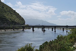
The Grey River / Māwheranui is located in the northwest of the South Island of New Zealand. It rises 12 kilometres southwest of the Lewis Pass in Lake Christabel, one of numerous small lakes on the western side of the Southern Alps, and runs westward for 120 kilometres before draining into the Tasman Sea at Greymouth. Thomas Brunner, who explored the area in the late 1840s, named the river in honour of Sir George Grey, who first served as Governor of New Zealand from 1845 to 1854. The Ngāi Tahu Claims Settlement Act 1998 changed the official name of the river to Grey River / Māwheranui in 1998. The Māori name for the river system and surrounding area is Māwhera, with Māwheranui being distinguished from the northern branch Little Grey River / Māwheraiti.
Awarua Point is located on the southwestern coast of New Zealand's South Island, at the northern end of Big Bay, 40 kilometres (25 mi) north of Milford Sound, and 15 kilometres (9.3 mi) north of the mouth of the Hollyford River.
The Burke River is a river of New Zealand's South Island, located in Mount Aspiring National Park. It flows east for 16 kilometres (10 mi) from close to the Mueller Pass, reaching the Haast River 10 kilometres (6 mi) south of the Haast Pass.
The Lambert River is a river of the West Coast Region of New Zealand's South Island. It flows north from the Lambert Glacier in the Southern Alps, joining with the Wanganui River 15 kilometres (9 mi) southeast of Harihari.
The Mangakahia River is a river of the Northland Region of New Zealand's North Island. It flows east from its sources in the Mataraua Forest, turning southeastward after about 20 kilometres (12 mi) on joining with the small Awarua River. It is joined by the Opouteke River near Pakotai, then turns east, until it is joined by the Hikurangi River. It then turns south again, passing Titoki and then joining with the Wairua River to form the Wairoa River approximately halfway between Whangarei and Dargaville.

The Manganuioteao River is a river of the centre of New Zealand's North Island. It has its source in numerous streams and small rivers which flow west from the slopes of Mount Ruapehu, though the main course of the river flows predominantly southwest through rugged hill country to meet with the Whanganui River 10 kilometres (6 mi) north of Pipiriki, at the edge of the Whanganui National Park.
The Ohikaiti River is a river of the West Coast Region of New Zealand's South Island. It flows north, paralleling the course of the larger Ohikanui River which lies two kilometres to the west. The Ohikaiti empties into the Buller River at the Buller Gorge, 15 kilometres southwest of Westport.
The Oneone River is a short river of the West Coast Region of New Zealand's South Island. It is located northwest of Harihari, and reaches the Tasman Sea at the estuary of its larger northern neighbour, the Wanganui River.
The Ōtoko River is a river of the West Coast Region of New Zealand's South Island. It flows generally northwest from the northern slopes of Mount Hooker, reaching the Paringa River 20 kilometres south of Bruce Bay.
The Te Rahotaiepa River is a river of the West Coast Region of New Zealand's South Island. It rises to the north of Lake Ianthe and flows parallel with the Tasman Sea coast along the edge of marshy ground for several kilometres to flow into the mouth of the Waitaha River.
The Totarakaitorea River is a short river of the West Coast Region of New Zealand's South Island. It flows west to reach the Three Mile Lagoon three kilometres to the south of Okarito.

The Tuke River is a river of the West Coast Region of New Zealand's South Island. It flows northwest from the Southern Alps, combining with the Dickson River to form the Mikonui River 15 kilometres southeast of Ross.
The Waiatoto River is a river of the West Coast of New Zealand's South Island. Formed from several small rivers which are fed by glaciers surrounding Mount Aspiring, it flows north along a valley flanked in the west by the Haast Range before turning northwest to reach the Tasman Sea 20 kilometres (12 mi) southwest of Haast. Much of the river's length is within Mount Aspiring National Park.
The Waitangiroto River is a river of the West Coast Region of New Zealand's South Island. It flows northwest from its origins north of Whataroa to reach the Tasman Sea two kilometres north of the Okarito Lagoon. The lower reaches of the longer Waitangitāhuna River follow a roughly parallel course one kilometre to the north. Both rivers are linked to the Whataroa River, which reaches the Tasman three kilometres to the north of the Waitangiroto's mouth.
The Whakaikai River is a short river of the West Coast Region of New Zealand's South Island. It flows generally northwest to reach the Tasman Sea five kilometres to the northwest of the mouth of the Wanganui River.
The Willberg River is a river of the West Coast Region of New Zealand's South Island. It initially flows northwest before turning southwest, reaching the Poerua River 12 kilometres south of Harihari.
Kaiaua Bay is a bay on the East Coast of New Zealand's North Island, ten kilometres north of Tolaga Bay. It is under the jurisdiction the Gisborne District Council.
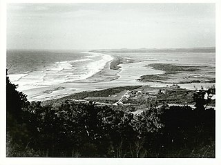
Ōkārito is a small coastal settlement on the West Coast of New Zealand's South Island, 127 kilometres (79 mi) southwest of Hokitika, and 10 kilometres (6.2 mi) from State Highway 6. It is built at the southern end of the Ōkārito Lagoon at the mouth of the Ōkārito River. The settlement of The Forks is located just inland, on the banks of the river.
References
- ↑ "1000 Māori place names". New Zealand Ministry for Culture and Heritage. 6 August 2019.
"Place name detail: Omoeroa River". New Zealand Gazetteer. New Zealand Geographic Board . Retrieved 12 July 2009.
Coordinates: 43°19′S170°02′E / 43.317°S 170.033°E