
Prince George's County is located in the U.S. state of Maryland bordering the eastern portion of Washington, D.C. As of the 2020 U.S. census, the population was 967,201, making it the second-most populous county in Maryland, behind neighboring Montgomery County. The 2020 census counted an increase of nearly 104,000 in the previous ten years. Its county seat is Upper Marlboro. It is the most populous African American-majority county in the United States, as well as the second most affluent behind neighboring Charles County.

Bladensburg is a town in Prince George's County, Maryland, United States. The population was 9,657 at the 2020 census. Areas in Bladensburg are located within ZIP code 20710. Bladensburg is 8.6 miles (13.8 km) from Washington, D.C.

Colmar Manor is a town located in Prince George's County, Maryland, United States. As of the 2010 census, the town had a population of 1,404. As the town developed at the beginning of the 20th century, it assumed a name derived from its proximity to the District of Columbia—the first syllable of Columbia and that of Maryland were combined to form "Colmar". Colmar Manor was incorporated in 1927.

Cottage City, officially the Town of Cottage City, is a town in Prince George's County, Maryland, United States. Per the 2020 census, the population was 1,335. Cottage City is a small, quiet community lying between Eastern Avenue, Brentwood, Colmar Manor, and the Anacostia River. Cottage City was developed, beginning in 1870, under the name of "The Highlands". The area was incorporated in 1924 as Cottage City.

Edmonston is a town in Prince George's County, Maryland, United States. As of the 2020 census, the town population was 1,617.

Hyattsville is a city in Prince George's County, Maryland, United States. It is an urban suburb of Washington, D.C. The population was 21,187 at the 2020 United States census.
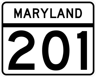
Maryland Route 201 is a state highway in the U.S. state of Maryland. Known for most of its length as Kenilworth Avenue, the highway runs 9.40 miles (15.13 km) from the District of Columbia boundary in Tuxedo, where the highway continues south as District of Columbia Route 295, north to MD 212 in Beltsville. MD 201 is a four to six-lane divided highway that connects Washington, D.C., with the northern Prince George's County municipalities of Cheverly, Bladensburg, Edmonston, Riverdale Park, College Park, Berwyn Heights, and Greenbelt. The highway also provides part of the connections from Interstate 95 (I-95)/I-495 to a pair of Washington Metro stations. MD 201 was built as two separate highways in the late 1920s: MD 201 from Washington, D.C., to Bladensburg and MD 205 from Bladensburg to Greenbelt. These highways, some of which became MD 769, were replaced with a relocated Kenilworth Avenue in the mid 1950s, including the Kenilworth Interchange with U.S. Route 50 and the Baltimore–Washington Parkway in Tuxedo. MD 201 was extended north to Beltsville in the early 1960s. The Maryland State Highway Administration (MDSHA) plans to extend MD 201 north toward Laurel.

Bladensburg High School is a public high school located in Bladensburg, Maryland, United States. The school, which serves grades 9 through 12, is a part of the Prince George's County Public Schools district.

Fort Lincoln is a neighborhood located in northeastern Washington, D.C. It is bounded by Bladensburg Road to the northwest, Eastern Avenue to the northeast, New York Avenue NE to the south, and South Dakota Avenue NE to the southwest. The town of Colmar Manor, Maryland, is across Eastern Avenue from the Fort Lincoln neighborhood, as is the Fort Lincoln Cemetery.

Bladensburg Dueling Grounds is a small spit of land, a fraction of its original size, along Dueling Creek, formerly in the town of Bladensburg, Maryland, and now within the town of Colmar Manor, just to the northeast of Washington, D.C., United States. Dueling Creek, formerly known as '"Blood Run" and "The Dark and Bloody Grounds", is a tributary of the Anacostia River, which was formerly, called the East Branch Potomac River.
Gwendolyn T. Britt was a member of the Maryland State Senate, first elected in 2003, to represent District 47 in Prince George's County, Maryland, USA, winning with 99.4% of the vote. Britt died suddenly in January 2008 of natural causes.

Maryland Route 769 is a collection of unsigned state highways in the U.S. state of Maryland. These three highways are sections of old alignment of MD 201 and the former MD 205 in Bladensburg. MD 769D and MD 769C form the old alignment of MD 201 between a dead end next to the Baltimore–Washington Parkway and MD 450. MD 769B forms part of the old alignment of MD 205 in Bladensburg and Edmonston. The portions of MD 201 and MD 205 that are now part of MD 769 were constructed in the mid- to late 1920s and widened in the early 1940s. Modern MD 201 was constructed in the early to mid-1950s; many of the bypassed sections later became portions of MD 769.

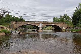
The Bladensburg Park Pedestrian Bridge is a bicycle and pedestrian bridge over the Anacostia River in the U.S. state of Maryland. The bridge lies between the communities of Colmar Manor and Bladensburg. The bridge was completed in 2005 using a bowstring truss design. The bridge closed for one month for renovations in January and February 2025.
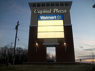
Capital Plaza Mall was a shopping mall located at the intersection of Annapolis Road and the Baltimore–Washington Parkway in Landover Hills, Maryland. It was built between 1961 and 1963, as a regional shopping center to serve the Bladensburg and Landover area of suburban Washington, D.C. The mall was a major attraction in Prince George's County, until its slow decline that began in the 1970s. This continued until the mall's closure in 2005, and ultimately its demolition in 2007. Part of the grounds are now occupied by a Wal-Mart store.
Rogers Heights is an unincorporated community in Prince George's County, Maryland, United States.

The Anacostia Tributary Trail System (ATTS) is a unified and signed system of stream valley trails joining trails along the Anacostia tributaries of Northwest Branch, Northeast Branch, Indian Creek and Paint Branch with a trail along the Anacostia River, set aside and maintained by the Maryland-National Capital Park and Planning Commission (M-NCPPC) in the Maryland suburbs of Washington, D.C.
Northeast Branch Anacostia River is a 3.2-mile-long (5.1 km) free-flowing stream in Prince George's County, Maryland. It is a tributary of the Anacostia River, which flows to the Potomac River and the Chesapeake Bay.

Maryland Route 208 is a state highway in the U.S. state of Maryland. The highway runs 1.86 miles (2.99 km) from U.S. Route 1 Alternate in Cottage City north to MD 500 in Hyattsville. MD 208 connects the northwestern Prince George's County suburbs of Cottage City, Colmar Manor, Brentwood, and Hyattsville. The highway was built in the late 1910s and early 1920s and originally passed through Mount Rainier. The portion of MD 208 between US 1 Alt. and US 1 was originally MD 206; the northern portion of the highway was originally part of MD 209 and then MD 410. MD 208 was extended to MD 500 and removed from Mount Rainier in the late 1950s, and extended south through Cottage City around 1970.

Fort Lincoln was one of seven temporary earthwork forts part of the Civil War Defenses of Washington, DC during the Civil War built in the Northeast quadrant of the city at the beginning of the Civil War by the Union Army to protect the city from the Confederate Army. From west to east, the forts were as follow: Fort Slocum, Fort Totten, Fort Slemmer, Fort Bunker Hill, Fort Saratoga, Fort Thayer and Fort Lincoln.
 Bladensburg
 Colmar Manor
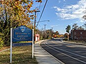 Cottage City
 Edmonston


