
Manchester Metrolink is a tram/light rail system in Greater Manchester, England. The network has 99 stops along 64 miles (103 km) of standard-gauge route, making it the most extensive light rail system in the United Kingdom. Over the 2022/23 financial year 36 million passenger journeys were made on the system.

Manchester Airport station is a railway, tram, bus and coach station at Manchester Airport, England which opened at the same time as the second air terminal in 1993. The station is 9+3⁄4 miles (15.7 km) south of Manchester Piccadilly, at the end of a short branch from the Styal line via a triangular junction between Heald Green and Styal stations. Manchester Metrolink tram services were extended to the airport in 2014 and operate to Manchester Victoria.

Brooklands is a tram stop and park and ride site on the Altrincham Line of Greater Manchester's light-rail Metrolink system in the Brooklands area of Sale. It opened on 15 June 1992 as part of Phase 1 of Metrolink's expansion.

Sale is a tram stop on the Altrincham Line of the Metrolink light-rail system in Sale, Greater Manchester, England. It opened on 15 June 1992 as part of Phase 1 of Metrolink's expansion. Prior to this, it was a railway station on the Manchester, South Junction and Altrincham Railway (MSJAR) line. It was built by John Brogden, who was a local builder in the Sale area.

Dane Road is a tram stop on the Altrincham Line of Greater Manchester's Metrolink light rail system. It is located on Dane Road in northern Sale, Greater Manchester, England. It opened on 15 June 1992 as part of Phase 1 of Metrolink's expansion.

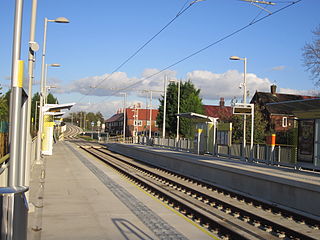
Peel Hall is a tram stop for Phase 3b of the Manchester Metrolink. The station opened on 3 November 2014 and is on the Airport Line on Simonsway next to the junction of Peel Hall Road. The station serves the Peel Hall district of Wythenshawe, Manchester.

Robinswood Road is a tram stop for Phase 3b of the Manchester Metrolink. It opened on 3 November 2014. and is on the Airport Line on Simonsway at the junction of Brownley Road and Ruddpark Road, with Manchester Airport-bound services stopping to the left of the junction and Manchester-bound services stopping to the right. For a brief period during construction, it appeared the stop would simply be named "Robinswood". Its up and down platforms are staggered and not opposite each other.

Wythenshawe Town Centre is a tram stop on the Manchester Metrolink Airport Line. It opened on 3 November 2014. It is in Wythenshawe town centre next to shops, the library and Wythenshawe Forum. A new Wythenshawe bus station was built next to the Metrolink station, which replaced existing stops at the former bus station and Wythenshawe Forum.
Crossacres is a tram stop for the Phase 3B Extension of Greater Manchester's Metrolink system. The stop is part of the Airport Line and is at the junction of Brownley Road and Crossacres Road in the Wythenshawe area of Manchester, England. It opened on 3 November 2014.
Benchill is a tram stop for Phase 3b of the Manchester Metrolink. It opened on 3 November 2014. It is on the Airport Line at the Brownley Road/Hollyhedge Road crossroads. A health centre and new sixth form college are also near the stop.
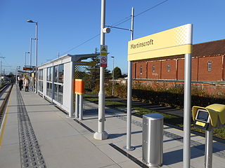
Martinscroft is a tram stop for Phase 3b of the Manchester Metrolink in Greater Manchester, England. It opened on 3 November 2014 and is on the Airport Line on Hollyhedge Road next to St Martin's Church in Baguley, Wythenshawe.

Roundthorn is a tram stop on the Manchester Metrolink network. It opened on 3 November 2014 on the Airport Line, between Southmoor Road and Roundthorn Road. The stop is next to the Roundthorn Industrial Estate and is the closest Metrolink stop to Wythenshawe Hospital.

Baguley tram stop is a tram stop on the Airport Line, built for phase 3B of the Manchester Metrolink to Manchester Airport. It opened on 3 November 2014 and is on Southmoor Road next to Roundthorn Industrial Estate and a Tesco supermarket.

Moor Road is a tram stop for Phase 3b of the Manchester Metrolink. It opened on 3 November 2014. and is on the Airport Line on Moor Road at the junction of Bideford Drive.
Wythenshawe Park is a tram stop for Phase 3b of the Manchester Metrolink. The station opened on 3 November 2014 and is on the Airport Line on Wythenshawe Road near the junction of Moor Road.
Northern Moor is a tram stop for Phase 3b of the Manchester Metrolink. It opened on 3 November 2014. and is on the Airport Line on Sale Road. The tram stop is on the Northern Moor / Sale Moor border.

Sale Water Park is a tram stop for Phase 3b of the Manchester Metrolink. It opened on 3 November 2014. and is on the Airport Line on Rifle Road near the Sale Water Park.

Exchange Square is a tram stop on the Manchester Metrolink's Second City Crossing line, and opened on 6 December 2015 as part of Phase 2CC of the network's expansion. It is located by the main entrance to the Manchester Arndale shopping centre, and is also close to the Printworks.

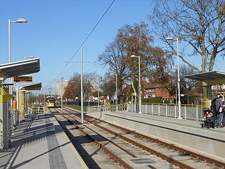
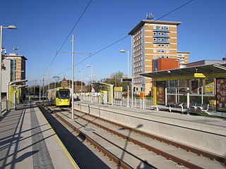
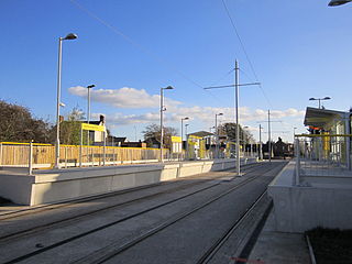
The Airport Line is a tram line of the Manchester Metrolink in Manchester, England, running from Manchester city centre to Manchester Airport via Wythenshawe. It opened in November 2014 as part of phase three of the system's expansion.

Zone 1 of the Manchester Metrolink light rail network is the heart of the system where all of the other lines converge. Its boundaries approximately mirror the city's Inner Ring Road. Within Zone 1, first opened in 1992 as the City Zone, trams largely run along semi-pedestrianised streets rather than on their own separate alignment.


