Old Trafford tram stop

Last updated

Old Trafford
Metrolink station
Old Trafford tram stop.jpg
A M5000 breaks the stream of football fans at Old Trafford tram stop. Jan 2017.
General information
LocationOld Trafford, Trafford
England
Coordinates 53°27′22″N2°17′06″W / 53.45605°N 2.28504°W / 53.45605; -2.28504 Coordinates: 53°27′22″N2°17′06″W / 53.45605°N 2.28504°W / 53.45605; -2.28504
Grid reference SJ812956
Line(s) Altrincham Line
Platforms2
Other information
StatusIn operation
Fare zone2
History
Opened5 May 1857
Previous names1862: Cricket Ground
1887: Cricket Ground (Old Trafford)
1910: Cricket and Football Grounds
1931: Warwick Road or Warwick Road (Old Trafford)
Original company MSJAR
Pre-groupingMSJAR
Post-groupingMSJAR
London Midland Region of British Railways
Key dates
24 December 1991Closed as a rail station
15 June 1992Conversion to Metrolink operation
Location
Old Trafford tram stop

Old Trafford is a tram stop on the Altrincham Line of the Metrolink light rail system in Old Trafford, Greater Manchester, England.

Contents

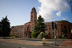
Before 1991, it was a railway station called Warwick Road; it reopened as a tram stop on 15 June 1992 with its current name. The stop is regularly used by crowds going to Old Trafford Football Ground and Old Trafford Cricket Ground which are both nearby. The stop was rebuilt in 2009 in order to better handle large crowds.

History

Old Trafford station (then named Warwick Road) in 1988, prior to conversion to Metrolink Old Trafford railway station in 1988.jpg
Old Trafford station (then named Warwick Road) in 1988, prior to conversion to Metrolink
A T-68 leaving Old Trafford in 2007 prior to the rebuild; the Old Trafford Cricket Ground scoreboard can be seen behind the vehicle. Old Trafford Tram Station - geograph.org.uk - 388410.jpg
A T-68 leaving Old Trafford in 2007 prior to the rebuild; the Old Trafford Cricket Ground scoreboard can be seen behind the vehicle.

A station, just to the north of the present station, was opened by the Manchester, South Junction and Altrincham Railway (MSJAR) [1] in May 1857 as Manchester Art Treasures Exhibition, [2] being built to serve the exhibition of that name, [1] which was open between 5 May 1857 and 17 October 1857. [3] The station closed in October 1857. [2] It was adapted and reopened as Old Trafford Cricket Ground in 1862 for use every year thereafter until 1866, [4] on match days only. [5]

The station opened for special events, such as the Royal Agricultural Society Exhibition in 1869, [6] and again between May and October 1887 [7] for the Royal Jubilee Exhibition in Stretford Royal Botanical Gardens, held to celebrate the Golden Jubilee of Queen Victoria, [8] during both of which the station was known as Exhibition; [6] [7] additional platforms were constructed for the latter. [9] From 1887 until 1963 it operated as a four-platform station.[ citation needed ] It was renamed Cricket Ground (Old Trafford) and continued to open on match days only; in 1910 it became Cricket and Football Grounds [10] following the opening of Manchester United's ground on 19 February 1910. [11]

On 11 May 1931, following the electrification of the MSJAR, the station was renamed Warwick Road and was open daily. [12] It was also referred to as Warwick Road (Old Trafford) [13] on early tickets, timetables, etc.[ citation needed ] Warwick Road closed as a British Rail station on 25 December 1991 [13] (the last trains having run on 24 December 1991) for conversion to light rail operation, [14] and reopened as a Metrolink station on 15 June 1992, at which point it was renamed Old Trafford. [13]

In 2009 the north-bound platform (to Manchester) was demolished and a new one was built further south. This was to allow the addition of a ground-level pedestrian crossing over the tracks, connecting the platforms. Trams on both lines will stop before reaching the crossing. The crossing is also suitable for wheelchairs, bicycles and horses. Previously there was an underground tunnel.

Location and use

The station is adjacent to Old Trafford Cricket Ground, the home of Lancashire County Cricket Club, and only a short walk from Old Trafford football stadium, the home of Manchester United F.C. [15] As a result, Old Trafford Station regularly faces heavy usage from the crowds attending cricket and football matches and concerts. Crowd control operations often involve the use of turnstiles.

An average of 2,000 passenger journeys are made per day to or from Old Trafford stop, but this can rise to 9,500 on a match day. In order to manage the crowds more effectively, the stop was rebuilt in 2009. The pedestrian underpass was closed and passengers instead cross the tram line to change platforms. The platforms themselves were rearranged into a staggered layout by moving the northbound platform (for trams into Manchester), and both platforms were doubled in length to 120 metres, to allow two double trams to stop at the same time. A new match day gating system was installed and the station was redecorated with the new yellow and silver Metrolink corporate identity. [16] [17]

Old Trafford Metrolink depot is next to the station on Elsinore Road and staff use the station regularly for access to it.

Services

Old Trafford is on the Altrincham Line with trams towards Altrincham stopping every 6 minutes during the day, Monday to Saturday, every 12 minutes Monday to Saturday evenings and Sundays. Trams also head towards Manchester and Bury, with the Monday to Saturday daytime service running every 12 minutes each to Piccadilly or Bury, while evening and Sunday journeys run to Piccadilly only. [18]

Service pattern

Ticket zones

As of January 2019, Old Trafford is located in Metrolink ticket zone 2. [19]

Connecting bus routes

Old Trafford station is only served by one service, Stagecoach Manchester service 253, which runs weekdays mornings to Piccadilly Gardens via the universities. [20] A more frequent service is provided on Chester Road.

Notes

  1. 1 2 Dixon 1994 , p. 27
  2. 1 2 Butt 1995 , p. 153
  3. Dixon 1994 , pp. 27, 31
  4. Butt 1995 , p. 177
  5. Dixon 1994 , p. 39
  6. 1 2 Dixon 1994 , p. 42
  7. 1 2 Butt 1995 , p. 93
  8. Dixon 1994 , p. 53
  9. Dow 1962 , p. 117
  10. Croughton, Kidner & Young 1982 , p. 109
  11. Bartram, Steve (19 February 2010). "On This Day: 19 Feb 1910". Manutd.com – The Official Website. Manchester: Manchester United Ltd. Retrieved 19 October 2010.
  12. Dixon 1994 , pp. 67, 68
  13. 1 2 3 Butt 1995 , p. 241
  14. Dixon 1994 , p. 119
  15. "Google Maps route from Old Trafford Metrolink station to Manchester United Football Club". Google Maps. Retrieved 22 July 2013.
  16. "Old Trafford Metrolink stop changes get green light". Transport Briefing. 13 July 2009. Retrieved 13 July 2009.
  17. "Manchester Metrolink Upgrades 2009". LRTA. Retrieved 2 June 2017.
  18. "Metrolink – Tram Times – Old Trafford". Metrolink. Retrieved 13 February 2013.
  19. "Metrolink ticket zones map". TfGM. Retrieved 5 December 2018.
  20. "Network Maps". Transport for Greater Manchester. Archived from the original on 2 November 2012. Retrieved 10 September 2012.

Related Research Articles

<span class="mw-page-title-main">Manchester Metrolink</span> Tram system in Greater Manchester, UK

Manchester Metrolink is a tram/light rail system in Greater Manchester, England. The network has 99 stops along 64 miles (103 km) of standard-gauge route, making it the most extensive light rail system in the United Kingdom. Metrolink is owned by the public body Transport for Greater Manchester (TfGM) and operated and maintained under contract by a Keolis/Amey consortium. In 2021/22, 26 million passenger journeys were made on the system.

<span class="mw-page-title-main">Manchester Oxford Road railway station</span> Railway station in Manchester, England

Manchester Oxford Road railway station is a railway station in Manchester, England, at the junction of Whitworth Street West and Oxford Street. It opened in 1849 and was rebuilt in 1960. It is the second busiest of the four stations in Manchester city centre.

<span class="mw-page-title-main">Timperley</span> Human settlement in England

Timperley is a suburban village in the borough of Trafford, Greater Manchester, England. Historically in Cheshire, it is approximately six miles southwest of central Manchester. The population at the 2011 census was 11,061.

<span class="mw-page-title-main">Altrincham Interchange</span> Railway, bus and tram interchange in Greater Manchester, England

Altrincham Interchange is a transport hub in Altrincham, Greater Manchester, England. It consists of a bus station on Stamford New Road, a Northern Trains-operated heavy rail station on the Mid-Cheshire Line, and a light rail stop which forms the terminus of Manchester Metrolink's Altrincham line. The original heavy rail element of the station was opened by the Manchester, South Junction and Altrincham Railway as Altrincham and Bowdon railway station in April 1881, changing to Altrincham railway station in May 1974. The Metrolink element opened in June 1992. The Interchange underwent a complete redevelopment, at a cost of £19 million, starting in mid-July 2013. The new bus station opened officially on 7 December 2014.

<span class="mw-page-title-main">Navigation Road station</span> Railway station in Greater Manchester, England

Navigation Road is a station that serves both Northern Trains and Manchester Metrolink located in the east of Altrincham, in Greater Manchester, England. It consists of a Northern-operated heavy rail station on the Mid-Cheshire Line, and an adjoining light rail stop on the Altrincham Line of Greater Manchester's Metrolink network. The original heavy rail element of the station was opened by the Manchester, South Junction and Altrincham Railway in 1931, and the Metrolink element opened in 1992. A level crossing operates at the southern end of the station.

<span class="mw-page-title-main">Mid-Cheshire line</span>

The Mid-Cheshire line is a railway line in the north-west of England that runs from Chester to Edgeley Junction, Stockport; it connects Chester with Manchester Piccadilly, via Knutsford. After Chester Northgate closed in 1969, the section between Mickle Trafford Junction and Chester was used for freight trains only until it closed in 1992; from Mickle Trafford, passenger trains use the Chester–Warrington line to Chester General instead. The route taken by passenger trains has changed over the years and now differs considerably from the original. Between 2001 and 2014, passenger journeys on the line increased to over 1.7 million per year. A near doubling of the passenger service was expected to occur from December 2018, however this did not materialise.

<span class="mw-page-title-main">Timperley tram stop</span> Manchester Metrolink tram stop

Timperley is a tram stop on the Altrincham Line of Greater Manchester's light-rail Metrolink system. In western Timperley about a mile west of the village centre, it opened on 15 June 1992 as part of Phase 1 of Metrolink's expansion.

<span class="mw-page-title-main">Manchester, South Junction and Altrincham Railway</span> Suburban railway in Manchester

The Manchester South Junction and Altrincham Railway (MSJ&AR) was a suburban railway which operated an 8+12-mile (14 km) route between Altrincham in Cheshire and Manchester London Road railway station in Manchester.

<span class="mw-page-title-main">Brooklands tram stop</span> Manchester Metrolink tram stop

Brooklands is a tram stop and park and ride site on the Altrincham Line of Greater Manchester's light-rail Metrolink system in the Brooklands area of Sale. It opened on 15 June 1992 as part of Phase 1 of Metrolink's expansion.

<span class="mw-page-title-main">Sale tram stop</span> Manchester Metrolink tram stop

Sale is a tram stop on the Altrincham Line of the Metrolink light-rail system in Sale, Greater Manchester, England. It opened on 15 June 1992 as part of Phase 1 of Metrolink's expansion. Prior to this, it was a railway station on the Manchester, South Junction and Altrincham Railway (MSJAR) line. It was built by John Brogden, who was a local builder in the Sale area.

<span class="mw-page-title-main">Dane Road tram stop</span> Metrolink stop in South Manchester

Dane Road is a tram stop on the Altrincham Line of Greater Manchester's Metrolink light rail system. It is located on Dane Road in northern Sale, Greater Manchester, England. It opened on 15 June 1992 as part of Phase 1 of Metrolink's expansion.

<span class="mw-page-title-main">Stretford tram stop</span> Manchester Metrolink tram stop

Stretford is a tram stop on the Altrincham Line of Greater Manchester's light-rail Metrolink system. It is located in Stretford, on the corner of Chester Road and Edge Lane. It opened on 15 June 1992 as part of Phase 1 of Metrolink's expansion.

<span class="mw-page-title-main">Trafford Bar tram stop</span> Manchester Metrolink tram stop

Trafford Bar is a tram stop on Greater Manchester's light rail system, Metrolink, at the junction of Talbot Road and Seymour Grove in Old Trafford. It opened on 15 June 1992 as part of Phase 1 of Metrolink's expansion, before which it was a mainline railway station.

<span class="mw-page-title-main">Cornbrook tram stop</span> Manchester Metrolink tram stop

Cornbrook tram stop is a tram stop on Greater Manchester's light rail Metrolink system in the Cornbrook area of Manchester, England. It is an interchange station, allowing passenger transfer between the network's Altrincham, Eccles, Airport, Trafford Park and South Manchester lines. The station opened on 6 December 1999 for line transfers and allowed street-level entry and exit to the public from 3 September 2005. It takes its name from Cornbrook Road, between the A56 and Pomona Docks on the Manchester Ship Canal, and was built on what was a Cheshire Lines Committee route to Manchester Central railway station. The stop is one of the most used on the Metrolink network.

<span class="mw-page-title-main">Deansgate-Castlefield tram stop</span> Manchester Metrolink tram stop

Deansgate-Castlefield is a tram stop on Greater Manchester's Metrolink light rail system, on Deansgate in the Castlefield area of Manchester city centre. It opened on 27 April 1992 as G-Mex tram stop, taking its name from the adjacent G-Mex Centre, a concert, conference and exhibition venue; the G-Mex Centre was rebranded as Manchester Central in 2007, prompting the Metrolink stop to be renamed on 20 September 2010. The station underwent redevelopment in 2014–15 to add an extra platform in preparation for the completion of the Second City Crossing in 2016–17.

Cornbrook railway station was opened on the south side of Cornbrook Road in the St. George's area of Manchester on 1 June 1856 by the Manchester South Junction and Altrincham Railway (MSJAR) to serve the nearby Pomona Gardens; there were four trains daily in each direction. It closed on 1 June 1865, the last trains having called on 31 May 1865.

<span class="mw-page-title-main">Altrincham Line</span> Manchester Metrolink line

The Altrincham Line is a tram line of the Manchester Metrolink running from Manchester to Altrincham in Greater Manchester. Originally a railway line, it was, along with the Bury Line, converted into a tramway during 1991–92, as part of the first phase of the Metrolink system.

<span class="mw-page-title-main">Proposed developments of Manchester Metrolink</span> Development of Manchester metro link light rail system

This is a list of confirmed or proposed future developments of the Manchester Metrolink light rail system.

<span class="mw-page-title-main">Zone 1 (Manchester Metrolink)</span>

Zone 1 of the Manchester Metrolink light rail network is the heart of the system where all of the other lines converge. Its boundaries are broadly equivalent to those of Manchester city centre, and approximately mirror the city's Inner Ring Road. Within Zone 1, first opened in 1992 as the City Zone, trams largely run along semi-pedestrianised streets rather than on their own separate alignment. The original route between the Altrincham and Bury lines ran to Victoria station via Market Street and High Street, and was soon joined by a branch to Piccadilly station by a three-way delta junction. A second route between the South-West and North-Eastern parts of the network was built to ease congestion on the original line. Opened in 2017, the Second City Crossing (2CC) added one additional stop to the network.

References

Further reading

Preceding station Manchester metrolink logo.PNG Manchester Metrolink Following station
Stretford
towards Altrincham
Altrincham–Bury Trafford Bar
towards Bury
Altrincham–Piccadilly Trafford Bar
towards Piccadilly