
Manchester Piccadilly is the main railway station of the city of Manchester, in the metropolitan county of Greater Manchester, England. Opened originally as Store Street in 1842, it was renamed Manchester London Road in 1847 and became Manchester Piccadilly in 1960. Located to the south-east of the city centre, it hosts long-distance intercity and cross-country services to national destinations including London, Birmingham, Nottingham, Glasgow, Edinburgh, Cardiff, Bristol, Exeter, Plymouth, Reading, Southampton and Bournemouth; regional services to destinations in Northern England including Liverpool, Leeds, Sheffield, Newcastle and York; and local commuter services around Greater Manchester. It is one of 19 major stations managed by Network Rail. The station has 14 platforms: 12 terminal and two through platforms. Piccadilly is also a major interchange with the Metrolink light rail system with two tram platforms in its undercroft.

Manchester Metrolink is a tram/light rail system in Greater Manchester, England. The network has 99 stops along 64 miles (103 km) of standard-gauge route, making it the most extensive light rail system in the United Kingdom. Over the 2023/24 financial year 42 million passenger journeys were made on the system.

Manchester Airport station is a railway, tram, bus and coach station at Manchester Airport, England which opened at the same time as the second air terminal in 1993. The station is 9+3⁄4 miles (15.7 km) south of Manchester Piccadilly, at the end of a short branch from the Styal line via a triangular junction between Heald Green and Styal stations. Manchester Metrolink tram services were extended to the airport in 2014 and operate to Manchester Victoria.

Altrincham Interchange is a transport hub in Altrincham, Greater Manchester, England. It consists of a bus station on Stamford New Road, a Northern Trains-operated heavy rail station on the Mid-Cheshire Line, and a light rail stop which forms the terminus of Manchester Metrolink's Altrincham line. The original heavy rail element of the station was opened by the Manchester, South Junction and Altrincham Railway as Altrincham and Bowdon railway station in April 1881, changing to Altrincham railway station in May 1974. The Metrolink element opened in June 1992. The Interchange underwent a complete redevelopment, at a cost of £19 million, starting in mid-July 2013. The new bus station opened officially on 7 December 2014.

Navigation Road is a station that serves both Northern Trains and Manchester Metrolink trams located in the east of Altrincham, in Greater Manchester, England. It consists of a Northern Trains-operated bidirectional heavy rail platform on the Mid-Cheshire Line opposite a bidirectional light rail platform on the Altrincham Line of Greater Manchester's Metrolink network. The original heavy rail station was opened by the Manchester, South Junction and Altrincham Railway in 1931 as a pair of single-face platforms, and in 1992 one was given over to the Metrolink network. A level crossing operates at the southern end of the station.

Chorlton is a stop on the South Manchester Line (SML) and Airport Line of the Metrolink light-rail system in Chorlton-cum-Hardy, Manchester, England. It was built as part of Phase 3a of the network's expansion, and opened on 7 July 2011 on a section of the former Cheshire Lines Committee railway.

The transport infrastructure of Greater Manchester is built up of numerous transport modes and forms an integral part of the structure of Greater Manchester and North West England – the most populated region outside of South East England which had approximately 301 million annual passenger journeys using either buses, planes, trains or trams in 2014. Its position as a national city of commerce, education and cultural importance means the city has one of the largest and most thorough transport infrastructures which is heavily relied upon by its 2.8 million inhabitants in the Greater Manchester conurbation and further afield in the North West region. Public transport comes under the jurisdiction of Transport for Greater Manchester.

Baguley railway station was a station in the south of Manchester, England, at the extreme western edge of Baguley near the southern end of Brooklands Road where Shady Lane crossed the railway line.

Peel Hall is a tram stop for Phase 3b of the Manchester Metrolink. The station opened on 3 November 2014 and is on the Airport Line on Simonsway next to the junction of Peel Hall Road. The station serves the Peel Hall district of Wythenshawe, Manchester.

Wythenshawe Town Centre is a tram stop on the Manchester Metrolink Airport Line. It opened on 3 November 2014. It is in Wythenshawe town centre next to shops, the library and Wythenshawe Forum. A new Wythenshawe bus station was built next to the Metrolink station, which replaced existing stops at the former bus station and Wythenshawe Forum.
Crossacres is a tram stop for the Phase 3B Extension of Greater Manchester's Metrolink system. The stop is part of the Airport Line and is at the junction of Brownley Road and Crossacres Road in the Wythenshawe area of Manchester, England. It opened on 3 November 2014.
Benchill is a tram stop for Phase 3b of the Manchester Metrolink. It opened on 3 November 2014. It is on the Airport Line at the Brownley Road/Hollyhedge Road crossroads. A health centre and new sixth form college are also near the stop.
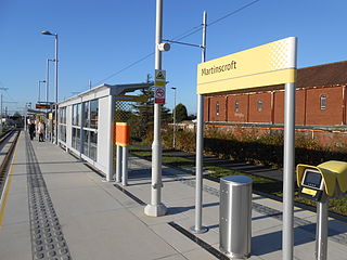
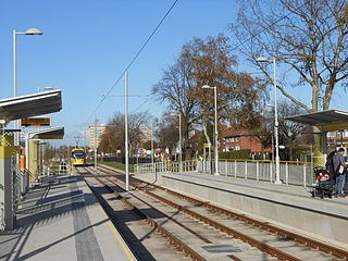
Martinscroft is a tram stop for Phase 3b of the Manchester Metrolink in Greater Manchester, England. It opened on 3 November 2014 and is on the Airport Line on Hollyhedge Road next to St Martin's Church in Baguley, Wythenshawe.

Roundthorn is a tram stop on the Manchester Metrolink network. It opened on 3 November 2014 on the Airport Line, between Southmoor Road and Roundthorn Road. The stop is next to the Roundthorn Industrial Estate and is the closest Metrolink stop to Wythenshawe Hospital.
Northern Moor is a tram stop for Phase 3b of the Manchester Metrolink. It opened on 3 November 2014. and is on the Airport Line on Sale Road. The tram stop is on the Northern Moor / Sale Moor border.

Sale Water Park is a tram stop for Phase 3b of the Manchester Metrolink. It opened on 3 November 2014. and is on the Airport Line on Rifle Road near the Sale Water Park.

Exchange Square is a tram stop on the Manchester Metrolink's Second City Crossing line, and opened on 6 December 2015 as part of Phase 2CC of the network's expansion. It is located by the main entrance to the Manchester Arndale shopping centre, and is also close to the Printworks.

The South Manchester Line (SML) is a tram line of the Manchester Metrolink in Manchester, England, running from Manchester city centre to Didsbury. The line opened as far as St. Werburgh's Road in 2011 and then to East Didsbury in 2013 as part of phase three of the system's expansion, along a former railway trackbed.

This is a list of confirmed or proposed future developments of the Manchester Metrolink light rail system in Greater Manchester, England.

Zone 1 of the Manchester Metrolink light rail network is the heart of the system where all of the other lines converge. Its boundaries approximately mirror the city's Inner Ring Road. Within Zone 1, first opened in 1992 as the City Zone, trams largely run along semi-pedestrianised streets rather than on their own separate alignment.


