
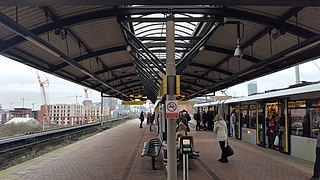
Rochdale railway station is a multi-modal transport hub in Rochdale, Greater Manchester, England. It consists of a Northern-operated heavy rail station on the Caldervale Line, and an adjoining light rail stop on Metrolink's Oldham and Rochdale Line. The original heavy-rail element of the station was opened by the Manchester and Leeds Railway in 1839 0.5 miles (0.80 km) to the south of Rochdale town centre. The Metrolink element opened in February 2013. Further changes to the station are planned as part of the Northern Hub rail-enhancement scheme.

Bury Interchange is a transport hub in the town of Bury, Greater Manchester, England. Opened in 1980, it is the northern terminus of the Manchester Metrolink's Bury Line, which prior to 1992 was a heavy-rail line. It also incorporates a bus station.

Navigation Road is a station that serves both Northern Trains and Manchester Metrolink located in the east of Altrincham, in Greater Manchester, England. It consists of a Northern Trains-operated heavy rail station on the Mid-Cheshire Line, and an adjoining light rail stop on the Altrincham Line of Greater Manchester's Metrolink network. The original heavy rail element of the station was opened by the Manchester, South Junction and Altrincham Railway in 1931, and the Metrolink element opened in 1992. A level crossing operates at the southern end of the station.

Hollinwood tram stop is a tram stop and park & ride site on the Manchester Metrolink Oldham and Rochdale Line in Hollinwood, Greater Manchester, England. It was formerly a railway station before its conversion to a tram stop between 2009 and 2012.

Failsworth tram stop is a Manchester Metrolink tram stop on the Oldham and Rochdale Line serving the town of Failsworth, Greater Manchester, England. It was formerly a railway station before its conversion to Metrolink in 2012.

Timperley is a tram stop on the Altrincham Line of Greater Manchester's light-rail Metrolink system. In western Timperley about a mile west of the village centre, it opened on 15 June 1992 as part of Phase 1 of Metrolink's expansion.

Brooklands is a tram stop and park and ride site on the Altrincham Line of Greater Manchester's light-rail Metrolink system in the Brooklands area of Sale. It opened on 15 June 1992 as part of Phase 1 of Metrolink's expansion.

Sale is a tram stop on the Altrincham Line of the Metrolink light-rail system in Sale, Greater Manchester, England. It opened on 15 June 1992 as part of Phase 1 of Metrolink's expansion. Prior to this, it was a railway station on the Manchester, South Junction and Altrincham Railway (MSJAR) line. It was built by John Brogden, who was a local builder in the Sale area.
Cornbrook tram stop is a tram stop on Greater Manchester's light rail Metrolink system in the Cornbrook area of Manchester, England. It is an interchange station, allowing passenger transfer between the network's Altrincham, Eccles, Airport, Trafford Park and South Manchester lines. The station opened on 6 December 1999 for interchange only and allowed street-level entry and exit to the public from 3 September 2005. It takes its name from Cornbrook Road, between the A56 and Pomona Docks on the Manchester Ship Canal, and was built on what was a Cheshire Lines Committee route to Manchester Central railway station. The stop is one of the most used on the Metrolink network.

Woodlands Road was a tram stop on the Bury Line of the Metrolink system in the Cheetham Hill area of north Manchester, England. It opened in 1913 as a heavy rail station and closed for conversion to light rail in 1991, opening with the new Metrolink system in 1992.

Crumpsall tram stop is a light rail station in the suburban area of Crumpsall, Greater Manchester, England. It is on the Bury Line of Greater Manchester's light rail Metrolink system.

Bowker Vale is a tram stop in the suburban areas of Bowker Vale and Blackley, Greater Manchester, England. It is on the Bury Line of Greater Manchester's light rail Metrolink system.

Heaton Park is a tram stop at Heaton Park in the town of Prestwich, Greater Manchester, England. It is on the Bury Line of Greater Manchester's light rail Metrolink system. It is part of Ticketing Zone 3, and is at the corner of Whittaker Lane and Bury Old Road, with an entrance to Heaton Park. This Metrolink stop is some 800 metres (2,600 ft) from the Lakeside terminus of the Heaton Park Tramway, the heritage tramway within Heaton Park.

Prestwich is a tram stop in the town of Prestwich, Greater Manchester, England. It is on the Bury Line of Greater Manchester's light rail Metrolink system.

Besses o' th' Barn is a tram stop in the suburban area of Besses o' th' Barn, Greater Manchester, England. It is on the Bury Line of Greater Manchester's light rail Metrolink system.

Radcliffe is a tram stop in the town of Radcliffe, Greater Manchester, England. It is on the Bury Line of Greater Manchester's light rail Metrolink system.

Central Park is a tram stop on the Oldham and Rochdale Line (ORL) of Greater Manchester's light rail Metrolink system. It opened to passengers on 13 June 2012 as part of Phase 3a of Metrolink's expansion, and is located in the Newton Heath area of Manchester, England.
Abraham Moss is a tram stop in the suburban area of Cheetham Hill, Greater Manchester, England. It is on the Bury Line of Greater Manchester's light rail Metrolink system. The station gained funding approval in 2010 and replaced nearby Woodlands Road stop. It is close to the local library and college campus. The planning application for the station was lodged June 2010. Construction began on 18 October 2010 and the station became operational on 18 April 2011.

The Bury Line is a tram line of the Manchester Metrolink running from Manchester city centre to Bury in Greater Manchester. Originally a railway line, it was, along with the Altrincham Line, converted into a tram line during 1991–92, as part of the first phase of the Metrolink system.

The Altrincham Line is a tram line of the Manchester Metrolink running from Manchester to Altrincham in Greater Manchester. Originally a railway line, it was, along with the Bury Line, converted into a tramway during 1991–92, as part of the first phase of the Metrolink system.


