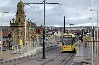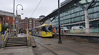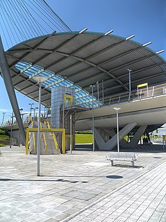
Manchester Metrolink is a tram/light rail system in Greater Manchester, England. The network has 99 stops along 64 miles (103 km) of standard-gauge route, making it the most extensive light rail system in the United Kingdom. Metrolink is owned by the public body Transport for Greater Manchester (TfGM) and operated and maintained under contract by a Keolis/Amey consortium. In 2021/22, 26 million passenger journeys were made on the system.

Oldham Mumps is a tram stop on the Oldham and Rochdale Line (ORL) of Greater Manchester's light-rail Metrolink system in the Mumps area of Oldham which opened in 2014.

Rochdale railway station is a multi-modal transport hub in Rochdale, Greater Manchester, England. It consists of a Northern-operated heavy rail station on the Caldervale Line, and an adjoining light rail stop on Metrolink's Oldham and Rochdale Line. The original heavy-rail element of the station was opened by the Manchester and Leeds Railway in 1839 0.5 miles (0.80 km) to the south of Rochdale town centre. The Metrolink element opened in February 2013. Further changes to the station are planned as part of the Northern Hub rail-enhancement scheme.

Bury Interchange is a transport hub in the town of Bury, Greater Manchester, England. Opened in 1980, it is the northern terminus of the Manchester Metrolink's Bury Line, which prior to 1992 was a heavy-rail line. It also incorporates a bus station.

St Peter's Square is a tram stop in St Peter's Square in Manchester city centre, England. It opened on 27 April 1992 and is in Zone 1 of Greater Manchester's Metrolink light rail system. The stop's platforms were extended in 2009. Later redevelopment in 2015–16 demolished the original two side platforms and replaced them with a twin-island platform layout which allows for limited cross-platform interchange.

Altrincham Interchange is a transport hub in Altrincham, Greater Manchester, England. It consists of a bus station on Stamford New Road, a Northern Trains-operated heavy rail station on the Mid-Cheshire Line, and a light rail stop which forms the terminus of Manchester Metrolink's Altrincham line. The original heavy rail element of the station was opened by the Manchester, South Junction and Altrincham Railway as Altrincham and Bowdon railway station in April 1881, changing to Altrincham railway station in May 1974. The Metrolink element opened in June 1992. The Interchange underwent a complete redevelopment, at a cost of £19 million, starting in mid-July 2013. The new bus station opened officially on 7 December 2014.

Navigation Road is a station that serves both Northern Trains and Manchester Metrolink located in the east of Altrincham, in Greater Manchester, England. It consists of a Northern-operated heavy rail station on the Mid-Cheshire Line, and an adjoining light rail stop on the Altrincham Line of Greater Manchester's Metrolink network. The original heavy rail element of the station was opened by the Manchester, South Junction and Altrincham Railway in 1931, and the Metrolink element opened in 1992. A level crossing operates at the southern end of the station.

Deansgate-Castlefield is a tram stop on Greater Manchester's Metrolink light rail system, on Deansgate in the Castlefield area of Manchester city centre. It opened on 27 April 1992 as G-Mex tram stop, taking its name from the adjacent G-Mex Centre, a concert, conference and exhibition venue; the G-Mex Centre was rebranded as Manchester Central in 2007, prompting the Metrolink stop to be renamed on 20 September 2010. The station underwent redevelopment in 2014–15 to add an extra platform in preparation for the completion of the Second City Crossing in 2016–17.

Shudehill Interchange is a transport hub between Manchester Victoria station and the Northern Quarter in Manchester city centre, England, which comprises a Metrolink stop and a bus station.

Crumpsall tram stop is a light rail station in the suburban area of Crumpsall, Greater Manchester, England. It is on the Bury Line of Greater Manchester's light rail Metrolink system.

Whitefield is a tram stop in the town of Whitefield, Greater Manchester, England. It is on the Bury Line of Greater Manchester's light rail Metrolink system.

Central Park is a tram stop on the Oldham and Rochdale Line (ORL) of Greater Manchester's light rail Metrolink system. It opened to passengers on 13 June 2012 as part of Phase 3a of Metrolink's expansion, and is located in the Newton Heath area of Manchester, England.

The history of Manchester Metrolink begins with its conception as Greater Manchester's light rail system in 1982 by the Greater Manchester Passenger Transport Executive, and spans its inauguration in 1992 and the successive phases of expansion.

The Trafford Centre is a tram stop built for Greater Manchester's Metrolink light rail system, built to serve passengers boarding and alighting at the Trafford Centre on the Trafford Park Line. Previously known as intu Trafford Centre, the tram terminus received the name The Trafford Centre after intu ceased ownership of the shopping centre, the tram stop's namesake. The stop is located adjacent to Barton Dock Road between Ellesmere Circle and Bright Circle.
This timeline of Manchester Metrolink lists significant events in the history of Greater Manchester's light rail network.

Manchester Airport High Speed Station is a planned High Speed 2 station at Manchester Airport, on the southern boundary of Manchester, England, next to Junction 5 of the M56 motorway on the northern side of the airport 1.5 miles (2.4 km) north-west of Manchester Airport railway station. Manchester Airport is the busiest airport in the UK outside London and offers more destinations than any other British airport. An airport station was recommended by local authorities during the consultation stage. The government agreed in January 2013 for an airport station, but only on the basis that private investment was involved, such as funding from the Manchester Airports Group to build the station. The government approved the scheme in November 2016.

This is a list of confirmed or proposed future developments of the Manchester Metrolink light rail system.

Zone 1 of the Manchester Metrolink light rail network is the heart of the system where all of the other lines converge. Its boundaries are broadly equivalent to those of Manchester city centre, and approximately mirror the city's Inner Ring Road. Within Zone 1, first opened in 1992 as the City Zone, trams largely run along semi-pedestrianised streets rather than on their own separate alignment. The original route between the Altrincham and Bury lines ran to Victoria station via Market Street and High Street, and was soon joined by a branch to Piccadilly station by a three-way delta junction. A second route between the South-West and North-Eastern parts of the network was built to ease congestion on the original line. Opened in 2017, the Second City Crossing (2CC) added one additional stop to the network.
Elton Reservoir, also known as Warth, is a proposed tram stop on the Bury Line of Greater Manchester's Metrolink light rail system. It is to be located between Bury Interchange and Radcliffe Metrolink station, southeast of Elton Reservoir and south of Bury town centre.


