Unshinagh Mountain

Last updated

Unshinagh Mountain
  • Irish: Sliabh Uinseannach
County
Country Northern Ireland
Sovereign state United Kingdom
Police Northern Ireland
Fire Northern Ireland
Ambulance Northern Ireland
EU Parliament Northern Ireland
List of places
UK
Northern Ireland
Antrim

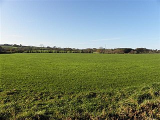
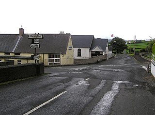
Unshinagh Mountain (from Irish : Uinseanach, meaning "place of ash trees") [1] is a townland of 635 acres in County Antrim, Northern Ireland. It is situated in the civil parish of Tickmacrevan and the historic barony of Glenarm Lower. [2]

Irish language Gaelic language spoken in Ireland and by Irish people

Irish is a Goidelic language of the Celtic languages family, itself a branch of the Indo-European language family. Irish originated in Ireland and was historically spoken by Irish people throughout Ireland. Irish is spoken as a first language in substantial areas of counties Galway, Kerry, Cork and Donegal, smaller areas of Waterford, Mayo and Meath, and a few other locations, and as a second language by a larger group of habitual but non-traditional speakers across the country.

A townland is a small geographical division of land used in Ireland and in the Western Isles in Scotland. The townland system is of Gaelic origin, pre-dating the Norman invasion, and most have names of Irish Gaelic origin. However, some townland names and boundaries come from Norman manors, plantation divisions, or later creations of the Ordnance Survey. The total number of inhabited townlands in Ireland was 60,679 in 1911. The total number recognised by the Irish Place Names database as of 2014 was 61,098, including uninhabited townlands, mainly small islands.

County Antrim Place in Antrim, Northern Ireland

County Antrim is one of six counties that form Northern Ireland. Adjoined to the north-east shore of Lough Neagh, the county covers an area of 3,046 square kilometres (1,176 sq mi) and has a population of about 618,000. County Antrim has a population density of 203 people per square kilometre or 526 people per square mile. It is also one of the thirty-two traditional counties of Ireland, as well as part of the historic province of Ulster.

See also

Related Research Articles

Tobergill human settlement in United Kingdom

Tobergill is a townland of 1,044 acres in County Antrim, Northern Ireland. Lying on the western aspect of Donegore hill, it is situated in the civil parish of Donegore and the historic barony of Antrim Upper.

Dunadry village in the United Kingdom

Dunadry is a small village and townland 3 miles (5km) from Antrim in County Antrim, Northern Ireland. It is situated in the civil parish of Grange of Nilteen and the historic barony of Antrim Upper. It is within the Borough of Antrim. It had a population of 430 people in the 2011 Census..

Dunamuggy human settlement in United Kingdom

Dunamuggy is a townland of 172 acres in County Antrim, Northern Ireland. It is situated in the civil parish of Donegore and the historic barony of Antrim Upper.

Ballystrudder village in the United Kingdom

Ballystrudder or Ballystruder is a small village and townland on Islandmagee in County Antrim, Northern Ireland. It is situated in the historic barony of Belfast Lower and the civil parish of Islandmagee. It is part of Mid and East Antrim Borough Council. It had a population of 992 people in the 2011 Census.

Cargan is a small village and townland in County Antrim, Northern Ireland. It lies at the foot of Slievenanee in Glenravel – locally known as "The Tenth Glen" along with the more widely known nine Glens of Antrim. It is part of Mid and East Antrim district. It had a population of 588 people in the 2011 Census.

Carnalbanagh village in the United Kingdom

Carnalbanagh is a small village and townland in County Antrim, Northern Ireland, 13km east-north-east of Ballymena. It is situated in the civil parish of Tickmacrevan and the historic barony of Glenarm Lower, and is part of Mid and East Antrim district. It lies above Glenarm and is close to Mount Slemish.

Solar, County Antrim

Solar is a townland of 42 acres in County Antrim, Northern Ireland. It is situated in the civil parish of Carncastle and the historic barony of Glenarm Upper.

Aghalislone is a townland of 664 acres in County Antrim, Northern Ireland. It is situated in the civil parish of Derriaghy and is split between the historic Baronies of Massereene Upper and Belfast Upper.

Aghnahough is a townland of 737 acres in County Antrim, Northern Ireland. It is situated in the civil parish of Derriaghy and the historic Barony of Massereene Upper.

Ardclinis

Ardclinis is a civil parish and townland in County Antrim, Northern Ireland. It is situated in the historic barony of Glenarm Lower.

Ault, Northern Ireland human settlement in United Kingdom

Ault,, is a townland of 367 acres in County Antrim, Northern Ireland. It is situated in the civil parish of Tickmacrevan and the historic barony of Glenarm Lower.

Ballintoy Demesne is a townland of 505 acres in County Antrim, Northern Ireland. It is situated in the civil parish of Ballintoy and the historic barony of Cary.

Whappstown is a townland of 634 acres in County Antrim, Northern Ireland. It is situated in the civil parish of Connor and the historic barony of Antrim Lower.

White Mountain is a townland of 484 acres in County Antrim, Northern Ireland, 14.5km south-west of Belfast. It is situated in the civil parish of Derriaghy and the historic barony of Massereene Upper.

White Park, County Antrim human settlement in United Kingdom

White Park, County Antrim is a townland of 170 acres in County Antrim, Northern Ireland. It is situated in the civil parish of Ballintoy and the historic barony of Cary.

Ballyclaverty human settlement in United Kingdom

Ballyclaverty is a townland of 339 acres in County Antrim, Northern Ireland. It is situated in the civil parish of Donegore and the historic barony of Antrim Upper.

Ballycollin is a townland of 883 acres in County Antrim, Northern Ireland. It is situated in the civil parish of Derriaghy and the historic Barony of Belfast Upper.

Derriaghy

Derriaghy,, , is a townland and civil parish in County Antrim, Northern Ireland, 5.5 miles (9 km) south-west of Belfast city centre. The townland is situated in the historic barony of Belfast Upper and the civil parish covers areas of both Belfast Upper and the barony of Massereene Upper.

References

  1. "Unshinagh Mountain". Place Names NI. Retrieved 21 April 2015.
  2. "Unshinagh Mountain". IreAtlas Townlands Database. Retrieved 21 April 2015.