Virginia Gardens, Florida

Last updated

Virginia Gardens, Florida
Village of Virginia Gardens
Virginiagardens.png
Miami-Dade County Florida Incorporated and Unincorporated areas Virginia Gardens Highlighted.svg
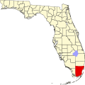
Location in Miami-Dade County and the state of Florida
Virginia Gardens.gif
U.S. Census Bureau map showing village boundaries
Coordinates: 25°48′33.03″N80°17′48.11″W / 25.8091750°N 80.2966972°W / 25.8091750; -80.2966972
Country Flag of the United States.svg  United States of America
State Flag of Florida.svg  Florida
County Flag of Miami-Dade County, Florida.png Miami-Dade
Incorporated July 10, 1947
Government
  Type Mayor-Council
   Mayor Fred "Spencer" Deno IV
   Council President Jorge Arce
   Councilmembers Debra Conover
Gabriel Fernandez
Richard Block
Elizabeth Taylor-Martinez
   Village Manager Mayor Fred "Spencer" Deno IV
   Village Clerk Maritza Fernandez-Guevara
Area
[1]
  Total0.29 sq mi (0.76 km2)
  Land0.29 sq mi (0.76 km2)
  Water0.00 sq mi (0.00 km2)
Elevation
3 ft (1 m)
Population
 (2020) [2]
  Total2,364
  Density8,040.82/sq mi (3,109.74/km2)
Time zone UTC-5 (EST)
  Summer (DST) UTC-4 (EDT)
ZIP Code
33166
Area code(s) 305, 786, 645
FIPS code 12-74575 [3]
GNIS feature ID0292782 [4]
Website www.virginiagardens-fl.gov

Virginia Gardens is a village in Miami-Dade County, Florida, United States. The village is a part of the Miami metropolitan area of South Florida. According to the U.S. Census Bureau, the village had a population of 2,364 in 2020. [2]

Contents

History

In 1947, Miami Springs (of which it was then a part) passed an ordinance outlawing horses from the city limits. In response, about 50 citizens decided to break away and form their own village. [5]

The village is named for the state of Virginia, original home of many of the wealthy transplants who made up the founding residents. At the time of incorporation, many of the residents owned large estates, some up to 5 acres (20,000 m2), suitable for horse ownership. Only a single 1-acre (4,000 m2) residential property remains within the village limits today; the bulk of residential property now consists of 0.2-acre (810 m2) lots typical of suburban developments. [5]

Geography

Virginia Gardens is located 9 miles (14 km) northwest of downtown Miami at 25°48′33″N80°17′48″W / 25.80917°N 80.29667°W / 25.80917; -80.29667 (25.809175, –80.296697). [6] It is bordered to the north and east by the city of Miami Springs and to the south by Miami International Airport.

According to the United States Census Bureau, the village has a total area of 0.3 square miles (0.8 km2), all land. [1]

Demographics

Historical population
CensusPop.Note
1950 235
1960 2,159818.7%
1970 2,52416.9%
1980 2,098−16.9%
1990 2,2125.4%
2000 2,3486.1%
2010 2,3751.1%
2020 2,364−0.5%
U.S. Decennial Census [7]

2020 census

Virginia Gardens racial composition
(Hispanics excluded from racial categories)
(NH = Non-Hispanic) [8]
RaceNumberPercentage
White (NH)28912.23%
Black or African American (NH)140.59%
Native American or Alaska Native (NH)30.13%
Asian (NH)150.63%
Pacific Islander or Native Hawaiian (NH)00.00%
Some other race (NH)130.55%
Two or more races/Multiracial (NH)220.93%
Hispanic or Latino (any race)2,00884.94%
Total2,364100.00%

As of the 2020 United States census, there were 2,364 people, 770 households, and 568 families residing in the village. [9]

2010 census

Virginia Gardens Demographics
2010 Census Virginia GardensMiami-Dade CountyFlorida
Total population2,3752,496,43518,801,310
Population, percent change, 2000 to 2010+1.1%+10.8%+17.6%
Population density8,062.3/sq mi1,315.5/sq mi350.6/sq mi
White or Caucasian (including White Hispanic)90.7%73.8%75.0%
(Non-Hispanic White or Caucasian)19.3%15.4%57.9%
Black or African-American 2.7%18.9%16.0%
Hispanic or Latino (of any race) 77.3%65.0%22.5%
Asian 1.7%1.5%2.4%
Native American or Native Alaskan 0.0%0.2%0.4%
Pacific Islander or Native Hawaiian 0.0%0.0%0.1%
Two or more races (Multiracial) 2.1%2.4%2.5%
Some Other Race 2.8%3.2%3.6%

As of the 2010 United States census, there were 2,375 people, 808 households, and 554 families residing in the village. [10]

2000 census

In 2000, 31.7% had children under the age of 18 living with them, 47.3% were married couples living together, 14.9% had a female householder with no husband present, and 33.0% were non-families. 27.1% of all households were made up of individuals, and 7.9% had someone living alone who was 65 years of age or older. The average household size was 2.63 and the average family size was 3.22.

In 2000, age distribution was 23.0% under the age of 18, 7.6% from 18 to 24, 31.9% from 25 to 44, 23.9% from 45 to 64, and 13.5% who were 65 years of age or older. The median age was 38 years. For every 100 females, there were 97.5 males. For every 100 females age 18 and over, there were 93.1 males.

In 2000, the median household income $40,197, and the median family income was $44,800. Males had a median income of $31,302 versus $26,274 for females. The per capita income for the village was $21,139. About 9.5% of families and 11.3% of the population were below the poverty line, including 16.3% of those under age 18 and 6.6% of those age 65 or over.

In 2000, speakers of Spanish as a first language made up 71.66%, and English as the main language accounted for 28.34% of the population. [11]

Education

Virginia Gardens is a part of Miami-Dade County Public Schools.

Related Research Articles

<span class="mw-page-title-main">Biscayne Park, Florida</span> Village in Florida

Biscayne Park is a village in Miami-Dade County, Florida, United States. It's also part of the Miami metropolitan area of South Florida. As of the 2020 census, the population was at 3,117 residents.

<span class="mw-page-title-main">Country Club, Florida</span> Census-designated place in Florida

Country Club is a census-designated place and a suburban unincorporated community located in northwest Miami-Dade County, Florida, United States. It is located in the Miami metropolitan area of South Florida. The CDP is named after the Country Club of Miami, which was established in 1961 in what was then an unpopulated and undeveloped section of the county. The population was 49,967 at the 2020 census, up from 3,408 in 1990.

<span class="mw-page-title-main">El Portal, Florida</span> Village in Florida

El Portal is a village in Miami-Dade County, Florida, United States. The name is derived from the Spanish term for "the gate", after two wooden gates that once stood as a gateway to the village. El Portal was originally annexed into the city of Miami in 1925. With the arrival of the Great Depression, Miami gave up its jurisdiction, and El Portal was incorporated as its own village in 1937. The village is part of the Miami metropolitan area of South Florida. As of the 2020 census, the population of El Portal was 1,986, down from 2,325 in 2010.

<span class="mw-page-title-main">Fontainebleau, Florida</span> Census-designated place in Florida

Fontainebleau(incorrectly spelled "Fountainebleau" in the 2000 census) is a census-designated place (CDP) in Miami-Dade County, Florida, United States. It is part of the Miami metropolitan area of South Florida. The population was 59,870 during the 2020 census.

<span class="mw-page-title-main">Goulds, Florida</span> Census-designated place in Florida

Goulds is an unincorporated community and census-designated place (CDP) in Miami-Dade County, Florida, United States. The area was originally populated as the result of a stop on the Florida East Coast Railroad. The railroad depot was located near the current Southwest 224th Street. The community was named after its operator, Lyman Gould, who cut trees for railroad ties. It is part of the Miami metropolitan area of South Florida. As of the 2020 US census, the population stood at 11,446, up from 10,103 in 2010 US census.

<span class="mw-page-title-main">Hialeah Gardens, Florida</span> City in Florida

Hialeah Gardens is a city in Miami-Dade County, Florida, United States. The city is part of the Miami metropolitan area of South Florida. The population was 23,068 at the 2020 US census, up from 21,744 in 2010 US census. The population density is mostly made up of single-story development.

<span class="mw-page-title-main">Ives Estates, Florida</span> Census-designated place in Florida

Ives Estates is a census-designated place (CDP) in Miami-Dade County, Florida. It is part of the Miami metropolitan area of South Florida. The population was 25,005 at the 2020 census, up from 19,525 in 2010.

<span class="mw-page-title-main">Kendale Lakes, Florida</span> Census-designated place in Florida

Kendale Lakes is a census-designated place (CDP) and a suburb of Miami in Miami-Dade County, Florida, United States. It is located in the Miami metropolitan area of South Florida. The population was 55,646 at the 2020 census.

<span class="mw-page-title-main">Medley, Florida</span> Town in the state of Florida, United States

Medley is a town in Miami-Dade County, Florida, United States. The town is part of the Miami metropolitan area of South Florida. As of the 2020 US census, the population was at 1,056 residents.

<span class="mw-page-title-main">Miami Springs, Florida</span> City in Florida

Miami Springs is a city in Miami-Dade County, Florida, United States. The city is part of the Miami metropolitan area of South Florida. As of 2020, the population recorded by the U.S. Census Bureau was 13,859.

<span class="mw-page-title-main">Palmetto Estates, Florida</span> Census-designated place in Florida

Palmetto Estates is an unincorporated area and census-designated place (CDP) in Miami-Dade County, Florida, United States. It is part of the Miami metropolitan area of South Florida. The population was 13,498 at the 2020 census.

<span class="mw-page-title-main">Pinewood, Florida</span> Census-designated place in Florida

Pinewood is an unincorporated community and census-designated place (CDP) in Miami-Dade County, Florida, United States. It is part of the Miami metropolitan area of South Florida. The population was 17,246 at the 2020 census.

<span class="mw-page-title-main">Sunset, Florida</span> Census-designated place in Florida

Sunset is a census-designated place (CDP) in Miami-Dade County, Florida, United States. It is part of the Miami metropolitan area of South Florida. The population was 15,912 at the 2020 census. The U.S. Postal Service uses the ZIP Codes of 33173 and 33183 for Sunset.

<span class="mw-page-title-main">Tamiami, Florida</span> Census-designated place in Florida

Tamiami is a census-designated place (CDP) in Miami-Dade County, Florida, United States. It is part of the Miami metropolitan area of South Florida. The population was 54,212 at the 2020 census.

<span class="mw-page-title-main">Three Lakes, Florida</span> Census-designated place in Florida

Three Lakes is a census-designated place (CDP) and planned community in Miami-Dade County, Florida, United States. It is part of the Miami metropolitan area of South Florida. The population was 16,540 at the 2020 census, up from 15,047 in 2010.

<span class="mw-page-title-main">West Miami, Florida</span> City in Florida, United States

West Miami is a city in Miami-Dade County, Florida, United States. The city is part of the Miami metropolitan area of South Florida. The population was 7,233 at the 2020 census, up from 5,965 in 2010.

<span class="mw-page-title-main">West Perrine, Florida</span> Census-designated place in Florida

West Perrine is a census-designated place (CDP) in Miami-Dade County, Florida, United States. It is part of the Miami metropolitan area of South Florida. The population was 10,602 at the 2020 census, up from 9,460 in 2010.

<span class="mw-page-title-main">Westview, Florida</span> Census-designated place in Florida

Westview is a census-designated place (CDP) in Miami-Dade County, Florida, United States. It is part of the Miami metropolitan area of South Florida. The population was 9,923 at the 2020 census.

<span class="mw-page-title-main">Westwood Lakes, Florida</span> Census-designated place in Florida

Westwood Lakes is a census-designated place and unincorporated community of Miami-Dade County, Florida, United States. It is part of the Miami metropolitan area of South Florida. The population was 11,373 at the 2020 census.

<span class="mw-page-title-main">South Miami Heights, Florida</span> Census-designated place in Florida

South Miami Heights is a census-designated place (CDP), originally known as Eureka, in Miami-Dade County, Florida. It is part of the Miami metropolitan area of South Florida. The population was 36,770 as of the 2020 census.

References

  1. 1 2 "2022 U.S. Gazetteer Files: Florida". United States Census Bureau. Retrieved January 3, 2023.
  2. 1 2 "P1. Race – Virginia Gardens village, Florida: 2020 DEC Redistricting Data (PL 94-171)". U.S. Census Bureau. Retrieved January 3, 2023.
  3. "U.S. Census website". United States Census Bureau . Retrieved January 31, 2008.
  4. "US Board on Geographic Names". United States Geological Survey. October 25, 2007. Retrieved January 31, 2008.
  5. 1 2 "Our Village History". virginiagardens-fl.gov. Retrieved January 21, 2015.
  6. "US Gazetteer files: 2010, 2000, and 1990". United States Census Bureau. February 12, 2011. Retrieved April 23, 2011.
  7. "Census of Population and Housing". Census.gov. Retrieved June 4, 2015.
  8. "Explore Census Data". data.census.gov. Retrieved February 9, 2022.
  9. "S1101 HOUSEHOLDS AND FAMILIES - 2020: Virginia Gardens village, Florida". United States Census Bureau .
  10. "S1101 HOUSEHOLDS AND FAMILIES - 2010: Virginia Gardens village, Florida". United States Census Bureau .
  11. "MLA Data Center Results of Virginia Gardens, FL". Modern Language Association . Retrieved October 31, 2007.
  12. "Home". Blessed Trinity Catholic School. Retrieved May 6, 2020. Address: 4020 Curtiss Parkway Virginia Gardens, FL 33166. - Comparison with the zoning map shows that it is physically in Virginia Gardens.
  13. "Zoning Map" (PDF). Virginia Gardens. Retrieved May 6, 2020.