Winnipeg metropolitan region

Last updated
Winnipeg Metro Region
Downtown Winnipeg Major Towers 2019.png
Downtown Winnipeg skyline in 2019
CAN MB Winnipeg Region.svg
Map of the Winnipeg Metro Region in relation to the rest of Manitoba
Country Flag of Canada (Pantone).svg  Canada
Province Flag of Manitoba.svg  Manitoba
Established1998;23 years ago (1998)
Government
  BodyBoard [1]
  Co-chairsScott Gillingham and Shelley Hart
Area
[2]
  Total7,795.96 km2 (3,010.04 sq mi)
Population
  Total821,537
  Density105.4/km2 (273/sq mi)
Time zone UTC-6 (CST)
  Summer (DST) UTC-5 (CDT)
Area code(s) 204, 431
Website winnipegmetroregion.ca

The Winnipeg Metro Region [4] (formerly called the Winnipeg Capital Region and the Manitoba Capital Region) [5] is a metropolitan area located in the Red River Valley in the southeast portion of the province of Manitoba, Canada. It contains the provincial capital of Winnipeg and 17 surrounding rural municipalities, cities, and towns. [4]

Contents

Other places in the Region besides Winnipeg with a population over 1,000 are the city of Selkirk; towns of Stonewall and Niverville; and communities of Oakbank, Oak Bluff, Stony Mountain, Teulon, and Lorette. As the most densely-populated and economically-important area of Manitoba, the Region accounts for two-thirds of the province's population and 70% of the provincial GDP as of 2021. [4]

It also includes the smaller census metropolitan area (CMA) of Winnipeg, with the addition of the Brokenhead 4 Indian Reserve. [6] [7]

History

In the late 1990s, issues such as providing Shoal Lake water to nearby municipalities and allowing exurban housing growth beyond Winnipeg became more important. At the time, Mayor Susan Thompson voiced the idea of a regional planning authority to mediate such issues. [8]

In June 1998, former Great West Life President Kevin Kavanagh was appointed by Premier Gary Filmon to chair the Capital Region Review Committee. [9] The panel looked at land-use planning and economic development between the City of Winnipeg and surrounding municipalities. Thompson along with the mayors and reeves of the 14 municipalities adjacent to Winnipeg began to meet on a regular basis starting in October 1998, thus forming the Winnipeg Metropolitan Region. [10] Due to a change of government in September 1999, however, creating a regional planning authority took longer than originally foreseen.

The Capital Region was originally defined in 2006, through The Capital Region Partnership Act, to include 16 municipalities. [11]

A pro-economic growth planning document was released in November 2018, called Securing Our Future: An Action Plan for Winnipeg's Metropolitan Region. [12]

In October 2019, Dentons released a speech and discussion document, For the Benefit of All: Regional Competitiveness and Collaboration in the Winnipeg Metro Region, [13] which sought to reform regional planning. Upon publication, Premier Brian Pallister and Winnipeg Mayor Brian Bowman spoke in favour of creating a new entity to manage development and transportation in the Winnipeg Metro Region. [14]

Membership

The Winnipeg Metro Region is located in the Red River Valley in the southeast portion of the province of Manitoba, and is bounded to the north by the south basin of Lake Winnipeg. [5]

The Region was originally defined in The Capital Region Partnership Act (2006) to include 16 municipalities. [11] Since that time, the Town of Niverville and the Village of Dunnottar have been incorporated into the Winnipeg Metropolitan Region, giving the Region 18 municipalities in total.

The Region today comprises the following cities, towns, and RMs: [4]

An aerial view of Winnipeg. Winnipeg from Above second version.jpg
An aerial view of Winnipeg.

However, there are some municipalities that are geographically (entirely or largely) within the Region's territory that are not officially part of the Metro Region. These include the town of Teulon, the village of Garson, and the Indian reserve of Brokenhead Ojibway Nation.

Winnipeg census metropolitan area

The Winnipeg Metro Region includes the smaller Winnipeg census metropolitan area (CMA), with the addition of the Brokenhead 4 Indian Reserve. The included CMA municipalities are: [6]

Demographics

The population of the Winnipeg Metro Region is greatly concentrated within the city of Winnipeg itself, which has 86.5% of the Region's population residing in less than 6% of its land area. On the provincial level, the city has 54.9% of the province's population, while the Region's share is 63.5%.

Census area 1991 census 1996 census 2001 census 2006 census 2011 census 2016 census 2018 estimate
City of Winnipeg [15] [16] 615,215618,477619,544633,451663,617705,244753,700
Winnipeg CMA [7] [17] [18] [19] 660,450672,109676,594694,668730,018778,489832,200
Winnipeg Capital Region [20] [21] 696,453705,806711,455730,305771,616821,537

Governance

Regional partnership is led by a board of governors. As of 2021, board members include: [1]

In addition to those located entirely in the City of Winnipeg, the Region falls into several federal electoral districts:

See also

Related Research Articles

Winnipeg City in Manitoba, Canada

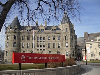
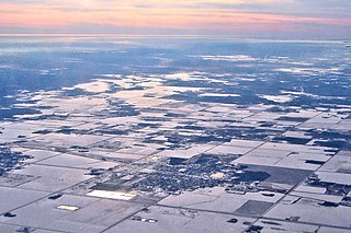
Winnipeg is the capital and largest city of the province of Manitoba in Canada. It is centred on the confluence of the Red and Assiniboine rivers, near the longitudinal centre of North America.

Selkirk, Manitoba City in Manitoba, Canada

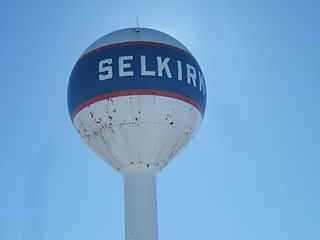
Selkirk is a city in the western Canadian province of Manitoba, located on the Red River about 22 kilometres (14 mi) northeast of the provincial capital Winnipeg. It has a population of 10,278 as of the 2016 census.

Rural Municipality of Rosser Rural municipality in Manitoba, Canada

Rosser is a rural municipality (RM) in the Canadian province of Manitoba, lying adjacent to the northwest side of Winnipeg and part of the Winnipeg Metro Region. Its population as of the 2016 Census was 1,372.

Rural Municipality of Hanover Place in Manitoba, Canada

The Rural Municipality of Hanover is a rural municipality (RM) in southeastern Manitoba, Canada, located southeast of Winnipeg in Division No. 2.

Rural Municipality of St. Andrews Rural Municipality in Manitoba, Canada

St. Andrews is a rural municipality in Manitoba, Canada. It lies west Red River; its southern border is approximately 8 kilometres (5.0 mi) north of Winnipeg.

Edmonton metropolitan region Metropolitan area in Canada, Alberta

The Edmonton Metropolitan Region (EMR), also commonly referred to as the Alberta Capital Region, Greater Edmonton or Metro Edmonton, is a conglomeration of municipalities centred on Alberta's provincial capital of Edmonton.

Old Kildonan Suburb of Winnipeg, Canada

Old Kildonan is the northernmost city ward of Winnipeg, Manitoba. Before the City of Winnipeg Act of 1972, it was an independent unincorporated municipality called the Municipality of Old Kildonan; prior to that, from 1914, it was a subdivision of the Rural Municipality of Kildonan.

St. Vital, Winnipeg A suburban community in Winnipeg, Manitoba

St. Vital is a ward and neighbourhood of Winnipeg, Manitoba, Canada.

St. James-Assiniboia, Winnipeg Suburb in Winnipeg, Manitoba, Canada

St. James-Assiniboia is a major community area in Winnipeg, Manitoba. As it encapsulates most of the city ward of St. James, which includes the major St. James Street, the area itself is often simply referred to "St. James."

Rural Municipality of St. Clements Rural municipality in Manitoba, Canada

St. Clements is a rural municipality in Manitoba, Canada. It is located to the north-east of Winnipeg, stretching from East St. Paul and Birds Hill Provincial Park in the south to Lake Winnipeg and Grand Beach Provincial Park to the north. The Red River demarcates the western boundary of the municipality. St. Clements contains the communities of East Selkirk, and Lockport east of the Red River. It almost completely surrounds the Brokenhead 4 Indian reserve, with the exception of a small lakefront on Lake Winnipeg.

Rural Municipality of Springfield Rural municipality in Manitoba, Canada

Springfield is a rural municipality (RM) in Manitoba, Canada.

Rural Municipality of Ritchot Rural Municipality in Manitoba, Canada

The Rural Municipality of Ritchot is a rural municipality in the Winnipeg Capital Region, bordering the south side of Winnipeg in Manitoba, Canada. The separately-administered town of Niverville lies adjacent to its southeast, between it and the Rural Municipality of Hanover.

Demographics of Manitoba

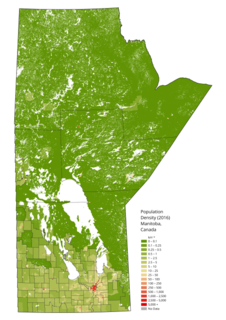
Manitoba is one of Canada's 10 provinces. It is the easternmost of the three Prairie provinces.

Rural Municipality of Brokenhead Rural municipality in Manitoba, Canada

The Rural Municipality of Brokenhead is a rural municipality (RM) in the Canadian province of Manitoba.

Municipal elections were held in the Canadian province of Manitoba on October 24, 2018. Mayors, councils and school board trustees were elected.

References

  1. 1 2 https://winnipegmetroregion.ca/about-us/governance/
  2. "Partnership of the Manitoba Capital Region A Regional Growth Strategy and Population Analysis" (PDF). The Partnership of the Manitoba Capital Region. 9 May 2016. p. 4. Retrieved 29 July 2019.
  3. "Resources". Winnipeg Metropolitan Region. 2018. Retrieved 29 July 2019.
  4. 1 2 3 4 "About Us - Winnipeg Metropolitan Region". Winnipeg Metropolitan Region. 2018. Retrieved 29 July 2019.
  5. 1 2 Municipal Relations. "Welcome to Manitoba's Capital Region". Province of Manitoba. Retrieved 2021-08-13.
  6. 1 2 Government of Canada, Statistics Canada (2017-02-08). "Focus on Geography Series, 2016 Census - Census metropolitan area of Winnipeg". www12.statcan.gc.ca. Retrieved 2021-08-13.
  7. 1 2 "2001 Census Data - Winnipeg Census Metropolitan Area (CMA)" (PDF). City of Winnipeg. Retrieved 1 August 2019.
  8. Santin, Aldo (February 8, 1998). "Mayor eyes mediator in water controversy". Winnipeg Free Press. p. 3.
  9. Redekop, Bill (November 9, 1998). "Hearings aim to heal relationship between city, nearby municipalities". Winnipeg Free Press. p. A3.
  10. MacKenzie, Glen (October 4, 1998). "Capital region chiefs bury hatchet". Winnipeg Free Press. p. A3.
  11. 1 2 "The Capital Region Partnership Act". Government of Manitoba. 2006. Retrieved 29 July 2019.
  12. Securing Our Future: An Action Plan for Winnipeg's Metropolitan Region (PDF). Winnipeg Metro Region. 2018.
  13. Murray, Robert W. (2019). For the Benefit of All: Regional Competitiveness and Collaboration in the Winnipeg Metro Region (PDF). Dentons.
  14. Kives, Bartley (October 31, 2019). "Province may appoint new planning authority to oversee development in Winnipeg and area". CBC News Manitoba. Retrieved October 31, 2019.
  15. "2001 Census Data - The City of Winnipeg" (PDF). City of Winnipeg. Retrieved 1 August 2019.
  16. "Population of Winnipeg" (PDF). City of Winnipeg. March 2019. Retrieved 1 August 2019.
  17. "Selected trend data for Winnipeg (CMA) for Winnipeg, 1996, 2001 and 2006 censuses". Statistics Canada. 22 February 2016. Retrieved 1 August 2019.
  18. "Census Profile, 2016 Census Winnipeg [Census metropolitan area], Manitoba and Manitoba [Province]". Statistics Canada. 21 June 2019. Retrieved 1 August 2019.
  19. "Annual Demographic Estimates: Subprovincial Areas, July 1, 2018". Statistics Canada. 28 March 2019. Retrieved 5 August 2019.
  20. "Partnership of the Manitoba Capital Region A Regional Growth Strategy and Population Analysis" (PDF). The Partnership of the Manitoba Capital Region. 9 May 2016. p. 4. Retrieved 29 July 2019.
  21. "Resources". Winnipeg Metropolitan Region. 2018. Retrieved 1 August 2019.
  22. "Charleswood--St. James--Assiniboia--Headingley (Manitoba)," Elections Canada. Retrieved 2021-08-12.
  23. "Kildonan--St. Paul," Elections Canada. Retrieved 2021-08-12.
  24. "Portage--Lisgar (Manitoba)," Elections Canada. Retrieved 2021-08-12.
  25. "Provencher (Manitoba)," Elections Canada. Retrieved 2021-08-12.
  26. "Selkirk--Interlake--Eastman (Manitoba)," Elections Canada. Retrieved 2021-08-12.

Coordinates: 49°53′N97°08′W / 49.88°N 97.13°W / 49.88; -97.13