
The Falkland Islands are located in the South Atlantic Ocean between 51°S and 53°S on a projection of the Patagonian Shelf, part of the South American continental shelf. In ancient geological time this shelf was part of Gondwana, and around 400 million years ago split from what is now Africa and drifted westwards from it. Today the islands are subjected to the Roaring Forties, winds that shape both their geography and climate.

Abbé Nicolas-Louis de Lacaille, formerly sometimes spelled de la Caille, was a French astronomer and geodesist who named 14 out of the 88 constellations. From 1750 to 1754, he studied the sky at the Cape of Good Hope in present-day South Africa. Lacaille observed over 10,000 stars using a refracting telescope.

Table Mountain is a flat-topped mountain forming a prominent landmark overlooking the city of Cape Town in South Africa. It is a significant tourist attraction, with many visitors using the cableway or hiking to the top. Table Mountain National Park is the most visited national park in South Africa, attracting 4.2 million people every year for various activities. The mountain has 8,200 plant species, of which around 80% are fynbos, meaning fine bush. It forms part of the Table Mountain National Park, and part of the lands formerly ranged by Khoe-speaking clans, such as the !Uriǁʼaes. It is home to a large array of mostly endemic fauna and flora. Its top elevates about 1.000 m above the surrounding city, making the popular hike upwards on a large variety of different and often steep pathways a serious mountain tour which should not be underestimated.

The Drakensberg is the eastern portion of the Great Escarpment, which encloses the central Southern African plateau. The Great Escarpment reaches its greatest elevation – 2,000 to 3,482 metres within the border region of South Africa and Lesotho.

The Zugspitze, at 2,962 m (9,718 ft) above sea level, is the highest peak of the Wetterstein Mountains and the highest mountain in Germany. It lies south of the town of Garmisch-Partenkirchen in Bavaria, and the Austria–Germany border is on its western summit. South of the mountain is the Zugspitzplatt, a high karst plateau with numerous caves. On the flanks of the Zugspitze are two glaciers, the largest in Germany: the Northern Schneeferner with an area of 30.7 hectares and Höllentalferner with an area of 24.7 hectares. Shrinking of the Southern Schneeferner led to the loss of glacier status in 2022.

The Witwatersrand is a 56-kilometre-long (35 mi), north-facing scarp in South Africa. It consists of a hard, erosion-resistant quartzite metamorphic rock, over which several north-flowing rivers form waterfalls, which account for the name Witwatersrand, meaning "white water ridge" in Afrikaans. This east-west-running scarp can be traced with only one short gap, from Bedfordview in the east, through Johannesburg and Roodepoort, to Krugersdorp in the west.

Devil's Peak is part of the mountainous backdrop to Cape Town, South Africa. When looking at Table Mountain from the city centre, or when looking towards the city across Table Bay, the skyline from left to right consists of Devil's Peak, the flat summit of Table Mountain, the peak of Lion's Head, and Signal Hill.
This is a list of the extreme points of Europe: the geographical points that are higher or farther north, south, east or west than any other location in Europe. Some of these positions are open to debate, as the definition of Europe is diverse.

The Karoo is a semi-desert natural region of South Africa. No exact definition of what constitutes the Karoo is available, so its extent is also not precisely defined. The Karoo is partly defined by its topography, geology and climate, and above all, its low rainfall, arid air, cloudless skies, and extremes of heat and cold. The Karoo also hosted a well-preserved ecosystem hundreds of million years ago which is now represented by many fossils.

The Alboran Sea is the westernmost portion of the Mediterranean Sea, lying between the Iberian Peninsula and the north of Africa. The Strait of Gibraltar, which lies at the west end of the Alboran Sea, connects the Mediterranean with the Atlantic Ocean.

The Cape Peninsula is a generally mountainous peninsula that juts out into the Atlantic Ocean at the south-western extremity of the African continent. At the southern end of the peninsula are Cape Point and the Cape of Good Hope. On the northern end is Table Mountain, overlooking Table Bay and the City Bowl of Cape Town, South Africa. The peninsula is 52 km long from Mouille point in the north to Cape Point in the south. The Peninsula has been an island on and off for the past 5 million years, as sea levels fell and rose with the ice age and interglacial global warming cycles of, particularly, the Pleistocene. The last time that the Peninsula was an island was about 1.5 million years ago. Soon afterwards it was joined to the mainland by the emergence from the sea of the sandy area now known as the Cape Flats. The towns and villages of the Cape Peninsula and Cape Flats, and the undeveloped land of the rest of the peninsula now form part of the City of Cape Town metropolitan municipality. The Cape Peninsula is bounded to the north by Table Bay, to the west by the open Atlantic Ocean, and to the east by False Bay in the south and the Cape Flats in the north.

South African Astronomical Observatory (SAAO) is the national centre for optical and infrared astronomy in South Africa. It was established in 1972. The observatory is run by the National Research Foundation of South Africa. The facility's function is to conduct research in astronomy and astrophysics. The primary telescopes are located in Sutherland, which is 370 kilometres (230 mi) from Observatory, Cape Town, where the headquarters is located.
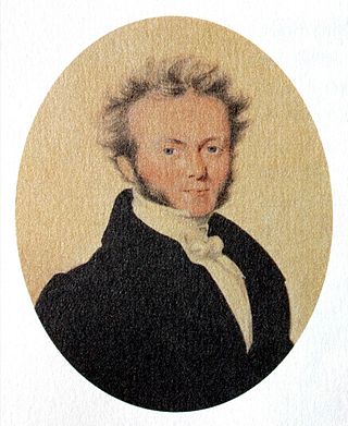
Sir Thomas Maclear was an Irish-born South African astronomer who became Her Majesty's astronomer at the Cape of Good Hope.

The Table Mountain Aerial Cableway is a cable car transportation system offering visitors a five-minute ride to the top of Table Mountain in Cape Town, South Africa. It is one of Cape Town's most popular tourist attractions with approximately one million people a year using the Cableway. In January 2019, the Cableway welcomed its 28 millionth visitor.

The Karoo Supergroup is the most widespread stratigraphic unit in Africa south of the Kalahari Desert. The supergroup consists of a sequence of units, mostly of nonmarine origin, deposited between the Late Carboniferous and Early Jurassic, a period of about 120 million years.

Titlis is a mountain of the Uri Alps, located on the border between the cantons of Obwalden and Bern. At 3,238 metres (10,623 ft) above sea level, it is the highest summit of the range north of the Susten Pass, between the Bernese Oberland and Central Switzerland. It is mainly accessed from Engelberg (OW) on the north side and is famous as the site of the world's first rotating cable car. The cable car system connects Engelberg to the summit of Klein Titlis through the three stages of Gerschnialp, Trübsee and Stand. In 2016, a direct route was created that bypassed Geraschnialp, going directly to Trübsee.

The Cape Fold Belt is a fold and thrust belt of late Paleozoic age, which affected the sequence of sedimentary rock layers of the Cape Supergroup in the southwestern corner of South Africa. It was originally continuous with the Ventana Mountains near Bahía Blanca in Argentina, the Pensacola Mountains, the Ellsworth Mountains and the Hunter-Bowen orogeny in eastern Australia. The rocks involved are generally sandstones and shales, with the shales persisting in the valley floors while the erosion resistant sandstones form the parallel ranges, the Cape Fold Mountains, which reach a maximum height of 2325 m at Seweweekspoortpiek.

Table Mountain Sandstone (TMS) is a group of rock formations within the Cape Supergroup sequence of rocks. Although the term "Table Mountain Sandstone" is still widely used in common parlance, the term TMS is no longer formally recognized; the correct name is the "Peninsula Formation Sandstone", which is part of the Table Mountain Group. The designation "Table Mountain Sandstone" will, however, in deference to the title, continue to be used in the rest of this article. The name is derived from the famous landmark in Cape Town, Table Mountain.

Cape Town lies at the south-western corner of the continent of Africa. It is bounded to the south and west by the Atlantic Ocean, and to the north and east by various other municipalities in the Western Cape province of South Africa.

The Royal Observatory, Cape of Good Hope, is a former scientific institution in South Africa. Founded by the British Board of Longitude in 1820, its main building is now the headquarters building of the South African Astronomical Observatory.

