Meteorological history | |
---|---|
Formed | Unknown |
Dissipated | August 12,1856 |
Category 4 major hurricane | |
1-minute sustained (SSHWS/NWS) | |
Highest winds | 150 mph (240 km/h) |
Lowest pressure | 934 mbar (hPa);27.58 inHg |
Overall effects | |
Fatalities | 300+ |
Areas affected | Louisiana and southwestern Mississippi |
IBTrACS | |
Part of the 1856 Atlantic hurricane season |
The 1856 Last Island hurricane (also known as the Great Storm of 1856) was a deadly and destructive tropical cyclone that is tied with 2020's Hurricane Laura and 2021's Hurricane Ida as the strongest hurricane on record to make landfall in the U.S. state of Louisiana,as measured by maximum sustained winds. [1] The first known tropical cyclone of 1856 Atlantic hurricane season,it was observed first as a minimal hurricane in the Gulf of Mexico near Dry Tortugas on August 9. Moving northwestward,the cyclone quickly intensified into a strong Category 4 hurricane on the modern-day Saffir–Simpson scale by the following day. Late on August 10,the hurricane made landfall on Last Island,Louisiana,with winds at 150 mph (240 km/h),hours before striking near New Iberia. The system rapidly weakened after moving inland,falling to tropical storm intensity on August 11. The storm would be last noted over Mississippi on the next day.
Offshore,at least 183 people drowned after steamers and schooners sank in rough seas produced by the hurricane. A storm surge between 11 and 12 feet (3.4 and 3.7 m) completely submerged Last Island in Louisiana,destroying virtually every structure,including the hotels and casinos,while all crops were ruined. Additionally,Last Island itself was split in two. Inland,heavy rainfall caused the Mermentau River to flood,destroying crops and every house in Abbeville. The storm produced as much as 13.14 inches (334 mm) of precipitation in New Orleans. In Plaquemines Parish,rice fields were under several feet of water,while many orange trees lost their fruit. Overall,the hurricane resulted in at least 300 fatalities.
The cyclone was first detected in the eastern Gulf of Mexico 125 miles (201 km) west-northwest of Key West, Florida, on August 8, 1856. Because it was already a hurricane when it was first observed, it probably had developed further east than here. It advanced steadily northwest, strengthening to the equivalent of a Category 3 hurricane. The hurricane gradually slowed prior to landfall on August 10, and it attained its estimated peak intensity of 150 mph (240 km/h). It was a tropical cyclone of small diameter, and its maximum sustained winds may have reached Category 5 status, but were unrecorded. During the early evening of August 10 the northeastern edge of the eye crossed over Last Island (Official name: Isle Dernière) before making landfall a few hours later south of New Iberia, Louisiana. The cyclone is believed to have struck southern Louisiana at peak intensity with an approximate central pressure of 934 mbar (27.6 inHg). [2] A ship reported a peripheral pressure of 955 mbar (28.2 inHg), [3] so a lower pressure was based on the small size of the hurricane. It quickly weakened over land, and it diminished to a tropical storm on August 11. It dissipated over southwestern Mississippi on August 12 with fully tropical characteristics. [2]
Strongest U.S. landfalling tropical cyclones† | |||||
---|---|---|---|---|---|
Rank | Name‡ | Season | Wind speed | ||
mph | km/h | ||||
1 | "Labor Day" | 1935 | 185 | 295 | |
2 | Karen | 1962 | 175 | 280 | |
Camille | 1969 | ||||
Yutu | 2018 | ||||
5 | Andrew | 1992 | 165 | 270 | |
6 | "Okeechobee" | 1928 | 160 | 260 | |
Michael | 2018 | ||||
8 | Maria | 2017 | 155 | 250 | |
9 | "Last Island" | 1856 | 150 | 240 | |
"Indianola" | 1886 | ||||
"Florida Keys" | 1919 | ||||
"Freeport" | 1932 | ||||
Charley | 2004 | ||||
Laura | 2020 | ||||
Ida | 2021 | ||||
Ian | 2022 | ||||
Source: Hurricane Research Division [4] | |||||
†Strength refers to maximum sustained wind speed upon striking land. | |||||
‡Systems prior to 1950 were not officially named. |
Many Last Island vacationers hoping to escape the approaching storm were awaiting the scheduled arrival of the ship Star, which provided regular service to the mainland. However, the Star was blown off course, barely escaping sailing into the open gulf, directly into the hurricane, where it would have almost certainly been lost. Passenger Tom Ellis, an experienced captain in local waters, and a few other passengers observed the ship was off course. Ellis alerted Captain Abe Smith, who corrected the course and barely making headway against the winds, managed to pull into the channel behind the hotel. The Star was swept, crashing into shore and beached on the sand, where it stayed through the storm. [5]
Visibility during the storm was extremely limited and eyes were blasted by sand until water covered the beaches. Sometime between 4:00 and 5:00 PM, the storm surge occurred suddenly, with the water rising several feet in a matter of minutes. The storm surge submerged the entire island and destroyed all of the buildings. The hotel, which held many women and children on the second floor and men on the first, collapsed, crushing many and sweeping others out to sea. [5]
Several survivors managed to make their way to the hull of the Star. By tying himself with a rope to the Star, Captain Abe Smith was able to rescue at least 40 people from the storm surge. [5] The Star would serve as a shelter for the survivors until rescuers arrived three days later.
Many managed to survive by sheltering in or behind overturned cisterns, which were large wooden cylindrical tanks reinforced with iron hoops. Some clung to the raised foundations of the cisterns and a few to trees. A dozen people survived by clinging to a large piece of rotating playground equipment atop a levee. [6] Many people floated on debris, including wall sections, logs and furniture. A sturdy wooden enclosure that held large terrapins, a regional delicacy, provided enough protection to save several individuals. Another group survived by burying their feet in the sand and holding hands. Some survivors were carried to the marshes on the mainland, although some perished from injuries or lack of food and water. [5]
Of the approximately 400 vacationers on the island, 198 were known or presumed dead and 203 were known survivors. Dixon (2009) provides lists of survivors and the dead. [5]
Several of the victims were enslaved people. Some of the enslaved people were credited with rescuing others, including several children.
The tragedy had a major impact on the planter society, which lost many members. At the time of the hurricane approximately two-thirds of the millionaires in the U.S. lived in Louisiana, many of those being plantation owners, especially sugar growers. Of the social group affected, many were friends, acquaintances, or related by marriage or known through business.
The family home of three of the Last Island casualties was Shadows-on-the-Teche in New Iberia, Louisiana, now a National Historic Landmark. Mrs. Frances Weeks (Magill) Pruett and her children Mary Ida Magill and Augustine Magill died in the natural disaster. The two children were buried in the plantation's cemetery.
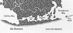
The island itself was split into the Last Islands (Isles Dernieres). [7] The island reportedly stayed submerged for several days before parts of it re-emerged as large sandbars. After the storm surge, the remains of the Star were the only sign that an island had ever existed there. [7] Presently, the area is the Isles Dernieres Barrier Islands Refuge owned and managed by the Louisiana Department of Wildlife and Fisheries to provide protected nesting grounds for pelicans and other waterbirds. [8]
The following are the numbers of deaths offshore: [5]
On Calliou Island, which was located near Last Island, four homes were destroyed, and the others suffered substantial damage. Tides generated by the storm capsized two boats and swept away stock. [9] The city of New Orleans was inundated with 13.14 inches (334 mm) of rain. Every building in Abbeville was destroyed, including St. Mary Magdalen Church. Crops along the Mermentau River suffered large losses from freshwater flooding. Farther east, storm surge and abnormally high tides left some sections of Plaquemines Parish inundated by several feet of water, resulting in a near-total loss of rice crops. Severe losses to orange crops were reported in the area. [7] Extensive damage occurred in St. Tammany Parish at Lewisburg, Mandeville, and other areas near the Tchefuncte River. The storm swept away bathhouses and wharves, while also downing fences, trees, and vegetation. [10]
The disaster became national news as soon as three survivors salvaged a small boat and sailed to the mainland for help.
In addition to the several firsthand accounts, the story of Last Island has been republished periodically. The list below includes only a few versions:
The 1909 Atlantic hurricane season was an average Atlantic hurricane season. The season produced thirteen tropical cyclones, twelve of which became tropical storms; six became hurricanes, and four of those strengthened into major hurricanes. The season's first storm developed on June 15 while the last storm transitioned into an extratropical cyclone on November 14. The most notable storm during the season formed in late August, while east of the Lesser Antilles. The hurricane devastated the Lesser Antilles, the Greater Antilles, and Mexico, leaving around 4,000 fatalities and more than $50 million (1909 USD) in damage.
The 1908 Atlantic hurricane season was an active Atlantic hurricane season. Thirteen tropical cyclones formed, of which ten became tropical storms; six became hurricanes, and one of those strengthened into a major hurricane – tropical cyclones that reach at least Category 3 on the modern day Saffir–Simpson scale. The season's first system developed on March 6, and the last storm transitioned into an extratropical cyclone on October 23.
The 1919 Florida Keys hurricane was a massive and damaging tropical cyclone that swept across areas of the northern Caribbean Sea and the United States Gulf Coast in September 1919. Remaining an intense Atlantic hurricane throughout much of its existence, the storm's slow movement and sheer size prolonged and enlarged the scope of the hurricane's effects, making it one of the deadliest hurricanes in United States history. Impacts were largely concentrated around the Florida Keys and South Texas areas, though lesser but nonetheless significant effects were felt in Cuba and other areas of the United States Gulf Coast. The hurricane's peak strength in Dry Tortugas in the lower Florida Keys made it one of the most powerful Atlantic hurricanes to make landfall in the United States.
The 1898 Atlantic hurricane season marked the beginning of the Weather Bureau operating a network of observation posts across the Caribbean Sea to track tropical cyclones, established primarily due to the onset of the Spanish–American War. A total of eleven tropical storms formed, five of which intensified into a hurricane, according to HURDAT, the National Hurricane Center's official database. Further, one cyclone strengthened into a major hurricane. However, in the absence of modern satellite and other remote-sensing technologies, only storms that affected populated land areas or encountered ships at sea were recorded, so the actual total could be higher. An undercount bias of zero to six tropical cyclones per year between 1851 and 1885 and zero to four per year between 1886 and 1910 has been estimated. The first system was initially observed on August 2 near West End in the Bahamas, while the eleventh and final storm dissipated on November 4 over the Mexican state of Veracruz.
The 1893 Atlantic hurricane season featured the only known instance of more than one tropical cyclone causing at least 1,000 deaths in the United States. It was a fairly active season, with 12 tropical storms forming, 10 of which became hurricanes. Of those, five became major hurricanes. The season is considered hyper-active in terms of accumulated cyclone energy, achieving a total of 231 units, which remains the third-highest ever recorded in the Atlantic basin. Additionally, 1893 became one of two seasons on record to see four Atlantic hurricanes active simultaneously, along with 1998. In the absence of modern satellite and other remote-sensing technologies, only storms that affected populated land areas or encountered ships at sea were recorded, so the actual total could be higher. An undercount bias of zero to six tropical cyclones per year between 1851 and 1885 and zero to four per year between 1886 and 1910 has been estimated. The first system was initially observed on June 12 in the Bay of Campeche, while the twelfth and final storm transitioned into an extratropical cyclone on November 9 over the northwestern Atlantic.
Last Island was a barrier island and location of a pleasure resort southwest of New Orleans on the Gulf Coast of Louisiana, United States. Located south of Dulac, Louisiana, between Lake Pelto, Caillou Bay, and the Gulf of Mexico, it was named Last Island because it was the last of a series of barrier islands which stretched westward from the mouth of the Mississippi River, 90 miles to the east.
The 1880 Atlantic hurricane season ran through the summer and fall of 1880. This is the period of each year when most tropical cyclones form in the Atlantic basin. In the 1880 Atlantic season there were two tropical storms, seven hurricanes, and two major hurricanes (Category 3+). However, in the absence of modern satellite and other remote-sensing technologies, only storms that affected populated land areas or encountered ships at sea were recorded, so the actual total could be higher. An undercount bias of zero to six tropical cyclones per year between 1851 and 1885 and zero to four per year between 1886 and 1910 has been estimated. Of the known 1880 cyclones, Hurricane Six was first documented in 1995 by José Fernández-Partagás and Henry Díaz. They also proposed large changes to the known tracks of several other storms for this year and 're-instated' Hurricane Ten to the database. A preliminary reanalysis by Michael Chenoweth, published in 2014, found thirteen storms, nine hurricanes, and four major hurricanes.
Hurricane Juan was a large and erratic tropical cyclone that looped twice near the Louisiana coast, causing widespread flooding. It was the tenth named storm of the 1985 Atlantic hurricane season, forming in the central Gulf of Mexico in late October. Juan moved northward after its formation, and was subtropical in nature with its large size. On October 27, the storm became a hurricane, reaching maximum sustained winds of 85 mph (140 km/h). Due to the influence of an upper-level low, Juan looped just off southern Louisiana before making landfall near Morgan City on October 29. Weakening to tropical storm status over land, Juan turned back to the southeast over open waters, crossing the Mississippi River Delta. After turning to the northeast, the storm made its final landfall just west of Pensacola, Florida, late on October 31. Juan continued quickly to the north and was absorbed by an approaching cold front, although its moisture contributed to a deadly flood event in the Mid-Atlantic states.
The Chenière Caminada hurricane, also known as the Great October Storm, was a powerful hurricane that devastated the island of Cheniere Caminada, Louisiana in early October 1893. It was one of three deadly hurricanes during the 1893 Atlantic hurricane season; the storm killed an estimated 2,000 people, mostly from storm surge. The high death toll ranks the hurricane as the deadliest hurricane in Louisiana history and the third deadliest hurricane in the continental U.S., behind only the 1900 Galveston hurricane and the 1928 Okeechobee hurricane.
The New Orleans Hurricane of 1915 was an intense Category 4 hurricane that made landfall near Grand Isle, Louisiana, and the most intense tropical cyclone during the 1915 Atlantic hurricane season. The storm formed in late September when it moved westward and peaked in intensity of 145 mph (233 km/h) to weaken slightly by time of landfall on September 29 with recorded wind speeds of 126 mph (203 km/h) as a strong category 3 Hurricane. The hurricane killed 275 people and caused $13 million in damage.
The 1886 Atlantic hurricane season included seven hurricanes that struck or moved across the United States at that intensity, the most ever recorded. The season featured 12 known tropical storms, 10 of which became hurricanes, then-tied for the most. Four of those cyclones became a major hurricane, the highest number until 1893. The season also had the most active June, and reached the modern seasonal average of hurricanes by mid-August. This occurred once more in 1893, and has remained a distant record since. However, with the absence of modern satellites and other remote-sensing technologies, only storms that affected populated land areas or encountered ships at sea were documented. The actual total is likely higher with an average under-count bias estimate of zero to six tropical cyclones per year between 1851 and 1885 and zero to four per year between 1886 and 1910. Several studies have also suggested that the 1883 eruption of Krakatoa may have played a significant role in the unusual and enhanced activity. The first system was initially observed on June 13 over the western Gulf of Mexico, while the final storm was last noted east-southeast of Bermuda on October 26.
The 1852 Atlantic hurricane season was the first of only three Atlantic hurricane seasons in which every known tropical cyclone attained hurricane status, preceding 1858 and 1884. Five tropical cyclones were reported during the season, which lasted from late August to the middle of October. These dates fall within the range of most Atlantic tropical cyclone activity, and none of the storms coexisted with another. Though there were officially five tropical cyclones in the season, hurricane scholar Michael Chenoweth assessed two of the cyclones as being the same storm. There may have been other unconfirmed tropical cyclones during the season, as meteorologist Christopher Landsea estimated that up to six storms were missed each year from the official database. This is unusual due to tropical cyclones being smaller than average, sparse ship reports, and relatively unpopulated coastlines at the time.
The 1882 Atlantic hurricane season ran through the summer and early fall of 1882. This is the period of each year when most tropical cyclones form in the Atlantic basin. In the 1882 Atlantic season there were two tropical storms, two Category 1 hurricanes, and two major hurricanes. However, in the absence of modern satellite and other remote-sensing technologies, only storms that affected populated land areas or encountered ships at sea were recorded, so the actual total could be higher. An undercount bias of zero to six tropical cyclones per year between 1851 and 1885 and zero to four per year between 1886 and 1910 has been estimated. Of the known 1882 cyclones, Hurricane One and Hurricane Five were both first documented in 1996 by Jose Fernandez-Partagas and Henry Diaz, while Tropical Storm Three was first recognized in 1997 and added to HURDAT in 2003. Partagas and Diaz also proposed large changes to the known track of Hurricane Two while further re-analysis, in 2000, led to the peak strengths of both Hurricane Two and Hurricane Six being increased. In 2011 the third storm of the year was downgraded from a hurricane to a tropical storm.
The 1854 Atlantic hurricane season featured five known tropical cyclones, three of which made landfall in the United States. At one time, another was believed to have existed near Galveston, Texas, in September. However, HURDAT – the official Atlantic hurricane database – now excludes this system. The first system, Hurricane One, was initially observed on June 25. The final storm, Hurricane Five, was last observed on October 22. These dates fall within the period with the most tropical cyclone activity in the Atlantic. No tropical cyclones during this season existed simultaneously. One tropical cyclone has a single known point in its track due to a sparsity of data.
The 1871 Atlantic hurricane season lasted from mid-summer to late-fall. Records show that 1871 featured two tropical storms, four hurricanes and two major hurricanes. However, in the absence of modern satellite and other remote-sensing technologies, only storms that affected populated land areas or encountered ships at sea were recorded, so the actual total could be higher. According to a study in 2004, an undercount bias of zero to six tropical cyclones per year between 1851 and 1885 and zero to four per year between 1886 and 1910 is possible. A later study in 2008 estimated that eight or more storms may have been missed prior to 1878.
The 1867 Atlantic hurricane season lasted from mid-summer to late-fall. A total of nine known tropical systems developed during the season, with the earliest forming on June 21, and the last dissipating on October 31. On two occasions during the season, two tropical cyclones simultaneously existed with one another; the first time on August 2, and the second on October 9. Records show that 1867 featured two tropical storms, six hurricanes and one major hurricane. However, in the absence of modern satellite and other remote-sensing technologies, only storms that affected populated land areas or encountered ships at sea were recorded, so the actual total could be higher. An undercount bias of zero to six tropical cyclones per year between 1851 and 1885 and zero to four per year between 1886 and 1910 has been estimated. Of the known 1867 cyclones Hurricanes Three, Four and Six plus Tropical Cyclones Five and Eight were first documented in 1995 by Jose Fernandez-Partagas and Henry Diaz. Hurricane One was first identified in 2003 by Cary Mock.
The 1856 Atlantic hurricane season featured six tropical cyclones, five of which made landfall. The first system, Hurricane One, was first observed in the Gulf of Mexico on August 9. The final storm, Hurricane Six, was last observed on September 22. These dates fall within the period with the most tropical cyclone activity in the Atlantic. Only two tropical cyclones during the season existed simultaneously. One of the cyclones has only a single known point in its track due to a sparsity of data. Operationally, another tropical cyclone was believed to have existed in the Wilmington, North Carolina area in September, but HURDAT – the official Atlantic hurricane database – excludes this system. Another tropical cyclone that existed over the Northeastern United States in mid-August was later added to HURDAT.
The 1888 Louisiana hurricane was a major hurricane that caused significant flooding and wind damage to the Mississippi River Delta and the Mississippi Valley in late August 1888. It was the third tropical cyclone and second hurricane of the 1888 Atlantic hurricane season.
The 1875 Indianola hurricane brought a devastating and deadly storm surge to the coast of Texas. The third known system of the 1875 Atlantic hurricane season, the storm was first considered a tropical cyclone while located east of the Lesser Antilles on September 8. After passing through the Windward Islands and entering the Caribbean Sea, the cyclone gradually began to move more northwestward and brushed the Tiburon Peninsula of Haiti late on September 12. On the following day, the storm made a few landfalls on the southern coast of Cuba before moving inland over Sancti Spíritus Province. The system emerged into the Gulf of Mexico near Havana and briefly weakened to a tropical storm. Thereafter, the storm slowly re-intensified and gradually turned westward. On September 16, the hurricane peaked as a Category 3 hurricane with winds of 115 mph (185 km/h). Later that day, the hurricane made landfall near Indianola, Texas. The storm quickly weakened and turned northeastward, before dissipating over Mississippi on September 18.
Notes
Bibliography