Anguilla Channel

Last updated
Anguilla Channel
SSS Islands Map.png
Saint-Martin collectivity relief location map.jpg
Red pog.svg
Anguilla Channel
Relief map of Lesser Antilles.png
Red pog.svg
Anguilla Channel
La2-demis-caribbean.png
Red pog.svg
Anguilla Channel
Location Caribbean
Coordinates 18°8′N63°5′W / 18.133°N 63.083°W / 18.133; -63.083
Basin  countries Anguilla (United Kingdom)
Saint Martin (France)
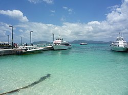
Settlements Grand Case, Marigot, Blowing Point
Blowing Point Ferry Terminal facing the Anguilla Channel Anguilla Ferry Terminal.jpg
Blowing Point Ferry Terminal facing the Anguilla Channel

The Anguilla Channel (French : Canal d'Anguilla) is a strait in the Caribbean Sea. It separates the island of Anguilla (a British Overseas Territory) in the north from the Collectivity of Saint Martin, an overseas collectivity of France on the island of Saint Martin, in the south.

Contents

Ecology

A coral reef in the channel known as Chris's Reef was found in 2009. It contains the remains of automotive vehicles which may have been destroyed by Hurricane Luis in 1995 and subsequently placed into the reef for disposal. [1]

Transport

See also

Related Research Articles

<span class="mw-page-title-main">Anguilla</span> British Overseas Territory in the Leeward Islands

Anguilla is a British Overseas Territory in the Caribbean. It is one of the most northerly of the Leeward Islands in the Lesser Antilles, lying east of Puerto Rico and the Virgin Islands and directly north of Saint Martin. The territory consists of the main island of Anguilla, approximately 16 miles long by 3 miles (5 km) wide at its widest point, together with a number of much smaller islands and cays with no permanent population. The territory's capital is The Valley. The total land area of the territory is 35 square miles (91 km2), with a population of approximately 15,753 (2021).

<span class="mw-page-title-main">Saint Martin (island)</span> Small island in the Caribbean

Saint Martin is an island in the northeast Caribbean, approximately 300 km (190 mi) east of Puerto Rico. The 87 square kilometres (34 sq mi) island is divided roughly 60:40 between the French Republic and the Kingdom of the Netherlands, but the Dutch part is more populated than the French part. The division dates to 1648. The northern French part comprises the Collectivity of Saint Martin and is an overseas collectivity of the French Republic. The southern Dutch part comprises Sint Maarten and is one of four constituent countries that form the Kingdom of the Netherlands. As an overseas possession of two European Union member states, the island is itself part of the EU.

Each entry below presents a list of topics about a specific nation or state (country), followed by a link to the main article for that country. Entries for nations are in bold type, while those for subnational entities are in normal (unbolded) type.

<span class="mw-page-title-main">Administrative divisions of France</span> Class grouping all types of territorial divisions of France (administrative or electoral)

The administrative divisions of France are concerned with the institutional and territorial organization of French territory. These territories are located in many parts of the world. There are many administrative divisions, which may have political, electoral (districts), or administrative objectives. All the inhabited territories are represented in the National Assembly, Senate and Economic and Social Council and their citizens have French citizenship and elect the President of France.

<span class="mw-page-title-main">Saint Martin national football team</span>

The Saint Martin national football team is the football team of the Collectivity of Saint Martin, the French half of the island of Saint Martin which was previously part of the French overseas department of Guadeloupe and is controlled by the Comité de Football des Îles du Nord. Saint Martin is not a member of FIFA, and is therefore not eligible to enter the World Cup, but it does compete in CONCACAF competitions.

<span class="mw-page-title-main">United Nations geoscheme for the Americas</span> United Nations geoscheme for North America and South America

The following is an alphabetical list of countries in the United Nations geoscheme for the Americas grouped by subregion and intermediate region. The continent of North America comprises the intermediate regions of the Caribbean, Central America, and Northern America.

This is a list of articles holding galleries of maps of present-day countries and dependencies. The list includes all countries listed in the List of countries, the French overseas departments, the Spanish and Portuguese overseas regions and inhabited overseas dependencies.

<span class="mw-page-title-main">Collectivity of Saint Martin</span> French overseas collectivity, part of the island of Saint Martin in the Lesser Antilles

The Collectivity of Saint Martin, commonly known as simply Saint Martin, is an overseas collectivity of France in the West Indies in the Caribbean, on the northern half of the island of Saint Martin, as well as some smaller adjacent islands. Saint Martin is separated from the island of Anguilla by the Anguilla Channel. Its capital is Marigot.

<span class="mw-page-title-main">Flag of the Collectivity of Saint Martin</span>

The French tricolore is the official national flag used in the Collectivity of Saint Martin.

<span class="mw-page-title-main">Caribbean Tourism Organization</span> Tourism agency based in Barbados

The Caribbean Tourism Organization's main objective is the development of sustainable tourism for the economic and social benefit of Caribbean people.

<span class="mw-page-title-main">Outline of the Collectivity of Saint Martin</span> Overview of and topical guide to the Collectivity of Saint Martin

The following outline is provided as an overview of and topical guide to the Collectivity of Saint Martin:

<span class="mw-page-title-main">1996 France–United Kingdom Maritime Delimitation Agreements</span>

The 1996 France – United Kingdom Maritime Delimitation Agreements are two treaties between France and the United Kingdom which establish a number of maritime boundary between French territories and British territories in the Caribbean Sea.

Saint-Barthélemy Channel is a strait in the Caribbean Sea that separates the French overseas collectivity of Saint Barthélemy and the island of Saint Martin, which is divided between a separate French overseas collectivity and Sint Maarten, a constituent country of the Kingdom of the Netherlands. The maritime boundary between Saint Bathélemy and Sint Maarten runs through Saint-Barthélemy Channel.

<span class="mw-page-title-main">Saint Barthélemy</span> French island in the Caribbean

Saint Barthélemy, officially the Collectivité territoriale de Saint-Barthélemy, also known as St. Barts (English) or St. Barth (French), is an overseas collectivity of France in the Caribbean. The island lies about 30 kilometres (19 mi) southeast of the island of Saint Martin; it is northeast of the Dutch islands of Saba and Sint Eustatius, as well as north of the independent country of Saint Kitts and Nevis.

<span class="mw-page-title-main">Prickly Pear Cays</span>

The Prickly Pear Cays, sometimes spelt as Prickley Pear Cays, are a small pair of uninhabited islands about six miles from Road Bay, Anguilla, in the Leeward Islands of the Caribbean. They are divided by a narrow boat channel between Prickly Pear East and Prickly Pear West. Prickly Pear Cays were classified as 'wildlands' by the "Eastern Caribbean Natural Area Management Programme" (ECNAMP). In addition, Prickly Pear Cays are one of six marine protected areas of Anguilla.

References

  1. "Blog Archive » Return to Chris's Reef". Les Fruits De Mer. 2010-06-07. Retrieved 2015-12-16.