Avon County Council

Last updated

Avon County Council
Arms of Avon County Council.svg
History
Founded1 April 1974
Disbanded1 April 1996
Succeeded by Bath and North East Somerset Council
Bristol City Council
North Somerset Council
South Gloucestershire Council
Meeting place
Avon House Bristol (24729505547).jpg
Avon House, Bristol

Avon County Council was the county council of the non-metropolitan county of Avon in south west England. [1] It came into its powers on 1 April 1974 and was abolished on 1 April 1996 at the same time as the county. The county council was based at Avon House in Bristol. [2] It was replaced with four authorities: Bristol City Council, South Gloucestershire Council, North Somerset Council and Bath and North East Somerset Council. [3]

Contents

Political control

From the first election to the council in 1973 political control of the council was held by the following parties: [4]

PartyTenure
No overall control 1973 1977
Conservative 1977 1981
Labour 1981 1985
No overall control 1985 1996

Council elections

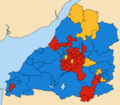
County result maps

See also

Related Research Articles

<span class="mw-page-title-main">Somerset</span> County in South West England

Somerset is a ceremonial county in South West England. It is bordered by the Bristol Channel, Gloucestershire, and Bristol to the north, Wiltshire to the east and the north-east, Dorset to the south-east, and Devon to the south-west. The largest settlement is the city of Bath, and the county town is Taunton.

<span class="mw-page-title-main">Avon (county)</span> Former non-metropolitan and ceremonial county in England

Avon was a non-metropolitan and ceremonial county in the west of England that existed between 1974 and 1996. The county was named after the River Avon, which flows through the area. It was formed from the county boroughs of Bristol and Bath, together with parts of the administrative counties of Gloucestershire and Somerset.

<span class="mw-page-title-main">North Somerset</span> District in England

North Somerset is a unitary authority in the ceremonial county of Somerset, England. The council is based in Weston-super-Mare, the area's largest town. The district also contains the towns of Clevedon, Nailsea and Portishead, along with a number of villages and surrounding rural areas. Some southern parts of the district fall within the Mendip Hills, a designated Area of Outstanding Natural Beauty.

<span class="mw-page-title-main">Flax Bourton</span> Human settlement in England

Flax Bourton is a village and civil parish in Somerset, England. The parish, with a population of 715, is situated within the unitary authority of North Somerset, on the edge of Nailsea Moor on the A370 road 5 miles (8.0 km) south west of Bristol city centre.

<span class="mw-page-title-main">Metropolitan and non-metropolitan counties of England</span> Subdivisions of England

Metropolitan and non-metropolitan counties are one of the four levels of subdivisions of England used for the purposes of local government outside Greater London and the Isles of Scilly. As originally constituted, the metropolitan and non-metropolitan counties each consisted of multiple districts, had a county council and were also the counties for the purposes of Lieutenancies. Later changes in legislation during the 1980s and 1990s have resulted in counties with no county council and 'unitary authority' counties with no districts. Counties for the purposes of Lieutenancies are now defined separately, based on the metropolitan and non-metropolitan counties.

Greater Bristol is a term used for the conurbation which contains and surrounds the city of Bristol in the South West of England. There is no official "Greater Bristol" authority, but the term is sometimes used by local, regional and national authorities, and others as a synonym for either the "Bristol Urban Area" or a wider area of the former County of Avon, and by some, TfGB, to refer to the Province of Bristol as defined by C. B. Fawcett (1919) or Derek Senior (1969).

Somerset County Council in England was elected every four years. Since the last boundary changes in 2001, 58 councillors were elected from 58 wards. In 2013 and 2017, 55 councillors were elected from 54 wards. In 2022, 110 councillors were elected and these transitioned over to Somerset Council, the unitary authority the replaced the county council on 1 April 2023.

<span class="mw-page-title-main">West of England</span> Combined authority area of England

West of England is a combined authority area in South West England, around the River Avon. It is made up of the Bristol, South Gloucestershire, and Bath and North East Somerset unitary authorities. The combined authority is led by the Mayor of the West of England Dan Norris. The city of Bristol is the region's largest population centre. Before the region, from 1974 until 1996, the area was under the County of Avon with North Somerset.

<span class="mw-page-title-main">Bath and North East Somerset Council</span> English local government council

Bath and North East Somerset Council is the local council for the district of Bath and North East Somerset in Somerset, England.

<span class="mw-page-title-main">Somerset Council</span> Unitary authority in England

Somerset Council, known until 1 April 2023 as Somerset County Council, is the unitary authority which governs the district of Somerset, which occupies the southern part of the ceremonial county of the same name in the South West of England. The council has been controlled by the Liberal Democrats since the 2022 local elections, and its headquarters is County Hall in Taunton.

North Somerset Council is the local authority for the unitary authority of North Somerset, England. Until 1 April 1996 it was a non-metropolitan district called Woodspring, in the county of Avon.

<span class="mw-page-title-main">Transport in Somerset</span> Overview of transport in Somerset

The earliest known infrastructure for transport in Somerset is a series of wooden trackways laid across the Somerset Levels, an area of low-lying marshy ground. To the west of this district lies the Bristol Channel, while the other boundaries of the county of Somerset are along chains of hills that were once exploited for their mineral deposits. These natural features have all influenced the evolution of the transport network. Roads and railways either followed the hills, or needed causeways to cross the Levels. Harbours were developed, rivers improved, and linked to sources of traffic by canals. Railways were constructed throughout the area, influenced by the needs of the city of Bristol, which lies just to the north of Somerset, and to link the ports of the far south-west with the rest of England.

<span class="mw-page-title-main">Bath City Council elections</span>

Bath City Council was a non-metropolitan district in Avon, England, that administered the city of Bath, Somerset, from 1974 until 1996. The district council replaced the pre-1974 county borough council.

Wansdyke was a non-metropolitan district in Avon, England. It was abolished on 1 April 1996 and replaced by Bath and North East Somerset.

<span class="mw-page-title-main">1993 Avon County Council election</span>

The 1993 Avon County Council election took place on 6 May 1993 to elect members of Avon County Council in England. This was on the same day as other nationwide local elections. The Liberal Democrats made a number of gains, mainly at the expense of the Conservatives. Labour remained the largest group on the council, but were 6 seats short of gaining a majority.

<span class="mw-page-title-main">2017 West of England mayoral election</span> First mayoral election in the West of England

The inaugural West of England mayoral election was held on 4 May 2017 to elect the Mayor of the West of England metropolitan area. The area is made up of Bath and North East Somerset, Bristol and South Gloucestershire. Subsequent elections will be held every four years. The election was won by Conservative Tim Bowles. The overall turnout for the election was low, with only 29.7% of the electorate voting.

<span class="mw-page-title-main">Avon Green Belt</span>

The Avon Green Belt, also known as the Bristol and Bath Green Belt, is a non-statutory green belt environmental and planning policy that regulates urban expansion and development in the countryside surrounding the cities of Bristol and Bath in the South West region of England. It covers areas in Bristol, South Gloucestershire, North Somerset, Bath and North East Somerset, Mendip, and Wiltshire. Essentially, the function of the green belt is to limit urban sprawl and maintain the open character of areas around the Bristol and Bath built up areas, and nearby towns and villages. The policy is implemented by local planning authorities on the basis of guidance from central government.

<span class="mw-page-title-main">1995 Bath and North East Somerset Council election</span>

The 1995 Bath and North East Somerset Council election was held on Thursday 4 May 1995 to elect councillors to the new Bath and North East Somerset Council in England. It took place on the same day as other district council elections in the United Kingdom.

References

  1. "Avon House". Skyscrapernews.com. Retrieved 17 November 2011.
  2. Whitaker's Almanack 1979, p. 630
  3. "Avon (Structural Change)". Hansard. 22 February 1995. Retrieved 15 September 2019.
  4. "Council compositions". The Elections Centre. Retrieved 21 October 2016.