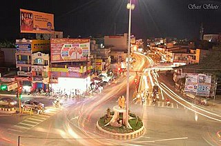
Dharmapuri, is a town in the western part of Tamil Nadu, India. The town is located at 50 km from Krishnagiri, 69 km from Salem, 126 km from Bangalore, 200 km from Coimbatore, and 300 km from the state capital Chennai. It is located between latitudes N 11 47’ and 12 33’ and longitudes E 77 02’ and 78 40’. It is one of top leading Mango cultivator and producer of state.

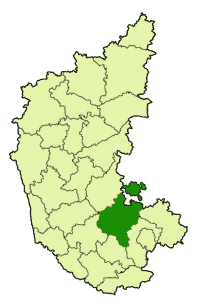
Tumakuru District is an administrative district in the state of Karnataka in India. It was formerly a part of the old Mysuru State. It was formed in 1832 during the days of British commissioner of Mysuru Sir Mark Cubbon as Chitaldroog Division including the area of present Chitradurga and Tumakuru districts headquartered at Tumakuru, Major General Richard Stewart Dobbs was the first collector of the district, who was key responsible for the establishment of Munro system of administration. In the year 1862 Chitaldroog division was abolished and Tumakuru and Chitradurga established as separate districts by Lewin Bentham Bowring. The district headquarters are located at Tumakuru. The district occupies an area of 10,598 km² and had a population of 2,678,980, of which 19.62% were urban as of 2011., It is a one-and-a-half-hour drive from Bengaluru, the capital of Karnataka. The district is known for the production of coconuts, called as 'Kalpataru Nadu'. It is the only discontiguous district in Karnataka.

Tumkur, officially renamed as Tumakuru, is one of the industrial cities located in the state of Karnataka, also known as Shaikshanika Nagari and Kalpatharu Nadu. Since 28 August 2010, Tumkur has been accorded the status of a city corporation. It is situated at a distance of 70 km (43 mi) northwest of Bangalore, along NH 48 and NH 73. It is the headquarters of the Tumkur district. Tumkur hosts India's first mega food park, a project of the ministry of food processing. The India Food Park was inaugurated by Prime Minister Narendra Modi in September 2014.
Chikkanayakanahalli ಚಿ. ನಾ. ಹಳ್ಳಿ is a town in Tumkur district, in the state of Karnataka, India. It is 67 km away from Tumkur and 132 km from Bangalore.
Koratagere is a Panchayat Town in Tumkur district in the Indian state of Karnataka.
Kunigal is a town in Tumakuru district in the Indian state of Karnataka. It is the headquarters of Kunigal taluk. As of 2011 census, the town has a population of 34155.

Madhugiri is a town in Tumkur district in the Indian state of Karnataka. The town derives its name from a hillock, Madhu-giri (honey-hill) which is to the south of the place. Madhugiri is one of the 34 educational districts of the Karnataka state
Pavagada or Pavgada is a taluk in the Tumkur district in Karnataka, India. Historically it was part of the Mysore kingdom. Though it is geographically connected to Chitradurga district inside state of Karnataka, it comes under Tumkur district. It is 157.8 km from state capital of Bangalore. Uttara Pinakini river flows into this Taluk. Pavagada Taluk falls on the border of karnataka, hence majority of the population are bilingual speaks kannada and telugu.

Yedeyur is a town in the Tumkur district of Karnataka state, India. It is an important center of pilgrimage for people of the Lingayat faith. It serves as both a temple to and tomb of Siddalinga Shivayogi, a great Lingayat saint of the 15th century.
Sira( ಶಿರಾ/ಸಿರಾ) is a city and taluk headquarters of Sira Taluk of Tumakuru district in the state of Karnataka, India. It lies on the AH 47, NH 48. It is second largest city in Tumkur district. Sira is one of the most commercial area in tumakuru district and it holds international school,college for arts,commerce and science and technical colleges.sira is also called historical City.
Byadanur is a village in the southern state of Karnataka, India. It is located in the Pavagada taluk of Tumkur district in Karnataka.

Hebbur is a village in the southern state of Karnataka, India. It is located in the Tumkur taluk of Tumkur district in Karnataka.

Huliyurdurga is a village in the southern state of Karnataka, India. It is located in the Kunigal taluk of Tumkur district in Karnataka.
Achenahalli is a village in the southern state of Karnataka, India. It is located in the Madhugiri taluk of Tumkur district in Karnataka.
Adavinagenahalli is a village in the southern state of Karnataka, India. It is located in the Madhugiri taluk of Tumkur district in Karnataka.
Akkajihalli is a village in the southern state of Karnataka, India. It is located in the Koratagere taluk of Tumkur district in Karnataka.
Doddakalahalli is a village in Kunigal taluk of Tumkur district of the Indian state of Karnataka. The name of the village is derived from the rocky landscape - kallu meaning stone in Kannada. As of 2001 census, the population of the village was 722 with a literacy level of 52.10%. The Mysore general census of 1871 listed 14 houses in the village with a total population of 102.
Dabaspete is a tiny town located in Nelamangala Taluk, Bangalore Rural District, Karnataka, India. formerly called as Somapura re named as Dobbspet in memory of Major General Richard Stewart Dobbs first collector of Tumkur District, who is an eminent statesman who devoted his major part of life for the service of the People by the establishment of order and systematic administration in Tumkur district. Dobbspet is located 50 km away from Bangalore along National Highway 4.Nearest city is Tumkur. Hindu pilgrimage site of Shivagange lies near the town. It is currently spelled Dabaspet, keeping in view the Kannada dialect.
Rayasandra is a village in the Tumkur district of Karnataka, India. It is located in the Dandinashivara hobli, Turuvekere taluk of Tumkur district in Karnataka. The village belongs to Machenahalli grampanchayat, has around 80-100 houses, the speaking language is Kannada. The village has mainly two communities Lingayat and Adi Karnataka.
Medigeshi or Midigeshi is a village in Madhugiri Taluk, Tumkur district in Karnataka, India. It has a population of 2,649 according to 2011 census. The village has a fort which is a tourist attraction.