
The A1 is a major route in Northern Ireland. It runs from Belfast via Lisburn and Banbridge to the border with the Republic of Ireland south of Newry, from where the road continues to Dublin, becoming the N1 road and M1 motorway. Between Sprucefield and Carrickcarnan the road forms part of the European route E01.
Metroads were the primary road routes serving the Sydney and Brisbane metropolitan areas from the 1990s to the early 2010s. The Metroads formed a network of radial and circumferential routes throughout the cities, simplifying navigation. Metroads have been progressively phased out in both Sydney and Brisbane, replaced by alphanumeric route numbers. Brisbane is the only city currently retaining the Metroad system.

The M1 is a motorway in Northern Ireland. It is the longest motorway in Northern Ireland and runs for 38 miles (61 km) from Belfast to Dungannon through County Antrim, County Down, County Armagh and County Tyrone. It forms part of the route via the A1 in Northern Ireland between Belfast and Dublin as well as being a part of the unsigned European E01 and E18 routes.

The M2 is a motorway in Belfast and County Antrim in Northern Ireland. It is in two sections, the southern section running from north Belfast to Antrim and the northern section acts as a bypass of Ballymena, with the A26 road linking the two sections. In total it is 22 miles (36.2 kilometres). The M2 has the busiest sections of any road or motorway in Northern Ireland. The M2 is one of Northern Ireland's most important motorways, forming most of the main route from Belfast city to both Belfast International Airport and less than a quarter of the way to Derry. It forms part of the unsigned European route E01, E16 and E18 roads.

The M3 is an urban motorway 0.8 miles (1.3 km) in length owned by Siac Construction and Cintra, S.A. that connects the M2 in north Belfast, Northern Ireland to the A2 Sydenham Bypass in east Belfast. It is the shortest motorway in Northern Ireland, and one of the busiest, carrying 60,000 vehicles per day as of 2005. It has a permanent speed limit of 50 mph (80 km/h).

The main roads in Northern Ireland are signed "M"/"A"/"B" as in Great Britain. Whereas the roads in Great Britain are numbered according to a zonal system, there is no available explanation for the allocation of road numbers in Northern Ireland, though their numbering is separate from the system in England, Scotland and Wales.

The Belfast–Newry line operates from Lanyon Place station in County Antrim to Newry in County Down, Northern Ireland. The manager for this line is based at Portadown railway station, although the line extends to the border to include the Scarva and Poyntzpass halts and Newry. Newry is on the fringe of the network, being the last stop before the border with the Republic of Ireland. The line follows the route of the northern half of the main Dublin–Belfast line.

The Westlink road in Belfast, Northern Ireland is a dual carriageway throughpass, designated the A12, connecting the M1 to the M2 and M3 motorways which run south, north and east of the city, respectively. The road forms part of European route E01.

The M5 is a spur motorway of 1.4 miles (2.3 km) length in north Belfast, Northern Ireland. It connects the M2 to the A2 Shore Road at Hazelbank in Newtownabbey. It is a dual two lane road with most of the road on a causeway in Belfast Lough in order to bypass Whitehouse beach.

The A6 road in Northern Ireland runs for 71.4 miles (114.9 km) from Belfast to Derry, via County Antrim and County Londonderry. While stretches of the road before Randalstown have now been superseded by a motorway, the A6 remains one of the most important arterial routes in Northern Ireland, connecting its two largest cities and urban areas. Between Randalstown and Derry, the road forms part of European route E16.
Sydney Bypass refers to a number of roads, existing and proposed, that motorists can use to avoid the congested approaches to the Sydney central business district (CBD). The main bypasses are:
Transportation systems in the city of Belfast, Northern Ireland, include road, air, rail, and sea. It is still a relatively car-dependent city; however, it is also served by a comprehensive rail and bus network. Belfast also ran electric trams prior to 1954. The city has two major airports, and the Port of Belfast is the busiest ferry port on the island of Ireland.

European route E1 is a series of roads in Europe, part of the United Nations International E-road network, running from Larne, Northern Ireland to Seville, Spain. There is a sea crossing between Rosslare Harbour, in Ireland, and Ferrol, but no ferry service. The road also passes through Portugal – past the city of Porto, through the capital, Lisbon, and then south to the Algarve, passing Faro before reaching the Spanish border west of Huelva.
The Comber Greenway is a 7-mile (11 km) traffic-free section of the National Cycle Network that runs along the old Belfast-Comber railway line. The cycle path starts on Dee Street in east Belfast and finishes at Comber in County Down. As well as a cycling path, it is also popular with people on foot. The most recent addition to the route was in November 2008 when the final link between Old Dundonald Road/Comber Rd junction and Comber was opened. This added 1.6 miles (2.6 km) to the route. One section runs through a SLNCI-designated Wetland ecosystem.

The Blackstaff River is a watercourse in County Antrim, Northern Ireland. It rises on the eastern slope of the Black Mountain before flowing down into the Bog Meadows and passing under the city of Belfast, where it enters the River Lagan. Much of its course has been culverted and built upon since the 19th century, making it largely invisible today. Its tributaries include the Forth or Clowney River, which meets it beneath the Broadway Roundabout in West Belfast.

The A55 road forms Belfast's outer-ring road.

In Ireland, the highest category of road is a motorway, indicated by the prefix M followed by a one- or two-digit number. The motorway network consists entirely of motorway-grade dual carriageways and is largely focused upon Dublin. There are also several three-lane motorways, while Ireland's busiest road, the M50, incorporates four-lane, five-lane, and six-lane stretches.

There have been routes and trackways in Ireland connecting settlements and facilitating trade since ancient times and the country now has an extensive network of public roads connecting all parts of the island.
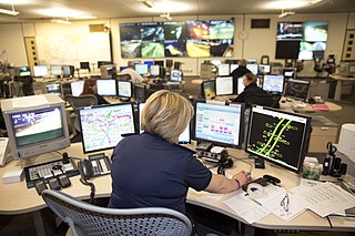
A smart motorway, also known in Scotland as an intelligent transport system, is a section of motorway in the United Kingdom that employs active traffic management (ATM) techniques to increase capacity through the use of MIDAS technology including variable speed limits and occasionally hard shoulder running and ramp metering at busy times. They were developed at the turn of the 21st century as a cost-effective alternative to traditional carriageway widening, with intended benefits ranging from more reliable journey times to lower vehicle emissions. However, despite the risk of a collision occurring between two moving vehicles being found to be decreased, there has been an acknowledged rise in the incidence of collisions involving vehicles where at least one was stationary in the first few years following the widespread removal of the hard shoulder on the country's busiest sections of motorway. Smart motorways garnered intense criticism from politicians, police representatives and motoring organisations, particularly from 2020 onwards, after a surge in near miss incidents and dozens of fatalities were revealed, and as of April 2023, no new smart motorways will be built.

