Bilyana, Queensland

Last updated

Bilyana
Queensland
Australia Queensland location map.svg
Red pog.svg
Bilyana
Coordinates 18°07′02″S145°57′44″E / 18.1172°S 145.9622°E / -18.1172; 145.9622 (Bilyana (centre of locality))
Population190 (2021 census) [1]
 • Density1.46/km2 (3.78/sq mi)
Postcode(s) 4854
Area130.3 km2 (50.3 sq mi)
Time zone AEST (UTC+10:00)
Location
LGA(s) Cassowary Coast Region
State electorate(s) Hinchinbrook
Federal division(s) Kennedy
Suburbs around Bilyana:
Murrigal Rockingham Coral Sea
Murray Upper Bilyana Coral Sea
Kennedy Kennedy Coral Sea

Bilyana is a coastal locality in the Cassowary Coast Region, Queensland, Australia. [2] In the 2021 census, Bilyana had a population of 190 people. [1]

Contents

Geography

The Coral Sea forms the eastern boundary, and the Murray River part of the northern. [3]

The Bruce Highway runs through from south-west to north-west. [4]

Bilyana railway station is on the North Coast railway line ( 18°06′52″S145°54′36″E / 18.1145°S 145.9101°E / -18.1145; 145.9101 (Bilyana railway station) ). [5]

The main land use is grazing on native vegetation in the north of the locality and growing sugarcane in the south of the locality. The residential areas are in the south and south-west of the locality. [4]

History

Girramay (also known as Giramay, Garamay, Giramai, Keramai) is a language of Far North Queensland, particularly the area around Herbert River Catchment taking in the towns of Cardwell and Ingham. The Girramay language region includes the landscape within the local government boundaries of Cassowary Coast and Hinchinbrook Regional Councils. [6]

Demographics

In the 2016 census, Bilyana had a population of 180 people. [7]

In the 2021 census, Bilyana had a population of 190 people. [1]

Education

There are no schools in Bilyana. The nearest government primary school is Murray River Upper State School in neighbouring Murray Upper to the west and Kennedy State School in neighbouring Kennedy to the south. The nearest government secondary school is Tully State High School in Tully to the north. [4]

Related Research Articles

<span class="mw-page-title-main">Cardwell, Queensland</span> Town in Queensland, Australia

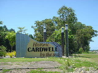
Cardwell is a coastal town and rural locality in the Cassowary Coast Region, Queensland, Australia. In the 2021 census, the locality of Cardwell had a population of 1,320 people.

<span class="mw-page-title-main">Kennedy, Queensland</span> Suburb of Cassowary Coast Region, Queensland, Australia

Kennedy is a coastal locality in the Cassowary Coast Region, Queensland, Australia. In the 2021 census, Kennedy had a population of 136 people.

<span class="mw-page-title-main">Feluga, Queensland</span> Suburb of Cassowary Coast Region, Queensland, Australia

Feluga is a rural locality in the Cassowary Coast Region, Queensland, Australia. In the 2021 census, Feluga had a population of 306 people.

<span class="mw-page-title-main">Lower Tully, Queensland</span> Suburb of Cassowary Coast Region, Queensland, Australia

Lower Tully is a rural locality in the Cassowary Coast Region, Queensland, Australia. In the 2021 census, Lower Tully had a population of 88 people.

<span class="mw-page-title-main">Murray Upper, Queensland</span> Suburb of Cassowary Coast Region, Queensland, Australia

Murray Upper is a rural locality in the Cassowary Coast Region, Queensland, Australia. In the 2021 census, Murray Upper had a population of 218 people.

<span class="mw-page-title-main">Boogan, Queensland</span> Suburb of Cassowary Coast Region, Queensland, Australia

Boogan is a rural locality in the Cassowary Coast Region, Queensland, Australia. In the 2021 census, Boogan had a population of 138 people.

<span class="mw-page-title-main">Euramo, Queensland</span> Suburb of Cassowary Coast Region, Queensland, Australia

Euramo is a rural locality in the Cassowary Coast Region, Queensland, Australia. In the 2021 census, Euramo had a population of 114 people.

No. 5 Branch is a rural locality in the Cassowary Coast Region, Queensland, Australia. In the 2021 census, No. 5 Branch had "no people or a very low population".

<span class="mw-page-title-main">Ellerbeck, Queensland</span> Suburb of Cassowary Coast Region, Queensland, Australia

Ellerbeck is a coastal locality in the Cassowary Coast Region, Queensland, Australia. In the 2021 census, Ellerbeck had a population of 207 people.

Rockingham is a rural town and coastal locality in the Cassowary Coast Region, Queensland, Australia. In the 2021 census, the locality of Rockingham had a population of 104 people.

<span class="mw-page-title-main">Tully Heads, Queensland</span> Town in Queensland, Australia

Tully Heads is a coastal town and locality in the Cassowary Coast Region, Queensland, Australia. In the 2021 census, the locality of Tully Heads had a population of 354 people.

Hull Heads is a coastal town and locality in the Cassowary Coast Region, Queensland, Australia. In the 2021 census, the locality of Hull Heads had a population of 127 people.

<span class="mw-page-title-main">Kurrimine Beach, Queensland</span> Town in Queensland, Australia

Kurrimine Beach is a coastal town and locality in the Cassowary Coast Region, Queensland, Australia. In the 2021 census, the locality of Kurrimine Beach had a population of 742 people.

Birkalla is a rural locality in the Cassowary Coast Region, Queensland, Australia. In the 2021 census, Birkalla had a population of 156 people.

Mighell is a rural locality in the Cassowary Coast Region, Queensland, Australia. In the 2021 census, Mighell had a population of 363 people.

Goolboo is a rural locality in the Cassowary Coast Region of Queensland, Australia. In the 2021 census, Goolboo had a population of 25 people.

Currajah is a rural locality in the Cassowary Coast Region, Queensland, Australia. In the 2021 census, Currajah had a population of 57 people.

Jaffa is a rural locality in the Cassowary Coast Region, Queensland, Australia. In the 2021 census, Jaffa had a population of 35 people.

Djarawong is a rural locality in the Cassowary Coast Region, Queensland, Australia. In the 2021 census, Djarawong had a population of 103 people.

Maadi is a rural locality in the Cassowary Coast Region, Queensland, Australia. In the 2021 census, Maadi had a population of 49 people.

References

  1. 1 2 3 Australian Bureau of Statistics (28 June 2022). "Bilyana (SAL)". 2021 Census QuickStats. Retrieved 28 February 2023. OOjs UI icon edit-ltr-progressive.svg
  2. "Bilyana – locality in Cassowary Coast Region (entry 45655)". Queensland Place Names. Queensland Government . Retrieved 24 May 2019.
  3. Google (29 August 2021). "Bilyana, Queensland" (Map). Google Maps . Google. Retrieved 29 August 2021.
  4. 1 2 3 "Queensland Globe". State of Queensland . Retrieved 26 August 2023.
  5. "Railway stations and sidings - Queensland". Queensland Open Data. Queensland Government. 2 October 2020. Archived from the original on 5 October 2020. Retrieved 5 October 2020.
  6. CC BY icon-80x15.png This Wikipedia article incorporates CC-BY-4.0 licensed text from: "Indigenous languages map of Queensland". State Library of Queensland. State Library of Queensland . Retrieved 5 February 2020.
  7. Australian Bureau of Statistics (27 June 2017). "Bilyana (SSC)". 2016 Census QuickStats. Retrieved 20 October 2018. OOjs UI icon edit-ltr-progressive.svg