Biscayne Gardens, Florida

Last updated

Biscayne Gardens
Miami-Dade County Florida Incorporated and Unincorporated areas Golden Glades Highlighted.svg
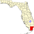
Location in Miami-Dade County and the state of Florida
Golden Glades.gif
U.S. Census Bureau map showing CDP boundaries
Coordinates: 25°54′46″N80°12′05″W / 25.91278°N 80.20139°W / 25.91278; -80.20139
Country Flag of the United States.svg  United States of America
State Flag of Florida.svg  Florida
County Flag of Miami-Dade County, Florida.png Miami-Dade
Area
[1]
  Total
5.02 sq mi (13.01 km2)
  Land4.83 sq mi (12.51 km2)
  Water0.19 sq mi (0.50 km2)
Elevation
3 ft (1 m)
Highest elevation
15 ft (5 m)
Population
 (2020) [2]
  Total
32,499
  Density6,725.8/sq mi (2,596.8/km2)
Time zone UTC-5 (Eastern (EST))
  Summer (DST) UTC-4 (EDT)
ZIP Codes
33054 (Opa Locka)
33161, 33167, 33168 (North Miami)
33162 (North Miami Beach)
33169 (Miami Gardens)
Area code(s) 305, 786, 645
FIPS code 12-26375 [3]
GNIS feature ID2402532 [4]
Biscayne Gardens, Florida

Biscayne Gardens is a census-designated place (CDP) in Miami-Dade County, Florida, United States. It is part of the Miami metropolitan area of South Florida. The population was 32,499 at the 2020 US census. [5]

Contents

It's also the location of the Golden Glades Interchange which connects the Florida Turnpike, Interstate 95, US 441, State Road 9, and the Palmetto Expressway.

History

The community overwhelmingly rejected a petition to incorporate on November 2, 2021. [6]

Geography

Biscayne Gardens is located in northeastern Miami-Dade County, 11 miles (18 km) north of downtown Miami. The community is bordered by four cities: Miami Gardens to the northwest, North Miami Beach to the northeast, North Miami to the southeast and south, and Opa-locka to the west.

According to the United States Census Bureau, the CDP has a total area of 5.0 square miles (13 km2). 4.8 square miles (12 km2) of it are land and 0.2 square miles (0.5 km2) (3.82%) are water. [1]

The Golden Glades Interchange is on the northern side of the community. From it, Interstate 95 leads south 11 miles (18 km) to the center of Miami and north-northeast 15 miles (24 km) to Fort Lauderdale, Florida's Turnpike leads north parallel to and inland from I-95, and the Palmetto Expressway leads west and south 23 miles (37 km) to U.S. Route 1 in Pinecrest. From the same interchange, State Road 9, a surface road, leads southwest 3 miles (5 km) to the center of Opa-locka, and U.S. 441 leads south parallel to I-95 as far as downtown Miami.

Demographics

Historical population
CensusPop.Note
1980 23,154
1990 25,47410.0%
2000 32,62328.1%
2010 33,1451.6%
2020 32,499−1.9%
U.S. Decennial Census [7]
2010 [8] 2020 [5]

The name of the CDP was changed in 2023 from Golden Glades to Biscayne Gardens [9] [10] although the latest American Community Survey as of June 2023, still lists the CDP as Golden Glades. [11]

Biscayne Gardens CDP, Florida – Racial and ethnic composition
Note: the US Census treats Hispanic/Latino as an ethnic category. This table excludes Latinos from the racial categories and assigns them to a separate category. Hispanics/Latinos may be of any race.
Race / Ethnicity (NH = Non-Hispanic)Pop 2000 [12] Pop 2010 [8] Pop 2020 [5] % 2000% 2010% 2020
White alone (NH)3,9482,3341,67612.10%7.04%5.16%
Black or African American alone (NH)20,66923,35822,20163.36%70.47%68.31%
Native American or Alaska Native alone (NH)6046370.18%0.14%0.11%
Asian alone (NH)5845205191.79%1.57%1.60%
Pacific Islander or Native Hawaiian alone (NH)2415130.07%0.05%0.04%
Other race alone (NH)62821750.19%0.25%0.54%
Mixed race or Multiracial (NH)1,5236566434.67%1.98%1.98%
Hispanic or Latino (any race)5,7536,1347,23517.63%18.51%22.26%
Total32,62333,14532,499100.00%100.00%100.00%

2020 census

As of the 2020 United States census, there were 32,499 people, 10,072 households, and 6,892 families residing in the CDP. [13]

As of the 2010 United States census, there were 33,145 people, 9,320 households, and 6,992 families residing in the CDP. [14]

2000 census

As of the census of 2000, there were 32,623 people, 9,826 households, and 7,281 families residing in the CDP. The population density was 2,560.1/km² (6,635.0/mi²). There were 10,540 housing units at an average density of 827.1/km² (2,143.7/mi²). The racial makeup of the CDP was 23.38% White (12.1% Non-Hispanic White), [15] 65.29% African American, 0.28% Native American, 1.81% Asian, 0.07% Pacific Islander, 2.92% from other races, and 6.24% from two or more races. Hispanic or Latino of any race were 17.63% of the population.

As of 2000, there were 9,826 households out of which 44.5% had children under the age of 18 living with them, 41.8% were married couples living together, 24.5% had a female householder with no husband present, and 25.9% were non-families. 20.6% of all households were made up of individuals and 7.3% had someone living alone who was 65 years of age or older. The average household size was 3.23 and the average family size was 3.72.

In 2000, in the CDP, the population was spread out with 31.1% under the age of 18, 10.2% from 18 to 24, 30.1% from 25 to 44, 18.5% from 45 to 64, and 10.1% who were 65 years of age or older. The median age was 31 years. For every 100 females there were 89.2 males. For every 100 females age 18 and over, there were 83.8 males.

In 2000, the median income for a household in the CDP was $30,841, and the median income for a family was $33,577. Males had a median income of $25,036 versus $21,409 for females. The per capita income for the CDP was $12,341. About 18.5% of families and 20.9% of the population were below the poverty line, including 25.4% of those under age 18 and 24.0% of those age 65 or over.

As of 2000, speakers of English as a first language accounted for 44.27% of residents, while French Creole made up 31.35%, Spanish was at 18.63%, and French was at 3.82% of the population. [16]

As of 2000, Biscayne Gardens had the highest percentage of Haitian residents in the US, with 33.50% of the populace (nearby North Miami had the second highest percentage in the US, with 33.0% of the populace.) [17] It had the fourth highest percentage of Bahamian residents in the US, at 1.80% of the population, [18] and the twentieth highest percentage of Jamaican residents in the US, at 5.70% (tied with Ives Estates, FL, East Orange, New Jersey and Gordon Heights, New York.) [19] It also had the seventy-eighth most Cubans in the US, at 4.04% of the population, [20] while it had the ninety-first highest percentage of Dominicans, at 1.72% of all residents (tied with North Miami and East Newark, New Jersey.) [21]

Education

Biscayne Gardens is within the Miami-Dade County Public Schools.

Transportation

Biscayne Gardens is served by Tri-Rail at the Golden Glades station. It contains a park-and-ride facility, and also serves as a feeder for buses from the surrounding area, run by both Miami-Dade Transit and Broward County Transit.

Related Research Articles

Miami Gardens was a census-designated place (CDP) in Broward County, Florida, United States. The population was 2,706 at the 2000 census.

<span class="mw-page-title-main">Miramar, Florida</span> City in Florida, United States

Miramar is a city in southern Broward County, Florida, United States. It is a suburb of the Miami metropolitan area. As of the 2020 census, the population was 134,721, making it the fourth-largest city in Broward County, the sixth-largest city in the Miami metro area, and the 14th-largest city in Florida.

<span class="mw-page-title-main">Pembroke Park, Florida</span> Town in the state of Florida, United States

Pembroke Park is a town in Broward County, Florida, United States. The town took its name from its location along Pembroke Road. It is part of the South Florida metropolitan area. Almost one-half of its residents live in mobile homes. As of the 2020 census, the population was 6,260.

<span class="mw-page-title-main">Pembroke Pines, Florida</span> City in Broward County, Florida, United States

Pembroke Pines is a city in southern Broward County, Florida, United States. The city is located 22 miles (35 km) north of Miami. It is a suburb of and the fourth-most populous city in the Miami metropolitan area. The population of Pembroke Pines was 171,178 at the 2020 census.

<span class="mw-page-title-main">Bunche Park, Florida</span> Neighborhood of Miami Gardens in Miami-Dade, Florida, United States

Bunche Park is a neighborhood in Miami Gardens, Florida, United States. It was formerly a census-designated place.

<span class="mw-page-title-main">Carol City, Florida</span> Neighborhood of Miami Gardens in Miami-Dade, Florida, United States

Carol City is a neighborhood in Miami Gardens, Florida, United States. It was formerly listed as a census-designated place in the 2000 U.S. Census.

<span class="mw-page-title-main">Country Club, Florida</span> Census-designated place in Florida

Country Club is a suburban census-designated place located in northwest Miami-Dade County, Florida, United States. It is located in the Miami metropolitan area of South Florida. The CDP is named after the Country Club of Miami, which was established in 1961 in what was then an unpopulated and undeveloped section of the county. The population was 49,967 at the 2020 census, up from 3,408 in 1990.

<span class="mw-page-title-main">Fisher Island, Florida</span> Census-designated place in Florida

Fisher Island is a census-designated place in Miami-Dade County, Florida, United States, located on a barrier island of the same name. Since 2015, Fisher Island has the highest per capita income of any place in the United States. It is located in the Miami metropolitan area of South Florida. As of the 2020 census, the population was 561.

<span class="mw-page-title-main">Florida City, Florida</span> City in Florida

Florida City is a city in Miami-Dade County, Florida, United States. It is the southernmost municipality in the South Florida metropolitan area. Florida City is primarily a Miami suburb and a major agricultural area. As of the 2020 census, it had a population of 13,085, up from 11,245 in 2010.

<span class="mw-page-title-main">Golden Beach, Florida</span> Town in Florida

Golden Beach is a town in Miami-Dade County, Florida, United States, between the Intracoastal Waterway and Atlantic Ocean. The town is part of the Miami metropolitan area of South Florida. As of the 2020 US census, the town had a population of 961.

<span class="mw-page-title-main">Goulds, Florida</span> Census-designated place in Florida

Goulds is an unincorporated community and census-designated place (CDP) in Miami-Dade County, Florida, United States. The area was originally populated as the result of a stop on the Florida East Coast Railroad. The railroad depot was located near the current Southwest 224th Street. The community was named after its operator, Lyman Gould, who cut trees for railroad ties. It is part of the Miami metropolitan area of South Florida. As of the 2020 US census, the population stood at 11,446, up from 10,103 in 2010 US census.

<span class="mw-page-title-main">Ives Estates, Florida</span> Census-designated place in Florida

Ives Estates is a census-designated place (CDP) in Miami-Dade County, Florida. It is part of the Miami metropolitan area of South Florida. The population was 25,005 at the 2020 census, up from 19,525 in 2010.

<span class="mw-page-title-main">Naranja, Florida</span> Census-designated place in Florida

Naranja is an unincorporated community and census-designated place (CDP) in Miami-Dade County, Florida, United States. Many orange groves were once located in this area, so the community name came from the Spanish word for orange, naranja, though the pronunciation among the local residents is "Na-Ran-Jah". Naranja was also a stop for the Florida East Coast Railroad that once ran through this area. It is part of the Miami metropolitan area of South Florida. The population was 13,509 at the 2020 census, up from 8,303 in 2010.

<span class="mw-page-title-main">North Miami, Florida</span> City in Florida

North Miami is a suburban city located in northeast Miami-Dade County, Florida, United States, about 10 miles (16 km) north of Miami. The city lies on Biscayne Bay and hosts the Biscayne Bay Campus of Florida International University. Originally the "Town of Arch Creek", the area was incorporated as the "Town of Miami Shores", which was renamed the "Town of North Miami" in 1931. It was reincorporated as a city in 1953. The city is part of the Miami metropolitan area of South Florida.

<span class="mw-page-title-main">North Miami Beach, Florida</span> City in Florida

North Miami Beach is a city in Miami-Dade County, Florida, United States. The City of North Miami Beach is part of the Miami metropolitan area of South Florida. Originally named "Fulford-by-the-Sea" in 1926, after Captain William H. Fulford of the U.S. Coast Guard, the city was renamed "North Miami Beach" in 1931. The population was 43,676 at the 2020 US census.

<span class="mw-page-title-main">Opa-locka North, Florida</span> Neighborhood of Miami Gardens in Miami-Dade, Florida, United States

Opa-locka North is a neighborhood in Miami Gardens, Florida, United States. It was formerly a census-designated place. The population was 6,224 at the 2000 census.

<span class="mw-page-title-main">Palm Springs North, Florida</span> Census-designated place in Florida

Palm Springs North is an unincorporated community and census-designated place (CDP) in Miami-Dade County, Florida, United States. It is part of the Miami metropolitan area of South Florida. The population was 5,030 at the 2020 census.

<span class="mw-page-title-main">Richmond West, Florida</span> Census-designated place in Florida

Richmond West is a census-designated place (CDP) in Miami-Dade County, Florida, United States. It is part of the Miami metropolitan area of South Florida. The population was 35,884 at the 2020 census, up from 31,973 at the 2010 census.

<span class="mw-page-title-main">Sunset, Florida</span> Census-designated place in Florida

Sunset is a census-designated place (CDP) in Miami-Dade County, Florida, United States. It is part of the Miami metropolitan area of South Florida. The population was 15,912 at the 2020 census. The U.S. Postal Service uses the ZIP Codes of 33173 and 33183 for Sunset.

<span class="mw-page-title-main">West Park, Florida</span> City in Florida

West Park, officially the City of West Park, is a municipality in Broward County, Florida, United States. It was created on March 1, 2005. West Park is part of the Miami metropolitan area of South Florida. It is located in the southeastern part of the county and consists of the neighborhoods of Carver Ranches, Lake Forest, Miami Gardens, and Utopia. A large portion of the city lies west of the town of Pembroke Park, so the new city was called "West Park". The city has a population of 15,130 as of the 2020 census.

References

  1. 1 2 "2022 U.S. Gazetteer Files: Florida". United States Census Bureau. Retrieved January 6, 2023.
  2. "P1. Race – Biscayne Gardens CDP, Florida: 2020 DEC Redistricting Data (PL 94-171)". U.S. Census Bureau. Retrieved January 6, 2023.
  3. "U.S. Census website". United States Census Bureau . Retrieved January 31, 2008.
  4. "Biscayne Gardens Census Designated Place". Geographic Names Information System . United States Geological Survey, United States Department of the Interior . Retrieved November 12, 2024.
  5. 1 2 3 "P2 Hispanic or Latino, and Not Hispanic or Latino by Race – 2020: DEC Redistricting Data (PL 94-171) – Golden Glades CDP, Florida". United States Census Bureau .
  6. Hanks, Douglas; Lieberman, Jesse (November 3, 2021). "No thanks: Biscayne Gardens residents turn down forming their own government in Miami-Dade". The Miami Herald .
  7. "Decennial Census of Population and Housing by Decades". US Census Bureau.
  8. 1 2 "P2 Hispanic or Latino, and Not Hispanic or Latino by Race – 2010: DEC Redistricting Data (PL 94-171) – Golden Glades CDP, Florida". United States Census Bureau .
  9. "State of Florida Census Designated Places - Current/BAS23 - 2022". Tigerweb.geo.census.gov. US Census Bureau.
  10. "State of Florida Census Designated Places - Current/BAS24 - 2023". Tigerweb.geo.census.gov. US Census Bureau.
  11. "Golden Glades CDP, Florida". United States Census Bureau . Retrieved December 21, 2024.
  12. "P004: Hispanic or Latino, and Not Hispanic or Latino by Race – 2000: DEC Summary File 1 – Golden Glades CDP, Florida". United States Census Bureau .
  13. "S1101 HOUSEHOLDS AND FAMILIES - 2020: Biscayne Gardens CDP, Florida". United States Census Bureau .
  14. "S1101 HOUSEHOLDS AND FAMILIES - 2010: Biscayne Gardens CDP, Florida". United States Census Bureau .
  15. "Demographics of Biscayne Gardens, FL". MuniNetGuide.com. Retrieved November 6, 2007.
  16. "MLA Data Center Results of Biscayne Gardens, FL". Modern Language Association . Retrieved November 6, 2007.
  17. "Ancestry Map of Haitian Communities". Epodunk.com. Archived from the original on September 23, 2012. Retrieved November 6, 2007.
  18. "Ancestry Map of Bahamian Communities". Epodunk.com. Retrieved November 6, 2007.
  19. "Ancestry Map of Jamaican Communities". Epodunk.com. Archived from the original on October 11, 2007. Retrieved November 6, 2007.
  20. "Ancestry Map of Cuban Communities". Epodunk.com. Archived from the original on November 7, 2007. Retrieved November 6, 2007.
  21. "Ancestry Map of Dominican Communities". Epodunk.com. Archived from the original on October 17, 2010. Retrieved November 6, 2007.