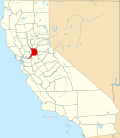
Carmichael | |
---|---|
Coordinates: 38°38′22″N121°19′17″W / 38.63944°N 121.32139°W | |
Country | United States |
State | California |
County | Sacramento |
Area | |
• Total | 15.57 sq mi (40.32 km2) |
• Land | 15.33 sq mi (39.71 km2) |
• Water | 0.23 sq mi (0.60 km2) 1.92% |
Elevation | 125 ft (38 m) |
Population (2020) | |
• Total | 79,793 |
• Density | 5,203.67/sq mi (2,009.17/km2) |
Time zone | UTC-8 (Pacific) |
• Summer (DST) | UTC-7 (PDT) |
ZIP codes | 95608 |
Area code | 916, 279 |
FIPS code | 06-11390 |
GNIS feature ID | 277484 |
Carmichael is a census-designated place (CDP) in Sacramento County, California, United States. It is an unincorporated suburb in the Greater Sacramento metropolitan area. The population was 79,793 at the 2020 census.
Carmichael is located at 38°38′22″N121°19′17″W / 38.63944°N 121.32139°W (38.639431, -121.321348). [3] According to the United States Census Bureau, the CDP has an area of 13.8 square miles (36 km2), of which 13.5 square miles (35 km2) is land and 0.3 square miles (0.78 km2) (1.92%) is water.
Daniel W. Carmichael (born 1867) came to California in 1885. [4] In 1909, he developed Carmichael Colony No. I, 2,000 acres (8 km2) of what was once part of the Rancho San Juan Mexican land grant. He later bought another 1,000 acres (4 km2), previously part of the Rancho Del Paso Mexican land grant, that he called Carmichael Colony No. 2. It bordered the first colony to the east and Walnut Avenue to the west; the southern boundary was Arden Way with Sutter Avenue to the north.
Casa de los Gobernadores was built in 1974, to serve as the official residence of the Governor of California. However, the residence was never occupied and was sold to private citizens in 1983.
Census | Pop. | Note | %± |
---|---|---|---|
2000 | 49,742 | — | |
2010 | 61,762 | 24.2% | |
2020 | 79,793 | 29.2% | |
U.S. Decennial Census [5] 1850–1870 [6] [7] 1880-1890 [8] 1900 [9] 1910 [10] 1920 [11] 1930 [12] 1940 [13] 1950 [14] 1960 [15] 1970 [16] 1980 [17] 1990 [18] 2000 [19] 2010 [20] |
At the 2010 census Carmichael had a population of 61,762. The population density was 4,477.8 inhabitants per square mile (1,728.9/km2). The racial makeup of Carmichael was 49,776 (80.6%) White, 3,972 (5.8%) African American, 546 (0.9%) Native American, 2,653 (4.3%) Asian (0.9% Filipino, 0.9% Chinese, 0.6% Korean, 0.5% Japanese, 0.5% Indian, 0.3% Vietnamese, 0.6% Other), 287 (0.5%) Pacific Islander, 2,035 (3.3%) from other races, and 3,493 (5.7%) from two or more races. There were 7.218 Hispanic or Latino people of any race (11.7%). [21]
The census reported that 60,790 people (98.4% of the population) lived in households, 467 (0.8%) lived in non-institutionalized group quarters, and 505 (0.8%) were institutionalized.
There were 26,036 households, 7,431 (28.5%) had children under the age of 18 living in them, 11,016 (42.3%) were opposite-sex married couples living together, 3,630 (13.9%) had a female householder with no husband present, 1,417 (5.4%) had a male householder with no wife present. There were 1,642 (6.3%) unmarried opposite-sex partnerships, and 229 (0.9%) same-sex married couples or partnerships. 8,080 households (31.0%) were one person and 3,363 (12.9%) had someone living alone who was 65 or older. The average household size was 2.33. There were 16,063 families (61.7% of households); the average family size was 2.91.
The age distribution was 13,060 people (21.1%) under the age of 18, 5,370 people (8.7%) aged 18 to 24, 14,388 people (23.3%) aged 25 to 44, 18,054 people (29.2%) aged 45 to 64, and 10,890 people (17.6%) who were 65 or older. The median age was 42.4 years. For every 100 females, there were 89.6 males. For every 100 females age 18 and over, there were 86.1 males.
There were 28,165 housing units at an average density of 2,042.0 per square mile, of the occupied units 14,472 (55.6%) were owner-occupied and 11,564 (44.4%) were rented. The homeowner vacancy rate was 2.3%; the rental vacancy rate was 9.8%. 34,442 people (55.8% of the population) lived in owner-occupied housing units and 26,348 people (42.7%) lived in rental housing units.
At the 2000 census there were 49,742 people, 20,631 households, and 13,224 families in the CDP. The population density was 4,622.2 inhabitants per square mile (1,784.6/km2). There were 21,383 housing units at an average density of 1,987.0 per square mile (767.2/km2). The racial makeup of the CDP was 86.61% White, 2.69% African American, 0.83% Native American, 3.58% Asian, 0.27% Pacific Islander, 2.09% from other races, and 3.92% from two or more races. Hispanic or Latino people of any race were 6.99%. [22]
Of the 20,631 households 29.4% had children under the age of 18 living with them, 46.7% were married couples living together, 12.9% had a female householder with no husband present, and 35.9% were non-families. 29.0% of households were one person and 10.5% were one person aged 65 or older. The average household size was 2.36 and the average family size was 2.90.
The age distribution was 23.3% under the age of 18, 8.2% from 18 to 24, 26.6% from 25 to 44, 24.8% from 45 to 64, and 17.1% 65 or older. The median age was 40 years. For every 100 females, there were 89.9 males. For every 100 females age 18 and over, there were 85.6 males.
The median household income was $47,041 and the median family income was $59,002. Males had a median income of $40,435 versus $32,265 for females. The per capita income for the CDP was $26,811. About 6.4% of families and 9.8% of the population were below the poverty line, including 12.8% of those under age 18 and 4.2% of those age 65 or over.
In the California State Legislature, Carmichael is in the 6th Senate District, represented by Republican Roger W. Niello and in 6th Assembly District, represented by Kevin McCarty. [23] https://findyourrep.legislature.ca.gov/
In the United States House of Representatives, Carmichael is in California's 6th Congressional district, represented by Ami Bera. [24] https://www.house.gov/representatives/find-your-representative
Law enforcement services are provided by the North Division of the Sacramento County Sheriff's Office [25]
Carmichael is served by one public school district, San Juan Unified.
La Sierra High School operated from 1957 to 1983, when it closed due to budget cuts, being selected among several schools in the district due to having the lowest attendance. The site was adapted as La Sierra Community Center in 1985. [37]
Local high school students also attend other nearby schools in the San Juan Unified School District, [38] such as:
Carmichael Park is a major 38-acre (150,000 m2) park in the town. The park includes five ballfields, six tennis courts, and a nine-hole disc golf course. The Community Clubhouse, Veterans' Memorial Building, the Daniel Bishop Memorial Pavilion for the Performing Arts, and the Great Wall of Carmichael are all within the park. [47] A year-round farmers market is held at the park every Sunday from 9 a.m. to 2 p.m., hosted by the nonprofit BeMoneySmartUSA. [48] [49]
The Jensen Botanical Gardens are at 8520 Fair Oaks Boulevard. They exhibit a variety of flora including camellias, dogwoods, azaleas, and rhododendrons.
The Chautauqua Playhouse has been in the La Sierra Community Center since 1985. The 95-seat theater shows comedies, dramas, and musicals. It has a children's theater with performances held on Saturdays. Chautauqua Playhouse is at 5325 Engle Road (between Walnut Avenue and Fair Oaks Boulevard).
Ancil Hoffman Park is a major park within the American River Parkway in Carmichael. It is a 396-acre (1.60 km2) park. It features the Effie Yeaw Nature Center. [50] The oak-canopied park is bordered on two sides by the American River. Reconstructed Maidu Indian homes are at the entrance to the nature center. The Ancil Hoffman Golf Course is also part of the park. Many species of animals can be seen, including wild turkey, deer, coyotes and hawks. One can access the park via Fair Oaks Blvd. by following the signs.
The American River Parkway is a 32-mile (51 km) parkway that runs along the American River throughout Sacramento County. The parkway connects many smaller parks and numerous boat launching points. It can be accessed by various exits off Highway 50 in Sacramento County.
A portion of the American River Bike Trail crosses Carmichael near the southern community boundary. The bike trail is used by bicycle commuters and for recreational walking, biking, and running.
Sacramento County is a county located in the U.S. state of California. As of the 2020 census, the population was 1,585,055. Its county seat is Sacramento, which has been the state capital of California since 1854.
Bay Point, formerly West Pittsburg and originally Bella Vista is a census-designated place located in the East Bay region of the San Francisco Bay Area in Contra Costa County, California. Bay Point is just west of Pittsburg, California, and northeast of Concord, California, on the southern shore of Suisun Bay. The population of Bay Point was 21,349 as of 2010. The Pittsburg/Bay Point Station of the Bay Area Rapid Transit (BART) rail system is located adjacent to Bay Point in Pittsburg. The community is traversed by a freeway, State Route 4, the California Delta Highway. Being unincorporated, Bay Point does not have its own police department. The community is policed by the California Highway Patrol and the Contra Costa County Sheriff's Office. The ZIP code is 94565, and the area code is 925.
Discovery Bay is a census-designated place (CDP) in eastern Contra Costa County, California in the United States, about 60 miles (97 km) from San Francisco. It is located in the San Francisco Bay Area. As of 2020, its population was 15,358, a 15% percent gain from 13,352 at the 2010 census.
Pittsburg is a city in Contra Costa County, California, United States. It is an industrial suburb located on the southern shore of the Suisun Bay in the East Bay region of the San Francisco Bay Area, and is part of the Sacramento–San Joaquin River Delta area, the Eastern Contra Costa County area, and the San Francisco Bay Area. The population was 76,416 at the 2020 United States Census.
Alondra Park, also known as El Camino Village, is a census designated place (CDP) in the South Bay region of Los Angeles County, California, United States. It is the unincorporated area north of Alondra Community Regional Park and El Camino College. It is east of Lawndale, south of Hawthorne, west of Gardena, and north of Torrance. Manhattan Beach Boulevard and Crenshaw Boulevard are the two major cross streets in the area. The population was 8,569 at the 2020 census, down from 8,592 at the 2010 census. There is an official Alondra Park Post Office of the U.S. Postal Service in nearby Gardena, California. Urbanized cement-lined Dominguez Creek bisects a portion of Alondra Park.
Cypress is a city in northwestern Orange County within Southern California. Its population was 50,151 as of the 2020 census.
Loomis is an incorporated town in Placer County, California, United States. It is part of the Sacramento–Arden-Arcade–Roseville Metropolitan Statistical Area. The town's population was reported as 6,836 in the 2020 United States Census. It shares borders with the city of Rocklin and the Census-Designated Places Penryn and Granite Bay.
Arden-Arcade is a census-designated place (CDP) in Sacramento County, California, United States. The population was 94,659 at the 2020 census, making it the second most populous census-designated place in California. It is east of the city of Sacramento and west of the community of Carmichael.
Fair Oaks is a census-designated place (CDP) in Sacramento County, California, United States. It is part of the Sacramento–Arden-Arcade–Roseville Metropolitan Statistical Area. The population was 32,514 at the 2020 census, up from 30,912 at the 2010 census. The Fair Oaks zip code is 95628 and its area codes are 916 and 279. It is bordered to the west by Carmichael, north by the city of Citrus Heights, to the east by Orangevale, and to the south by the American River.
Folsom is a city in Sacramento County, California, United States. The population was 80,454 at the 2020 census.
Gold River is a census-designated place (CDP) in Sacramento County, California. The population was 7,812 at the 2010 census, down from 8,023 at the 2000 census. Gold River is part of the Sacramento–Arden-Arcade–Roseville Metropolitan Statistical Area. With a median family income of $141,399 according to U.S Census Bureau in 2021, Gold River is the highest-income place in Sacramento County.
North Highlands is a census-designated place (CDP) in Sacramento County, California, United States. It is part of the Sacramento–Arden-Arcade–Roseville Metropolitan Statistical Area. The population was 42,694 at the 2010 census, down from 44,187 at the 2000 census.
Orangevale is a census-designated place (CDP) in Sacramento County, California, United States. It is part of the Sacramento–Arden-Arcade–Roseville Metropolitan Statistical Area. The population was 33,960 at the 2010 census, up from 26,705 at the 2000 census. It is located approximately 25 miles (40 km) northeast of Sacramento. The community is known for its rolling hills that offer the best views of the Sierra Nevada mountain range, its foothills, and a rural environment in the middle of a growing metropolitan area. Some residential properties in the area are zoned to accommodate horses and orchards. It has a ZIP Code of 95662.
Rosemont is a census-designated place (CDP) in Sacramento County, California, United States. It is part of the Sacramento–Arden-Arcade–Roseville metropolitan area. The population rose to 23,510 at the 2020 census. It was 22,681 at the 2010 census, down from 22,904 at the 2000 census.
West Sacramento is a city in Yolo County, California, United States. The city is separated from Sacramento by the Sacramento River, which also separates Sacramento and Yolo counties. It is a fast-growing community; the population was 53,915 at the 2020 census, up from 48,744 at the 2010 census. The traditional industrial center of the region since the Gold Rush era, West Sacramento is home to a diverse economy and is one of the area's top four employment centers.
Westland is a city in Wayne County in the U.S. state of Michigan. A western suburb of Detroit, Westland is located about 18 miles (29 km) west of downtown Detroit. As of 2022, the city had a population of 84,037.
Lincroft is an unincorporated community and census-designated place (CDP) within Middletown Township, in Monmouth County, in the U.S. state of New Jersey. As of the 2020 United States census, the CDP had a population of 7,060, reflecting a 15.1% increase from the 6,135 residents enumerated at the 2010 U.S. Census, in turn a decline of 120 residents (-1.9%) from the 6,255 counted in the 2000 U.S. Census.
Antelope is a census-designated place in Sacramento County, California, United States located approximately 15 miles (24 km) northeast of downtown Sacramento and 5 miles (8 km) southwest of Roseville. The population was 45,770 at the 2020 census.
San Juan Unified School District is a school district in Sacramento County, California, that serves all or part of the following cities and unincorporated communities:
Elverta is a census-designated place in Sacramento County, California. It is part of the Sacramento metropolitan area, which includes Sacramento, Arden-Arcade, and Roseville. It is about 20 miles (32 km) from Sacramento, 2.5 miles (4.0 km) from Rio Linda, 6 miles (9.7 km) from Roseville, and 8.0 miles (12.9 km) from Antelope. The population was 5,492 as of the 2010 census.
Miller, who grew up in Carmichael before leaving for the San Francisco Bay Area...