
East Liverpool is a city in southeastern Columbiana County, Ohio, United States. The population was 9,958 at the 2020 census. It lies along the Ohio River within the Upper Ohio Valley and borders Pennsylvania to the east and West Virginia to the south. East Liverpool is included in the Salem micropolitan area, about 34 miles (55 km) from both Youngstown and downtown Pittsburgh.

The Athens Governmental Buildings are a complex of buildings in central Athens, Ohio, United States. Among these buildings are the Athens County Courthouse, the Athens City Hall, and the former post office, now Haning Hall of Ohio University. The current post office is a much more recent building away from the town center, on East Stimson Avenue. Together, they were added to the National Register of Historic Places in 1979.

The Beginning Point of the U.S. Public Land Survey is the point from which the United States in 1786 began the formal survey of the lands known then as the Northwest Territory, now making up all or part of Ohio, Indiana, Illinois, Michigan, and Wisconsin. The survey is claimed to be the first major cadastral survey undertaken by any nation. The point now lies underwater on the state line between Ohio and Pennsylvania. Because it is submerged, a monument commemorating the point is adjacent to the nearest roadway and located on the state line between East Liverpool, Ohio and Ohioville, Pennsylvania. The area around the marker was designated a National Historic Landmark in 1965.

This is a list of the National Register of Historic Places listings in Columbiana County, Ohio.

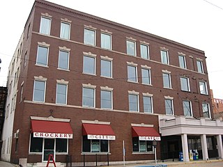
The Museum of Ceramics, housed in the former East Liverpool Post Office, is a ceramics museum that contains an extensive collection of ceramic wares produced in and around East Liverpool, Ohio, United States. The museum is operated by a Museum of Ceramics Foundation and by the Ohio Historical Society in a city long known as "America's Crockery City" and "The Pottery Capital of the Nation."

The Elks Club in East Liverpool, Ohio was built in 1916. It was listed on the National Register of Historic Places in 1985.

The Godwin–Knowles House is a historic former house in downtown East Liverpool, Ohio, United States. A Colonial Revival structure built in 1890, it has played important parts both in the city's industry and in its society.

The Odd Fellows Temple in East Liverpool, Ohio, was built in 1907. It was listed on the National Register of Historic Places in 1985.

The YMCA in East Liverpool, Ohio was built in 1913 in Classical Revival style. It was listed on the National Register of Historic Places in 1985.

The Cassius Clark Thompson House is a historic residence on the edge of downtown East Liverpool, Ohio, United States. Built in 1876 in a Late Victorian form of the Italianate style of architecture, it was built as the home of one of East Liverpool's leading businessmen.

The Carnegie Public Library in East Liverpool, Ohio is a public library located at 219 East Fourth Street. The construction of the library, which opened in 1902, was funded by industrialist and philanthropist Andrew Carnegie, whose uncle lived in East Liverpool. Along with the Steubenville, Ohio library, it was the first library in Ohio funded by Carnegie. It was listed on the National Register of Historic Places in March 1980.

East Liverpool Pottery operated in East Liverpool, Ohio from its construction in 1844 until it ceased production in 1939. The site was made up of five buildings and 2 kilns. The company's bottle kilns, their shape resembling a bottle, were used for the production of pottery ware.

The Potters National Bank was a regional bank located in East Liverpool, Ohio, United States. It opened in 1881, and operated until its acquisition by National City Corp. in 1993, as a member bank of Ohio Bancorp.
The Travelers Hotel, in East Liverpool, Ohio, was built in 1907 and had 105 rooms. Located at 117 East Fourth Street, on the banks of the Ohio River, it is one of the few remaining river town hotels that faces the river. The original name of the hotel is the Landora.

The Potters Savings and Loan Company was a savings and loan association in East Liverpool, Ohio. The association was organized by John Purinton and incorporated on February 11, 1889.
The East Liverpool Downtown Historic District is located in East Liverpool, Ohio. The district, which covers approximately 22 acres (8.9 ha), was added to the National Register of Historic Places in May 2001.The district is bordered by West Sixth Street, Dresden Avenue, Welch Avenue, Broadway, Walnut and East Fourth Streets, and East Alley.

The Homer Laughlin House was built by Homer Laughlin in 1882. The house is located in East Liverpool, Ohio. Laughlin was a prominent pottery manufacturer and founder of the Homer Laughlin China Company.
The East Fifth Street Historic District, located in East Liverpool, Ohio, was added to the National Register of Historic Places in November 1985. The district encompasses three blocks of downtown East Liverpool along East Fifth street between Market Street and Broadway.

Columbus City Hall is the city hall of Columbus, Ohio, in the city's downtown Civic Center. It contains the offices of the city's mayor, auditor, and treasurer, and the offices and chambers of Columbus City Council.
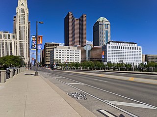
Broad Street is a major thoroughfare in Central Ohio, predominantly in Franklin County and Columbus. It stretches east from West Jefferson at Little Darby Creek to Pataskala. The street is considered one of Columbus's two main roads, along with High Street.


