A prince consort is the husband of a monarch who is not a monarch in his own right. In recognition of his status, a prince consort may be given a formal title, such as prince. Most monarchies do not allow the husband of a queen regnant to be titled as a king because it is perceived as a higher title than queen, however, some monarchies use the title of king consort for the role.

The Montenegrin Mountain Hound is a rare dog breed originating from the mountainous regions of Montenegro. Black and tan, with a smooth coat, the Montenegrin Mountain Hound was called Black Hound in the past. The breed is of the same origin as the other Balkan hounds. It stands 18 to 22 inches high and weighs 44 to 55 pounds. The breed is used to hunt fox, hare, and small game, occasionally hunting larger animals such as deer or even wild boar.

The urial, also known as arkars, shapo, or shapu, is a wild sheep native to Central and South Asia. It is listed as Vulnerable on the IUCN Red List.

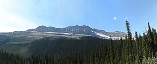
The Winston Churchill Range is a mountain range in the central section of the Park Ranges of the Canadian Rockies located in Jasper National Park. The range was named after Sir Winston Churchill, former British prime minister.
Mount Clemenceau is the fourth highest mountain in the Park Ranges of the Canadian Rockies. The peak was originally named "Pyramid" in 1892 by Arthur Coleman. The mountain was renamed by the Interprovincial Boundary Survey in 1919 to its present name, which is for Georges Clemenceau, premier of France during World War I.

The President Range is a mountain range of the Canadian Rockies, located in the northwestern section of Yoho National Park. The range is named for the highest peak in the range, The President.

The Beaverfoot Range is a mountain range of the Canadian Rockies, located in southeastern British Columbia. The range extends from Cedared Creek near Spillimacheen north to the Kicking Horse River.

The Wapta Icefield is a series of glaciers located on the Continental Divide in the Waputik Mountains of the Canadian Rockies, in the provinces of British Columbia and Alberta, in Yoho National Park in the Canadian Rockies. The icefield is shared by Banff and Yoho National Parks and numerous outlet glaciers extend from the icefield, including the Vulture, Bow and Peyto Glaciers. Runoff from the icefields and outlet glaciers supply water to both the Kicking Horse and Bow Rivers, as well as numerous streams and lakes.

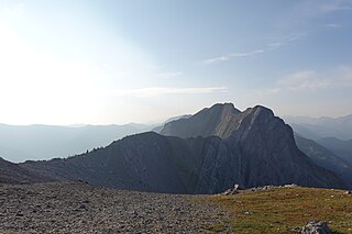
The Fiddle Range is a mountain range of the Canadian Rockies located south of Highway 16 on the east border of Jasper National Park, Canada.

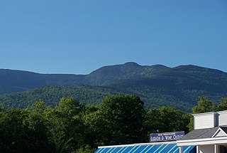
Mount Moriah is a mountain located in Coos County, New Hampshire. The mountain is part of the Carter-Moriah Range of the White Mountains, which runs along the northern east side of Pinkham Notch. The summit is approximately 5 miles (8 km) southeast of the center of the town of Gorham. Mount Moriah is flanked to the northeast by Middle Moriah Mountain and to the southwest by Imp Mountain. The summit is located on the Appalachian Trail and affords views in all directions.
Snaring Mountain is the highest mountain in the Victoria Cross Ranges of Alberta, Canada. The peak was named for a local Indian tribe who used snares to trap small animals; the name became official in 1934.
The Lewis Range is a small mountain range in southwestern British Columbia, Canada, located north of Mereworth Sound. It has an area of 52 km2 and is a subrange of the Pacific Ranges which in turn form part of the Coast Mountains.

The Park Ranges, also known as the Main Ranges, are a group of mountain ranges in the Canadian Rockies of southeastern British Columbia and southwestern Alberta, Canada. It is one of the three main subranges and the most central of the Continental Ranges, extending from southeast of Mount McGregor to the Fernie Basin.

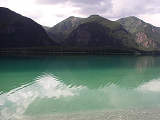
The Terminal Range is the northernmost mountain range of the Canadian Rockies, so-named for its position at the northern terminus of the Rockies. Lying west of Muncho Lake and the Trout River, its northern perimeter is the Liard River. The Sentinel Range lies to its east.

Morrissey Ridge is a mountain range of the Border Ranges located south-east of Fernie.

The Sundance Range is a mountain range in the Canadian Rockies, south of the town of Banff. It is located on the Continental Divide, which forms the boundary between British Columbia and Alberta in this region.

The Hsinbyume Pagoda is a large pagoda on the northern side of Mingun in Sagaing Region in Myanmar, on the western bank of the Irrawaddy River. It is approximately 10 kilometres (6.2 mi) northwest of Mandalay and is located in the proximity of the Mingun Pahtodawgyi. The pagoda is painted white and is modelled on the physical description of the Buddhist sacred mountain, Mount Meru.
Long Pasia is a tourist spot and eco tourism village in Ulu Padas River, Sipitang District, Sabah. Long Pasia is a home town of Lun Bawang/Lun Dayeh tribes and has a population of about 1,000 people, and all of them are Christians of Borneo Evangelical Church (SIB). It is located about 300 kilometres (190 mi) southwest of Kota Kinabalu.

Dong Ding, also spelled Tung-ting, is an oolong tea from Taiwan. A translation of Dong Ding is "Frozen Summit" or "Icy Peak", and is the name of the mountain in Taiwan where the tea is cultivated. Those plants were brought to Taiwan from the Wuyi Mountains in China's Fujian Province about 150 years ago.

Mojave Trails National Monument is a large U.S. National Monument located in the state of California between Interstates 15 and 40. The park was created to preserve a wide variety of geological and cultural features including several titular trails - the Old Spanish Trail, the World War II-era Desert Training Center and Route 66. It partially surrounds the Mojave National Preserve. It was designated by President Barack Obama on February 12, 2016, along with Castle Mountains National Monument and Sand to Snow National Monument, also in southern California. It is under the administration of the Bureau of Land Management.


