Cross-border town naming

Last updated

Cross-border town naming occurs where towns or villages with the same or equivalent names are divided between two different countries. This does not necessarily imply that those towns or villages are located in geographic proximity or that they are located near a current border (divided cities). Reasons for this taking place may include the following:

Contents

Most places are in Europe, but there are also some examples in North America and Asia. In Europe, until the first half of the 20th century and again since the Schengen Agreement in the late 20th century, such divisions could be mostly ignored by the inhabitants.

Examples

Note that this list includes only places with similar names that are in someway connected (by history, geography or otherwise) across modern-day international borders. Towns that have the same name but bear no relationship to each other are also very common but not particularly notable.

Africa

Cross-border townCountries
Moyale and Moyale Flag of Ethiopia.svg  Ethiopia / Flag of Kenya.svg  Kenya
Mobaye and Mobayi-Mbongo Flag of the Central African Republic.svg  Central African Republic / Flag of the Democratic Republic of the Congo.svg  Democratic Republic of the Congo
Cocobeach and Cogo Flag of Gabon.svg  Gabon / Flag of Equatorial Guinea.svg  Equatorial Guinea
Loukolela and Lukolela Flag of the Republic of the Congo.svg  Republic of the Congo / Flag of the Democratic Republic of the Congo.svg  Democratic Republic of the Congo
Mulanje and Milange Flag of Malawi.svg  Malawi / Flag of Mozambique.svg  Mozambique
Chirundu and Chirundu Flag of Zambia.svg  Zambia / Flag of Zimbabwe.svg  Zimbabwe
Mukumbura and Mucumbara Flag of Zimbabwe.svg  Zimbabwe / Flag of Mozambique.svg  Mozambique
Tin Zaouatine and Tinzaouaten Flag of Algeria.svg  Algeria / Flag of Mali.svg  Mali

Asia

Cross-border townCountries
Astara and Astara Flag of Azerbaijan.svg  Azerbaijan / Flag of Iran.svg  Iran
Julfa and Julfa
Biləsuvar and Bileh Savar
Luohu District and Lowu Flag of the People's Republic of China.svg  China / Flag of Hong Kong.svg  Hong Kong SAR
Shatoujiao Subdistrict and Sha Tau Kok
Khorgas and Khorgas Flag of the People's Republic of China.svg  China / Flag of Kazakhstan.svg  Kazakhstan
Sarpi and Sarp Flag of Georgia.svg  Georgia / Flag of Turkey.svg  Turkey
Padang Besar and Padang Besar Flag of Malaysia.svg  Malaysia / Flag of Thailand.svg  Thailand
Dibba /Al Buraimi-Al Ain Flag of Oman.svg  Oman / Flag of the United Arab Emirates.svg  UAE
Al-Mazyunah and Shahan District Flag of Oman.svg  Oman / Flag of Yemen.svg  Yemen
Ishkoshim and Ishkashim Flag of Tajikistan.svg  Tajikistan / Flag of the Taliban.svg  Afghanistan
Sarahs and Sarakhs Flag of Turkmenistan.svg  Turkmenistan / Flag of Iran.svg  Iran
Kara-Suu and Qorasuv Flag of Uzbekistan.svg  Uzbekistan / Flag of Kyrgyzstan.svg  Kyrgyzstan

Europe

Cross-border townCountries
Helsingør and Helsingborg Flag of Denmark.svg  Denmark / Flag of Sweden.svg  Sweden
Rhederbrug, Rhederveld and Rhede Flag of the Netherlands.svg  Netherlands / Flag of Germany.svg  Germany
Barnflair (Ter Apel) and Barnfleer
Veenebrugge and Vennebrügge
Zwillbroek and Zwillbrock
Ubach over Worms and Übach-Palenberg
Spijk and Spyck
Baarle-Nassau and Baarle-Hertog Flag of the Netherlands.svg  Netherlands / Flag of Belgium (civil).svg  Belgium
Clinge and De Klinge
Koewacht and Koewacht
Putte and Putte
Lichtenbusch and Aachen-Lichtenbusch Flag of Belgium (civil).svg  Belgium / Flag of Germany.svg  Germany
Stubach and Stupbach
Obereisenbach, Untereisenbach and Übereisenbach Flag of Luxembourg.svg  Luxembourg / Flag of Germany.svg  Germany
Wallendorf-Pont and Wallendorf
Bollendorf-Pont and Bollendorf
Echternach and Echternacherbrück
Wasserbillig and Wasserbilligerbrück
Comines-Warneton and Comines Flag of Belgium (civil).svg  Belgium / Flag of France.svg  France
Wervik and Wervicq-Sud
Quiévrain and Quiévrechain
Gœgnies-Chaussée and Gognies-Chaussée
Grand-Reng and Vieux-Reng
Mondorf-les-Bains and Mondorff Flag of Luxembourg.svg  Luxembourg / Flag of France.svg  France
Leiding and Leidingen Flag of France.svg  France / Flag of Germany.svg  Germany
Petite-Rosselle and Großrosseln
Grosbliederstroff and Kleinblittersdorf
Obergailbach and Niedergailbach
Scheibenhard and Scheibenhardt
Lauterbourg and Neulauterburg
Neuf-Brisach and Breisach
Kembs and Klein Kembs
Huningue and Kleinhüningen Flag of France.svg  France / Flag of Switzerland (Pantone).svg   Switzerland
Lucelle and Lucelle, Kleinlützel
Saint-Gingolph and Saint-Gingolph
Île des Faisans and Isla de los Faisanes (Konpantzia / Île de l’hôpital / Île de la Conférence)Flag of France.svg  France / Flag of Spain.svg  Spain
Rheinfelden-Baden (Badisch-Rhyfälde) and Rheinfelden (Rhyfälde) Flag of Germany.svg  Germany / Flag of Switzerland (Pantone).svg   Switzerland
Laufenburg and Laufenburg
Reckingen (Küssaberg)  [ de ] / Rekingen
Vorderriß and Hinterriß Flag of Germany.svg  Germany / Flag of Austria.svg  Austria
Bayerisch Gmain and Großgmain
Altwarp and Nowe Warpno Flag of Germany.svg  Germany / Flag of Poland.svg  Poland
Rosow and Rosówek
Hohenwutzen and Osinów Dolny (Niederwutzen)
Zäckericker Loose and Siekierki (Zäckerick)
Güstebieser Loose and Gozdowice (Güstebiese)
Altrüdnitzer Ausbau and Stara Rudnica (Altrüdnitz)
Neulietzegöricke and Stare Łysogórki (Altlietzegöricke)
Zelliner Loose and Czelin (Zellin)
Küstrin-Kietz and Kostrzyn nad Odrą (Küstrin)
Lebus and Nowy Lubusz (Neulebus)
Kunitzer Loose / Kunice (Kunitz)
Aurith and Urad (Aurith)
Guben and Gubin
Zelz and Siedlec (Zelz)
Klein Priebus and Przewóz (Priebus)
Görlitz and Zgorzelec
Altlandsberg and Gorzów ((Neu))Landsberg)
Altentreptow and Trzebiatów (Treptow)
Seifhennersdorf and Horní Jindřichův (Oberhennersdorf)Flag of Germany.svg  Germany / Flag of the Czech Republic.svg  Czech Republic
Zinnwald and Cínovec (Zinnwald)
Deutschgeorgenthal and Český Jiřetín (Georgendorf)
Deutscheinsiedel and Mníšek (Böhmisch Einsiedel)
Deutschneudorf and Nová Ves v Horách (Gebirgsneudorf)
Deutschkatharinenberg and Hora Svaté Kateřiny (Böhmisch Katherinenberg)
Hammerunterwiesenthal and České Hamry (Böhmisch Hammer)
Oberwiesenthal and Loučna (Böhmisch Wiesenthal)
Neualbenreuth and Mýtina (Altalbenreuth)
Bayerisch Eisenstein and Železná Ruda (Markt Eisenstein)
Pelhřimovy and Pielgrzymów Flag of the Czech Republic.svg  Czech Republic / Flag of Poland.svg  Poland
Opavice and Opawica
Krásné Loučky / Krasne Pole
Chomýž and Chomiąża
Český Těšín (Czeski Cieszyn) / Cieszyn
Horní Líštná and Leszna Górna
Dziewięcierz and Devyatyr (Дев'ятир)Flag of Poland.svg  Poland / Flag of Ukraine.svg  Ukraine
Uhrusk and Novouhruzke (Новоугрузьке)
Tokary and Tokary (Токари, Такары)Flag of Poland.svg  Poland / Flag of Belarus.svg  Belarus
Usnarz Górny and Usnar-Dolnyy (Уснар-Дольный)
Minkowce and Minkovcy
Nowodziel and Novodel
Český Heršlák and Deutsch Hörschlag Flag of the Czech Republic.svg  Czech Republic / Flag of Austria.svg  Austria
České Velenice and Gmünd
Bad Radkersburg and Gornja Radgona Flag of Austria.svg  Austria / Flag of Slovenia.svg  Slovenia
Deutschfeistritz and Slovenska Bistrica (Windischfeistritz)
Graz and Slovenj Gradec
Deutschlandsberg and Podčetrtek (Windischlandsberg)
Oberdrauburg and Dravograd (Unterdrauburg)
Unterloibl and Podljubelj (Unterloibl)
Moncenisio and Lanslebourg-Mont-Cenis Flag of Italy.svg  Italy / Flag of France.svg  France
Briga Alta and La Brigue
Gorizia and Nova Gorica Flag of Italy.svg  Italy / Flag of Slovenia.svg  Slovenia
Lavena Ponte Tresa and Ponte Tresa Flag of Italy.svg  Italy / Flag of Switzerland (Pantone).svg   Switzerland
Cremenaga and Ponte Cremenaga
Ponte Chiasso and Chiasso
Komárom and Komárno Flag of Hungary.svg  Hungary / Flag of Slovakia.svg  Slovakia
Sátoraljaújhely and Slovenské Nové Mesto
Balassagyarmat and Slovenské Ďarmoty
Esztergom and Štúrovo
Nagylak and Nădlac Flag of Hungary.svg  Hungary / Flag of Romania.svg  Romania
Újszalonta and Salonta
Kelebia and Kelebija Flag of Hungary.svg  Hungary / Flag of Serbia.svg  Serbia
Rio de Onor and Rihonor de Castilla Flag of Portugal.svg  Portugal / Flag of Spain.svg  Spain
Karesuando and Kaaresuvanto Flag of Sweden.svg  Sweden / Flag of Finland.svg  Finland
Kuttainen and Kuttanen
Katkesuando and Kätkäsuvanto
Muonionalusta and Muonio
Kihlangi and Kihlanki
Pello and Pello
Övertorneå and Ylitornio
Karungi and Karunki
Valga and Valka Flag of Estonia.svg  Estonia / Flag of Latvia.svg  Latvia
Hrvatska Kostajnica and Kostajnica Flag of Croatia.svg  Croatia / Flag of Bosnia and Herzegovina.svg  Bosnia and Herzegovina
Hrvatska Dubica and Kozarska Dubica
Stara Gradiška and Gradiška
Dolina and Donja Dolina, Gornja Dolina
Orubica and Orubica
Slavonski Kobaš and Kobaš
Dubočac and Bosanski Dubočac
Slavonski Brod and Brod
Svilaj and Donji Svilaj, Gornji Svilaj
Slavonski Šamac and Šamac
Bosanska Rača and Sremska Rača Flag of Bosnia and Herzegovina.svg  Bosnia and Herzegovina / Flag of Serbia.svg  Serbia
Zvornik and Mali Zvornik
Metaljka and Metaljka Flag of Bosnia and Herzegovina.svg  Bosnia and Herzegovina / Flag of Montenegro.svg  Montenegro
Mali Žam and Jamu Mare Flag of Serbia.svg  Serbia / Flag of Romania.svg  Romania
Požeženo and Pojejena
Veliki Gaj and Gaiu Mic
Chilia Veche and Kiliya Flag of Romania.svg  Romania / Flag of Ukraine.svg  Ukraine
Sculeni and Sculeni Flag of Romania.svg  Romania / Flag of Moldova.svg  Moldova
Ungheni and Ungheni

North America

Towns and cities listed have names of a common origin across an international boundary; matching pairs across provincial or state boundaries (such as Kansas City or Lloydminster) are common but are not listed here.

Cross-border townCountries
Beebe Plain, Quebec and Beebe Plain, Vermont Flag of the United States.svg  United States / Flag of Canada (Pantone).svg  Canada
Niagara Falls, Ontario and Niagara Falls, New York
Sault Ste. Marie, Ontario and Sault Ste. Marie, Michigan
North Portal, Saskatchewan and Portal, North Dakota
Madawaska County, New Brunswick and Madawaska, Maine
Calexico, California and Mexicali, Baja CaliforniaFlag of the United States.svg  United States / Flag of Mexico.svg  Mexico
Tecate, California and Tecate, Baja California
Naco, Arizona and Naco, Sonora
Nogales, Arizona and Nogales, Sonora
San Luis, Arizona and San Luis Río Colorado, Sonora
El Paso, Texas and Ciudad Juárez, Chihuahua (formerly El Paso del Norte, 1852–1888)
Boquillas, Texas and Boquillas del Carmen, Coahuila
Laredo, Texas and Nuevo Laredo, Tamaulipas
Progreso, Texas and Nuevo Progreso, Tamaulipas

South America

Cross-border townCountries
Antofagasta de la Sierra and Antofagasta Flag of Argentina.svg  Argentina / Flag of Chile.svg  Chile
Coquimbito and Coquimbo
San Sebastián
Foz do Iguaçu and Puerto Iguazú Flag of Brazil.svg  Brazil / Flag of Argentina.svg  Argentina
Guajará-Mirim and Guayaramerín Flag of Brazil.svg  Brazil / Flag of Bolivia.svg  Bolivia
Oiapoque and Saint-Georges-de-l'Oyapock Flag of Brazil.svg  Brazil / Flag of France.svg  French Guiana
Chuí and Chuy Flag of Uruguay.svg  Uruguay / Flag of Brazil.svg  Brazil
Acegua and Aceguá

See also

Related Research Articles

A county is a geographic region of a country used for administrative or other purposes in some nations. The term is derived from the Old French comté denoting a jurisdiction under the sovereignty of a count (earl) or, in his stead, a viscount (vicomte). Literal equivalents in other languages, derived from the equivalent of "count", are now seldom used officially, including comté, contea, contado, comtat, condado, Grafschaft, graafschap, and zhupa in Slavic languages; terms equivalent to 'commune' or 'community' are now often instead used.
<span class="mw-page-title-main">Clapham</span> District of London

Clapham is a district in south west London, England, lying mostly within the London Borough of Lambeth, but with some areas extending into the neighbouring London Borough of Wandsworth.

<span class="mw-page-title-main">Parish church</span> Church which acts as the religious centre of a parish

A parish church in Christianity is the church which acts as the religious centre of a parish. In many parts of the world, especially in rural areas, the parish church may play a significant role in community activities, often allowing its premises to be used for non-religious community events. The church building reflects this status, and there is considerable variety in the size and style of parish churches. Many villages in Europe have churches that date back to the Middle Ages, but all periods of architecture are represented.
<span class="mw-page-title-main">Border</span> Geographic boundaries of political entity

Borders are generally defined as geographical boundaries, imposed either by features such as oceans and terrain, or by political entities such as governments, sovereign states, federated states, and other subnational entities. Political borders can be established through warfare, colonization, or mutual agreements between the political entities that reside in those areas.

A census-designated place (CDP) is a concentration of population defined by the United States Census Bureau for statistical purposes only.
<span class="mw-page-title-main">North Caucasus</span> Subregion in Eastern Europe

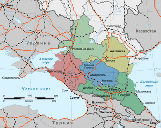
The North Caucasus, or Ciscaucasia, is a subregion in Eastern Europe governed by Russia. It constitutes the northern part of the wider Caucasus region, which separates Europe and Asia. The North Caucasus is bordered by the Sea of Azov and Black Sea to the west, the Caspian Sea to the east, and the Caucasus Mountains to the south. The region shares land borders with the countries of Georgia and Azerbaijan in the South Caucasus. Located in the south of the region, Mount Elbrus is the tallest peak in Europe. Krasnodar is the most populous among the urban centres in the region.

An urban area or tätort in Sweden has a minimum of 200 inhabitants and may be a city, town or larger village. It is a purely statistical concept, not defined by any municipal or county boundaries. Larger urban areas synonymous with cities or towns for statistical purposes have a minimum of 10,000 inhabitants. The same statistical definition is also used for urban areas in the other Nordic countries.

<span class="mw-page-title-main">Fairlington, Virginia</span> United States historic place

Fairlington is an unincorporated neighborhood in Arlington County, Virginia, located adjacent to Shirlington in the southernmost part of the county on the boundary with the City of Alexandria. The main thoroughfares are Interstate 395, which divides the neighborhood into North and South Fairlington, State Route 7 and State Route 402.

<span class="mw-page-title-main">New England town</span> Unit of government in New England, US

The town is the basic unit of local government and local division of state authority in the six New England states. Most other U.S. states lack a direct counterpart to the New England town. New England towns overlie the entire area of a state, similar to civil townships in other states where they exist, but they are fully functioning municipal corporations, possessing powers similar to cities and counties in other states. New Jersey's system of equally powerful townships, boroughs, towns, and cities is the system which is most similar to that of New England. New England towns are often governed by a town meeting, an assembly of eligible town residents. The great majority of municipal corporations in New England are based on the town model; there, statutory forms based on the concept of a compact populated place are uncommon, though elsewhere in the U.S. they are prevalent. County government in New England states is typically weak, and in some states nonexistent. Connecticut, for example, has no county governments, nor does Rhode Island. Both of those states retain counties only as geographic subdivisions with no governmental authority, while Massachusetts has abolished eight of fourteen county governments so far. Counties serve mostly as dividing lines for the states' judicial systems and some other state services in the southern New England states while providing varying services in the more sparsely populated three northern New England states.
<span class="mw-page-title-main">Ludford, Shropshire</span> Village in Shropshire, England

Ludford is a small village and civil parish in south Shropshire, England. The parish is situated adjacent to the market town of Ludlow and was, until 1895, partly in Herefordshire.
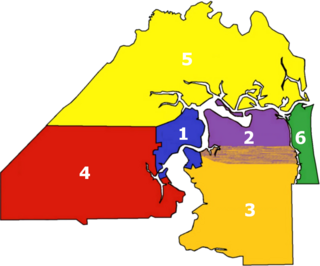
<span class="mw-page-title-main">Neighborhoods of Jacksonville</span> Neighborhoods in Jacksonville, Florida

There are more than 500 neighborhoods within the area of Jacksonville, Florida, the largest city in the contiguous United States by area. These include Downtown Jacksonville and surrounding neighborhoods. Additionally, greater Jacksonville is traditionally divided into several major sections with amorphous boundaries: Northside, Westside, Southside, and Arlington, as well as the Jacksonville Beaches.

<span class="mw-page-title-main">Neighborhoods of Milwaukee</span>

The neighborhoods of Milwaukee include a number of areas in southeastern Wisconsin within the state's largest city at nearly 600,000 residents.

Columbus, the state capital and Ohio's largest city, has numerous neighborhoods within its city limits. Neighborhood names and boundaries are not officially defined. They may vary or change from time to time due to demographic and economic variables.

<span class="mw-page-title-main">MidTown (Columbus, Georgia)</span> Neighborhood in Muscogee, Georgia, United States

Midtown has an area of six square miles in Columbus, Georgia. It possesses residential neighbourhoods, eleven public schools, the Columbus Museum, the Columbus Public Library, the Muscogee County Public Education Center, the Columbus Aquatic Center and the international headquarters for Aflac. The population of Midtown is 22,000 residents living in 8500 households and is 10 kilometres north of Fort Benning on I-185.

<span class="mw-page-title-main">Beechmont, New York</span> Populated place in New York, United States

Beechmont is an upscale residential community located in the northern end of New Rochelle in Westchester County, New York. Its boundaries are the Town of Mamaroneck on the east, Iona College, Sunset View Park, and City Park on the south, by Huguenot Park on the west and by Forest Heights, Larchmont Woods, and Bayberry on the north. Beechmont is within the larger Wykagyl sub-section of New Rochelle, served by the 10804 zip-code. The United States Board on Geographic Names recognizes Beechmont as the official common name for the neighborhood, which it defines as a populated place existing within the incorporated City of New Rochelle.

<span class="mw-page-title-main">Jugtown Historic District</span> Historic district in New Jersey, United States

The Jugtown Historic District consists of a cluster of historic buildings surrounding the intersection of Harrison Street and Nassau Street in Princeton, New Jersey. The settlement dates to colonial times and is sometimes known as Queenston. In 1987, the district was listed on the National Register of Historic Places.