Transborder agglomeration

Last updated
San Diego-Tijuana is an urban agglomeration across the Mexico-United States border. San Diego-Tijuana JPLLandsat.jpg
San Diego–Tijuana is an urban agglomeration across the Mexico–United States border.

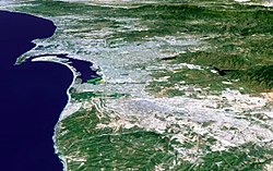
A transborder agglomeration is an urban agglomeration or conurbation that extends into multiple sovereign states and/or dependent territories. It includes city-states that agglomerate with their neighbouring countries.

Contents

List of transborder agglomerations

Africa

Main municipalitiesCountriesTotal population
Kinshasa–Brazzaville Flag of the Democratic Republic of the Congo.svg  Democratic Republic of the Congo /Flag of the Republic of the Congo.svg  Republic of the Congo 19,547,463
BukavuCyangugu Flag of the Democratic Republic of the Congo.svg  Democratic Republic of the Congo / Flag of Rwanda.svg  Rwanda 1,200,000 [1] [2]
GomaGisenyi 756,323
Abidjan–Lagos Flag of Cote d'Ivoire.svg  Côte d'Ivoire / Flag of Ghana.svg  Ghana Flag of Togo (3-2).svg  Togo / Flag of Benin.svg  Benin / Flag of Nigeria.svg  Nigeria 27,000,000
LoméAflao Flag of Togo (3-2).svg  Togo / Flag of Ghana.svg  Ghana 1,544,206
N'DjamenaKousséri Flag of Chad.svg  Chad / Flag of Cameroon.svg  Cameroon 1,694,819

Asia

Main municipalitiesCountriesTotal population
Astara and Astara Flag of Iran.svg  IranAzerbaijan 100,000
Basra and Khorramshahr and Abadan Flag of Iraq.svg  IraqFlag of Iran.svg  Iran 2,000,000
Blagoveshchensk and Heihe Flag of Russia.svg  RussiaFlag of the People's Republic of China.svg  China 400,000
Dandong and Sinuiju Flag of the People's Republic of China.svg  ChinaFlag of North Korea.svg  North Korea 1,000,000
Dhahran and Jubail and Manama Flag of Saudi Arabia.svg  Saudi ArabiaFlag of Bahrain.svg  Bahrain 2,000,000
Fergana and Kyzyl-Kiya Flag of Uzbekistan.svg  UzbekistanFlag of Kyrgyzstan.svg  Kyrgyzstan 300,000
Sijori Growth Triangle Singapore and Johor Bahru and Batam and Bintan)Flag of Singapore.svg  SingaporeFlag of Malaysia.svg  MalaysiaFlag of Singapore.svg  SingaporeFlag of Indonesia.svg  Indonesia 9,000,000
Greater Bay Area (Guangzhou and Dongguan and Shenzhen and Hong KongMacau Flag of the People's Republic of China.svg  ChinaFlag of Hong Kong.svg  Hong KongFlag of Macau.svg  Macau 71,200,000
Kara-Suu and Qorasuv Flag of Kyrgyzstan.svg  KyrgyzstanFlag of Uzbekistan.svg  Uzbekistan 40,000
Lahore and Amritsar Flag of Pakistan.svg  PakistanFlag of India.svg  India 12,000,000
Mukdahan and Savannakhet Flag of Thailand.svg  ThailandFlag of Laos.svg  Laos 200,000
Padang Besar and Padang Besar Flag of Malaysia.svg  MalaysiaFlag of Thailand.svg  Thailand 20,000
Tashkent and Saryagash Flag of Uzbekistan.svg  UzbekistanFlag of Kazakhstan.svg  Kazakhstan 3,000,000 [3]
Vientiane and Nong Khai Flag of Laos.svg  LaosFlag of Thailand.svg  Thailand 900,000

Europe

Main municipalitiesCountriesTotal population[ citation needed ]
Øresund Region (Greater Copenhagen and Malmö)Flag of Denmark.svg  DenmarkFlag of Sweden.svg  Sweden 3,964,522
Baarle-Hertog and Baarle-Nassau Flag of Belgium (civil).svg  BelgiumFlag of the Netherlands.svg  Netherlands 9,262
Basel and Huningue and Weil am Rhein (Regio TriRhena)Flag of Switzerland (Pantone).svg   SwitzerlandFlag of France.svg  FranceFlag of Germany.svg  Germany 2,400,000
Bourg-Madame and Puigcerdà Flag of France.svg  FranceFlag of Spain.svg  Spain
Como and Chiasso (part of Greater Milan ) [4] Flag of Italy.svg  ItalyFlag of Switzerland (Pantone).svg   Switzerland 189,000 [5]
Geneva and Annemasse and Ferney-Voltaire and Nyon (Flag of France.svg  France–Vaud–Geneva basin or Grand Genève )Flag of Switzerland (Pantone).svg   SwitzerlandFlag of France.svg  France 890,000
Gorizia and Nova Gorica Flag of Italy.svg  ItalyFlag of Slovenia.svg  Slovenia
Görlitz and Zgorzelec Flag of Germany.svg  GermanyFlag of Poland.svg  Poland 85,000
Guben and Gubin Flag of Germany.svg  GermanyFlag of Poland.svg  Poland 35,000
Hendaye and Irun Flag of France.svg  FranceFlag of Spain.svg  Spain
Ivangorod and Narva Flag of Russia.svg  RussiaFlag of Estonia.svg  Estonia 69,000
Komárno and Komárom Flag of Slovakia.svg  SlovakiaFlag of Hungary.svg  Hungary 56,000
Le Perthus and Els Límits Flag of France.svg  FranceFlag of Spain.svg  Spain 700
Basque Eurocity Bayonne-San Sebastián Flag of France.svg  FranceFlag of Spain.svg  Spain 620,000
Lille and Roubaix and Tourcoing and Mouscron and Tournai and Kortrijk Flag of France.svg  FranceFlag of Belgium (civil).svg  Belgium 1,850,000
Longwy and Aubange and Pétange Flag of France.svg  FranceFlag of Belgium (civil).svg  BelgiumLuxembourg 80,000
Strasbourg and Kehl Flag of France.svg  FranceFlag of Germany.svg  Germany 700,000
Konstanz and Kreuzlingen Flag of Germany.svg  GermanyFlag of Switzerland (Pantone).svg   Switzerland 110,000
Kerkrade and Herzogenrath Flag of the Netherlands.svg  NetherlandsFlag of Germany.svg  Germany 95,000
Frankfurt (Oder) and Słubice Flag of Germany.svg  GermanyFlag of Poland.svg  Poland 75,000
Haparanda and Tornio Flag of Sweden.svg  Sweden /Flag of Finland.svg  Finland 32,000
Pello and Pello 4,500
Karesuando and Karesuvanto 500
Imatra and Svetogorsk Flag of Finland.svg  Finland /Flag of Russia.svg  Russia 45,000
Rousse and Giurgiu Flag of Bulgaria.svg  Bulgaria /Flag of Romania.svg  Romania 250,000
Lifford and Strabane Flag of Ireland.svg  IrelandFlag of the United Kingdom.svg  United Kingdom 18,500
Saarbrücken and Forbach Flag of Germany.svg  GermanyFlag of France.svg  France 700,000
Salzburg and Freilassing Flag of Austria.svg  AustriaFlag of Germany.svg  Germany 175,000
Slavonski Brod and Brod Flag of Croatia.svg  CroatiaFlag of Bosnia and Herzegovina.svg  Bosnia and Herzegovina 110,000
Szczecin Flag of Poland.svg  PolandFlag of Germany.svg  Germany 763,321
Valka and Valga Flag of Latvia.svg  LatviaFlag of Estonia.svg  Estonia 20,000
Vienna and Bratislava Flag of Austria.svg  AustriaFlag of Slovakia.svg  Slovakia 1,900,000

North America

Main municipalitiesCountriesTotal population
Paso Canoas Flag of Costa Rica.svg  Costa Rica / Flag of Panama.svg  Panama 9,543
Metro VancouverFraser ValleyBellingham-Whatcom County Flag of the United States.svg  United States / Flag of Canada (Pantone).svg  Canada 3,350,000
Detroit–Windsor 5,976,595
Buffalo-Niagara Region 1,614,790
Port HuronSarniaPoint Edward 105,776
Sault Ste. MarieSault Ste. Marie 93,944
San Diego–Tijuana Flag of the United States.svg  United States / Flag of Mexico.svg  Mexico 5,105,769 [6]
Calexico–Mexicali 1,143,000
San Luis Río ColoradoSan Luis 227,000
NogalesNogales 240,000
El Paso–Juárez 2,500,000 [7]
Laredo–Nuevo Laredo 775,481 [8]
Lower Rio Grande Valley 2,671,028 [9]
Reynosa–McAllen 1,500,000 [10]
Brownsville–Matamoros 1,387,985 [11]

South America

Main municipalitiesCountriesTotal population
Saint-Laurent-du-MaroniAlbina Flag of France.svg  French Guiana / Flag of Suriname.svg  Suriname
Saint GeorgesOiapoque Flag of France.svg  French Guiana / Flag of Brazil.svg  Brazil 32,000
Santana do LivramentoRivera Flag of Brazil.svg  Brazil / Flag of Uruguay.svg  Uruguay 140,000
ChuíChuy 15,592 [12] [13]
CorumbáPuerto Suárez Flag of Brazil.svg  Brazil / Flag of Bolivia.svg  Bolivia 124,000
LeticiaTabatingaSanta Rosa ColombiaBrazilPeru 107,000
Ponta PorãPedro Juan Caballero Flag of Brazil.svg  Brazil / Flag of Paraguay.svg  Paraguay 209,000
Foz do IguaçuCiudad del EstePuerto Iguazu Flag of Brazil.svg  Brazil / Flag of Paraguay.svg  Paraguay /Flag of Argentina.svg  Argentina 800,000
Bernardo de IrigoyenBarracãoDionísio Cerqueira Flag of Argentina.svg  Argentina /Flag of Brazil.svg  Brazil 36,000
UruguaianaPaso de los Libres 170,000
TulcánIpiales Flag of Ecuador.svg  Ecuador / Flag of Colombia.svg   Colombia 190,000
CúcutaSan Antonio del Táchira Flag of Colombia.svg  Colombia / Flag of Venezuela.svg  Venezuela 700,000 [14]

See also

Related Research Articles

A megacity is a very large city, typically with a population of more than 10 million people. The United Nations Department of Economic and Social Affairs in its 2018 "World Urbanization Prospects" report defines megacities as urban agglomerations with over 10 million inhabitants. A University of Bonn report holds that they are "usually defined as metropolitan areas with a total population of 10 million or more people". Elsewhere in other sources, from five to eight million is considered the minimum threshold, along with a population density of at least 2,000 per square kilometre. The terms conurbation, metropolis, and metroplex are also applied to the latter.

<span class="mw-page-title-main">Walnut, California</span> City in California, United States

Walnut is a city in the eastern part of Los Angeles County in the U.S. state of California. According to the 2010 census, the city had a population of 29,172, and the population was estimated to be 29,685 in 2019.

<span class="mw-page-title-main">Seven Points, Texas</span> City in Texas, United States

Seven Points is a city in Henderson and Kaufman counties in the U.S. state of Texas. The population was 1,370 at the 2020 census, up from 1,455 at the 2010 census.

<span class="mw-page-title-main">Surada</span> Town in Odisha, India

Surada is a town and a Notified Area Council in Ganjam district in the Indian state of Odisha.

<span class="mw-page-title-main">San Antonio del Táchira</span> Place in Táchira, Venezuela

San Antonio del Táchira is a city in the Venezuelan Andean state of Táchira. The busy highway across the Simón Bolívar International Bridge linking the cities of Cúcuta, Colombia, and San Cristóbal, Venezuela, passes through San Antonio del Táchira, making it an important gateway between the two nations. This city is the shire town of the Municipio Bolívar de Táchira and, according to the 2001 Venezuelan census, the municipality has a population of 48,171.

Water supply and sanitation (WSS) in the European Union (EU) is the responsibility of each member state, but in the 21st century union-wide policies have come into effect. Water resources are limited and supply and sanitation systems are under pressure from urbanisation and climate change. Indeed, the stakes are high as the European Environmental Agency found that one European out of ten already suffers a situation of water scarcity and the IEA measured the energy consumption of the water sector to be equivalent to 3,5% of the electricity consumption of the EU.

<span class="mw-page-title-main">Kamëz</span> Municipality in Tirana, Albania

Kamëz is a municipality in Tirana County, Albania. It was formed at the 2015 local government reform by the merger of the former municipalities Kamëz and Paskuqan, that became municipal units. The seat of the municipality is the town Kamëz. The total population is 104,190, in a total area of 37.20 km2. The population of the former municipality at the 2011 census was 66,841.

<span class="mw-page-title-main">Katowice urban area</span> Silesian conurbation and largest urban area in Poland

The Katowice urban area, also known as the Upper Silesian urban area, is an urban area/conurbation in southern Poland, centered on Katowice. It is located in the Silesian Voivodeship. The Katowice urban area is the largest urban area in Poland and 22nd largest urban area in the European Union. According to Demographia, its population is 1,903,000.

<span class="mw-page-title-main">Reynosa–McAllen</span> International transborder agglomeration in southern Texas and northern Tamaulipas

Reynosa–McAllen, also known as McAllen–Reynosa, or simply as Borderplex, is one of the six international conurbations along the Mexico–U.S border. The city of Reynosa is situated in the Mexican state of Tamaulipas, on the southern bank of the Rio Grande, while the city of McAllen is located in the American state of Texas, directly north across the bank of the Rio Grande. This area has a population of roughly 1,500,000, making it the largest and most populous in the state of Tamaulipas, and third most populous on the US–Mexico border.

<span class="mw-page-title-main">Pendle Way</span> Long-distance footpath in Lancashire, England

The Pendle Way is a recreational path in the South Pennines of England, which encircles the borough of Pendle; it was officially opened in 1987. The circuit is 45 miles (72 km) in length and, according to the Long Distance Walkers Association, involves 1839 m (6033 ft) ascent reaching 557 m (1,827 ft) maximum height. Its attractions include historical associations with the seventeenth century Pendle Witches, connections with the Brontës, stonebuilt villages in the traditional style of East Lancashire and the South Pennines, relics of the weaving and lead mining industry, and limestone meadows and millstone grit moorland culminating in the ascent of Pendle Hill.

<span class="mw-page-title-main">Metropolitan Region of Caracas</span> Place in Venezuela

Metropolitan Region of Caracas (MRC) or Greater Caracas (GC) is the urban agglomeration comprising the Metropolitan District of Caracas and the adjacent 11 municipalities over Miranda and Vargas state in Venezuela. Thus, it does not constitute a single administrative unit. The conurbation spreads south, west, east and north of Caracas. It has a population of 5,243,301.

<span class="mw-page-title-main">East Marmara Region</span> Region in Turkey

The East Marmara Region (TR4) is a statistical region in Turkey.

<span class="mw-page-title-main">Aegean Region (statistical)</span> Region in Turkey

The Aegean Region (TR3) is a statistical region in Turkey.

<span class="mw-page-title-main">Mediterranean Region (statistical)</span> Region in Turkey

The Mediterranean Region (TR6) is a statistical region in Turkey.

<span class="mw-page-title-main">East Black Sea Region (statistical)</span> Region in Turkey

The East Black Sea Region (TR9) is a statistical region in Turkey.

<span class="mw-page-title-main">Northeast Anatolia Region (statistical)</span> Region in Turkey

The Northeast Anatolia Region (TRA) is a statistical region in Turkey.

<span class="mw-page-title-main">Southeast Anatolia Region (statistical)</span> Region in Turkey

The Southeast Anatolia Region (TRC) is a statistical region in Turkey.

References

  1. "Bukavu, Democratic Republic of the Congo Population (2023) - Population Stat". populationstat.com. Retrieved 2 May 2023.
  2. "Explore Cyangugu Town". Nyungwe Forest National Park. Retrieved 2 May 2023.
  3. "Central Asian cities are overgrown with slums". centre1.com. Retrieved 12 May 2017.
  4. "Archived copy" (PDF). www.espon.eu. Archived from the original (PDF) on 24 September 2015. Retrieved 12 January 2022.{{cite web}}: CS1 maint: archived copy as title (link)
  5. "Archived copy" (PDF). www.espon.eu. Archived from the original (PDF) on 24 September 2015. Retrieved 12 January 2022.{{cite web}}: CS1 maint: archived copy as title (link)
  6. "San Diego - Tijuana". World Gazetteer. Archived from the original on 2007-10-01. Retrieved 1 September 2011.
  7. "The 411 - Fascinating Facts". Guest Life: El Paso/Juarez and Southern New Mexico. Archived from the original on 28 September 2007. Retrieved 17 Feb 2010.
  8. "Nuevo Laredo Metro area". World Gazetteer. Archived from the original on 9 February 2013. Retrieved 1 September 2011.
  9. Gomez, Rodney; Guajardo, Luis; Ely-Ledesma, Edna (June 15, 2022). "It is time to recognize the Rio Grande Valley as a rising borderland metropolis". Rice University: Kinder Institute for Urban Research.{{cite web}}: CS1 maint: multiple names: authors list (link)
  10. "McAllen Overview". McAllen Chamber of Commerce. Retrieved 26 August 2011.
  11. "Explore Matamoros". Brownsville South Padre Island International Airport. Retrieved 5 February 2024.
  12. "IBGE Cidades (Brazil's Census 2010)".
  13. "INE (Uruguay's Census 2011)".
  14. http://www.lapatilla.com/site/2016/08/15/cucuta-y-san-antonio-dos-ciudades-unidas-pero-separadas-por-cierre-frontera/ "...que une ambas ciudades formando una conurbación, los 650.000 habitantes de Cúcuta y los 50.000 de San Antonio supieron que comenzaban tiempos difíciles."