List
Bold represents largest city in country, Italic represents capital city.
| City | Nation | Image | Population | |||
|---|---|---|---|---|---|---|
| City proper | Metropolitan area | Urban area [1] | Remarks | |||
| Shanghai |  | 24,256,800 [2] | 23,416,000 [a] | 34,750,000 [3] | ||
| Beijing |  | 21,516,000 [4] | 21,009,000 | 21,148,000 [5] | ||
| Karachi |  | 20,382,881 [6] (2023) | 25,400,000 [7] | 25,400,000 | ||
| Guangzhou |  | 18,676,605 [8] (2020) | 44,259,000 [9] | 20,800,654 [10] | ||
| Mumbai |  | 17,673,000 [11] (2024) | 18,414,288 [12] (2011) | 20,748,395 [12] (2011) | Mumbai City Proper, Mumbai Metropolitan Area and Mumbai Urban Area are considered synonymous with the officially designated Mumbai City district, Mumbai Metropolitan Region and Mumbai Extended Urban Agglomeration. [12] | |
| Shenzhen |  | 17,494,398 [8] (2020) | 12,084,000 | 10,630,000 | ||
| Delhi |  | 16,787,941 (2011) | 22,200,000 [13] (2011) | 46,069,000 [14] (2011) | Delhi City Proper, Delhi Metropolitan Area and Delhi Urban Area are assumed to be synonymous with the current designations of Delhi Capital Territory, Central National Capital Region and National Capital Region, respectively. | |
| Istanbul [b] |  | 14,657,000 [15] | 15,328,000 [15] | 16,703,000 [15] | ||
| Tokyo |  | 13,513,734 [16] | 37,843,000 | 36,923,000 [17] | ||
| Metro Manila |  | 13,484,462 [18] | 28,250,517 [18] | 27,123,000 | ||
| Lahore |  | 13,004,135 [19] (2023) | 10,355,000 | |||
| Bangkok |  | 10,539,415 [20] | 14,998,000 | 8,305,218 [21] | ||
| Dhaka | | 10,295,786 [22] | ||||
| Suzhou |  | 10,650,501 [23] | ||||
| Jakarta |  | 10,075,310 [24] | 30,539,000 | 30,075,310 [25] | ||
| Seoul |  | 10,010,784 [26] | 12,700,000 | 25,520,000 [27] | ||
| Ho Chi Minh City |  | 8,993,082 [28] | 21,281,639 [28] | |||
| Bengaluru |  | 8,443,675 [29] (2011) | 9,621,551 [30] (2011) | 11,695,110 [31] (2011) | Bengaluru City Proper, Bengaluru Metropolitan Area and Bengaluru Urban Area are considered synonymous with Bruhat Bengaluru Mahanagara Palike (Municipal Corporation), Bengaluru Urban district (comprising five taluks: Bangalore North (Bengaluru), Bangalore South (Kengeri), Bangalore East (Krishnaraja Pura), Yelahanka and Anekal) and Bengaluru Metropolitan Region (combination of Bengaluru Urban District, Bengaluru Rural District and Ramanagara district), respectively. | |
| Dongguan |  | 8,220,207 [32] | ||||
| Chongqing | 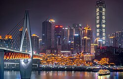 | 8,189,800 [d] | 18,384,100 [34] | |||
| Nanjing |  | 8,187,828 [35] | ||||
| Tehran |  | 8,154,051 [36] | 13,532,000 | 14,595,904 [37] | ||
| Shenyang |  | 8,106,171 [38] | ||||
| Hanoi |  | 8,053,663 [28] | 17,067,480 [28] | |||
| Hong Kong |  | 7,298,600 [39] | 7,331,699 [40] | |||
| Baghdad | 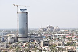 | 7,180,889 [41] | ||||
| Chennai |  | 4,646,732 [42] [43] (2011) | 8,696,010 [12] (2011) | 8,917,749 [12] (2011) | Chennai City Proper, Chennai Metropolitan Area and Chennai Urban Area are considered synonymous with the officially designated Chennai City district, Chennai Urban Agglomeration and Chennai Extended Urban Agglomeration. [12] [43] | |
| Changsha | | 7,044,118 | ||||
| Wuhan | 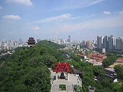 | 6,886,253 [44] | ||||
| Tianjin |  | 6,859,779 [45] | 10,920,000 | |||
| Hyderabad |  | 6,809,970 [46] | 7,749,334 [46] | |||
| Faisalabad | 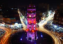 | 6,480,765 [47] | 3,675,000 | |||
| Foshan |  | 6,151,622 [48] [49] | ||||
| Zunyi |  | 6,127,009 | ||||
| Chittagong |  | 6,025,985 [50] | 8,440,000 [51] | |||
| Riyadh |  | 5,676,621 [52] | ||||
| Ahmedabad |  | 5,570,585 [46] | 6,352,254 [46] | |||
| Singapore | | 5,535,000 [53] | ||||
| Shantou |  | 5,391,028 [54] | ||||
| Ankara | 5,271,000 [15] | 4,585,000 [15] | 4,919,000 [15] | |||
| Yangon |  | 5,214,000 [55] | ||||
| Chengdu | | 4,741,929 [56] | 10,376,000 | |||
| Kolkata | | 4,486,679 [46] | 14,667,000 | 14,617,882 [46] | ||
| Xi'an |  | 4,467,837 [57] | ||||
| Surat |  | 4,462,002 [46] | ||||
| Vadodara |  | 4,280,701 [58] [59] | ||||
| İzmir | | 4,168,000 [15] | 3,019,000 [15] | 3,575,000 [15] | ||
| Zhengzhou |  | 4,122,087 [60] | ||||
| New Taipei City |  | 4,000,164 [61] | ||||
| Yokohama |  | 3,726,167 [16] | ||||
| Hangzhou |  | 3,560,391 [62] | ||||
| Xiamen | 3,531,347 [63] | |||||
| Quanzhou | 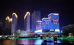 | 3,520,846 [64] | ||||
| Busan |  | 3,510,833 [27] | ||||
| Rawalpindi |  | 3,510,000[ citation needed ] | ||||
| Jeddah |  | 3,456,259 [65] | ||||
| Hyderabad |  | 3,429,471 [66] | ||||
| Kabul |  | 3,414,100 [67] | ||||
| Hefei | 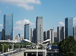 | 3,352,076 [68] | ||||
| Pyongyang |  | 3,255,388 [69] | ||||
| Peshawar |  | 3,201,000[ citation needed ] | ||||
| Cebu |  | 3,164,337 [18] | 3,325,385 [18] | |||
| Zhongshan | | 3,121,275 [70] | ||||
| Pune |  | 3,115,431 [46] | ||||
| Jaipur | 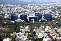 | 3,073,350 [46] | ||||
| Lucknow |  | 3,001,475 [46] | 6,500,000 [46] | |||
| Wenzhou |  | 3,039,439 [71] | ||||
| Incheon |  | 2,978,367 [72] | ||||
| Quezon City |  | 2,936,116 [73] [e] | ||||
| Taichung |  | 2,809,004 | ||||
| Kaohsiung |  | 2,773,229 [74] | ||||
| Surabaya |  | 2,765,487 [75] | 7,302,283 | |||
| Taipei |  | 2,704,974 | 7,045,488 [76] | |||
| Osaka |  | 2,691,742 [16] | 19,341,976 [17] | 17,444,000 | ||
| Dubai |  | 2,643,410 | ||||
| Bandung |  | 2,575,478 | 6,965,655 | |||
| Daegu |  | 2,492,994 [77] | ||||
| Nagpur |  | 2,405,665[ citation needed ] | 2,497,870 | |||
| Nagoya |  | 2,296,014 [16] | 9,107,414 [17] | 10,177,000 | ||
| Baku |  | 2,269,700 [78] | ||||
| Phnom Penh | 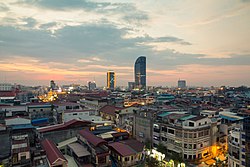 | 2,234,566 | ||||
| Kochi |  | 2,232,456 | 4,221,140 | |||
| Taoyuan |  | 2,230,653 | ||||
| Medan |  | 2,097,610 | 4,103,696 | |||
| Kuala Lumpur |  | 1,982,112 [79] | 8,455,029 [80] | |||
| Sapporo |  | 1,918,096 [16] | 2,584,880 | |||
| Tainan |  | 1,883,078 | ||||
| Almaty |  | 1,806,833 | 2,460,400 | |||
| Davao City | | 1,632,991 [81] | 2,516,216 [h] | |||
| Novosibirsk |  | 1,612,833 | ||||
| Caloocan |  | 1,583,978 [73] [j] | ||||
| Kobe |  | 1,536,499 [16] [k] | ||||
| Yekaterinburg |  | 1,501,652 [82] | ||||
| Khulna |  | 1,500,689 [83] | ||||
| Fukuoka |  | 1,483,052 [16] | 5,590,378 | |||
| Kyoto |  | 1,474,570 [16] [l] | ||||
| Kawasaki |  | 1,437,266 [16] | ||||
| Omsk |  | 1,154,116 | ||||
| Ranchi |  | 1,126,741 [46] | ||||
| Chelyabinsk |  | 1,202,371 | ||||
| Krasnoyarsk |  | 1,090,811 | ||||
| Tbilisi |  | 1,178,100[ citation needed ] | 1,485,293 | |||
| Yerevan |  | 1,081,800 [84] | 1,420,000 | |||
| Astana |  | 1,047,966 | 1,200,000 | |||
| Shymkent |  | 1,005,996 | 1,800,000 | |||
