Dome Fire Part of the August 2020 California lightning siege | |
---|---|
Date(s) |
|
Location |
|
Coordinates | 35°18′04″N115°35′53″W / 35.301°N 115.598°W |
Statistics | |
Burned area | 43,273 acres (17,512 ha; 68 sq mi; 175 km2) |
Impacts | |
Structures destroyed | 6 |
Damage |
|
Ignition | |
Cause | Lightning |
Map | |
The location of the Dome Fire in Southern California |
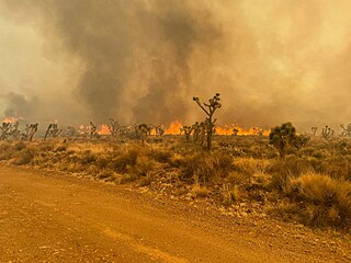
The 2020 Dome Fire was a large and ecologically destructive wildfire in the Mojave National Preserve in California's San Bernardino County. Caused by a lightning strike on August 15, the fire began near Cima Dome (a geological formation for which the fire was named) and exhibited rapid growth over the following 36 hours, aided by weather conditions and a lack of available firefighting resources. During this period the Dome Fire destroyed only 6 structures, but burned more than a quarter of the Cima Dome Joshua tree forest, one of the largest and densest populations of Joshua trees known in the world. The fire killed as many as 1.3 million Joshua trees. No injuries or fatalities were reported among firefighters or civilians. The fire cost $2.2 million to suppress, and burned 43,273 acres (17,512 ha) before being fully contained on August 24. [1] [2]
The Dome Fire was one of the many large wildfires of the 2020 California wildfire season, which was notable for its severity. The Dome Fire burned at the same time as other wildfires in the state considered a higher priority, such as the Lake Fire elsewhere in Southern California and the LNU, SCU, CZU, and August Complex fires, which contributed to the lack of fire suppression resources available to the Dome Fire effort. [3]
The mass Joshua tree destruction resulting from the Dome Fire has led to concern about the future of the species, which is predicted to face declines in its range due to development and climate change, with its increasing wildfire risk. Wildfires are not unknown in the region; the 2005 Hackberry Complex, also sparked by lightning, burned more than 70,000 acres in the Mojave National Preserve southwest of the Dome Fire footprint. However, fire is not an integral or frequent part of the fragile desert ecosystem, as it is in some other California ecosystems (such as chaparral and coniferous forests), and species like the Joshua tree do not have adaptations to readily protect or recover from wildfires. Therefore, the ecological ramifications of the Dome Fire are expected to be long-lasting, if not permanent. [4]
Due to a strong high pressure system to California's west, in mid-August temperatures were abnormally hot statewide, including in the High Desert. Relative humidity was low, and an abnormal lack of moisture from the monsoon that summer meant vegetation was even drier than usual. [5] This meant that conditions were already conducive to wildfire growth when a plume of moist and unstable air brought north from the decaying Tropical Storm Fausto off the coast of Baja California interacted with the high pressure system in the desert southwest on August 15 and 16. This led to a dry thunderstorm outbreak across California. [6] Nearly 11,000 cloud-to-ground lightning strikes were recorded, very few accompanied by significant precipitation. The frequent lightning and gusty outflow winds combined with the heat and dry vegetation ignited many quick-spreading fires throughout the state, creating an immediate draw on firefighting resources.
The fire began after one such lightning strike near Deer Spring, an old ranching qanat located on Cima Dome, at approximately 3:22 p.m. PDT on August 15. [7] [3] The Mojave National Preserve fire crew, composed of roughly a dozen personnel, was already at the preserve and arrived on the scene near 5:00 pm, when the blaze was around 70 acres. The fire, driven by erratic winds, was burning into inaccessible wilderness areas, and passing thunderstorms caused the head of the fire to switch directions rapidly, creating extreme and potentially unsafe conditions for firefighting. [8] The combination of challenging firefighting conditions and the inability to get more firefighting resources meant that the crew was forced to pull back for the night.
By 11:00 a.m. the next morning (August 16), the Dome Fire was more than 16,000 acres. [3] Winds gusted up to 20 miles per hour, and temperatures reached a reported 115 degrees. [9] This made the fire difficult to stop, and it experienced its largest single day of growth, increasing to more than 40,000 acres. During this time it exhibited active fire behavior, including pyrocumulus clouds and fire whirls. More resources finally arrived on the 16th, a team of smokejumpers from Redding, California, a helitanker, and multiple fixed-wing aircraft. [5] One of those included the Boeing 747-400 Global Supertanker. [10] During these first two days, crews also lit backfires—or controlled burns—to stop the Dome Fire's progression to the east, which threatened habitat for the critically endangered desert tortoise. [7]
Conditions made the going difficult. In addition to the wind, temperatures remained extremely high; in the Baker area 20 miles to the west of the fire, temperatures reached a high of 117 degrees on August 17. [11] Another challenging factor was the lack of bulldozers, often used to create a firebreak clear of vegetation so as to stop a fire's spread. The ecologically sensitive nature of the preserve meant much of the firefighting had to be done by hand, with aircraft supporting when available. [11]
In the afternoon of August 17, the fire's management was transferred to a Type 2 incident management team, which was able to requisition more personnel and resources. [3] Eight aircraft continued to drop water and fire retardant to halt the fire's spread, which also slowed as it encountered rockier areas with sparser vegetation. [11] [7] During the peak of the suppression and mop-up effort, more than 180 firefighters were assigned to the Dome Fire.
On August 20, up to 0.5 inches of rain fell over the burn area, further helping the firefight, and on August 24, the Dome Fire was declared 100% contained. [5] The fire's advance was stopped at Morning Star Mine Road to the east, Powerline Road to the south, near Aiken Mine Road to the west, and near the intersection of Cima Road and Zinc Mine Road south of Striped Mountain to the north.
Trails and facilities in the immediate of the area were closed for safety, including the Teutonia Peak Trail, multiple primitive campsites, visitor's centers, pit toilets, and the Lava Tube. The fire's smoke plume drifted over Interstate 15 to the north, but remained aloft and did not impair visibility. [9]
The fire burned in an unpopulated area, but destroyed multiple structures dating back to the Rock Springs Land and Cattle Company ranching operation in the late 19th century, then the second-largest in California. Historic structures that burned included Kessler Springs Historical Ranch House, bunkhouses at Kessler Springs Ranch and Valley View Ranch, and numerous water tanks, troughs, corrals, and other outbuildings. Historic mining operations, such as the Morning Star Mine and Evening Star Mine, were threatened but ultimately spared. [3]
After the Dome Fire 1.33 million Joshua trees were estimated burned, and of those, less than 200,000 were showing green leaves (meaning a possibility of survival). [3] [5] Scientists affiliated with the Mojave National Preserve attributed much of the intensity of the fire to an increased fuel load; the Cima Dome Joshua tree forest is one of the densest Joshua tree forests in the world. [5] Preserve scientists suspect this was the result of cattle grazing until the establishment of the preserve in the 1990s. Cattle may have grazed on many other plants but let flammable blackbrush alone, which shielded many Joshua tree seedlings. The eventual combination of blackbrush, flammable invasive species like red brome, and dense Joshua tree stands led to a wildfire-receptive ecology. [5]
The death of so many Joshua trees, which are native only to the southwestern United States, led to concern about the species' vulnerability to climate change and other pressures. [12] Joshua trees are split into two varieties—an eastern and a western—and while the Cima Dome population was of the less-threatened eastern kind, the western species was, at the time, a candidate for threatened status under the California Endangered Species Act, though it did not ultimately become listed as such. [13]
The Mojave National Preserve's lead wildlife biologist estimated that small animal mortality had been low, under 20% for small reptile and mammal species such as snakes, lizards, and rabbits. The Dome Fire also burned in areas considered habitat for the desert tortoise, a critically endangered species, but "no direct tortoise mortality" was found during or after the fire in surveys, and total mortality was estimated at "perhaps a dozen individuals." [3]
The majority of the Dome Fire footprint burned at a moderate severity, leaving intact the root systems of many native shrubs and grasses. [5] However, the Mojave National Preserve landscape is not a fire succession landscape, meaning that desert plants are poorly adapted to surviving wildfire, and the ecosystem is not necessarily expected to recover on its own and may convert to a different ecosystem type. [4] [7] Preserve scientists and botanists involved in the restoration and recovery effort are concerned about the possible post-fire takeover of invasive species like red brome, which are flammable and could lead to recurring wildfires. [5] Restoration is mainly focused on the eradication of these invasive species and the small-scale planting of new Joshua tree seedlings.
Replanting efforts took place in the winter of 2021 and are planned to continue through 2023, relying on volunteer planting, watering, and reporting programs organized by the National Park Service. [13] [14] According to the National Park Service, "Joshua trees have poor seed dispersal and may only migrate about 100 feet for every 20 years," making these projects critical for the long-term recovery of the species in the Cima Dome region. Additionally, Cima Dome has been modelled as a climate refugia for Joshua trees, making their existence there important for the long-term health of the species. [14]
Yucca brevifolia is a plant species belonging to the genus Yucca. It is tree-like in habit, which is reflected in its common names.
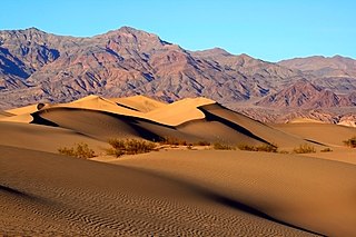
The Mojave Desert is a desert in the rain shadow of the southern Sierra Nevada mountains and Transverse Ranges in the Southwestern United States. Named for the indigenous Mohave people, it is located primarily in southeastern California and southwestern Nevada, with small portions extending into Arizona and Utah.
Mojave National Preserve is a United States National Preserve located in the Mojave Desert of San Bernardino County, California, US, between Interstate 15 and Interstate 40. The preserve was established October 31, 1994, with the enactment of the California Desert Protection Act by the United States Congress, which also established Joshua Tree National Park and Death Valley National Park as National Parks. Previously, some lands contained within the Preserve were the East Mojave National Scenic Area, under the jurisdiction of the Bureau of Land Management. At 1,542,776 acres (6,243 km2), within the contiguous United States it is the third largest unit of the National Park System and the first largest National Preserve. The preserve was created within the Pacific West Region of the National Park Service and remains within that jurisdiction today.
Big Basin Redwoods State Park is a state park in the U.S. state of California, located in Santa Cruz County, about 36 km (22 mi) northwest of Santa Cruz. The park contains almost all of the Waddell Creek watershed, which was formed by the seismic uplift of its rim, and the erosion of its center by the many streams in its bowl-shaped depression.
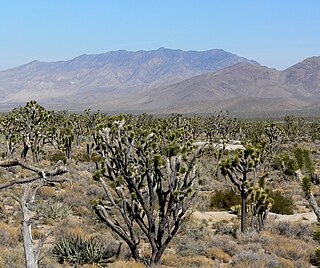
The Clark Mountain Range is located in southeastern California, north of Interstate 15 and the community of Mountain Pass. The range stretches approximately 15 miles (24 km) in a southwest-northeasterly direction, beginning in the Mojave National Preserve, and ending near Stateline Pass, about one mile (1.6 km) from the Nevada border. Clark Mountain, at 7,929 feet above sea level, is the principal peak of the range.
Wildfire suppression is a range of firefighting tactics used to suppress wildfires. Firefighting efforts depend on many factors such as the available fuel, the local atmospheric conditions, the features of the terrain, and the size of the wildfire. Because of this wildfire suppression in wild land areas usually requires different techniques, equipment, and training from the more familiar structure fire fighting found in populated areas. Working in conjunction with specially designed aerial firefighting aircraft, fire engines, tools, firefighting foams, fire retardants, and using various firefighting techniques, wildfire-trained crews work to suppress flames, construct fire lines, and extinguish flames and areas of heat in order to protect resources and natural wilderness. Wildfire suppression also addresses the issues of the wildland–urban interface, where populated areas border with wild land areas.
The Yellowstone fires of 1988 collectively formed the largest wildfire in the recorded history of Yellowstone National Park in the United States. Starting as many smaller individual fires, the flames quickly spread out of control due to drought conditions and increasing winds, combining into several large conflagrations which burned for several months. The fires almost destroyed two major visitor destinations and, on September 8, 1988, the entire park was closed to all non-emergency personnel for the first time in its history. Only the arrival of cool and moist weather in the late autumn brought the fires to an end. A total of 793,880 acres (3,213 km2), or 36 percent of the park, burned at varying levels of severity.
Joshua Tree National Park is a national park of the United States in southeastern California, east of San Bernardino and Los Angeles and north of Palm Springs. It is named after the Joshua trees native to the Mojave Desert. Originally declared a national monument in 1936, Joshua Tree was redesignated as a national park in 1994 when the U.S. Congress passed the California Desert Protection Act. Encompassing a total of 795,156 acres – slightly larger than the state of Rhode Island – the park includes 429,690 acres of designated wilderness. Straddling San Bernardino and Riverside Counties, the park includes parts of two deserts, each an ecosystem whose characteristics are determined primarily by elevation: the higher Mojave Desert and the lower Colorado Desert. The Little San Bernardino Mountains traverse the southwest edge of the park.
The Long Draw Fire was a wildfire started by a lightning strike on July 8, 2012 that burned 557,648 acres (2,257 km2) acres in southeastern Oregon, in the Western United States. It was Oregon's largest wildfire since the 1865 Silverton Fire which burned over 1 million acres.
The Barry Point Fire was a wildfire that burned over 92,977 acres (376.26 km2) of Oregon and California forest land during the summer of 2012. The fire began on 5 August 2012, the result of a lightning strike. The fire consumed public forest and rangeland as well as private forest and grazing land located in Lake County, Oregon and Modoc County, California. The public lands affected by the fire are administered by the United States Forest Service and the Oregon Department of Forestry. The largest part of the private land was owned by the Collins Timber Company. At the peak of the firefighting effort, there were 1,423 personnel working on the fire. It took 22 days to fully contain the fire and then an additional three weeks to mop it up.
Sand to Snow National Monument is a U.S. National Monument located in San Bernardino County and northern Riverside County, Southern California.
The CZU Lightning Complex fires were wildfires that burned in Northern California starting in August 2020. The fire complex consisted of fires in San Mateo and Santa Cruz counties, including fires that had previously been separately tracked as the Warnella and Waddell fires. The firefighting effort was primarily administered by the California Department of Forestry and Fire Protection.
The 2020 Creek Fire was a very large wildfire in central California's Sierra National Forest, in Fresno and Madera counties. One of the most significant fires of California's record-setting 2020 wildfire season, it began on September 4, 2020, and burned 379,895 acres (153,738 ha) over several months until it was declared 100% contained on December 24, 2020. The Creek Fire is the sixth-largest wildfire in recorded California history and the third-largest single fire—i.e. not part of a larger wildfire complex—following the 2021 Dixie Fire.
The SQF Complex fire—also called the SQF Lightning Complex—was a wildfire complex that burned in Tulare County in Central California in 2020. Comprising the Castle and Shotgun fires, it affected Sequoia National Forest and adjacent areas. Both fires began on August 19, 2020, and burned a combined total of 175,019 acres before the complex as a whole was declared 100 percent contained on January 6, 2021. In the course of the fires, 232 structures were destroyed. There were no fatalities.
The River Complex 2021 was a wildfire complex burning in Klamath National Forest in Siskiyou County, California in the United States. The complex comprises over 20 wildfires that started as a result of lightning strikes during a series of thunderstorms in late July 2021. As of 25 October 2021, the fire had burned a total of 199,343 acres (80,671 ha) and became 100% contained. The largest fires in the complex were the Haypress–Summer Fire and the Cronan Fire.
The Silver Fire was a 1987 wildfire in the Siskiyou National Forest in Oregon. It burned 96,240 acres (389 km2), of which 42,350 acres (171 km2) was located in the Kalmiopsis Wilderness. Parts of its burned area were re-burned in the Biscuit Fire and the Chetco Bar Fire. It was started by a lightning strike near Silver Creek on August 30, and was contained on November 2 after a dry summer in the area, with relative humidity as low as 4% at times in certain places, was ended by heavy rain. Firefighters from across the country, as far away as Virginia, went to Oregon to fight the fire. Nearly 4,000 people were involved in the effort.
The 1992 Fountain Fire was a large and destructive wildfire in Shasta County, California. The fire ignited on August 20 in an act of probable but unattributed arson, and was quickly driven northeast by strong winds. It outpaced firefighters for two days, exhibiting extreme behavior such as long-range spot fires, crown fire runs, and pyrocumulonimbus clouds with dry lightning. The fire was contained after burning for nine days, though work to strengthen and repair fire lines continued for more than two months.
The 2001 California wildfire season was a series of wildfires that burned throughout the U.S. state of California during 2001. According to California Department of Forestry and Fire Protection statistics, 9,317 fires burned a total of 377,340 acres.
The York Fire was a large wildfire in the Mojave National Preserve in San Bernardino County, California, and in Clark County, Nevada. The fire burned 93,078 acres (37,667 ha). The cause of the fire is undetermined.
{{cite web}}
: CS1 maint: unfit URL (link){{cite web}}
: CS1 maint: numeric names: authors list (link)