Forreston Township | |
|---|---|
 Forreston Township Building in Forreston, Illinois. | |
 Location of Illinois in the United States | |
| Coordinates: 42°07′44″N89°34′46″W / 42.12889°N 89.57944°W | |
| Country | United States |
| State | Illinois |
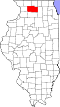
| County | Ogle |
| Settled | March 4, 1857 |
| Government | |
| • Mayor | Jim Miller |
| Area | |
• Total | 36.36 sq mi (94.2 km2) |
| • Land | 36.34 sq mi (94.1 km2) |
| • Water | 0.02 sq mi (0.05 km2) |
| Elevation | 902 ft (275 m) |
| Population (2010) | |
| 1,974 | |
| • Density | 57.2/sq mi (22.1/km2) |
| Time zone | UTC-6 (CST) |
| • Summer (DST) | UTC-5 (CDT) |
| FIPS code | 17-141-27078 |
Forreston Township is located in Ogle County, Illinois. As of the 2010 census, its population was 2,080 and it contained 885 housing units. [2] Forreston Township was formed from a portion of Brookville Township on March 4, 1857. The village of Forreston and the unincorporated community of Baileyville are located within it.