Narberth is a borough in Montgomery County, Pennsylvania, United States. It is one of many neighborhoods on the historic Philadelphia Main Line. The population was 4,282 at the 2010 census.

Ardmore is an unincorporated community and census-designated place (CDP) spanning the border between Delaware and Montgomery counties in the U.S. state of Pennsylvania. The population was 12,455 at the time of the 2010 census and had risen to 13,566 in the 2020 census.

Haverford is an unincorporated community located in both Haverford Township in Delaware County, Pennsylvania, United States, and Lower Merion Township in Montgomery County, approximately 3 miles (4.8 km) west of Philadelphia. The Pennsylvania Railroad (PRR) opened Haverford Station in 1880 on their Main Line west out of Broad Street Station in Philadelphia. Haverford sits at milepost 9.17.
Powelton Village is a neighborhood of mostly Victorian, mostly twin homes in the West Philadelphia section of the United States city of Philadelphia, Pennsylvania. It is a national historic district that is part of University City. Powelton Village extends north from Market Street to Spring Garden Street, east to 32nd Street, west to 40th and Spring Garden Streets, and to 44th and Market Streets.

Overbrook is an historic neighborhood that is located in the Commonwealth of Pennsylvania, United States. It is situated northwest of West Philadelphia, Philadelphia.

West Philadelphia, nicknamed West Philly, is a section of the city of Philadelphia. Alhough there are no officially defined boundaries, it is generally considered to reach from the western shore of the Schuylkill River, to City Avenue to the northwest, Cobbs Creek to the southwest, and the SEPTA Media/Wawa Line to the south. An alternate definition includes all city land west of the Schuylkill; this would also include Southwest Philadelphia and its neighborhoods. The eastern side of West Philadelphia is also known as University City.

Mantua is a neighborhood in the West Philadelphia section of Philadelphia, Pennsylvania, United States. It is located north of Spring Garden Street, east of 40th Street, south of Mantua Avenue, and west of 31st Street. The neighborhood's northern and western reaches are predominantly working-class and African American, although its southern border with Powelton Village has seen recent gentrification and an influx of Drexel University and University of Pennsylvania student renters.

Overbrook Park is a neighborhood in the West Philadelphia section of Philadelphia, Pennsylvania, United States. It was founded in the 1940s on the site of a former farm known as Supio's farm, offering new housing for returning GIs and their families. Overbrook Park remains a stable, safe, African-American middle-class neighborhood.

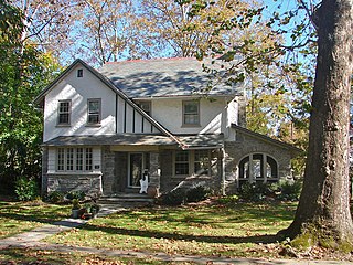
Wynnewood is a suburban unincorporated community, located west of Philadelphia, straddling Lower Merion Township in Montgomery County, Pennsylvania and Haverford Township in Delaware County, Pennsylvania, United States.

Cobbs Creek is an 11.8-mile-long (19.0 km) tributary of Darby Creek in Delaware County, Pennsylvania, in the United States. It forms an approximate border between Montgomery County and Delaware County. After Cobbs Creek passes underneath Township Line Road, it forms the border between Philadelphia County and Delaware County. It runs directly through the two sides of Mount Moriah Cemetery which spans the border of Southwest Philadelphia and Yeadon, Pennsylvania. It later joins Darby Creek before flowing into the Delaware River.

Kensington, colloquially known locally as “Kenzo,” is a neighborhood in Philadelphia that belongs to or divides Lower Northeast and North Philadelphia. As with all neighborhoods in the city, the lack of any official designation means the boundaries of the area vary between sources over time and are disputed among locals. Kensington, as most long-term residents view it, refers generally to the area consisting of Kensington, East, or Lower Kensington, West Kensington, and Harrowgate. The adjacent Fairhill and Norris Square neighborhoods are more separate but may be included in Kensington; Fishtown and South (Olde) Kensington were previously included but have developed new identities with gentrification. The most conservative boundaries of the neighborhood, shown in the map below, are Front Street and 5th Street to the west, the Amtrak train tracks to the North, Trenton Avenue, the Trenton Avenue train tracks, and Frankford Avenue to the east, and Cecil B. Moore Avenue to the south.

Indian Creek is a tributary of Cobbs Creek in the Philadelphia area of Pennsylvania in the United States.

Haddington is a neighborhood in the West Philadelphia section of Philadelphia, Pennsylvania, United States. Its borders are defined as Haverford Avenue/Girard Avenue to the north, 52nd Street to the east, Market Street to the south, and 67th Street to the westernmost edge of the neighborhood.

Dunlap is a small neighborhood in the West Philadelphia section of Philadelphia, Pennsylvania, United States. The neighborhood lies between Haverford Avenue and Market Street and stretches from 46th to 52nd streets. Dunlap is squeezed between the neighborhoods of Mill Creek and Haddington and situated just north of Walnut Hill. The neighborhood is named after the former historic Thomas Dunlap School that was restored into senior homes in 1991. Dunlap is located in the 19139 ZIP Code, and is situated in the Philadelphia Police Department's 19th police district, which encompasses a large portion of West Philadelphia.

U.S. Route 1 (US 1) is a major north–south U.S. Route, extending from Key West, Florida, in the south to Fort Kent, Maine, at the Canadian border in the north. In the U.S. state of Pennsylvania, US 1 runs for 81 miles (130 km) from the Maryland state line near Nottingham northeast to the New Jersey state line at the Delaware River in Morrisville, through the southeastern portion of the state. The route runs southwest to northeast and serves as a major arterial road through the city of Philadelphia and for many of the suburbs in the Delaware Valley metropolitan area. South of Philadelphia, the road mostly follows the alignment of the Baltimore Pike. Within Philadelphia, it mostly follows Roosevelt Boulevard. North of Philadelphia, US 1 parallels the route of the Lincoln Highway. Several portions of US 1 in Pennsylvania are freeway, including from near the Maryland state line to Kennett Square, the bypass of Media, the concurrency with Interstate 76 and the Roosevelt Expressway in Philadelphia, and between Bensalem Township and the New Jersey state line.

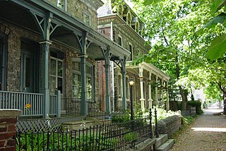
Spring Garden is a neighborhood in central Philadelphia, Pennsylvania, United States, bordering Center City on the north. Spring Garden is a neighborhood that combines diverse residential neighborhoods and significant cultural attractions. The residential areas on the north side of the neighborhood are composed mostly of brick and brownstone three-story townhouses built during the mid-to-late 19th century. The houses include townhouses in the Italianate style, Second Empire, Queen Anne, and Venetian Gothic. Many streets include "terraced" set ups, which include a small gardened plot, often raised, in front of the house. The residential areas to the south are dominated by taller, multi-family buildings built during the 20th century. The museum area, also to the south of Spring Garden Street, includes the Rodin Museum, the Central Library of Philadelphia, and the Barnes Museum. Before consolidation of Philadelphia, Spring Garden was a district of Philadelphia County.

Carroll Park is a neighborhood in West Philadelphia, Pennsylvania, United States. Its boundaries are Lansdowne Avenue to the north, West Girard Avenue to the south, North 63rd Street to the west, and North 52nd Street to the east. Along major streets of the neighborhood, the Carroll Park Community Council, Inc. has placed banners that say “Carroll Park: Where our neighbors become friends.” The 10 trolley runs along Lansdowne Avenue and the 15 trolley runs along Girard Avenue. There is a park by the name of Carroll Park between North 59th and North 58th Streets and West Thompson Street and West Girard Avenue. Carroll Park’s residents are primarily working-class and lower-income African-Americans.

SEPTA Route 103 is a bus route operated by the Southeastern Pennsylvania Transportation Authority (SEPTA) on the outskirts of Philadelphia, Pennsylvania, United States. Route 103 runs between Ardmore and the 69th Street Transportation Center in Upper Darby. It began as a streetcar line in 1902, operated by the Ardmore and Llanerch Street Railway, then the Philadelphia Suburban Transportation Company until converted bus operation to December 1966. SEPTA acquired PSTC and assumed operations of the Red Arrow Lines in January 1970.
The Food Trust is a nonprofit organization. It was founded in 1992 by Duane Perry in Philadelphia, Pennsylvania. The current executive director is Yael Lehmann. The goal of the organization is to improve the health of children and adults by providing better nutrition. The Food Trust works with neighborhoods, schools, grocers, farmers and policymakers to implement a comprehensive approach to improved food access that combines nutrition education and greater availability of affordable, healthy food. It is currently operating 25 farmer's markets in the Philadelphia region. The markets accept SNAP/food stamps, Farmers’ Market Nutrition Program vouchers and Philly Food Bucks. The Food Trust is funded by private foundations, government grants, and individual donors.
