
Roxborough is a neighborhood in the Northwest section of the city of Philadelphia, Pennsylvania, United States. It is bordered to the southwest, along the Schuylkill River, by the neighborhood of Manayunk, along the northeast by the Wissahickon Creek section of Fairmount Park, and to the southeast by the neighborhood of East Falls. Beyond Roxborough to the northwest is Montgomery County. Roxborough's ZIP code is 19128. Most of Roxborough is in Philadelphia's 21st Ward.
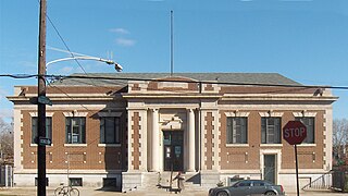
Kingsessing is a neighborhood in the Southwest section of Philadelphia, Pennsylvania, United States. On the west side of the Schuylkill River, it is next to the neighborhoods of Cedar Park, Southwest Schuylkill, and Mount Moriah, as well as the borough of Yeadon in Delaware County. It is roughly bounded by 53rd Street to the northeast, Baltimore Avenue to the northwest, Cobbs Creek and 60th Street to the southwest, and Woodland Avenue to the southeast.

Manayunk is a neighborhood in the section of Lower Northwest Philadelphia in the state of Pennsylvania. Located adjacent to the neighborhoods of Roxborough and Wissahickon and also on the banks of the Schuylkill River, Manayunk contains the first canal begun in the United States.
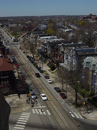
West Philadelphia, nicknamed West Philly, is a section of the city of Philadelphia. Alhough there are no officially defined boundaries, it is generally considered to reach from the western shore of the Schuylkill River, to City Avenue to the northwest, Cobbs Creek to the southwest, and the SEPTA Media/Wawa Line to the south. An alternate definition includes all city land west of the Schuylkill; this would also include Southwest Philadelphia and its neighborhoods. The eastern side of West Philadelphia is also known as University City.

Brewerytown is a neighborhood in the North Philadelphia section of Philadelphia, Pennsylvania, United States. An unofficial region, Brewerytown runs approximately between the Schuylkill River's eastern bank and 25th Street, bounded by Montgomery Avenue to the north and Parrish Street to the south. Brewerytown derived its name from the numerous breweries that were located along the Schuylkill during the late 19th century and early 20th century. It is now primarily a residential neighborhood, with a growing and active commercial sector along Girard Avenue.

East Falls is a neighborhood in Lower Northwest, Philadelphia, Pennsylvania, United States. It lies on the east bank of the "Falls of the Schuylkill," cataracts submerged in 1822 by the Schuylkill Canal and Fairmount Water Works projects. East Falls sits next to the Germantown, Roxborough, Allegheny West, and Nicetown-Tioga neighborhoods. Wissahickon Valley Park separates it from Manayunk, Philadelphia.

Southwest Center City (SWCC), also known as Graduate Hospital, is a neighborhood that is located in South Philadelphia, Pennsylvania, United States, bordering Center City Philadelphia. The neighborhood is bordered on the north by South Street, on the south by Washington Avenue, on the west by the Schuylkill River, and on the east by Broad Street.

Point Breeze is a multicultural neighborhood in South Philadelphia in Philadelphia, Pennsylvania, United States. It is bounded by 25th Street to the west, Washington Avenue to the north, 18th Street to the east, and Moore Street to the south. Graduate Hospital lies to its north, and Newbold lies to its east. Point Breeze is separated from Grays Ferry to the west by a CSX railway viaduct over 25th Street.

Grays Ferry, also known as Gray's Ferry, is a neighborhood in South Philadelphia, Pennsylvania, United States, bounded (roughly) by 25th Street on the east, the Schuylkill River on the west, Vare Avenue on the south, and Grays Ferry Avenue on the north. The section of this neighborhood west of 34th Street is also known as Forgotten Bottom. Grays Ferry shares borders with Southwest Center City to the North, Point Breeze to the East, and Girard Estate to the South. Gray’s Ferry is across from where Mill Creek debouches at about 43rd street. Historically, Grays Ferry was one of the largest enclaves of Irish Americans in the city, and while there are still many Irish left, it is now home to a significant African American population.

Logan Square is a neighborhood in Philadelphia, Pennsylvania, United States. Bounded by Market Street on the south, Spring Garden Street on the north, Broad Street on the east, and the Schuylkill River on the west, it occupies the northwestern quadrant of Center City. The square for which it is named is one of the five squares central to William Penn's design for Philadelphia. Originally called Northwest Square, it was renamed in honor of James Logan, an 18th-century mayor of Philadelphia.
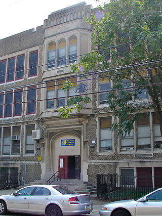
Belmont District is a defunct district that existed briefly in Philadelphia County, Pennsylvania, United States. The district was created on April 14, 1853 from northern Blockley Township ceased to exist and on February 2, 1854 the district was incorporated into the City of Philadelphia following the passage of the Act of Consolidation, 1854.
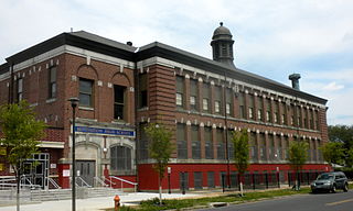
Elmwood Park, also known simply as Elmwood, is a neighborhood in the Southwest section of Philadelphia, Pennsylvania, United States. It borders the city line with Delaware County at Cobbs Creek, and extends to the Schuylkill River. The Eastwick neighborhood borders it to the southwest, and Kingsessing borders it on the northeast.

The Philadelphia Quartermaster Depot, now known as the Defense Logistics Agency Troop Support, was founded as the Schuylkill Arsenal in 1799.

Bartram Village is a small neighborhood in Southwest Philadelphia, Pennsylvania, United States. It is located in the vicinity of South 56th Street and Lindbergh Boulevard.

Fairmount Rowing Association is an amateur rowing club, founded in 1877. The facility, located at #2 Boathouse Row in the historic Boathouse Row of Philadelphia, Pennsylvania, is on the National Register of Historic Places. Fairmount originally catered to blue-collar youths living in the Fairmount neighborhood. In 1916, after decades of being rejected, the club was finally allowed to join the Schuylkill Navy. The Club boasts being known as the "premiere club for Masters rowing in the mid-Atlantic region" and has produced several world class rowers.

The Marine Corps Depot of Supplies, Schuylkill Warehouse was an historic, American warehouse that was located in the Schuylkill neighborhood of Philadelphia, Pennsylvania. The structure was demolished in 2015 to make way for the Children's Hospital of Philadelphia expansion.

The Hardy Williams Academy, formerly the Anna Howard Shaw Junior High School is an historic junior high school building which is located in the Southwest Schuylkill neighborhood of Philadelphia, Pennsylvania.
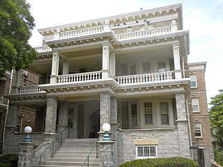
Regent-Rennoc Court is an historic, American apartment complex that is located in the Southwest Schuylkill neighborhood of Philadelphia, Pennsylvania.

Girard Avenue is a major commercial and residential street in Philadelphia, Pennsylvania. For most of its length it runs east–west, but at Frankford Avenue it makes a 135-degree turn north. Parts of the road are signed as U.S. Route 13 and U.S. Route 30.


