Isle of Palms, South Carolina | |
---|---|
Coordinates: 32°47′24″N79°47′2″W / 32.79000°N 79.78389°W | |
Country | United States |
State | South Carolina |
County | Charleston |
Incorporated | 1938 (town), 1957 (city) |
Government | |
• Leader = Stewart H Garrett Mayor | Jimmy Carroll |
Area | |
• Total | 5.44 sq mi (14.08 km2) |
• Land | 4.44 sq mi (11.49 km2) |
• Water | 1.00 sq mi (2.59 km2) |
Elevation | 11 ft (3 m) |
Population | |
• Total | 4,347 |
• Density | 979.94/sq mi (378.36/km2) |
Time zone | UTC−5 (EST) |
• Summer (DST) | UTC−4 (EDT) |
ZIP code | 29451 |
Area code | 843, 854 |
FIPS code | 45-36115 [3] |
GNIS feature ID | 1227790 [4] |
Website | www |
Isle of Palms is a city in Charleston County, South Carolina, United States. At the 2010 census, the population was 4,133. [5] Isle of Palms is a barrier island on the South Carolina coast. The city is included within the Charleston-North Charleston-Summerville metropolitan area and the Charleston-North Charleston Urbanized Area. The town lies along a narrow strip of land, hugging the beach, separated from the mainland by the Intracoastal Waterway. It is a community of both vacation home owners and year-round residents, with large beachfront homes, resorts, and local restaurants. Beach volleyball is popular in the summer, and the "Windjammer" club hosts several tournaments throughout the year.
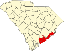
Isle of Palms is located along the Atlantic Ocean, 15 miles (24 km) by road east of downtown Charleston. According to the United States Census Bureau, the city of Isle of Palms has a total area of 5.4 square miles (14.1 km2), of which 4.4 square miles (11.5 km2) is land, and 1.0 square mile (2.6 km2) (18.40%) is water. [5]
Census | Pop. | Note | %± |
---|---|---|---|
1960 | 1,186 | — | |
1970 | 2,657 | 124.0% | |
1980 | 3,421 | 28.8% | |
1990 | 3,680 | 7.6% | |
2000 | 4,583 | 24.5% | |
2010 | 4,133 | −9.8% | |
2020 | 4,347 | 5.2% | |
U.S. Decennial Census [6] [2] |
Race | Num. | Perc. |
---|---|---|
White (non-Hispanic) | 4,085 | 93.97% |
Black or African American (non-Hispanic) | 12 | 0.28% |
Native American | 2 | 0.05% |
Asian | 35 | 0.81% |
Pacific Islander | 2 | 0.05% |
Other/Mixed | 118 | 2.71% |
Hispanic or Latino | 93 | 2.14% |
As of the 2020 United States census, there were 4,347 people, 1,799 households, and 1,325 families residing in the city.
As of the census [3] of 2010, there were 4,133 people living in the city. The population density was 743.6 inhabitants per square mile (287.1/km2). There were 4,274 housing units at an average density of 868.7 per square mile (335.4/km2). The racial makeup of the city was 97.65% White, 1.06% Hispanic or Latino, 0.56% African American, 0.75% Asian, 0.15% Native American, 0.17% from other races, and 0.73% from two or more races.
There were 1,828 households, of which 20.1% had children under the age of 18 living with them, 62.4% were married couples living together, 6.4% had a female householder with no husband present, and 28.8% were non-families. 20.9% of all households were made up of individuals, and 7.5% had someone living alone who was 65 years of age or older. The average household size was 2.26 and the average family size was 2.66.
The city population was spread out, with 17.0% under the age of 18, 3.2% from 18 to 24, 23.8% from 25 to 49, 31.8% from 50 to 64, and 22.6% who were 65 years of age or older. The median age was 47. For every 100 females, there were 98 males.
The median income for a household in the city was $76,170, and the median income for a family was $88,874. Males had a median income of $60,640 versus $37,500 for females. The per capita income for the city was $44,221. About 1.7% of families and 3.4% of the population were below the poverty line, including 4.3% of those under age 18 and 1.0% of those age 65 or over.
The city is run by an elected Mayor-council government system.
Phillip Pounds
Randy Bell, Ryan L. Buckhannon, Jimmy Carroll (Mayor), John Moye, Kevin Popson, Phillip Pounds, Rusty Streetman, Susan Hill Smith, Jimmy Ward. [8]
The island's original inhabitants were the Sewee tribe.
During the Civil War, the Confederate submarine H.L. Hunley departed from Breach Inlet, between Isle of Palms and neighboring Sullivan's Island.
In the late nineteenth century, local residents began using the island as a vacation spot. At that time it was only accessible by ferry. It was bought by J.S. Lawrence in 1899, who gave the island its current name; before then it was known as "Hunting Island" or "Long Island". A 50-room hotel was built in 1906. In 1912, James Sottile had a beach pavilion and an amusement park built, and a trolley line was constructed from Mount Pleasant on the mainland to Isle of Palms via Sullivan's Island. In 1929, Grace Memorial Bridge was built between Charleston and Mount Pleasant to allow automobile traffic to reach the island.
Large-scale residential development began when J.C. Long bought up most of the island and built low-cost housing for World War II veterans. In 1975, the Sea Pines Company (of Hilton Head Island fame) established the 900-acre (360 ha) development now known as the Wild Dunes Beach and Racquet Club.
E. Lee Spence, a pioneer underwater archaeologist and prolific author of books and articles about shipwrecks and sunken treasure, discovered, with the help of Isle of Palms residents Wally Shaffer and George Campsen, many shipwrecks along the shores of the Isle of Palms in the 1960s. Their discoveries included the Civil War blockade runners Rattlesnake , Stonewall Jackson , Mary Bowers , Constance , Norseman and the Georgiana . The iron-hulled steamer Georgiana, which was sunk on her maiden voyage, was described in contemporary documents as pierced for 14 guns and more powerful than the famous Confederate cruiser Alabama . These historic discoveries resulted in the passage of South Carolina's Underwater Antiquities Act allowing the archaeological salvage of shipwrecks.
During Hurricane Hugo, which struck September 21, 1989, much of the island was flooded by the storm surge.
The northeastern end of the Isle of Palms, home to Wild Dunes private community, endured a severe erosion crisis when a shoal caused sand to wash away from the foundation of a large condominium building. The city undertook a controversial beach restoration project in the spring and summer of 2008 [9] which replenished the beach with dredged sand and saved the threatened structures.
In February 2019, it was reported that the city's police force was undergoing a crisis following several resignations. [10]
On April 7, 2023, 6 people were injured in a mass shooting. [11]
The Charleston County Park and Recreation Commission (CCPRC) [12] operates numerous facilities within Charleston County including Isle of Palms County Park.
Marinas and boat landings:
Georgetown County is a county located in the U.S. state of South Carolina. As of the 2020 census, the population was 63,404. Its county seat is Georgetown. The county was founded in 1769. It is named for George III of the United Kingdom.
Colleton County is in the Lowcountry region of the U.S. state of South Carolina. As of the 2020 census, the population was 38,604. Its county seat is Walterboro. The county is named after Sir John Colleton, 1st Baronet, one of the eight Lords Proprietor of the Province of Carolina. After two previous incarnations, the current Colleton County was created in 1800.
Charleston County is located in the U.S. state of South Carolina along the Atlantic coast. As of the 2020 census, the population was 408,235, making it the third most populous county in South Carolina. Its county seat is Charleston. It is also the largest county in the state by total area, although Horry County has a larger land area. The county was created in 1800 by an act of the South Carolina State Legislature.
Berkeley County is a county in the U.S. state of South Carolina. As of the 2020 census, its population was 229,861. Its county seat is Moncks Corner, and the largest community is Goose Creek. After two previous incarnations of Berkeley County, the current county was created in 1882. Berkeley County is included in the Charleston-North Charleston, SC Metropolitan Statistical Area.
Golden Beach is a town in Miami-Dade County, Florida, United States, between the Intracoastal Waterway and Atlantic Ocean. The town is part of the Miami metropolitan area of South Florida. As of the 2020 US census, the town had a population of 961.
Highland Beach is a town in Palm Beach County, Florida, United States. It is part of the Miami metropolitan area of South Florida, and situated 50 miles north of Miami and 28 miles south of Palm Beach. As of the 2020 US census, the population was 4,295.
Palm Beach Shores is a town in Palm Beach County, Florida, United States. The town is part of the Miami metropolitan area of South Florida. The population was 1,330 at the 2020 US census.
Indian Rocks Beach, or IRB, is a city in Pinellas County, Florida, United States. Indian Rocks Beach is part of the Tampa-St. Petersburg-Clearwater, FL Metropolitan Statistical Area. Located on the barrier island Sand Key, it has over two miles of beach along the Gulf of Mexico, with 26 public beach accesses. Tourism is its primary industry. It was incorporated in 1956. The population was 3,673 at the 2020 census.
Treasure Island is a city in Pinellas County, Florida, United States. It is situated on a barrier island in the Gulf of Mexico. As of the 2020 census, the city population was 6,584.
Presque Isle Township is a civil township of Presque Isle County in the U.S. state of Michigan. The population was 1,656 at the 2010 census.
Ocean Isle Beach is a small seaside town in Brunswick County, North Carolina, United States. It was incorporated as a town in 1959 and is part of the Wilmington, NC Metropolitan Statistical Area. The population was 867 at the 2020 census. Located at the southern end of North Carolina's Atlantic coastline, along the Atlantic Intracoastal Waterway, Ocean Isle Beach has private homes, seasonal rentals, and tourist attractions.
Emerald Isle is a town in Carteret County, North Carolina, United States. It is part of the Crystal Coast and is located entirely on Bogue Banks. The population was 3,847 at the 2020 census, but as many as 50,000 tourists each week inhabit the area during the summer season, filling up vacant rental properties that do not count toward official census results.
Indian Beach is a town in Carteret County, North Carolina, United States. The population was 223 as of the 2020 census.
Carolina Beach is a beach town in New Hanover County, North Carolina, United States, situated about 12 miles (19 km) south of Wilmington International Airport in southeastern coastal North Carolina. As of the 2020 census, the city population was 6,564. It is part of the Wilmington metropolitan area. The community of Wilmington Beach was annexed by the town in 2000.
Folly Beach is a public city on Folly Island in Charleston County, South Carolina, United States. The population was 2,617 at the 2010 census, up from 2,116 in 2000. Folly Beach is within the Charleston-North Charleston-Summerville metropolitan area and the Charleston-North Charleston Urbanized Areas.
Kiawah is a sea island, or barrier island, on the Atlantic coast of the United States. Located 25 miles (40 km) southwest of Charleston in Charleston County, South Carolina, it is primarily a private beach and golf resort. It is home to the Kiawah Island Golf Resort, with spacious villas, beaches, large and acclaimed golf courses, and other attractions. As of the 2010 census, Kiawah Island's population was 1,626, up from 1,163 at the 2000 census. The island is part of the Charleston-North Charleston-Summerville metropolitan area. Alternative spellings and variants of the name itself include "Kiawa", "Kittiwar", and "Kittiwah". Census Tract 21.04, located on the island, has a per capita income of $168,369, the highest in South Carolina.
Rockville is a town in Charleston County, South Carolina, United States, that was founded in 1784. The population was 134 at the 2010 census. Rockville is part of the Charleston-North Charleston-Summerville metropolitan area.
Seabrook Island, formerly known as Simmons Island, is a barrier island in Charleston County, South Carolina, United States. The population was 1,714 at the 2010 census, up from 1,250 in 2000.
Edisto Beach is a town in Colleton County, South Carolina, United States. Edisto Beach's population was 414 as of the 2010 census, down from 641 in 2000. The town limits include only the developed coastal area of Edisto Island within Colleton County, while the majority of the island consists of unincorporated land in Charleston County. Due to its status as a bedroom community, Edisto Beach is among the most affluent communities in the state.
Ladson is a census-designated place (CDP) in Berkeley, Charleston and Dorchester counties in the U.S. state of South Carolina. The population was 13,790 at the 2010 census. It is named in honor of the Ladson family, one of the oldest planter and merchant families in the Charleston area; one of its members was lieutenant governor James Ladson.