
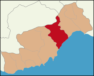
Denizli Province is a province of Turkey in Western Anatolia, on high ground above the Aegean coast. Neighbouring provinces are Uşak to the north, Burdur, Isparta, Afyon to the east, Aydın, Manisa to the west and Muğla to the south. It is located between the coordinates 28° 30’ and 29° 30’ E and 37° 12’ and 38° 12’ N. It covers an area of 11,868 km2, and the population is 931,823. The population was 750,882 in 1990. The provincial capital is the city of Denizli.

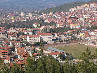
Denizli is an industrial city in the southwestern part of Turkey and the eastern end of the alluvial valley formed by the river Büyük Menderes, where the plain reaches an elevation of about three hundred and fifty metres (1,148 ft). Denizli is located in the country's Aegean Region.
Tokat Province is a province in northern Turkey. Its adjacent provinces are Amasya to the northwest, Yozgat to the southwest, Sivas to the southeast, and Ordu to the northeast. Its capital is Tokat, which lies inland of the middle Black Sea region, 422 kilometers from Ankara.

Nevşehir is a city in the Central Anatolia Region of Turkey. It is the seat of Nevşehir Province and Nevşehir District. Its population is 123,882 (2022). It is 290 km (180 mi) from the capital Ankara and lies within the historical region of Cappadocia.

Beyşehir is a large town and district of the Konya Province in the Akdeniz region of Turkey. The town is located on the southeastern shore of Lake Beyşehir and is marked to the west and the southwest by the steep lines and forests of the Taurus Mountains, while a fertile plain, an extension of the lake area, extends in the southeastern direction. According to the 2000 census, the population of the district was 118,144, of which 41,312 lived in the town of Beyşehir.

Bozyazı is a town and district of Mersin Province on the Mediterranean coast of Turkey, 220 km (137 mi) west of the city of Mersin.
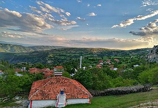
Çal is a town and a district of Denizli Province in the inner Aegean region of Turkey. Çal district area occupies a central position in the northern part of its province and neighbors the central district of Denizli to the south-west and the district areas of Güney to the west and Honaz to the south. To the east of Çal district lies clockwise the districts of Bekilli, Çivril and Baklan.

Çamlıyayla is a town and district of Mersin Province in the Mediterranean region of Turkey. The district has a population of 10,558 of which 3335 lives in the town of Çamlıyayla.
Çivril is a town and district of Denizli Province in the inner Aegean region of Turkey. Çivril district area neighbors those of two districts of Uşak Province to its north, namely Sivaslı and Karahallı, and four districts of Afyonkarahisar Province from the north-east to the south which are, clockwise, Sandıklı, Dinar, Dazkırı and Dazkırı, and to its south-west, three districts of the same province as itself depending Denizli. These last three are Bekilli, Çal and Baklan.
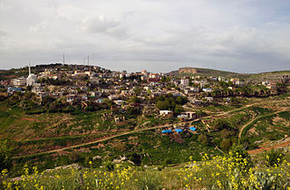
Eğil is a town and district of Diyarbakır Province of Turkey. As of 2018, the district's population is 23,369. The elected mayor Mustafa Akkul of the Peoples' Democratic Party (HDP) was dismissed on the 23 March 2020 and replaced by a trustee. The current Kaymakam is İdris Arslan.
Erdemli is a town and district of Mersin Province in the Mediterranean region of Turkey, 35 km (22 mi) west of the city of Mersin.

Honaz is a town and a district of Denizli Province in the Aegean Region, also known as Khonaz or Cadmus. It covers an area of 504 km2 (195 sq mi). The population was 9,830 and 30,530.

Sarayköy is a town and district of Denizli Province in Turkey, 20 km west of the city of Denizli, on a plain between mountains and watered by Büyük Menderes River. The area is around 470 km², and the population (2010) is 29,854 of which 18,510 live in the town of Sarayköy, and the rest in surrounding villages.
Serinhisar is a town and district of Denizli Province of Turkey.
Tavas is a town and a district of Denizli Province of Turkey, on a wide plain on the road to Muğla, near to the district of Kale. Population is around 12,720
Baklan is a town and a district of Denizli Province, in Turkey's Aegean Region. The town is at a distance of about an hour from the city of Denizli, neighboring the town of Çivril, and it is situated on the road to Ankara.

Bozkurt is a town and a rural district of Denizli Province in the Aegean Region of Turkey. The town is situated on a plain 52 km (32 mi) east of the city of Denizli. The altitude of the town is 866.8 m, and the district area is around 400 km2 (150 sq mi). The population is 11,738 of which 4,589 live in the small town of Bozkurt itself. It is quite close to the Lake Acıgöl and the neighboring town of Çardak and İnceler Kasabası

Buldan is a town and a district of Denizli Province in the inner Aegean Region of Turkey. Buldan district area neighbors to the east and the south three other districts of the same province, namely Güney, Akköy and Sarayköy, and to the west by the areas of three districts of Aydın Province, Buharkent, Kuyucak and Karacasu, and to the northwest by Sarıgöl district of Manisa Province.

Çardak is a town and a district of Denizli Province of Turkey. It is situated on the road from Denizli to Ankara near the banks of the Lake Acıgöl.
Tabae or Tabai was a city in ancient Caria, although, according to Strabo it was located in a plain in Phrygia on the boundaries of Caria. The place is now Tavas, near Kale, Denizli in Turkey; some inscriptions and numerous ancient remains have been found.


