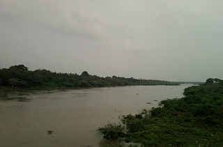
Shivdaspur is a census town and a red light district in Varanasi in eastern Uttar Pradesh in India. It resides on periphery of Varanasi city, surrounded by Lahartara, Manduadih.

Kachhwa is a town and a nagar panchayat in Mirzapur district in the Indian state of Uttar Pradesh.
Khekada is an NCR City and sub-district headquarters of Baghpat district in the Indian state of Uttar Pradesh.

Kotwa is a census town in Varanasi district in the Indian state of Uttar Pradesh.

Lohta is a census town in Varanasi district in the Indian state of Uttar Pradesh.

Mangawan is a town and a nagar panchayat in Rewa district in the Indian state of Madhya Pradesh. It is 30 km (19 mi) from the District headquarters of Rewa. NH 7 and NH 27 goes through Mangawan. Allahabad is 96 km (60 mi) on NH 27 and Varanasi is 220 km (140 mi) on NH 7.

Mukundgarh is a city and a municipality in Jhunjhunu district in the Indian state of Rajasthan.It is part of Shekhawati region. It lies a few kilometres from Nawalgarh.
Northern Railway Colony is a census town in Kanpur Nagar district in the Indian state of Uttar Pradesh.
Oel Dhakwa is a town and a nagar panchayat in Lakhimpur Kheri district in the Indian state of Uttar Pradesh.
Paintepur is a town and a Nagar panchayat in Sitapur district in the Indian state of Uttar Pradesh.The current Chairman of Nagar Panchayat is Mohammed Afzal.

Phulpur is a town and a nagar panchayat in Azamgarh district in the Indian state of Uttar Pradesh.

Phulwaria is a census town in Varanasi district in the Indian state of Uttar Pradesh.
Salarpur Khadar is a census town in Gautam Buddha Nagar district in the Indian state of Uttar Pradesh.

Salur or Saluru is a municipal town and mandal headquarters in Vizianagaram district, of the Indian state of Andhra Pradesh.
Siddharthnagar is a city and a Municipal board in Siddharthnagar district in the Indian state of Uttar Pradesh. Siddharthnagar is also known as Tetri Bazar.

Gangachara is an upazila of Rangpur District in the Division of Rangpur, Bangladesh.

Ramnagar is a city and a municipal board in Varanasi district in the Indian state of Uttar Pradesh. Ramnagar has a fort known as Ramnagar Fort which is still the residence of King of Varanasi (Benares). He was known as Kashi Naresh meaning king of Kashi and is still regarded by old residents of the city of Varanasi. Ramnagar Fort and its museum are the repository of the history of the kings of Benares and since the 18th century has been the home of Kashi Naresh. Even today the Kashi Naresh is deeply revered by the people of Benares. He is the religious head and the people of Benares consider him the incarnation of Shiva. He is also the chief cultural patron and an essential part of all religious celebrations. Ramnagar is popular for Ramlila that is held annually under the aegis of King of Varanasi

Saidpur is a town and a nagar panchayat in the Ghazipur district of the Indian state of Uttar Pradesh with the pin code 233304.The nearest railway station is in Aunrihar Jn. Aunrihar is a main hub for travelling, business, politicians and the site of the Temple of Varah-Bhagwan.

Gangapur is a town and a nagar panchayat in Varanasi district in the state of Uttar Pradesh, India.

Badlapur is an administrative division in Jaunpur District in the Indian state of Uttar Pradesh. It was accorded the status of Town Area Nagar Panchayat on 27 June 2014.


