
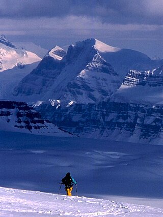
Mount Assiniboine, also known as Assiniboine Mountain, is a pyramidal peak mountain on the Great Divide, on the British Columbia/Alberta border in Canada.

Mount Columbia is a mountain located in the Winston Churchill Range of the Rocky Mountains. It is the highest point in Alberta, Canada, and is second only to Mount Robson for height and topographical prominence in the Canadian Rockies. It is located on the border between Alberta and British Columbia on the northern edge of the Columbia Icefield. Its highest point, however, lies within Jasper National Park in Alberta.

Mount Bryce is a mountain at the southwestern corner of the Columbia Icefield, in British Columbia, Canada, near the border with Alberta. It can be seen from the Icefields Parkway.

Lynx Mountain is a mountain peak in the Canadian Rockies. It is located on the Continental Divide between the provinces of Alberta and British Columbia, in the Cushina Ridge of the Continental Ranges. It was named by Lucius Quincy Coleman for the remains of a lynx they found on the ice of the nearby Coleman Glacier in 1908.
Treadmill Ridge is a mountain ridge located at the northern end of Mount Robson Provincial Park, on the Alberta/British Columbia border. It is Alberta's 98th most prominent mountain. It was named in 1923 by Arthur O. Wheele who believed that the mountain resembled a treadmill.
Tatei Ridge is a mountain ridge east of Berg Lake at the northern end of Mount Robson Provincial Park on the Continental Divide marking the Alberta-British Columbia border. It was named in 1912 by Charles D. Walcott as tatei is the Stoney language word for "wind".
Younghusband Ridge is located east of Wood Arm Kinbasket Lake and straddles the Continental Divide marking the Alberta-British Columbia border. It was named in 1927 by Alfred J. Ostheimer after Lt. Col. Sir Francis Younghusband.
Farbus Mountain is located on the provincial border of Alberta and British Columbia in Banff National Park. It was named in 1918 after Farbus, a village on the eastern slopes of Vimy Ridge in France.In the Battle of Vimy Ridge, Canadian troops retook Farbus from German control on April 9, 1917 as part of securing the Brown Line objective.

Aiguille Peak is a peak located on the Canadian provincial boundary of Alberta and British Columbia in Banff National Park. It was named in 1915 by Arthur O. Wheeler. "Aiguille" is French for "needle" and is also a mountaineering term for a sharp-ridged summit.
Mount Barlow is located on the Continental Divide along the border of Alberta and British Columbia at the southern edge of the Freshfield Icefield in Banff National Park. It was named in 1916 by D.B. Dowling after Dr. Alfred Ernest Barlow, a cartographer with the Geological Survey of Canada who died in the 1914 Empress of Ireland disaster.

Wenkchemna Peak is located on the SE ridge coming off of Mount Hungabee on the border of Alberta and British Columbia. It was named in 1894 by Samuel E. S. Allen for the Stoney Indian word for ten.
Mount Armstrong is a mountain located on the Canadian provincial boundary between Alberta and British Columbia on the Continental Divide. It was named in 1918 after John Douglas Armstrong, a lieutenant with the Canadian Engineers who was killed in action on April 9, 1917, at Vimy Ridge World War I.
Allison Peak is located on the Canadian provincial boundary of Alberta and British Columbia along the Continental Divide. It was named in 1915 by Morrison P. Bridgland after Douglas Allison. Douglas Allison was a law enforcement agent.
Hollebeke Mountain is located on the border of Alberta and British Columbia on the Continental Divide. It was named in 1917 after Hollebeke, a village in Belgium.

Mount Haig is located on the border of Alberta and British Columbia on the Continental Divide. It was named in 1862 after Haig, Captain R.W. Mount Haig is the highest peak of Gravenstafel Ridge; its lower north and east faces feature as back country cat skiing for Castle Mountain Resort on neighbouring Gravenstafel Mountain.
Rainy Ridge is located on the border of Alberta and British Columbia on the Continental Divide. It was named in 1958 origin of the name is unknown.
Three Lakes Ridge is located on the border of Alberta and British Columbia on the Continental Divide. It was named by the Interprovincial Boundary Survey.
Scarpe Mountain is located at the head of Commerce Creek and straddles the Continental Divide marking the Alberta-British Columbia border. It was named after the Scarpe River in France.
La Coulotte Ridge is a mountain ridge which straddles the Continental Divide marking the Alberta-British Columbia border. It was named after La Coulotte in France.


