Ladywood Estates | |
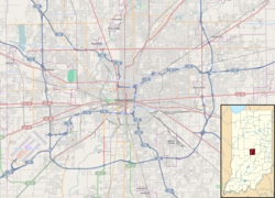   | |
| Location | Roughly bounded by the 5200 blk. of Emerson Way, Ladywood Dr. & the hill west of Nob Ln., Indianapolis, Indiana |
|---|---|
| Coordinates | 39°50′55″N86°5′11″W / 39.84861°N 86.08639°W |
| Area | approx. 10 acres (4.0 ha) |
| Built | 1967 |
| Architect | Avriel Shull |
| Architectural style | Mid-century modern |
| NRHP reference No. | 100004728 [1] |
| Added to NRHP | December 2, 2019 |
Ladywood Estates is a historic district in Indianapolis, Indiana. Built in 1967, it consists of 14 contributing multi-family residential buildings, 16 contributing garage buildings, and one contributing object. [2] Originally planned as apartments, the residential buildings vary in size and number of units. All structures maintain a mid-century modern design relating to the community's post-war era development. The buildings are limestone, brick, and wood siding, with post-and-beam construction typical of mid-century modern open design. [2]
The community was planned by lawyer and developer Fredrick J. Capp, who purchased the land in 1965. Capp employed architectural designer Avriel Shull to design it. [2]
It was listed as a historic district on the National Register of Historic Places in 2019. [1]
