Sri Ganganagar is the northernmost city of the Indian state of Rajasthan, near the international border of India and Pakistan. It is the administrative headquarters of Sri Ganganagar district. It is named after Maharaja Shri Ganga Singh Bahadur, Maharaja of Bikaner. The city is also known as the "Food Basket of Rajasthan".

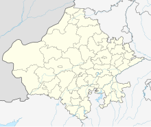
Sri Ganganagar district is the northernmost district of Rajasthan state of India.

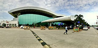
Jaipur International Airport is an international airport serving Jaipur, the capital of Rajasthan. It is located in the southern suburb of Sanganer, which is located 13 km (8.1 mi) from Jaipur. It is the 13th busiest airport in India in daily scheduled flight operations.

Maharana Pratap Airport is a domestic airport serving Udaipur, Rajasthan, India. It is situated at Dabok, located 22 km east of Udaipur. The airport is named after Maharana Pratap who was a Maharana (ruler) of the princely state of Mewar, in north-western India.

Anupgarh is a town in the state of Rajasthan in India. It is administrative headquarters of the Anupgarh district, which was formed on 17 March 2023.

Bilasa Devi Kevat Airport, also known as Bilaspur Airport, is a domestic airport serving the city of Bilaspur, Chhattisgarh, India. It is located at Chakarbhata, 10 km (6.2 mi) south from the city centre. The airport made by the Royal Indian Air Force in 1942, making it the first and oldest airport of Chhattisgarh. It is owned by the Airports Authority of India. In 1980s, the airport was used by Vayudoot to provide flights to Bhopal, Nagpur, Mumbai and Delhi. Currently, commercial scheduled flights are operated by Alliance Air to Bhopal, Delhi, Jabalpur and Prayagraj. It is named after Bilasa Bai Kevtin, a renowned 16th-century personality known for her bravery and courage to fight against difficult situations, who belonged to a fishermen tribe residing near the Arpa River.
Birsa Munda Airport is a domestic airport serving Ranchi, the capital city of Jharkhand, India. It is named after the famous Indian tribal freedom fighter, Birsa Munda, and is currently managed by the Airports Authority of India. The airport is located in Hinoo, approximately 5 km (3.1 mi) from the city center. The airport sprawls over an area of 1,568 acres. The airport is used by more than 2.5 million passengers annually and is the 28th busiest airport in India.

Agatti Airport is a regional airport serving the union territory of Lakshadweep, India. It is located at the southern end of Agatti Island, and is the sole airstrip in the archipelago, which lies off the west coast of mainland India.
X Corps is a corps of the Indian Army. It is based in Bathinda and is a part of South Western Command.
Sri Gurusar Modia is a village in the Indian state of Rajasthan situated near borders of Rajasthan, Haryana and Punjab states and the international border of India and Pakistan. This village is located in the tehsil Suratgarh of district Sri Ganganagar. Suratgarh, once known as Sodhal was believed to be surrounded by the confluence of Saraswati and Drishyati rivers but now the land is a deserted one lying amidst the expanse of The great Indian Thar desert. Suratgarh is famous for its agriculture, air force and army base stations, largest thermal power plant of Rajasthan and largest radio station of Rajasthan called as "Cotton City Channel". Sri Gurusar Modia came into limelight when a controversial self-proclaimed saint and spiritual leader Gurmeet Ram Rahim Singh was believed to be incarnated there and crowned to the throne of Dera Sacha Sauda at Sirsa in 1990. With setting up of Shah Satnam Schools for both boys and girls, super speciality hospitals etc. this village became nationwide popular

Sansha Yongxing Airport is a civilian-military dual-use airport located on Yongxing Island, the largest of the disputed Paracel Islands in the South China Sea. Yongxing/Woody Island is occupied and administered by China (PRC) as the seat of Sansha city of Hainan Province. The airport was expanded in 1990 to increase the combat range of Chinese warplanes. Further construction and reclamation of land commenced in 2012 to lengthen the airstrip. This work was completed in October 2014.
Lalgarh Jattan is a municipality located in India, in the district of Sri Ganganagar and state Rajasthan. According to the 2011 total population calculation of 8LLG, Lalgarh has the highest population in the district of Sri Ganganagar, with a total of 11,361 residents and 2,380 homes. Lalgarh's 2010 total vote calculation was 8500, and the village's total female population is 2,300.
Lalgarh Junction railway station is a main railway station in Bikaner district, Rajasthan. Its code is LGH. It serves the northern part of Bikaner city. The station consists of three platforms. The platforms are not well sheltered. It lacks many facilities including water and sanitation.
Civil Aviation Department, Haryana is a Ministry and department of the Government of Haryana in India.
Narnaul Airport, also Bachhod Airstrip, is an airstrip adjacent to Bhilwara village 10 km east of Narnaul city in the Indian state of Haryana. The airstrip is used mainly by Rajiv Gandhi National Centre for Aero Sports, which was inaugurated in 2010. The airstrip is owned by the Civil Aviation Department of Haryana government. Its ICAO code is VINL as listed in India AIP May 2023.
Kolana Airport is an airport serving Jhalawar in the state of Rajasthan, India. It is owned and operated by the State Government of Rajasthan. The airport is spread over 23.5 acres, has a 1710 metre long runway and a 2340 square metre apron for two small aircraft. The terminal building covers 466 Square metres.

Supreme Airlines was a private non-scheduled airline, with bases in Jaipur and Ahmedabad. It operated 18 daily flights between 11 cities under an agreement with the State Govt of Rajasthan. Between 4th October 2016 and 7th August 2018, Supreme Airlines hauled 20,625 passengers in 4,167 flights, with 2,000+ tones of cargo. Supreme Airlines has sued the Ministry of Civil Aviation, D.G.C.A. and Airports Authority of India for Rs. 40+ Crores.
National Highway 911, commonly referred to as NH 911 is a national highway in India. It is a spur road of National Highway 11. NH-911 runs in the state of Rajasthan in India. The route of national highway 911 was further extended to Sri Ganganagar in Rajasthan.
The Suratgarh–Bathinda line or Suratgarh–Shri Ganganagar–Bathinda line is a railway route on the North Western Railway zone and Northern Railway zone of Indian Railways. This route plays an important role in rail transportation of Bikaner division of Rajasthan state and Fazilka district, Sri Muktsar Sahib district and Bathinda district of Punjab.
The Shri Ganganagar–Sadulpur line or Sri Ganganagar–Hanumangarh–Ellenabad–Sadulpur line is a railway route on the North Western Railway zone of Indian Railways. This route plays an important role in rail transportation of Bikaner division of Rajasthan state and Ellenabad portion of Sirsa district of Haryana.