Air Force Base Hoedspruit is an airbase of the South African Air Force. It is located adjacent to the Kruger National Park. In the late 1990s an unused portion of the base was converted into a civilian airport known as Eastgate Airport. It was also an emergency landing site for the Space Shuttle.
Araria is a city and a municipality that is the headquarters of Araria district in the Indian state of Bihar. Araria is situated in the northern part of Bihar.
Katihar is a city situated in the eastern part of the state of Bihar in India. It is the headquarters of Katihar district and Katihar railway division. It is one of the important cities of Bihar. It is also a main stop on the Barauni–Guwahati line.
Madhepura is a municipality in Madhepura district in the Indian state of Bihar. It stands at the centre of Kosi ravine, It was called Madhyapura- a place centrally situated which was subsequently transformed as Madhipura into present Madhepura. It is surrounded by Araria and Supaul districts in the north, Khagaria and Bhagalpur districts in the south, Purnia district in the east and Saharsa district in the West.

Purnia is the fourth largest city of Bihar and is emerging as the largest economic hub in North Bihar. It serves as the administrative headquarters of both Purnia district and Purnia division in the Indian state of Bihar. It is well known for its favourable climate like Darjeeling and has an abundance of resources for human settlements and economic activities.
Supaul is a town and a municipality that is headquarters of Supaul district in the Indian state of Bihar. Supaul is the administrative headquarters of this district. There Are 11 block under the Supaul district Supaul, Kishanpur, Saraigarh-Bhaptiyahi, Pipra, Triveniganj, Raghopur, chhatapur, Nirmali, Marauna, Basantpur and pratapganj.

Jay Prakash Narayan Airport is an domestic airport serving Patna, the capital of Bihar, India. It is named after the independence activist and political leader, Jayprakash Narayan. It is the 15th busiest airport in India. To meet demand, the Airports Authority of India (AAI) is working to expand and modernise airport infrastructure. The airport is currently undergoing an ambitious expansion project that includes a new two-level passenger terminal, which will be completed by May 2024. Patna Airport is enabled with Digi Yatra facility from July 2024, passengers traveling from Patna Airport can avail it for seamless check-in experience and save their time.

Forbesganj is a city with municipality in the Araria District in the state of Bihar, India, situated at the border of Nepal.

Gaya International Airport is an international airport serving Gaya, Bihar, India. It is located 12 km (7.5 mi) south-west of Gaya and 5 km (3.1 mi) from Bodh Gaya, from where Gautama Buddha attained enlightenment.

Kasba is a satellite town of Purnia city and part of Purnia Urban Agglomeration in Purnia district in the Indian state of Mithila region of Bihar.
Chunapur is a village situated 3 km west of Purnia town in the Indian state of Bihar. It is situated on the bank of Kari Kosi, a tributary of Koshi river.
This article deals with the system of transport in Bihar, both public and private.
Banmankhi is a block in Purnia district of Bihar state, India.
Sulur Air Force Station is an air base of the Indian Air Force located at Sulur near Coimbatore, Tamil Nadu and is India's second largest air base after Hindon AFS. It is the base which is responsible for protection of India's sea area. It is the only base in India which handles both fighter and transport flights at one location; no other base in India is equipped to do so. It is also the only IAF base in India to have all Departments at one location: fighters, carrier planes, carrier helicopters, attack helicopters, a repair and overhauling depot, TETTRA school, Garud Force, Air Force Hospital, Southern Command Sub Headquarters, & ECHS. It is a former Royal Navy and Indian Navy base.

INS Hansa, is an Indian naval air station located near Dabolim in Goa, India. It is India's biggest naval airbase. The military air base has a civil enclave, that operates as Dabolim Airport.
Danapur Railway Station or Danapur Junction, station code DNR, is a large railway station and headquarters of Danapur railway division of East Central Railway. Danapur is connected to metropolitan areas of India by the Delhi–Kolkata main line via Mughalsarai–Patna route. It is in Khagaul city about 6 km from Danapur Cantonment, in Patna district in the Indian state of Bihar.
Bihta is a town and Block under Danapur Tehsil in Patna district in the Indian state of Bihar. Bihta is part of Maner assembly constituency under the Pataliputra Lok Sabha. It is located around 30 km (19 mi) west of Patna. Bihta is also an upcoming satellite town of Patna. The IIT Patna is around 3.5 km (2.2 mi) from Bihta railway station.
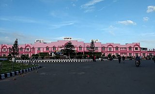
Purnea Junction railway station, is the railway station serving the city of Purnea in the Purnea district in the Indian state of Bihar. It is a A category railway station of Katihar railway division in Northeast Frontier Railway.

The Bihta Air Force Station is an Indian Air Force (IAF) base in Bihta, Bihar, India. The military airfield, lies 40 kilometres southwest of state capital Patna and is spread over an area of around 900 acres.
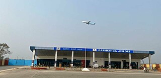
Darbhanga Airport is a domestic airport and an Indian Air Force Station, serving Darbhanga, Bihar, India. It is located just at the outskirts of the city near the NH-527B and NH-57 highways, which passes through Darbhanga. The airport is operated by the Airports Authority of India (AAI). The foundation stone for the airport was laid by the then Chief Minister of Bihar, Nitish Kumar, and the then Civil Aviation Minister, Suresh Prabhu, in the presence of the State Civil Aviation Minister, Jayant Sinha, on 24 December 2018. After efforts taken by the then Civil Aviation Minister, Hardeep Singh Puri. Commercial flights started on 8 November 2020.