List of places in Arizona (W–Z)

Last updated

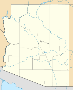
This is a list of cities, towns, unincorporated communities, counties, and other places in the U.S. state of Arizona, which start with the letters U or V. This list is derived from the Geographic Names Information System, which has numerous errors, so it also includes many ghost towns and historical places that are not necessarily communities or actual populated places. This list also includes information on the number and names of counties in which the place lies, its lower and upper ZIP code bounds, if applicable, its U.S. Geological Survey (USGS) reference number(s) (called the GNIS), class as designated by the USGS, and incorporated community located in (if applicable).
Contents

W

Name of placeNumber
of
counties
Principal
county
GNIS #(s)ClassLocated inZIP code
LowerUpper
Waddell [1] 1 Maricopa County 24677 Populated Place Surprise 85355
Wagoner [2] 1 Yavapai County 35806 Populated Place 86332
Wagon Wheel [3] 1 Navajo County 2582893 CDP
Wahak Hotrontk [4] 1 Pima County 2582894 CDP 85634
Wahweap [5] 1 Coconino County 25256 Populated Place 86040
Walapai [6] 1 Mohave County 24678 Populated Place
Walker [7] 1 Yavapai County 35817 Populated Place 86301
Wall Lane [8] 1 Yuma County 2582895 CDP 85634
Walnut Creek [9] 1 MohaveCounty 2582896 CDP 85634
Walnut Grove [10] 1 Yavapai County 35860 Populated Place 86332
Walpi [11] 1 Navajo County 24679 Populated Place First Mesa 86042
Warren [12] 1 Cochise County 13360 Populated Place Bisbee 85603
Washington Camp [13] 1 Santa Cruz County 35906 Populated Place 85624
Washington Park [14] 1 Gila County 2582897 CDP
Weedville [15] 1 Maricopa County 13436 Populated Place Peoria 85301
Wellton [16] 1 Yuma County 2413467 Civil (town) 85356
Wellton Hills [17] 1 Yuma County 2582898 CDP
Wenden [18] 1 La Paz County 2409543 CDP 85357
Wepo Village [19] 1 Navajo County 24682 Populated Place
Wet Camp Village [20] 1 Pina County 2612149 CDP 85357
Wheatfields [21] 1 Apache County 25274 Populated Place 86057
Wheatfields [22] 1 Gila County 2582899 CDP 86057
Whetstone [23] 1 Cochise County 2409579 CDP
Whispering Pines [24] 1 Gila County 2582900 CDP
Whitecone [25] 1 Navajo County 2582901 CDP 86031
White Hills [26] 1 Mohave County 2582902 CDP
White Mountain Lakes [27] 1 Navajo County 2582903 CDP
White Mountain Lakes Estates [28] 1 Navajo County 40290 Populated Place White Mountain Lake
Whiteriver [29] 1 Navajo County 2409588 CDP 85941
Why [30] 1 Pima County 2582904 CDP 85321
Wickchoupai [31] 1 Pima County 24689 Populated Place
Wickenburg [32] 1 Maricopa County 2413484 Civil (town) 85358
Wide Ruins [33] 1 Apache County 2582905 CDP 86502
Wikieup [34] 1 Mohave County 2582906 CDP 85360
Wilhoit [35] 1 Yavapai County 2409594 CDP 86332
Willcox [36] 1 Cochise County 2412266 Civil (city) 85643
Williams [37] 1 Coconino County 2412267 Civil (city) 86046
Williamson [38] 1 Yavapai County 2409597 CDP
Willow Canyon [39] 1 Pima County 2582907 CDP
Willow Springs [40] 1 Coconino County 24692 Populated Place
Willow Valley [41] 1 Mohave County 2409600 CDP
Window Rock [42] 1 Apache County 2409610 CDP 86515
Winkelman [43] 2 Gila County 2413499 Populated Place 85292
Winona [44] 1 Coconino County 36324 Populated Place 86001
Winslow [45] 1 Navajo County 2412286 Civil (city) 86047
Winslow West [46] 2 Coconino County 2409612 CDP
Wintersburg [47] 1 Maricopa County 2582908 CDP 85322
Wittmann [48] 1 Maricopa County 2582909 CDP 85361
Woodruff [49] 1 Navajo County 2582910 CDP 85942

Y

Name of placeNumber
of
counties
Principal
county
GNIS #(s)ClassLocated inZIP code
LowerUpper
Yarnell [50] 1 Yavapai County 2409635 CDP 85362
Yava [51] 1 Yavapai County 24697 Populated Place 86301
York [52] 1 Greenlee County 2582911 CDP 85534
Young [53] 1 Gila County 2409639 CDP 85554
Youngberg [54] 1 Pinal County 29401 Populated Place
Youngtown [55] 1 Maricopa County 2413523 Civil (town) 85363
Yucca [56] 1 Mohave County 2582912 CDP 86438
Yuma [57] 1 Yuma County 2412328 Civil (city) 8536469

Z

Name of placeNumber
of
counties
Principal
county
GNIS #(s)ClassLocated inZIP code
LowerUpper
Zeniff [58] 1 Navajo County 36502 Populated Place

Related Research Articles

<span class="mw-page-title-main">Anegam, Arizona</span> Populated place in Arizona, United States

Anegam (O'odham) name translates as "Desert Willow", is a populated place and census-designated place (CDP), situated on the Tohono O'odham Indian Reservation, in Pima County, Arizona, United States. Its population was 151 as of the 2010 census, and 154 as of July 1, 2015. It has an estimated elevation of 1,762 feet (537 m) above sea level.

<span class="mw-page-title-main">Wellton Hills, Arizona</span> CDP in Yuma County, Arizona

Wellton Hills is a census-designated place in Yuma County, in the U.S. state of Arizona. The population was 258 at the 2010 census.

Wheatfields is a populated place situated in Apache County, Arizona, United States, right along the border with New Mexico. It has an estimated elevation of 7,287 feet (2,221 m) above sea level. It is one of two places in Arizona with this name, the other being a CDP in Gila County. In 1909, the US Government set up an irrigation project to assist the Navajo residents. It is a chapter of the Navajo Nation.

East Village is a census-designated place (CDP) in the town of Monroe, Fairfield County, Connecticut, United States. It occupies the northeast end of the town of Monroe, extending northeast to the Housatonic River and southwest to Walnut Street. It is bordered to the southeast by the city of Shelton and to the northwest by the town of Newtown.

References

  1. "Feature Detail Report for: Waddell". Geographic Names Information System . United States Geological Survey, United States Department of the Interior.
  2. "Feature Detail Report for: Wagoner". Geographic Names Information System . United States Geological Survey, United States Department of the Interior.
  3. "Feature Detail Report for: Wagon Wheel Census Designated Place". Geographic Names Information System . United States Geological Survey, United States Department of the Interior.
  4. "Feature Detail Report for: Wahak Hotrontk Census Designated Place". Geographic Names Information System . United States Geological Survey, United States Department of the Interior.
  5. "Feature Detail Report for: Wahweap". Geographic Names Information System . United States Geological Survey, United States Department of the Interior.
  6. "Feature Detail Report for: Walapai". Geographic Names Information System . United States Geological Survey, United States Department of the Interior.
  7. "Feature Detail Report for: Walker". Geographic Names Information System . United States Geological Survey, United States Department of the Interior.
  8. "Feature Detail Report for: Wall Lane Census Designated Place". Geographic Names Information System . United States Geological Survey, United States Department of the Interior.
  9. "Feature Detail Report for: Walnut Creek Census Designated Place". Geographic Names Information System . United States Geological Survey, United States Department of the Interior.
  10. "Feature Detail Report for: Walnut Grove". Geographic Names Information System . United States Geological Survey, United States Department of the Interior.
  11. "Feature Detail Report for: Walpi". Geographic Names Information System . United States Geological Survey, United States Department of the Interior.
  12. "Feature Detail Report for: Warren". Geographic Names Information System . United States Geological Survey, United States Department of the Interior.
  13. "Feature Detail Report for: Washington Camp". Geographic Names Information System . United States Geological Survey, United States Department of the Interior.
  14. "Feature Detail Report for: Washington Park Census Designated Place". Geographic Names Information System . United States Geological Survey, United States Department of the Interior.
  15. "Feature Detail Report for: Weedville". Geographic Names Information System . United States Geological Survey, United States Department of the Interior.
  16. "Feature Detail Report for: Town of Wellton". Geographic Names Information System . United States Geological Survey, United States Department of the Interior.
  17. "Feature Detail Report for: Wellton Hills Census Designated Place". Geographic Names Information System . United States Geological Survey, United States Department of the Interior.
  18. "Feature Detail Report for: Wenden Census Designated Place". Geographic Names Information System . United States Geological Survey, United States Department of the Interior.
  19. "Feature Detail Report for: Wepo Village". Geographic Names Information System . United States Geological Survey, United States Department of the Interior.
  20. "Feature Detail Report for: Wet Camp Village Census Designated Place". Geographic Names Information System . United States Geological Survey, United States Department of the Interior.
  21. "Feature Detail Report for: Wheatfields". Geographic Names Information System . United States Geological Survey, United States Department of the Interior.
  22. "Feature Detail Report for: Wheatfields Census Designated Place". Geographic Names Information System . United States Geological Survey, United States Department of the Interior.
  23. "Feature Detail Report for: Whetstone Census Designated Place". Geographic Names Information System . United States Geological Survey, United States Department of the Interior.
  24. "Feature Detail Report for: Whispering Pines Census Designated Place". Geographic Names Information System . United States Geological Survey, United States Department of the Interior.
  25. "Feature Detail Report for: Whitecone Census Designated Place". Geographic Names Information System . United States Geological Survey, United States Department of the Interior.
  26. "Feature Detail Report for: White Hills Census Designated Place". Geographic Names Information System . United States Geological Survey, United States Department of the Interior.
  27. "Feature Detail Report for: White Mountain Lakes Census Designated Place". Geographic Names Information System . United States Geological Survey, United States Department of the Interior.
  28. "Feature Detail Report for: White Hills Mobile Home Park". Geographic Names Information System . United States Geological Survey, United States Department of the Interior.
  29. "Feature Detail Report for: Whiteriver Census Designated Place". Geographic Names Information System . United States Geological Survey, United States Department of the Interior.
  30. "Feature Detail Report for: Why Census Designated Place". Geographic Names Information System . United States Geological Survey, United States Department of the Interior.
  31. "Feature Detail Report for: Wickchoupai". Geographic Names Information System . United States Geological Survey, United States Department of the Interior.
  32. "Feature Detail Report for: Town of Wickenburg". Geographic Names Information System . United States Geological Survey, United States Department of the Interior.
  33. "Feature Detail Report for: Wide Ruins Census Designated Place". Geographic Names Information System . United States Geological Survey, United States Department of the Interior.
  34. "Feature Detail Report for: Wikieup Census Designated Place". Geographic Names Information System . United States Geological Survey, United States Department of the Interior.
  35. "Feature Detail Report for: Wilhoit Census Designated Place". Geographic Names Information System . United States Geological Survey, United States Department of the Interior.
  36. "Feature Detail Report for: City of Willcox". Geographic Names Information System . United States Geological Survey, United States Department of the Interior.
  37. "Feature Detail Report for: City of Williams". Geographic Names Information System . United States Geological Survey, United States Department of the Interior.
  38. "Feature Detail Report for: Williamson Census Designated Place". Geographic Names Information System . United States Geological Survey, United States Department of the Interior.
  39. "Feature Detail Report for: Willow Canyon Census Designated Place". Geographic Names Information System . United States Geological Survey, United States Department of the Interior.
  40. "Feature Detail Report for: Willow Springs". Geographic Names Information System . United States Geological Survey, United States Department of the Interior.
  41. "Feature Detail Report for: Willow Valley Census Designated Place". Geographic Names Information System . United States Geological Survey, United States Department of the Interior.
  42. "Feature Detail Report for: Window Rock Census Designated Place". Geographic Names Information System . United States Geological Survey, United States Department of the Interior.
  43. "Feature Detail Report for: Town of Winkelman". Geographic Names Information System . United States Geological Survey, United States Department of the Interior.
  44. "Feature Detail Report for: Winona". Geographic Names Information System . United States Geological Survey, United States Department of the Interior.
  45. "Feature Detail Report for: City of Winslow". Geographic Names Information System . United States Geological Survey, United States Department of the Interior.
  46. "Feature Detail Report for: Winslow West Census Designated Place". Geographic Names Information System . United States Geological Survey, United States Department of the Interior.
  47. "Feature Detail Report for: Wintersburg Census Designated Place". Geographic Names Information System . United States Geological Survey, United States Department of the Interior.
  48. "Feature Detail Report for: Wittmann". Geographic Names Information System . United States Geological Survey, United States Department of the Interior.
  49. "Feature Detail Report for: Woodruff". Geographic Names Information System . United States Geological Survey, United States Department of the Interior.
  50. "Feature Detail Report for: Yarnell Census Designated Place". Geographic Names Information System . United States Geological Survey, United States Department of the Interior.
  51. "Feature Detail Report for: Yava". Geographic Names Information System . United States Geological Survey, United States Department of the Interior.
  52. "Feature Detail Report for: York Census Designated Place". Geographic Names Information System . United States Geological Survey, United States Department of the Interior.
  53. "Feature Detail Report for: Young Census Designated Place". Geographic Names Information System . United States Geological Survey, United States Department of the Interior.
  54. "Feature Detail Report for: Youngberg". Geographic Names Information System . United States Geological Survey, United States Department of the Interior.
  55. "Feature Detail Report for: Town of Youngtown". Geographic Names Information System . United States Geological Survey, United States Department of the Interior.
  56. "Feature Detail Report for: Yucca Census Designated Place". Geographic Names Information System . United States Geological Survey, United States Department of the Interior.
  57. "Feature Detail Report for: City of Yuma". Geographic Names Information System . United States Geological Survey, United States Department of the Interior.
  58. "Feature Detail Report for: City of Willcox". Geographic Names Information System . United States Geological Survey, United States Department of the Interior.