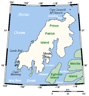
A member of the Canadian Arctic Archipelago, Prince Patrick Island is the westernmost of the Queen Elizabeth Islands in the Northwest Territories of Canada. The area of the island is 15,848 km2 (6,119 sq mi), making it the 55th largest island in the world and Canada's 14th largest island. It has historically been icebound all year, making it one of the least accessible parts of Canada.

Lot 36 is a township in Queens County, Prince Edward Island, Canada. It is part of Bedford Parish. Lot 36 was awarded to merchants George Spence and John Mill in the 1767 land lottery. It was sold to Donald MacDonald in 1775.
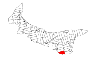
Lot 62 is a township in Queens County, Prince Edward Island, part of St. John's Parish. Lot 62 was awarded to Richard Spry, Esquire in the 1767 Land Lottery, and came to be settled through the efforts of Thomas Douglas, The 5th Earl of Selkirk in 1803. Richard Spry, Esquire, was then Commodore, Commander-in-Chief, Mediterranean Fleet at Gibraltar 1766–1769. Becoming the proprietor, he would be familiar with then the Island of St. John, having first come out to North America in 1754, with the English naval blockade of Ile Royal and the Fortress of Louisbourg in 1756, and then serving off Quebec and in the St. Lawrence into 1759. In 1762, he returned as Commander-in-Chief, North America, quartered in Halifax.

Lot 39 is a township in Kings County, Prince Edward Island, Canada. It is part of St. Patrick's Parish. Lot 39 was one of four lots awarded to the officers of the 78th Fraser Highlanders in the 1767 land lottery. Col. Thomas Dawson purchased 500 acres (2.0 km2) of land in Lot 39 on March 19, 1800, for 135 pounds, 8 shillings and 4 pence, later adding another 100 acres (0.40 km2). He emigrated from Coote Hill, County Cavan, Ireland with wife Elizabeth and six children, arriving in PEI on June 6, 1801. Col. Thomas Dawson (1762–1804) called his new property Dawson's Grove, after a Dawson family property in Ireland. He is buried at Elm Avenue Cemetery, Charlottetown, PEI.
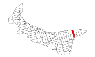
Lot 43 is a township in Kings County, Prince Edward Island, Canada. It is part of East Parish. Lot 43 was awarded to George Brydges Rodney, 1st Baron Rodney in the 1767 land lottery.

Lot 51 is a township in Kings County, Prince Edward Island, Canada. It is part of St. George's Parish. Lot 51 was awarded to John Pringle in the 1767 land lottery.

Lot 52 is a township in Kings County, Prince Edward Island, Canada. It is part of St. George's Parish. Lot 52 was awarded to Stuart, William, and Stair Douglas in the 1767 land lottery.

Lot 53 is a township in Kings County, Prince Edward Island, Canada. It is part of St. George's Parish. Lot 53 was awarded to merchant John Williams, Lieutenant George Campbell, and doctor Richard Huck in the 1767 land lottery. By 1806 the western third was owned by the Earl of Selkirk.
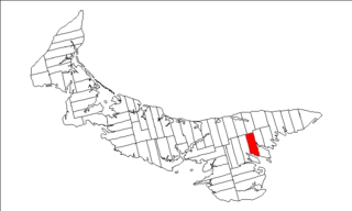
Lot 54 is a township in Kings County, Prince Edward Island, Canada. It is part of St. George's Parish. In the 1767 land lottery, Lot 54 was awarded to Robert Adair, surgeon to King George III of the United Kingdom.

Lot 55 is a township in Kings County, Prince Edward Island, Canada. It is part of St. George's Parish. Lot 55 was awarded to Hugh Finlay and Francis and Samuel McKay in the 1767 land lottery.

Lot 56 is a township in Kings County, Prince Edward Island, Canada. It is part of St. George's Parish. Lot 56 was awarded to George Townshend, 1st Marquess Townshend in the 1767 Lottery. General Townshend had assumed command of the British forces after General James Wolfe fell at the Battle of the Plains of Abraham during the Seven Years' War. Townshend later became Lord Lieutenant of Ireland. One quarter of the lot was granted to Loyalists in 1783.

Lot 66 is a township in Kings County, Prince Edward Island, Canada. It is part of St. George's Parish. Lot 66 was not distributed in the 1767 land lottery, but was reserved as demesne lands of the Crown.

Prince County is located in western Prince Edward Island, Canada. The county's defining geographic feature is Malpeque Bay, a sub-basin of the Gulf of St. Lawrence, which creates the narrowest portion of Prince Edward Island's landmass, an isthmus upon which the city of Summerside is located.
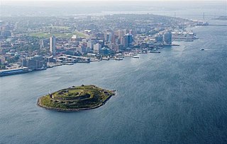
Georges Island is a glacial drumlin and the largest island entirely within the harbour limits of Halifax Harbour located in Nova Scotia's Halifax Regional Municipality. The Island is the location of Fort Charlotte - named after King George's wife Charlotte. Fort Charlotte was built during Father Le Loutre's War, a year after Citadel Hill. The island is now a National Historic Site of Canada.

Quatsino is a small hamlet of 91 people located on Quatsino Sound in Northern Vancouver Island, Canada only accessible by boat or float plane. Its nearest neighbour is Coal Harbour, to the east, about 20 minutes away by boat, and Port Alice, to the south, about 40 minutes away by boat. The largest town in the region, Port Hardy, is located about an hour northeast by boat and vehicle.
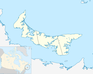
The Municipality of Malpeque Bay is a municipality that holds community status in Prince Edward Island, Canada. It is located in Prince County and Queens County.

Resort Municipality, officially named the Resort Municipality of Stanley Bridge, Hope River, Bayview, Cavendish and North Rustico, is the lone municipality in Prince Edward Island, Canada that holds resort municipality status. It was established in 1990.

Long River is an unincorporated community, in Queens County. Long River is in Lot 20 of Statistics Canada


