The topic of this article may not meet Wikipedia's notability guideline for geographic features .(December 2016) (Learn how and when to remove this template message) |
| Lot 47, Prince Edward Island | |
|---|---|
| Township | |
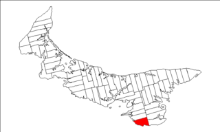
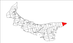 Map of Prince Edward Island highlighting Lot 47 | |
| Coordinates: 46°26′N62°5′W / 46.433°N 62.083°W Coordinates: 46°26′N62°5′W / 46.433°N 62.083°W | |
| Country | Canada |
| Province | Prince Edward Island |
| County | Kings County, |
| Parish | East Parish |
| Area [1] | |
| • Total | 34.65 sq mi (89.74 km2) |
| Population (2006) [1] | |
| • Total | 519 |
| • Density | 15/sq mi (5.8/km2) |
| Time zone | AST (UTC-4) |
| • Summer (DST) | ADT (UTC-3) |
| Canadian Postal code | C0A |
| Area code(s) | 902 |
| NTS Map | 011L08 |
| GNBC Code | BAESH |
Lot 47 is a township in Kings County, Prince Edward Island, Canada. It is part of East Parish. Lot 47 was awarded to Gordon Graham and Robert Porter in the 1767 land lottery. [2]

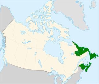
Kings County is located in eastern Prince Edward Island, Canada.
Prince Edward Island is a province of Canada consisting of the Atlantic island of the same name along with several much smaller islands nearby. PEI is one of the three Maritime Provinces. It is the smallest province of Canada in both land area and population, but it is the most densely populated. Part of the traditional lands of the Mi'kmaq, it became a British colony in the 1700s and was federated into Canada as a province in 1873. Its capital is Charlottetown. According to the 2016 census, the province of PEI has 142,907 residents.

Canada is a country in the northern part of North America. Its ten provinces and three territories extend from the Atlantic to the Pacific and northward into the Arctic Ocean, covering 9.98 million square kilometres, making it the world's second-largest country by total area. Canada's southern border with the United States is the world's longest bi-national land border. Its capital is Ottawa, and its three largest metropolitan areas are Toronto, Montreal, and Vancouver. As a whole, Canada is sparsely populated, the majority of its land area being dominated by forest and tundra. Consequently, its population is highly urbanized, with over 80 percent of its inhabitants concentrated in large and medium-sized cities, many near the southern border. Canada's climate varies widely across its vast area, ranging from arctic weather in the north, to hot summers in the southern regions, with four distinct seasons.