This article relies largely or entirely on a single source . (May 2013) |
Marsh Creek Lake | |
---|---|
Marsh Creek Lake at Marsh Creek State Park | |
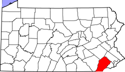
Location | Chester County, Pennsylvania |
Coordinates | 40°04′N75°44′W / 40.07°N 75.73°W Coordinates: 40°04′N75°44′W / 40.07°N 75.73°W |
Type | reservoir |
Primary inflows | Marsh Creek |
Basin countries | United States |
Surface area | 535 acres (217 ha) |
Marsh Creek Lake is a man-made lake that resulted from the construction of a dam across Marsh Creek, filling a valley that prompted the relocation of residents from Milford Mills, Pennsylvania to higher ground. The reasons for creating the lake were "... frequent flooding, water shortages and lack of recreational opportunities for nearby population centers...." [1]
The lake is bordered by Marsh Creek State Park to the east and Lyndell, Pennsylvania to the west.
The Allegheny River is a 325-mile (523 km) long headwater stream of the Ohio River in western Pennsylvania and New York, United States. The Allegheny River runs from its headwaters just below the middle of Pennsylvania's northern border northwesterly into New York then in a zigzag southwesterly across the border and through Western Pennsylvania to join the Monongahela River at the Forks of the Ohio on the "Point" of Point State Park in Downtown Pittsburgh, Pennsylvania. The Allegheny River is, by volume, the main headstream of both the Ohio and Mississippi Rivers. Historically, the Allegheny was considered to be the upper Ohio River by both Native Americans and European settlers.
Bernville is a borough in Berks County, Pennsylvania, United States. The population was 955 at the 2010 census. Bernville is bordered by Penn Township to the north, east, and south and by Jefferson Township to the west.
Tulpehocken Creek is a 39.5-mile-long (63.6 km) tributary of the Schuylkill River in southeastern Pennsylvania in the United States, and during the American Canal Age, once provided nearly half the length of the Union Canal linking the port of Philadelphia, the largest American city and the other communities of Delaware Valley with the Susquehanna basin and the Pennsylvania Canal System connecting the Eastern seaboard to Lake Erie and the new settlements of the Northwest Territory via the Allegheny}, Monongahela. and Ohio Rivers at Pittsburgh.
White Clay Creek is an 18.5-mile-long (29.8 km) tributary of the Christina River in southern Pennsylvania and northern Delaware in the United States. It is renowned for its scenic character and is largely federally protected.
Milford Mills was a village in the Marsh Creek Valley of Chester County, Pennsylvania that was inundated by the construction of the Marsh Creek Dam in 1972.
French Creek State Park is a 7,526-acre (3,046 ha) Pennsylvania state park in North Coventry and Warwick Townships in Chester County and Robeson and Union Townships in Berks County, Pennsylvania in the United States. It straddles northern Chester County and southern Berks County along French Creek. It is located in the Hopewell Big Woods. The park is the home of two lakes: Hopewell Lake, a 68-acre (28 ha) warm water lake, and Scotts Run Lake, a 22-acre (8.9 ha) cold water lake. The state record smallmouth bass was caught in Scotts Run Lake. There are extensive forests, and almost 40 miles (64 km) of hiking and equestrian trails. The park is also friendly to mountain bikers, having some renowned technical trails. Hopewell Furnace National Historic Site, which features a cold blast furnace restored to its 1830s appearance, is surrounded by the park. The Six Penny Day Use Area and Group Camp are listed on the National Register of Historic Places. French Creek State Park is located off of Pennsylvania Route 345 to the south of Birdsboro.
White Clay Creek Preserve is a 1,255-acre (508 ha) Pennsylvania state park along the valley of White Clay Creek in London Britain Township in Chester County, Pennsylvania in the United States. The park was donated by the DuPont Company in 1984 for the purpose of "preserving the diverse and unique plant and animal species, and the rich cultural heritage of the area". Dupont also donated an additional 528 acres (214 ha) for the adjoining White Clay Creek State Park to the state of Delaware. White Clay Creek Preserve is 3 miles (4.8 km) north of Newark, Delaware on Pennsylvania Route 896.
Prince Gallitzin State Park is a 6,249-acre (2,529 ha) Pennsylvania state park with acreage in both Chest and White Townships in Cambria County of North Central Pennsylvania in the United States, near both Gallitzin Borough, & Gallitzin Township in the greater Altoona, Pennsylvania area.
Bald Eagle State Park is a 5,900-acre (2,388 ha) Pennsylvania state park in Howard, Liberty, and Marion townships in Centre County, Pennsylvania in the United States. The park includes the Foster Joseph Sayers Reservoir, formed by damming Bald Eagle Creek and other smaller streams and covering 1,730 acres (700 ha). Bald Eagle State Park is at the meeting point of two distinct geologic features. The Allegheny Plateau is to the north and the Ridge and Valley area of Pennsylvania is to the south. The park is in the Bald Eagle Valley off Pennsylvania Route 150 in Howard, between Milesburg and Lock Haven.
Lyman Run State Park is a 595-acre (241 ha) Pennsylvania state park in Ulysses and West Branch Townships in Potter County, Pennsylvania in the United States. Lyman Run Lake is a 45-acre (18 ha) man-made lake within the park, surrounded by a northern hardwood forest of mainly maple and cherry trees. Lyman Run State Park is 7 miles (11 km) west of Galeton and 15 miles (24 km) east of Coudersport, and is nearly completely surrounded by the Susquehannock State Forest.
Prompton State Park is a Pennsylvania state park on 2,000 acres (809 ha) in Clinton and Dyberry Townships, Wayne County, Pennsylvania in the United States. This park, which was established in 1962, is officially listed by the Pennsylvania Department of Conservation and Natural Resources as being undeveloped. This means that it is officially a state park but the PA-DCNR is not currently managing the park. However, the lands of the park are open to visitors. Friends of Prompton State Park, a grassroots organization is working to take over management of the park in much the same way that Salt Springs State Park in Susquehanna County is managed by The Friends of Salt Springs Park. Northeast Sports Ltd. of Honesdale sponsors several outdoor sports events that are held at the park. Prompton State Park is 4.2 miles (6.8 km) west of Honesdale on Pennsylvania Route 170.
Marsh Creek State Park is a 1,705 acres (690 ha) Pennsylvania state park in Upper Uwchlan and Wallace Townships, Chester County, Pennsylvania in the United States. The park is the location of the 535-acre (217 ha) man-made Marsh Creek Lake. With an average depth of 40 feet, the lake is stocked with fish and is a stop for migrating waterfowl. Marsh Creek State Park is 2 miles (3.2 km) west of Eagle on Pennsylvania Route 100. Park road hours 8:00 am until sunset. All other access open 24 hours.
Norristown Farm Park is a 690-acre (279 ha) Pennsylvania state park in East Norriton and West Norriton Townships and the Borough of Norristown, Montgomery County, Pennsylvania, in the United States. It is operated in partnership with the Montgomery County Department of Parks. The park is a working farm on the site of Norristown State Hospital. Many colonial era farm buildings and homes are on the grounds. Hiking, bicycling, ball fields, fishing, picnicking, and cross-country skiing are available in the park. The park hosts musical concerts in the summer. Stony Creek flows through the park. Norristown Farm Park is just off Interstate 276 on West Germantown Pike.
The geography of New York state varies widely. Most of New York is dominated by farms, forests, rivers, mountains, and lakes. New York's Adirondack Park is larger than any U.S. National Park in the contiguous United States. Niagara Falls, on the Niagara River as it flows from Lake Erie to Lake Ontario, is a popular attraction. The Hudson River begins near Lake Tear of the Clouds and flows south through the eastern part of the state without draining lakes George or Champlain. Lake George empties at its north end into Lake Champlain, whose northern end extends into Canada, where it drains into the Richelieu River and then the St. Lawrence. Four of New York City's five boroughs are on the three islands at the mouth of the Hudson River: Manhattan Island, Staten Island, and Brooklyn and Queens on Long Island.
Mountain Creek is a 20.9-mile-long (33.6 km) tributary of Yellow Breeches Creek in Cumberland County, Pennsylvania.
Larkin Covered Bridge is a 60-foot-long (18 m), Burr truss wooden covered bridge located in Chester Springs, Chester County, Pennsylvania, near the village of Eagle. The bridge, which originally crossed over Marsh Creek, now spans a dry ditch and is a feature of the Upper Uwchlan Township trail system.
Dunes Creek is a northwards-flowing 4.3-mile-long (6.9 km) stream which drains the Great Marsh of Indiana Dunes State Park and Indiana Dunes National Park in Porter County, Indiana, United States. Dunes Creek passes through the coastal sand dunes to empty into Lake Michigan.
The Pennsylvania State Game Lands Number 25 are Pennsylvania State Game Lands in Elk County in Pennsylvania in the United States providing hunting, bird watching, and other activities.
This Chester County, Pennsylvania state location article is a stub. You can help Wikipedia by expanding it. |