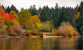
Memory Island Provincial Park is a provincial park located on Vancouver Island in British Columbia, Canada. It was established by BC Parks on 23 August 1945 to protect a small island located at the southern end of Shawnigan Lake.

Sproat Lake is a lake on central Vancouver Island in British Columbia, Canada. It was known as Kleecoot, meaning "wide open" by local indigenous people.

Louise Island is a 275-square-kilometre (106 sq mi) island in Haida Gwaii, in British Columbia, Canada, off the east coast of Moresby Island and just north of Laskeek Bay. It was named for Princess Louise, Duchess of Argyll, fourth daughter of Queen Victoria. Louise Island is located east of Moresby Island and Carmichael Passage, and south of Cumshewa Inlet.

Mount Bishop is a mountain named in 1918 after W.A. "Billy" Bishop VC who was a Colonel and a Canadian fighter pilot awarded the Victoria Cross during World War I. It is located in the Elk Range of the Canadian Rockies and sits on the Continental Divide, which forms the British Columbia-Alberta border in this area.
Vesuvius, also known as Vesuvius Bay, is an unincorporated settlement and ferry terminal on the northwest coast of Saltspring Island in the Gulf Islands of British Columbia, Canada. It is the eastern terminus of a ferry which connects Saltspring Island to Vancouver Island across Sansum Narrows to Crofton, which is just north of the city of Duncan.
Mount Morkill is located on the border of Alberta and British Columbia, near McBride which is a town in British Columbia, Canada. There is a subpeak to the southwest of the main peak, at an elevation of 2,185 m (7,169 ft) named The Gazetted Peak. It was named in 1965 after D.B. Morkill, a British Columbia land surveyor.

Mount Bess is located on the border of Alberta and British Columbia. It is the 83rd highest peak in Alberta. It was named in 1910 by J. Norman Collie after Bessie Gunn, who accompanied Collie's expedition.
Mount Machray is located on the western side of Grant Pass, NE side of Mount Robson Provincial Park on the Continental Divide marking the Alberta-British Columbia border. It was named in 1923 after Robert Machray, Archbishop of Rupert's Land.
Mount McCord is located at the northern end of Miette Pass, NE side of Mount Robson Provincial Park on the Continental Divide marking the Alberta-British Columbia border. It was named in 1923 after W.C. McCord, a surveyor who led a Canadian Pacific Railway trail-making party in 1872.
Caniche Peak is located on the border of Alberta and British Columbia. It was named in 1922 by Arthur O. Wheeler. He suggested it be called Poodle Park as he thought it resembled the head of a poodle. The French word for poodle, "Caniche", was adopted to give the name more class.

Mount Fraser is a mountain located on the border of Alberta and British Columbia. It is Alberta's 38th highest peak and Alberta's 22nd most prominent mountain. It is also British Columbia's 50th highest peak. It was named in 1917 after Simon Fraser.
Mount Ross Cox is located north of the Hooker Icefield in Hamber Provincial Park and straddles the Continental Divide marking the Alberta-British Columbia border. It was named in 1920 after Ross Cox who traveled the area in 1817.

McGillivray Ridge is located on the border of Alberta and British Columbia. Sometime before 1814, this massive mountain was called McGillvray's Rock after William McGillivray of the NWC.
Mount Bulyea is located in Banff National Park on the border of Alberta and British Columbia. It was named in 1920 after Hon. George H. V. Bulyea, a Canadian Pacific Railway employee and first Lieutenant Governor of Alberta.
Mount Barnard is located on the border of Alberta and British Columbia, NW of the head of Waitabit Creek and North of Golden. It is the 30th highest peak in Alberta and the 42nd highest peak in British Columbia. It was named in 1917 by boundary surveyors after Sir Francis Stillman Barnard, a Lieutenant Governor of BC during the 1910s. It should not be confused with the higher Californian peak of the same name.
Mount Barlow is located on the Continental Divide along the border of Alberta and British Columbia at the southern edge of the Freshfield Icefield in Banff National Park. It was named in 1916 by D.B. Dowling after Dr. Alfred Ernest Barlow, a cartographer with the Geological Survey of Canada who died in the 1914 Empress of Ireland disaster.

Mount Beatty is a mountain located on the border of Alberta and British Columbia on the Continental Divide. It was named in 1924 after David Beatty, a British naval officer of Irish ancestry who commanded ships in the First World War.

Mount Worthington is located on the eastern side of Mount McHarg, in Height of the Rockies Provincial Park, and straddles the Continental Divide marking the Alberta-British Columbia border. It was named in 1956 after Lt. Col. Don Worthington who was killed in action in 1944 during the Second World War while commanding the 7th Battalion, The British Columbia Regiment.

Mount Armstrong is a mountain located on the Canadian provincial boundary between Alberta and British Columbia on the Continental Divide. It was named in 1918 after John Douglas Armstrong, a lieutenant with the Canadian Engineers who was killed in action on April 9, 1917, at Vimy Ridge World War I.

Andy Good Peak is located just south of Crowsnest Pass on the Canadian provincial boundary between Alberta and British Columbia on the Continental Divide. It was named in 1916 after Andy Good, a hotel owner in nearby Crowsnest Pass whose bar straddled the provincial border.


